The Terraces and High Camp
The Terraces is another wonder of the Palm Creek area, arguably the better of the three to see. The other two points of interest are Hidden Falls and The Cascades.


Location - Bowling Green Bay National Park, Queensland, Australia
Grade - 5, difficult, recommended for experienced bushwalkers
Distance - 12 km return
Time - 7-9 hours return
Elevation gain - 500 m (at High Camp)
The Terraces is another wonder of the Palm Creek area and arguably the better (and easier) of the three attractions to see! Many consider it to be the best walk in North Queensland. This area is thought to have been discovered by Townsville Bushwalking Club in ~1966. The other two points of interest are Hidden Falls and The Cascades. If you would like to do this walk, it is recommended to go with the Townsville Bushwalking Club, as they have access via the property owner.
Wanderstoires now offers this as a guided tour. Contact us for more information.
UPDATE 2019- present: This area is no longer accessible via the Palm Creek Eco Park and is only accessible via private property. The Townsville Bushwalking Club still have access, however. If you're keen, join them on a hike to explore this area.
The Terraces and Prince Falls
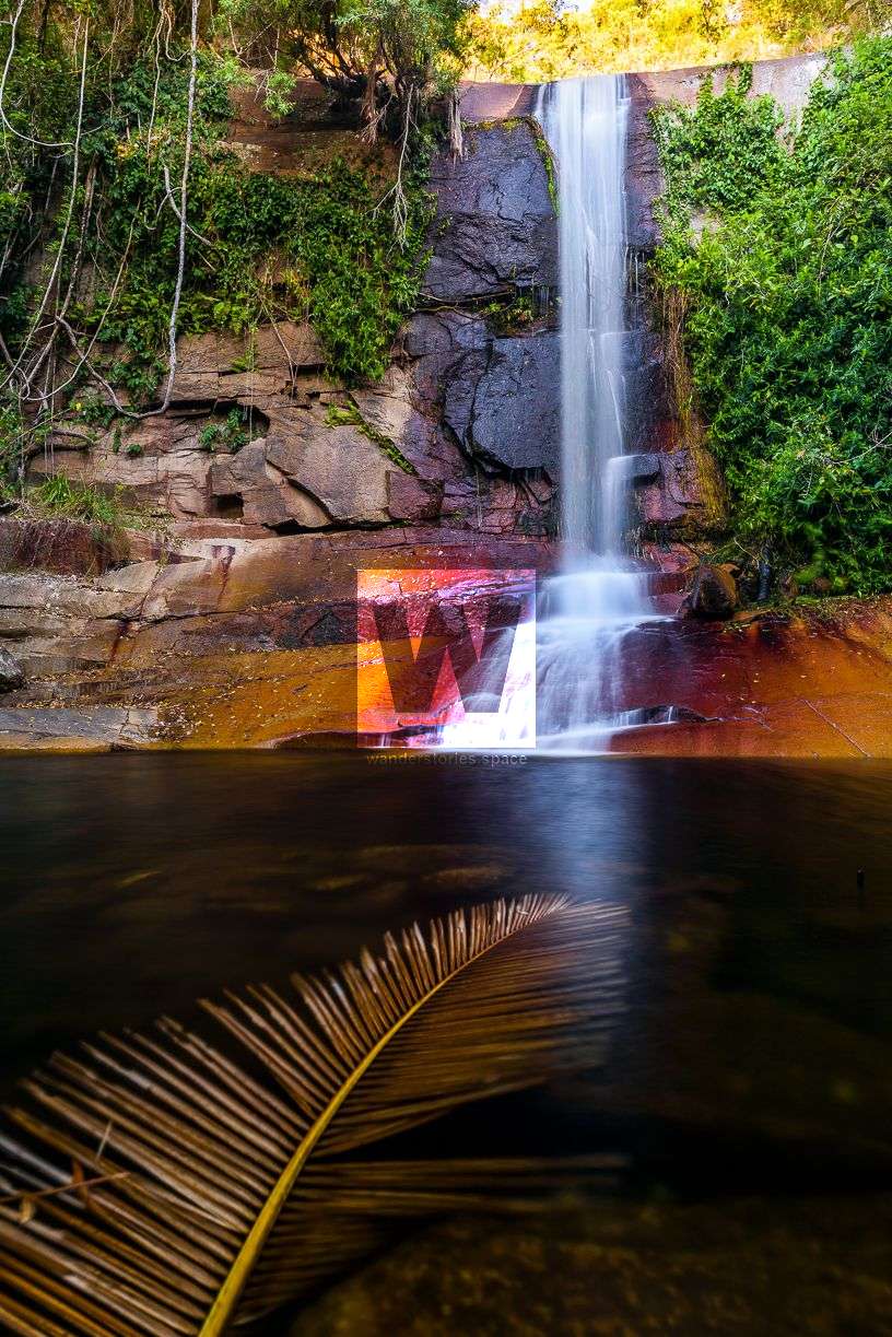
The Terraces is an easy hike that follows one of the creeks upstream. Moreover, it's one of those hikes that we classify as 'little effort for high reward'. This creek itself is a beauty, and you seemingly encounter waterfall after waterfall after waterfall, with each more gorgeous than the next. The water just cascades down the terraced rock faces, a sight that has inspired many with a passion for photography. Enjoy the numerous places to swim and take in the countless views along the way. A 1.5 kilometre stretch of waterfalls here, undoubtedly, comprises some of the best in the entire Townsville area.
How to Get There
Because The Terraces can now only be accessed via private property in the vicinity of Palm Creek, it is important to have permission. As mentioned above, this can be done by joining the Townsville Bushwalking Club on their semi-regular trips.
Some of this information below can also be found in the post about Palm Creek Rockslides.
Once you get to the power line track and see the high voltage power lines, make your way along an old, overgrown road toward the mountains, a track known as Palm Creek Track. Follow this trail toward the old Chinese Farm, where, through the lantana and the mango trees, you can see the rusty ploughs and machinery from the middle of the 20th century. Continue to the bold "Black Rock", also known as "Palm Creek Boulder", which demarcates the National Park Boundary. You really cannot miss it. If you walk around the back of it, you will find a chain to assist you in climbing to the top. However, you may choose to challenge yourself to summit Black Rock unassisted. At the top of this boulder is also the last place where mobile phone reception (Telstra) is available. For this reason, the location is also marked on the map for safety reasons.
From Black Rock, continue along the marked track parallel to St Margaret Creek. When you reach a very large, white gumtree, there will be a pronounced fork in the track. The right-ward path steeply descends into the creek, where you will find a waterhole called "Princess Pools" and "Sandy Beach". This is a commonly used camping area for local bushwalkers. The left-ward track will continue on to the Palm Creek Rockslides.
From Princess Pools, either go back downstream approximately 80 metres to a tributary on your left - or alternatively, proceed over the ridge into the parallel creek.
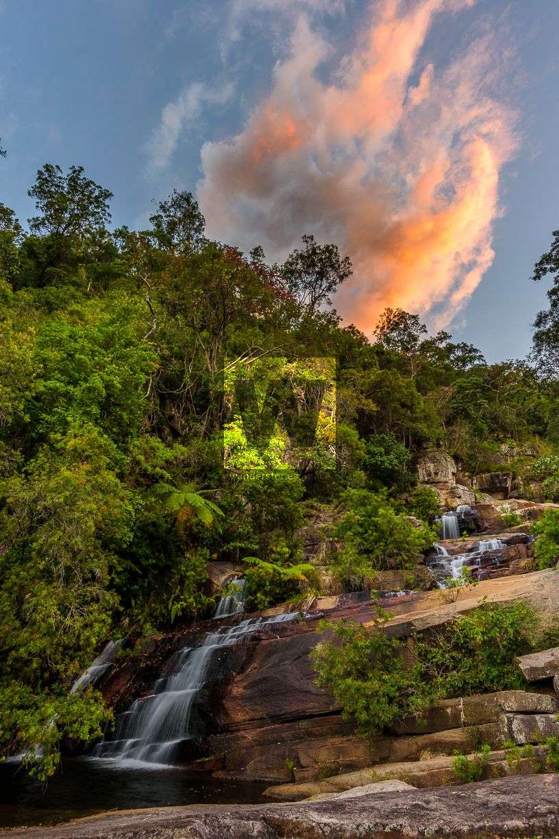
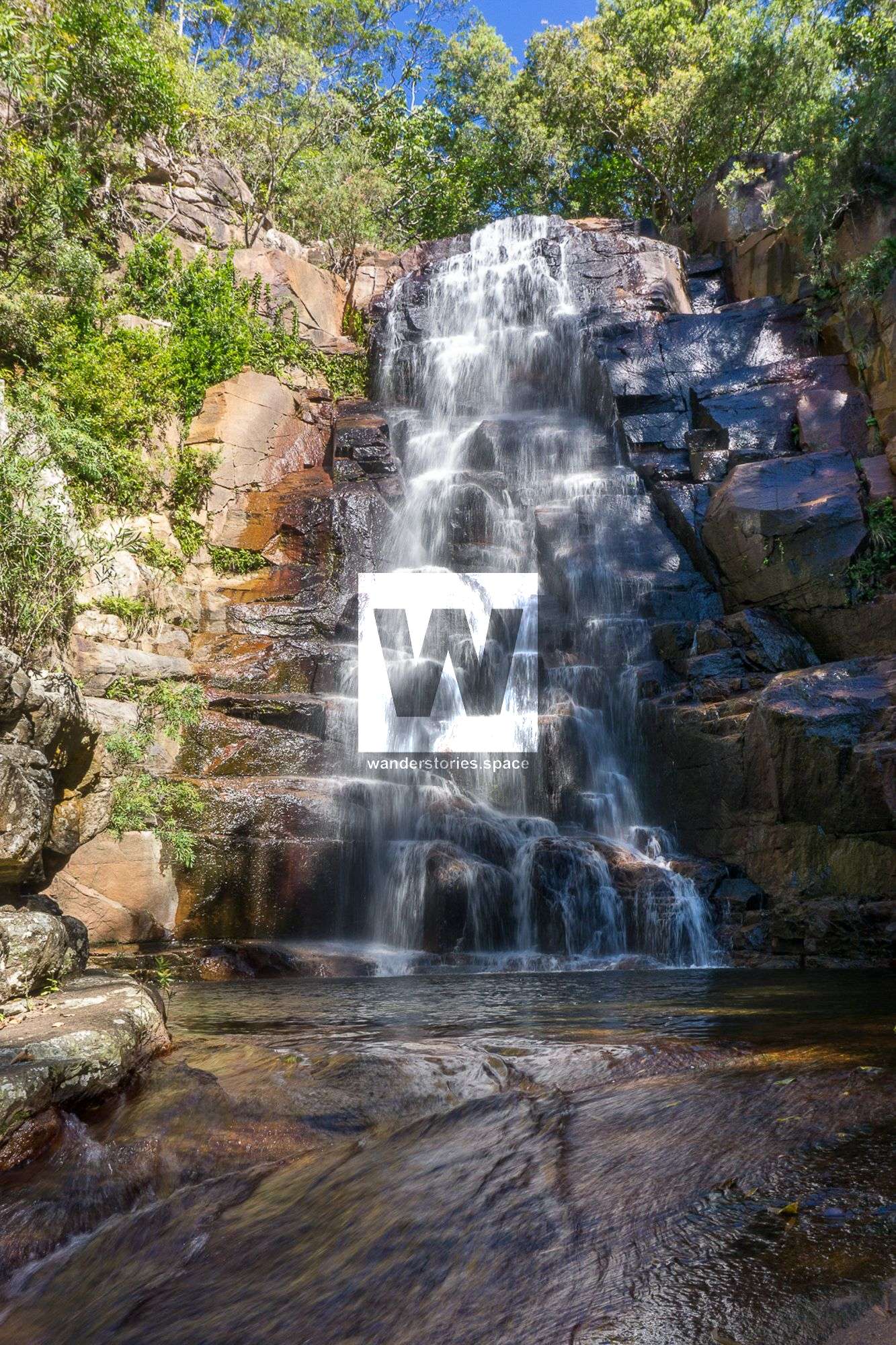
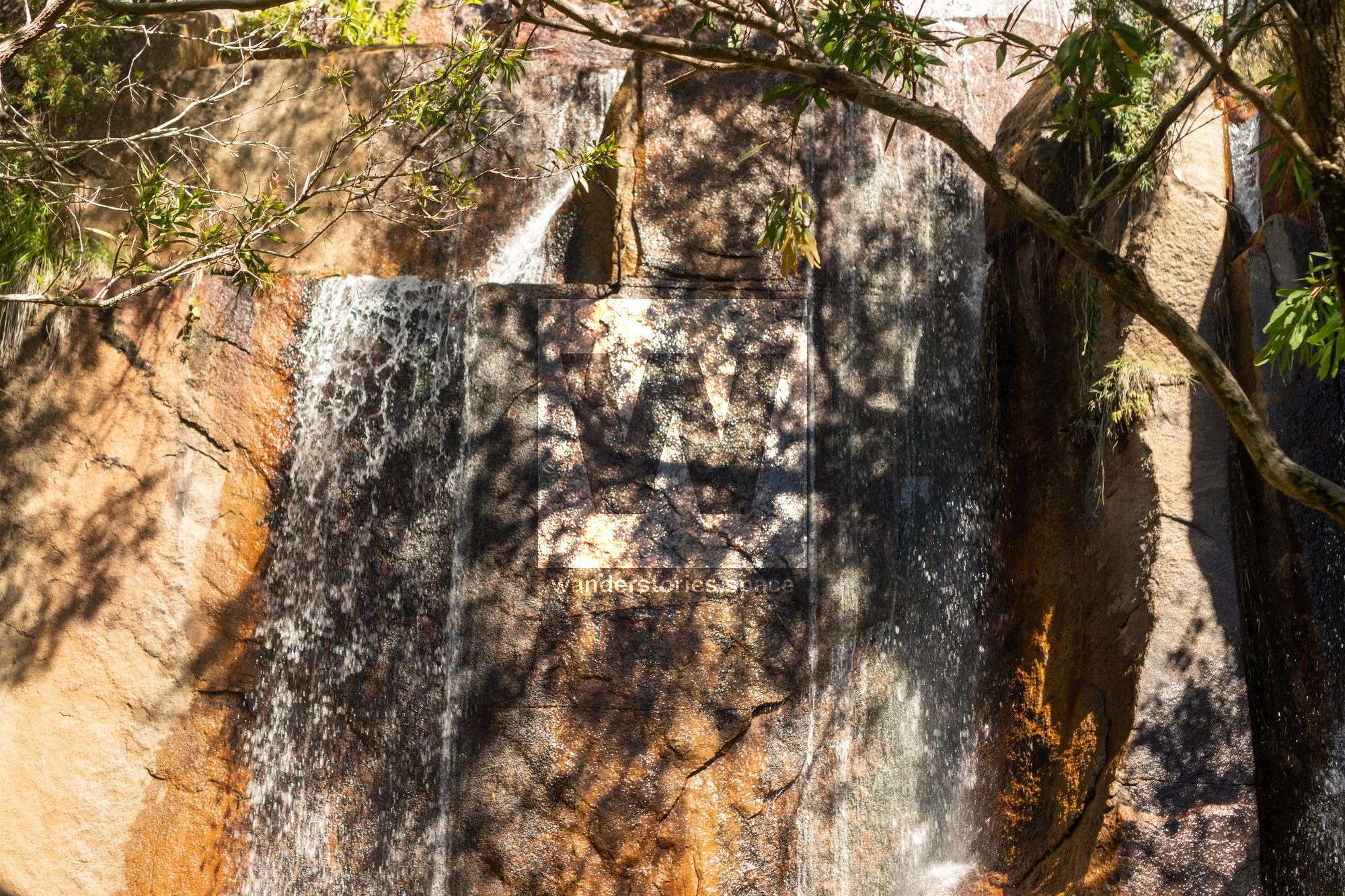
Follow the creek line to the first waterfall. Then, climb up the right side of the waterfall/cliff to reach "The Terraces".

At this point, you will be at approximately 260 metres in elevation.
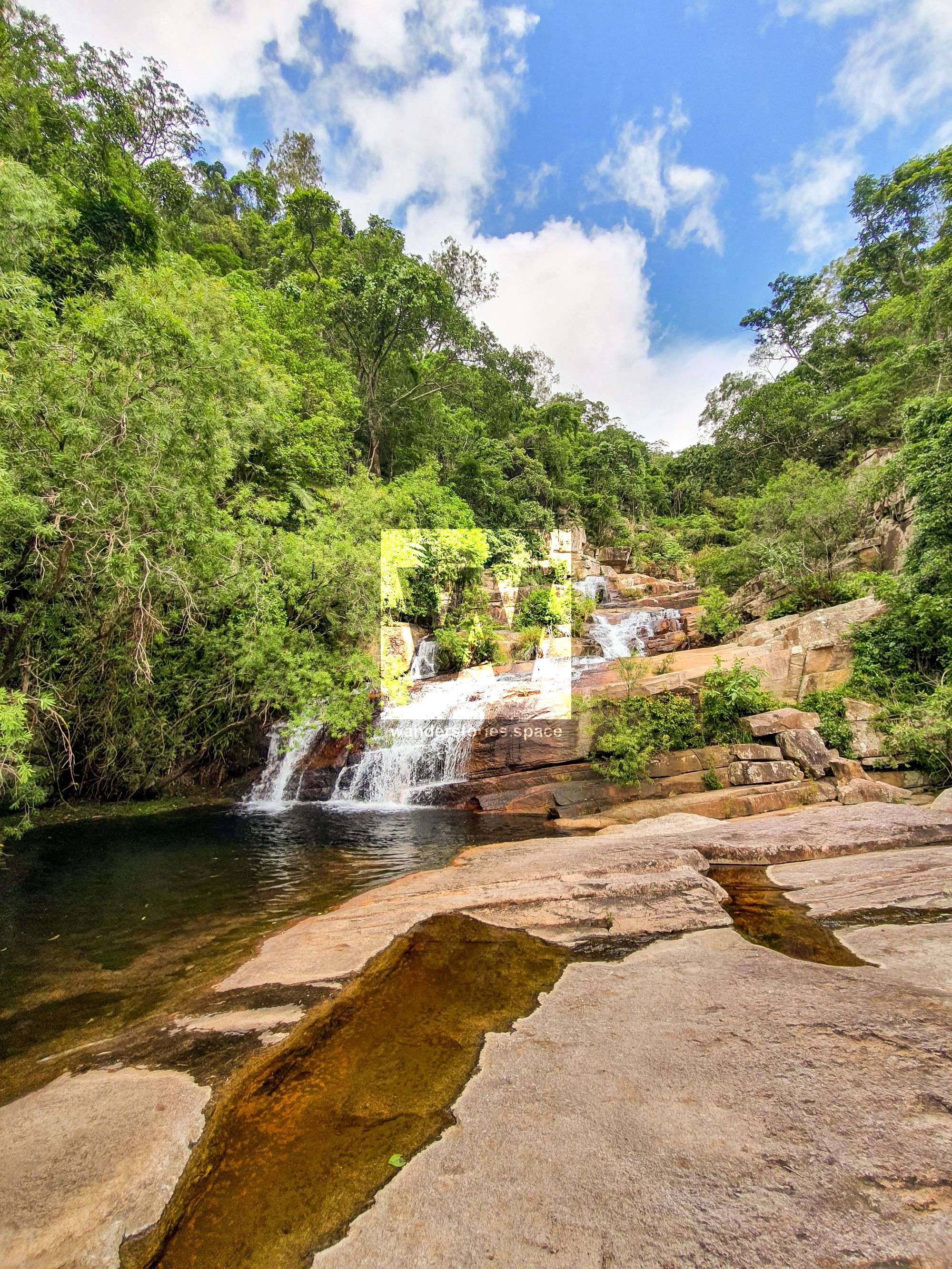
The first waterfall of the creek and The Terraces
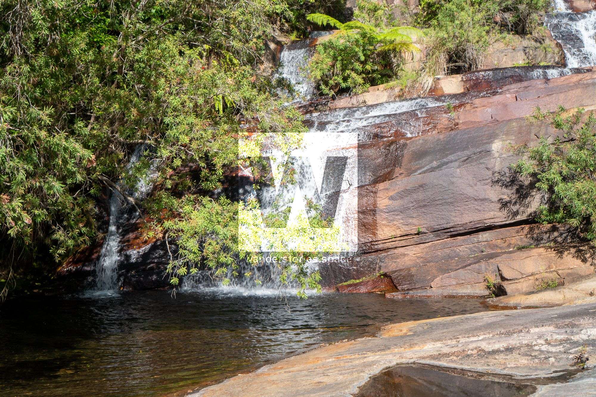
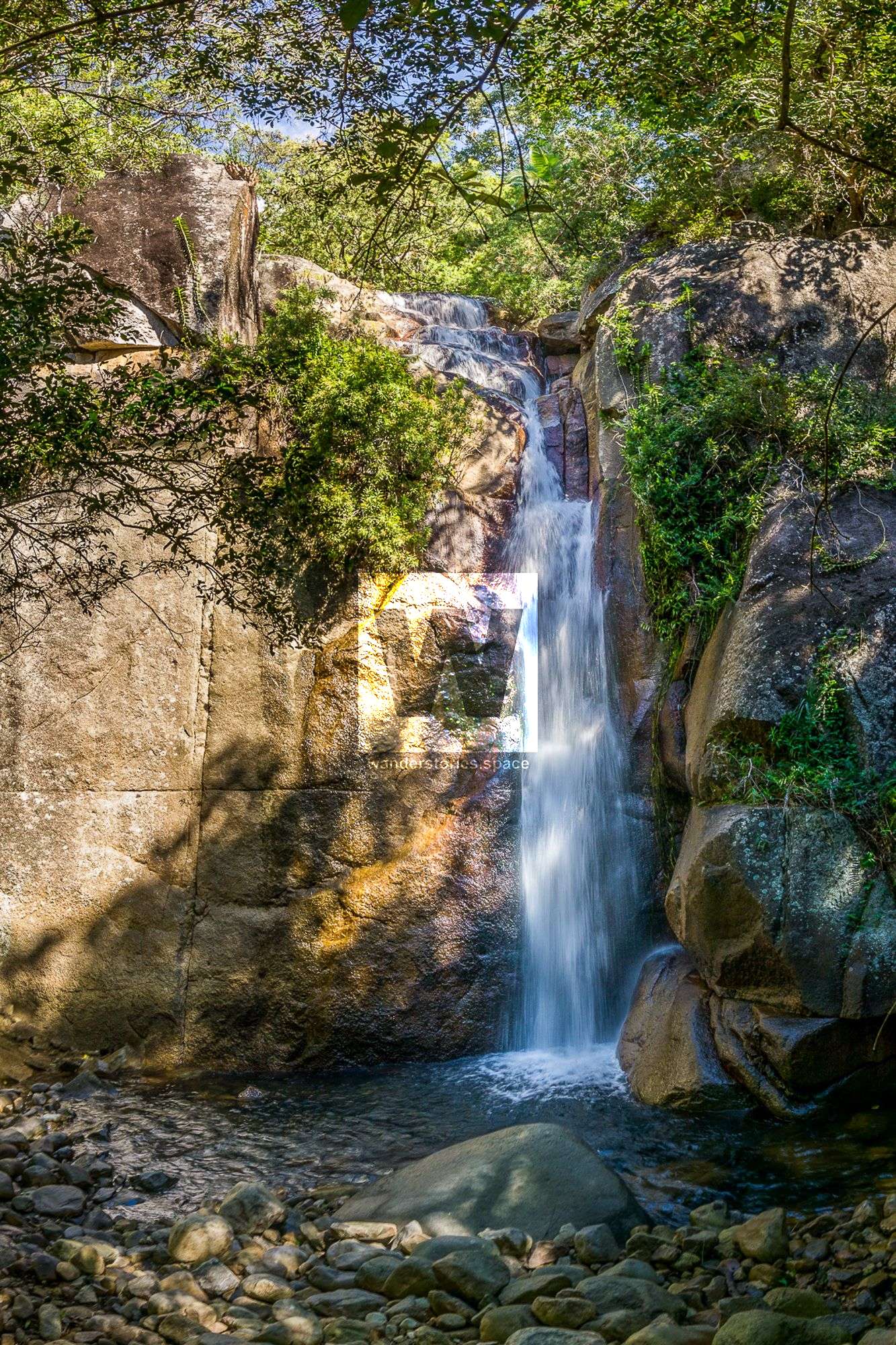
Then, rock hop up approximately 200 metres, and you will arrive at another spectacular waterfall called "Prince Falls". Then, climb up and around to the right of the falls, where you have the option to walk across into the basin of "Crystal Falls". Or, you can continue to scramble around to the right of Crystal Falls.


Prince Falls (top) and Crystal Falls (bottom) - Combined, they are known as Ultima Falls
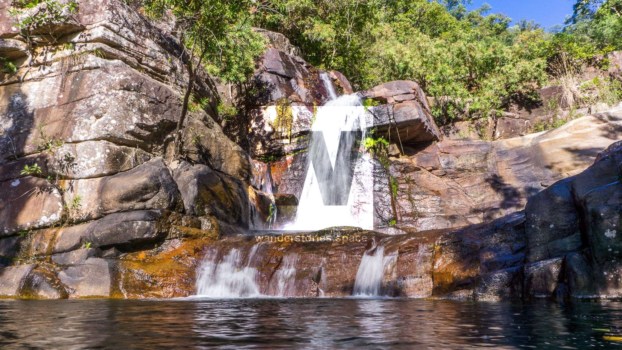
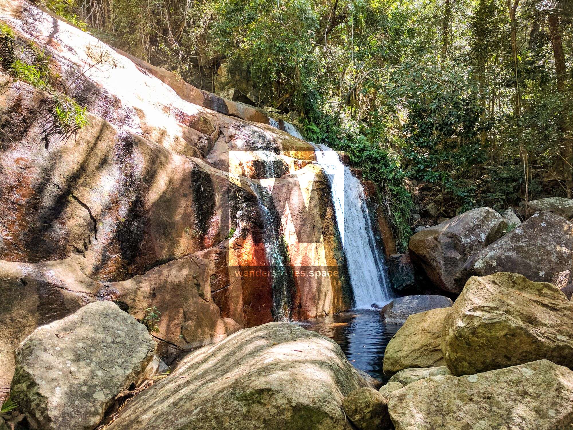
After scrambling around the right of Crystal Falls, rock hop up the creek another 100-200 meters to the base of the next falls, which some call "King Falls". If there is a lot of water, this waterfall is truly remarkable in how much power flows through the rocks. Then, scramble up and around the right of King Falls. following a rough but somewhat intuitive track.

King Falls
Dip back down into the creek to see some other falls:
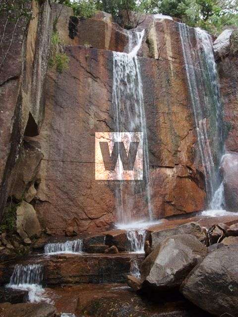
An unnamed waterfall along the way (left) and the Rock Garden Wall (middle/right)
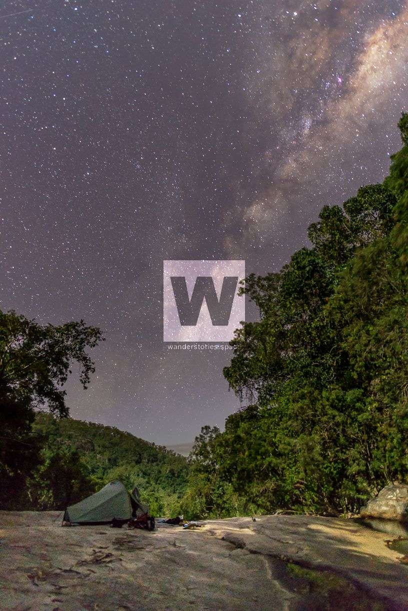
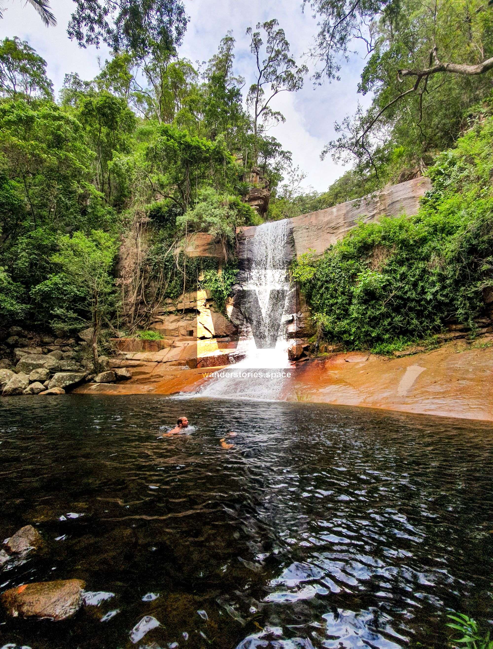
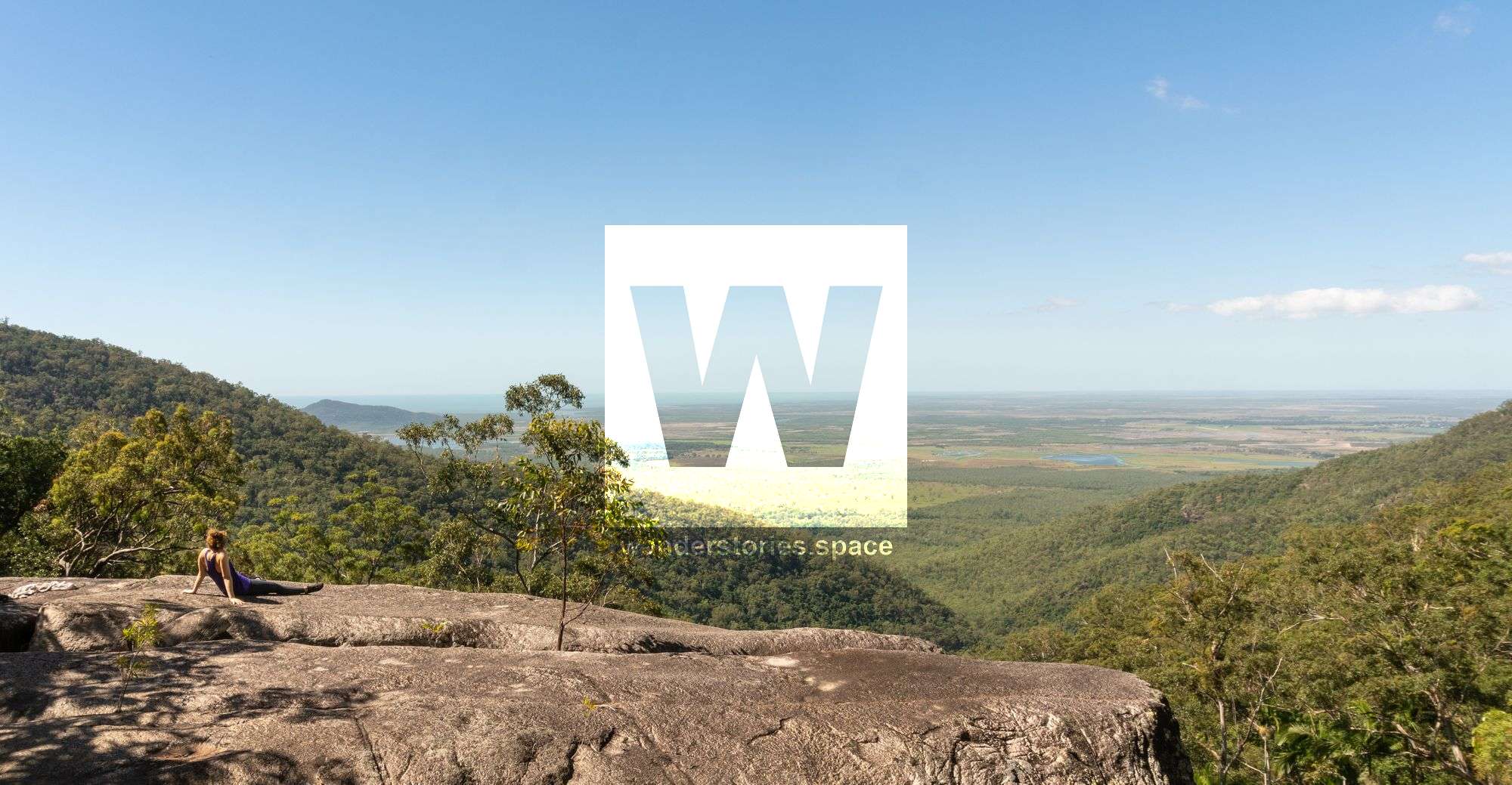
Continue ascending, scrambling up, up, up until you arrive at "High Camp". At this point, you will be at the highest point on the creek, approximately 500 metres in elevation. High Camp is a massive boulder formation that was originally named by Alan Simet. High Camp overlooks the coast and boasts a small swimming pool and a nearby waterfall. Below High Camp is known as The Wall.
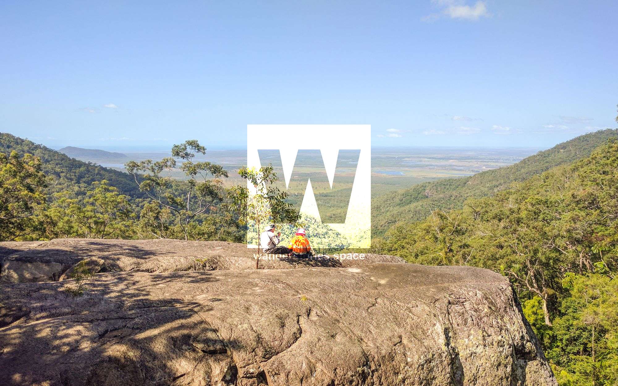
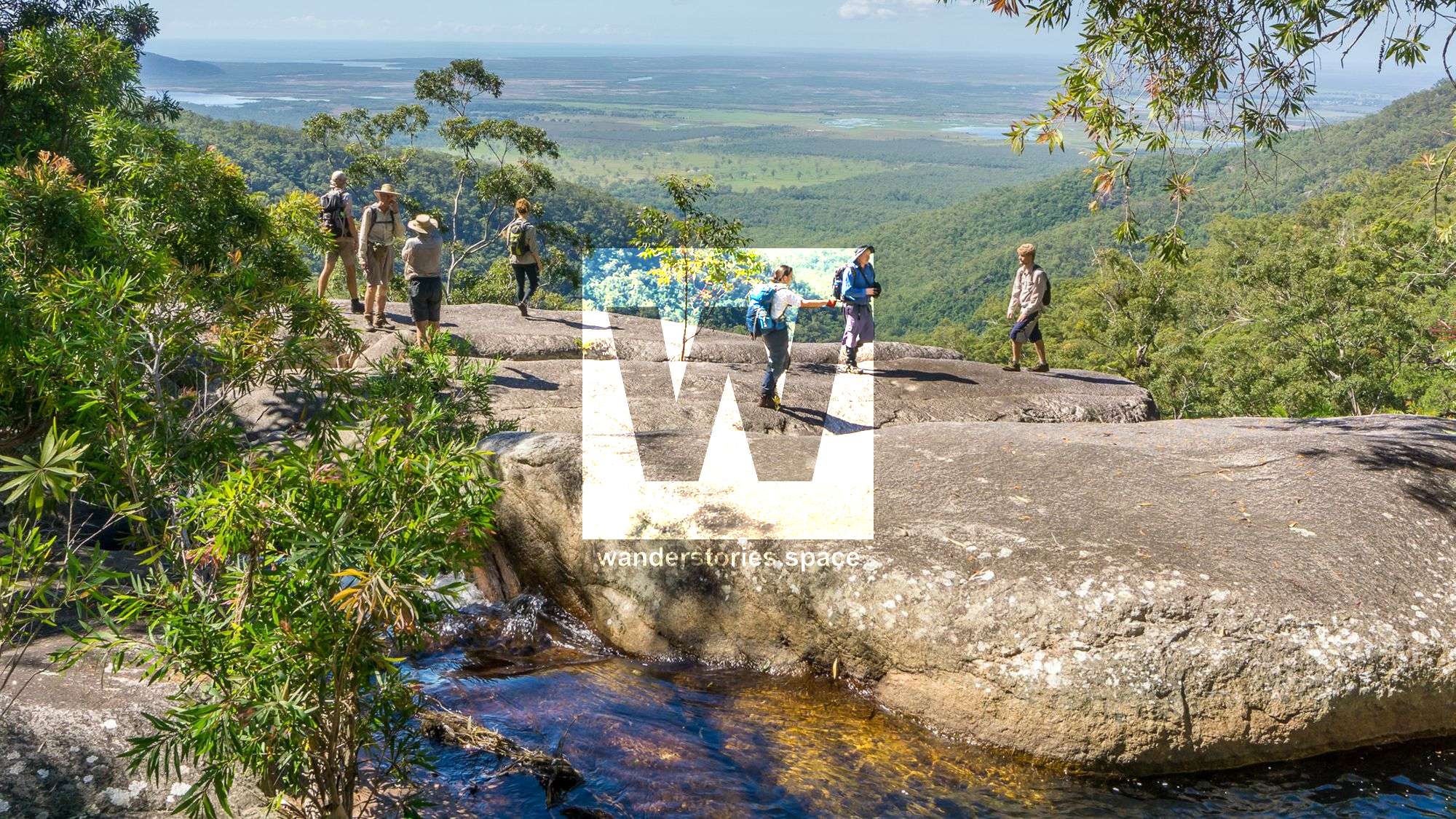


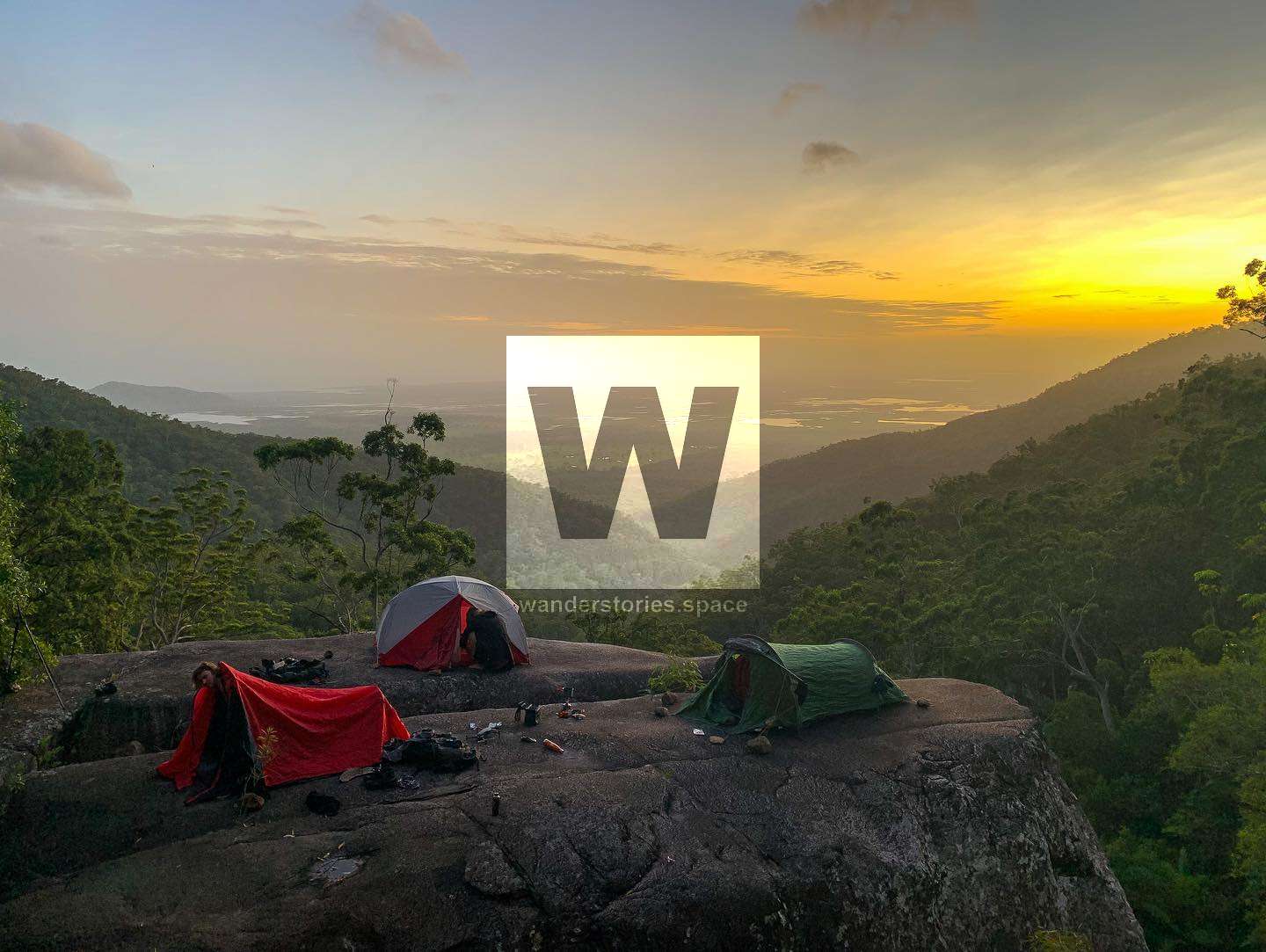
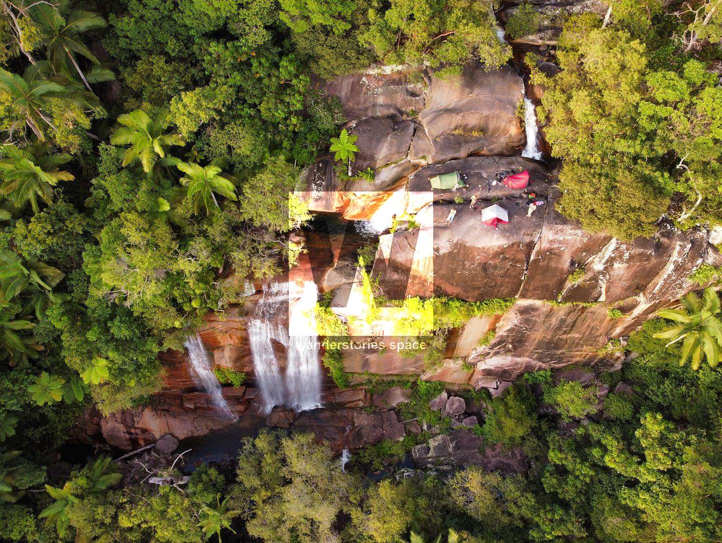
High Camp
Here - and along the way, for that matter - you are certainly rewarded with stunning views of Cape Cleveland and the Giru area. Consider camping at High Camp overnight or at least enjoying a picnic lunch to relax and take in the views before heading back down.
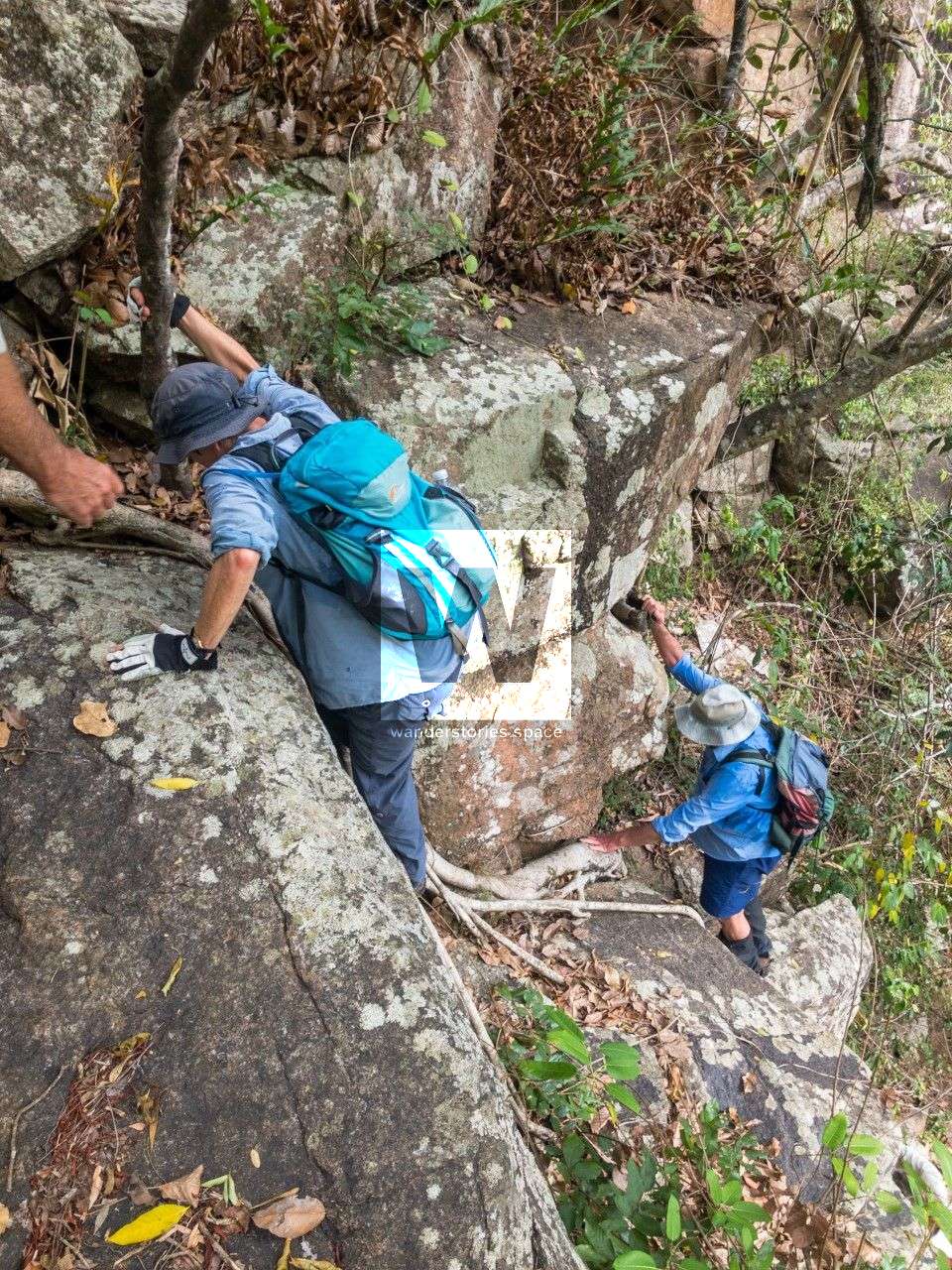
You will need to do a bit of rock hopping up the creek and there is a little bit of scrambling/climbing involved to get around some of the waterfalls.
Interactive Map
Here's an interactive map of the area: