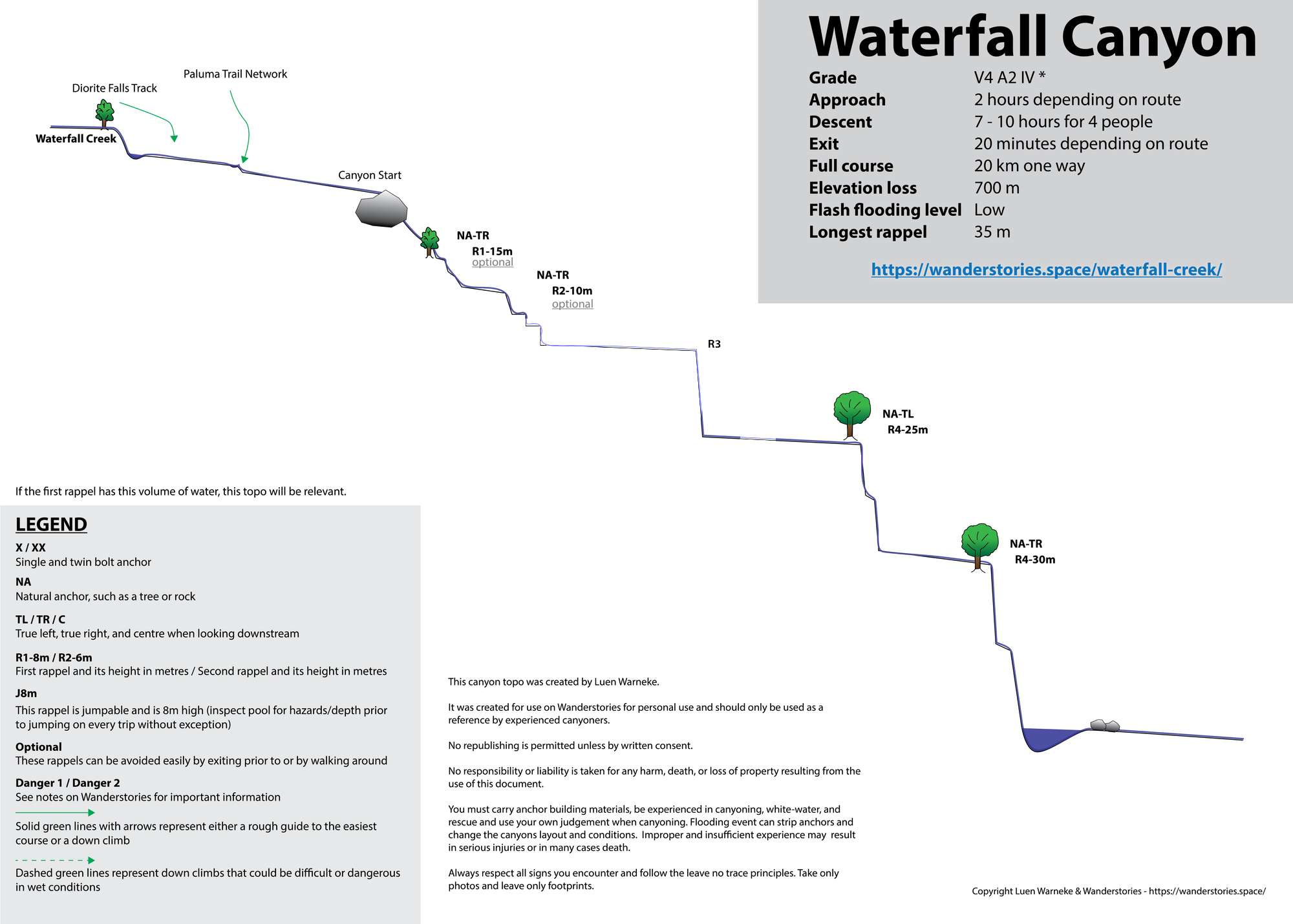
Waterfall Canyon, Waterfall Creek - Paluma Dam to Zammits Rd, Bruce Highway
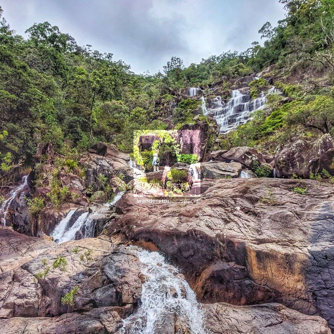
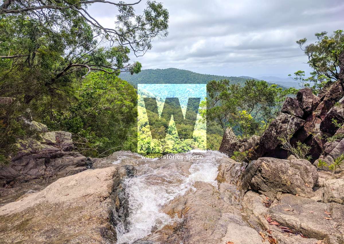
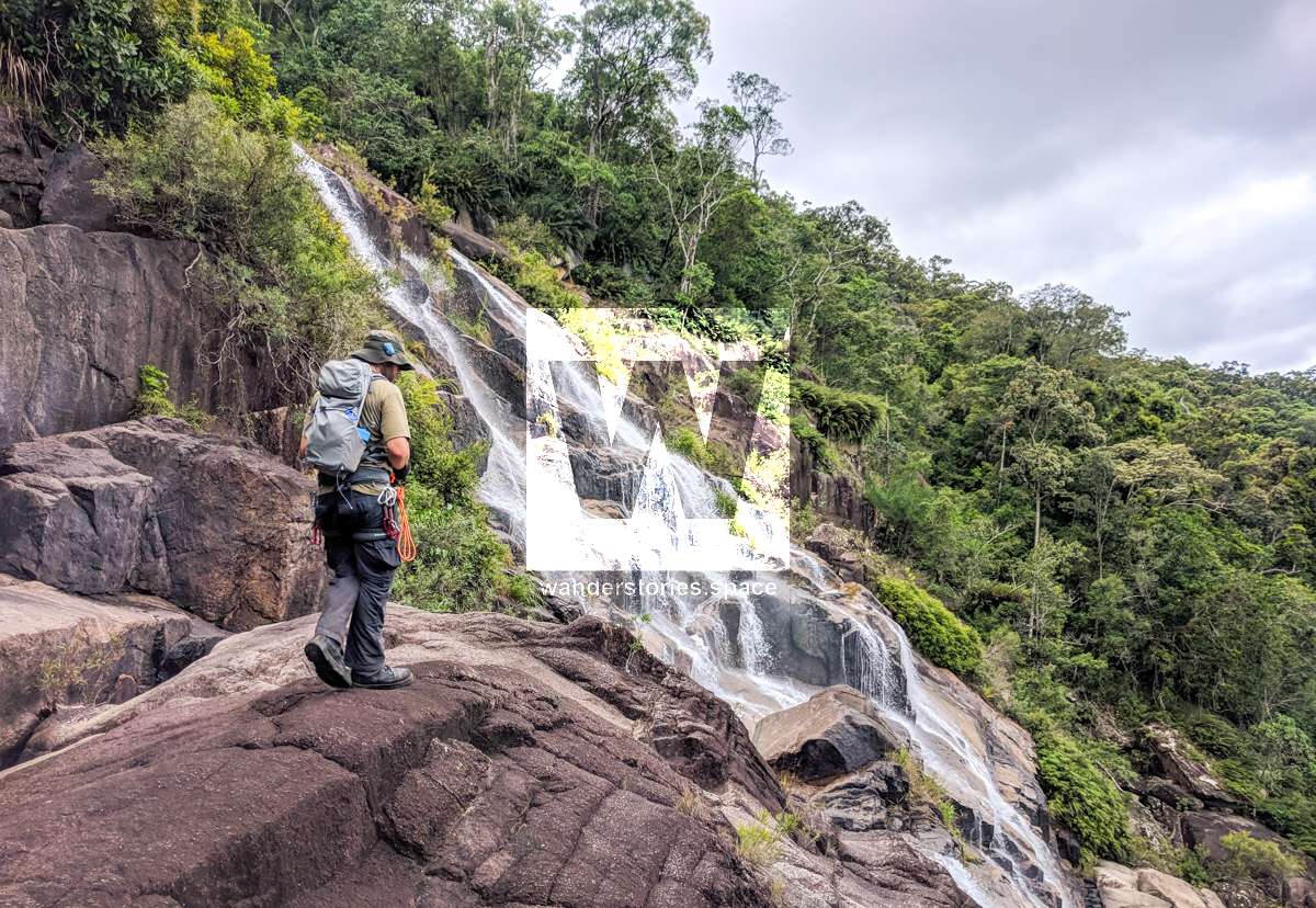
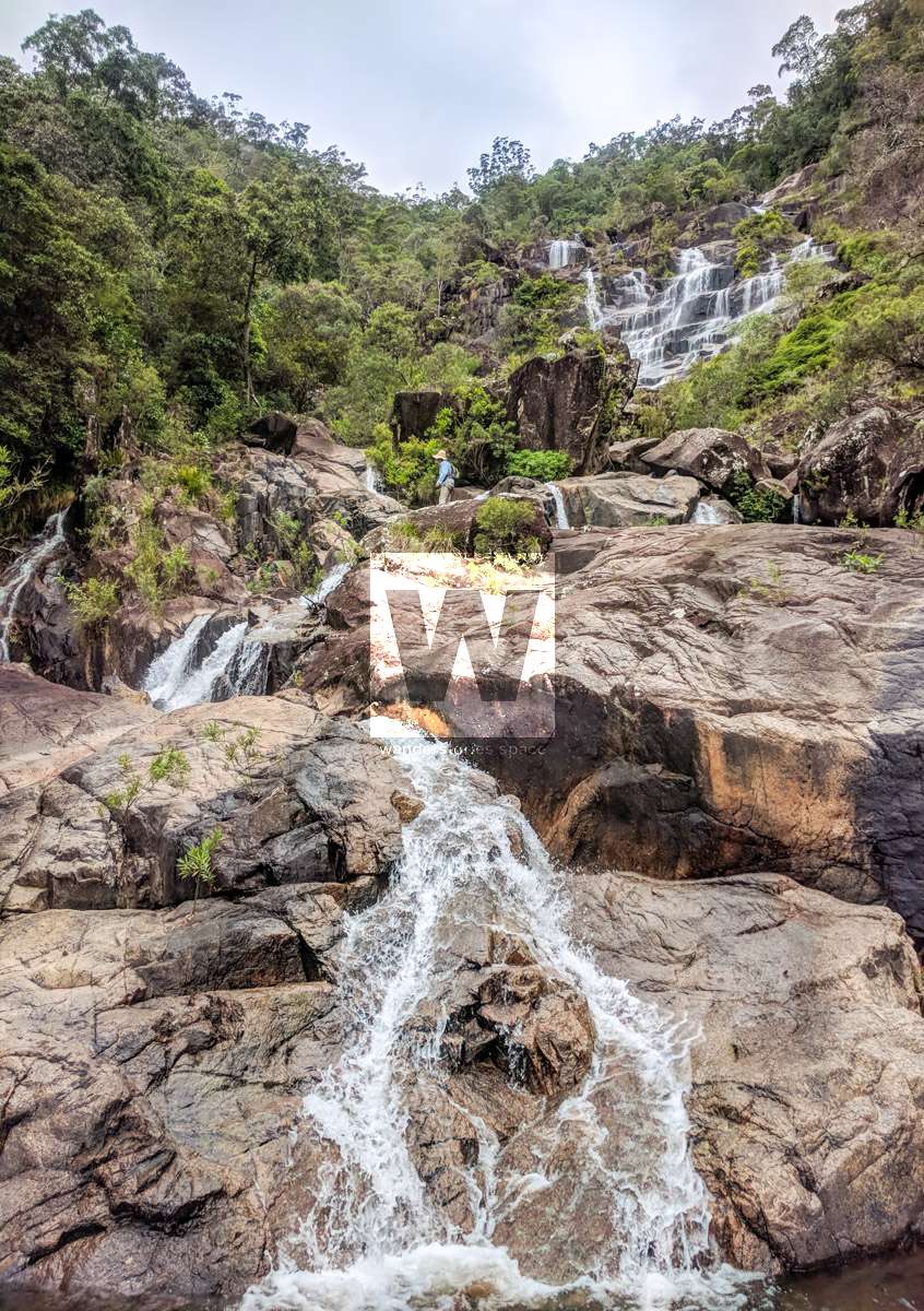
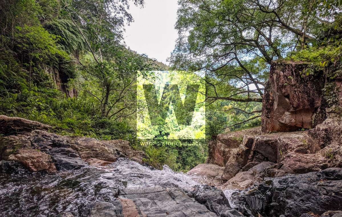
Waterfall Creek is the massive waterfall that you can see from the highway on your way back to Townsville from Ingham. It's a beautiful creek full of waterfalls, I guess that's why it's named Waterfall Creek!

Waterfall Canyon
Location - Paluma Range National Park, North Queensland, Australia
Distance - Approximately 14 km one way
Time - Approximately 10-12 hours
Grade: V3 A2 IV * (French Grading System)
Approach: 2 hours
Descent: 8 hour for 4-6 people
Exit: 20 minutes depending on route
Total time: Allow 12-14 hours on the first trip. Recommended two-day trip.
Full course: 20 km one way (car shuttle)
Elevation loss: Approximately 700 metres
Flash flooding level: Low
Longest rappel - 35 m
First Descentists: Unknown
This will take you down the massive waterfall that you can see in the mountains from the highway on your way back to Townsville from Ingham. It's a beautiful creek full of waterfalls, maybe that's why it's nicknamed Waterfall Creek! The trip up Waterfall Creek used to be advertised for horse-riders as the place to "see 75 waterfalls in a day" and apparently this creek is used by Defence as an adventure training exercise and you can still see the discarded ropes and old sacrificial slings that were used from previous abseils.
The exit at bottom of the range is via private property (Zammits Road). So prior permission is needed before embarking on this trip.
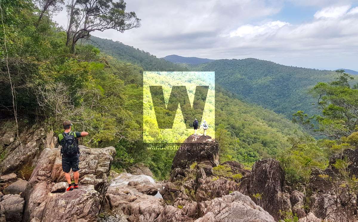
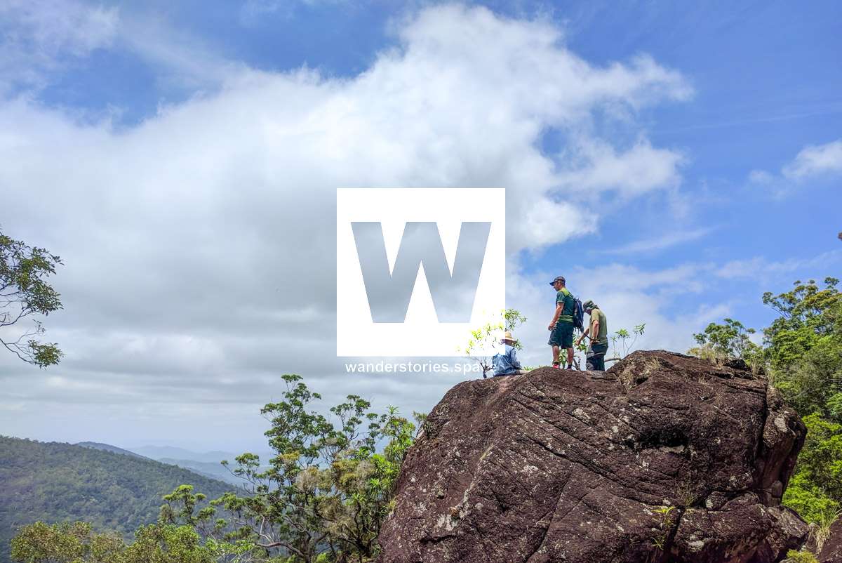
Approach
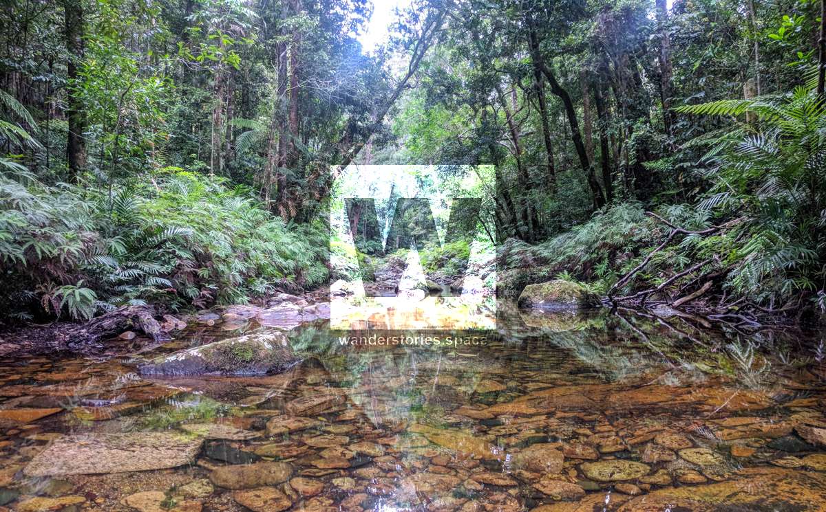
The hike is about 11 km in total. It is on track for about 6.5 km and down the creek for about 4.5 km. It's a full days walk. The drive up and arranging the car shuttle will take about two hours before and after the hike. So start very early and don't expect to get home before dark. If you're going as a group, one of the petrol stations Deeragun is a great meeting point.
Interactive Map
Here's an interactive map of the hike. Note take we take the Paluma tracks to Waterfall Creek so no bush bashing is involved.
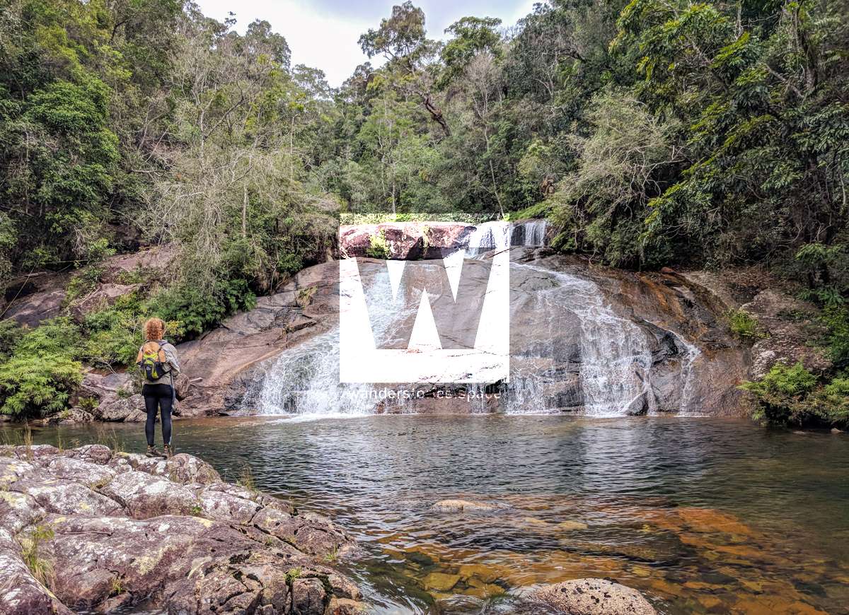
Be sure to stop off at Diorite Falls by taking the southern route into the creek marked on the map above.
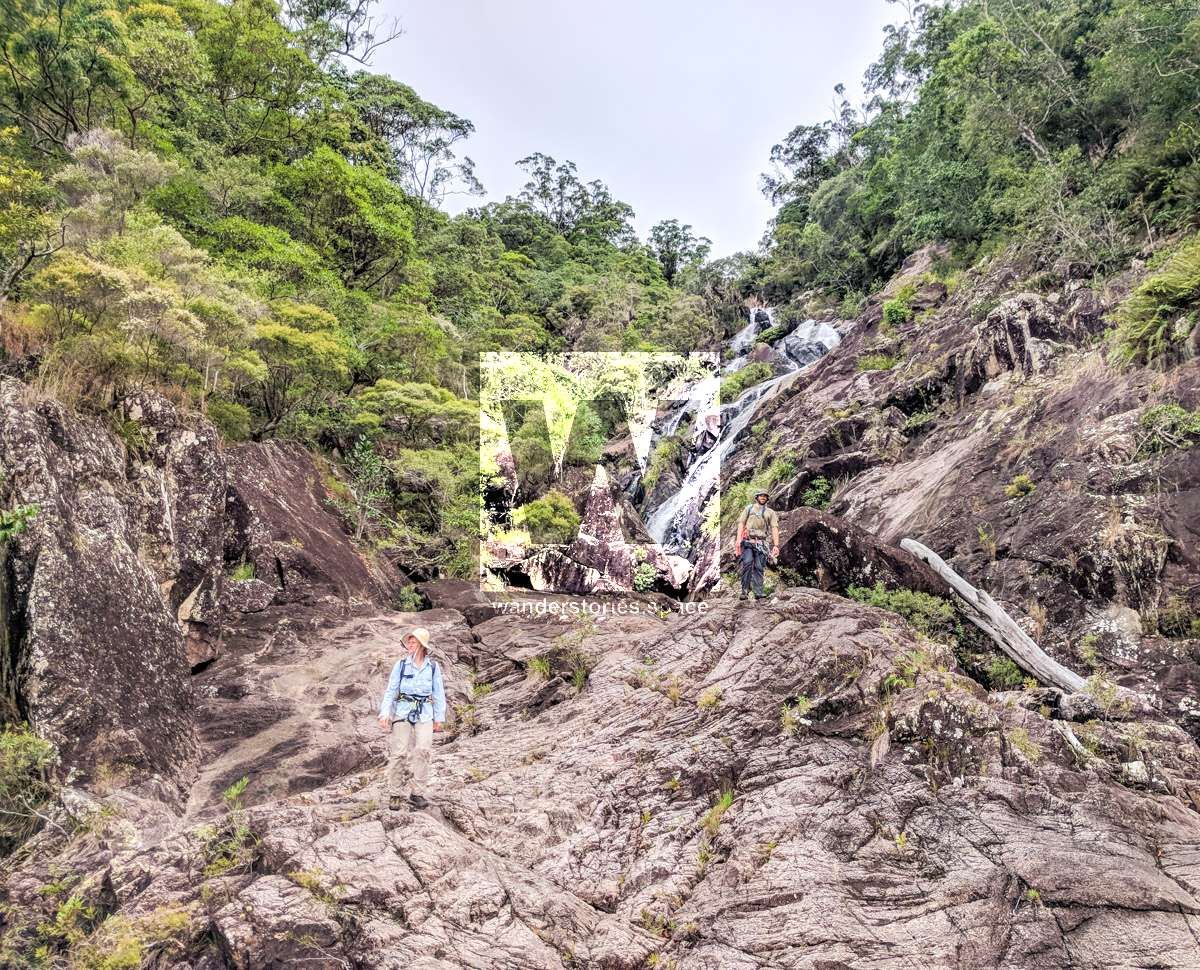
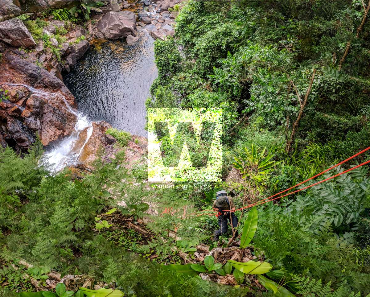
It's easy enough to rock scramble down the large waterfall you can see from the highway but there are a few technical bits along the way. The Townsville Bushwalking Club have gone down this creek several times and bushwalked around the cliffs.
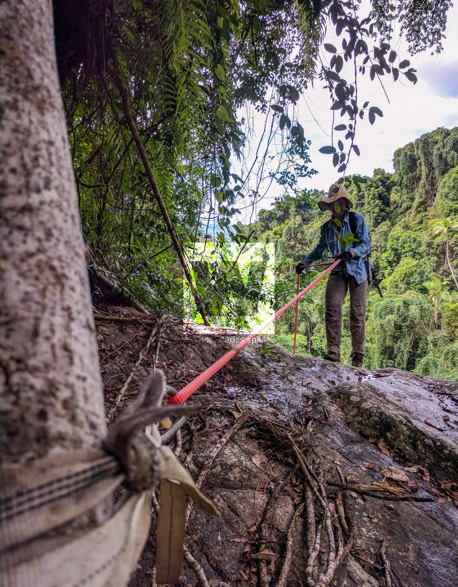
There are no bolts on this trip but there are plenty of natural anchors to use. Take a few extra slings to rap from. It is highly recommended to cancel your trip plans if it's forcasted to rain.
Rappel 1 (optional)
You can either set up an abseil or find a path that can be climbed down easily.
Rappel 2 (optional)
We used a rope to get down this section instead of finding a way we could rock scramble down the steep parts.

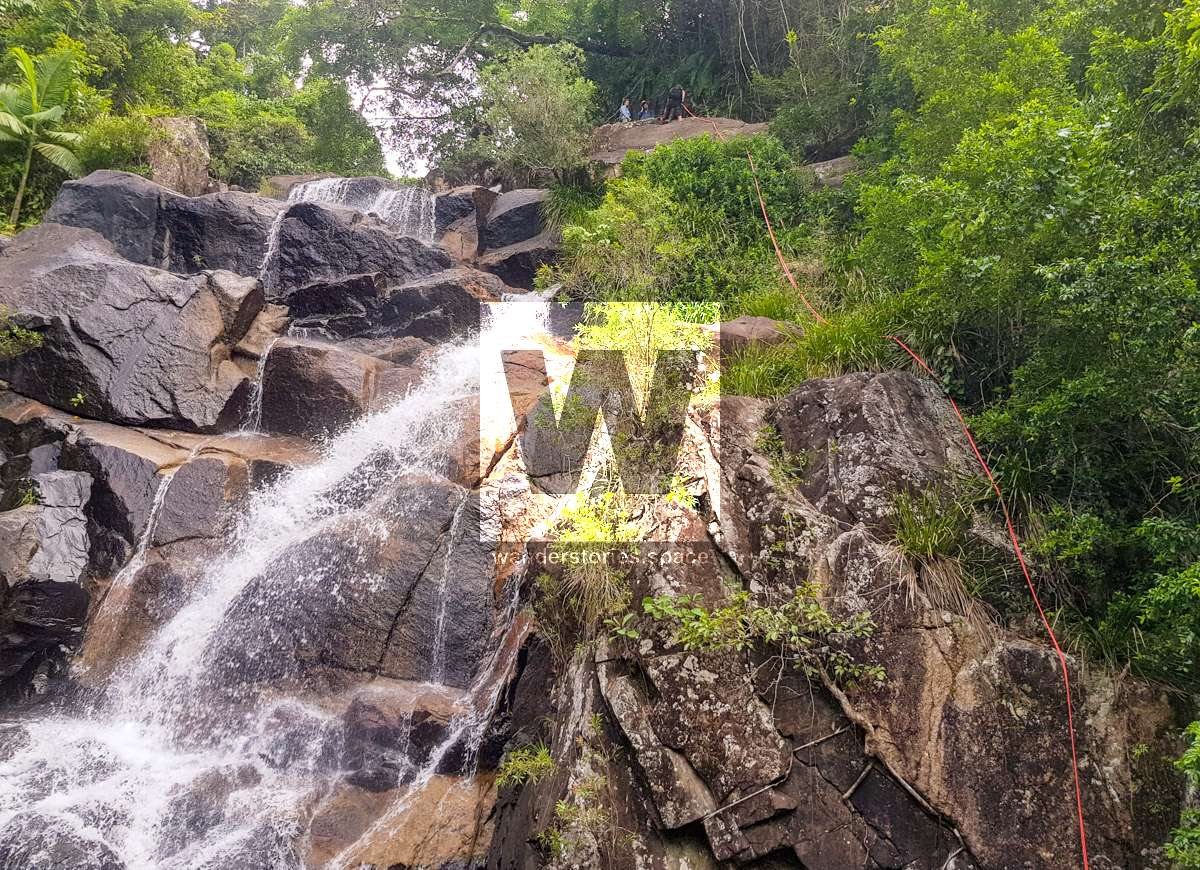
Rappel 3
A 15m rappel wrap
Rappel 4
30m rappel
Sacrificial sling required. Wrap around fig tree root.
Rappel 5
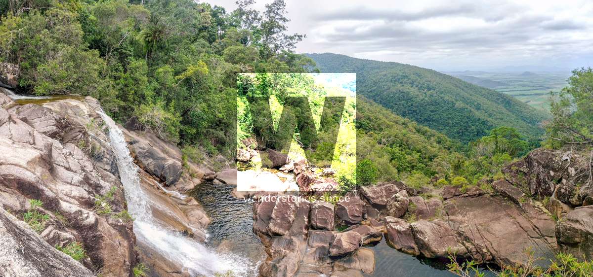
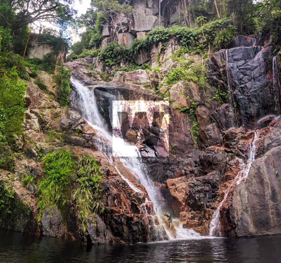
Two large waterfalls - a fork in the creek.
35m rappel
Option 1: Throw your 70m rope over the large tree branch and swing-out.
Option 2: Sling around tree roots. Sacrificial sling required.
Rappel 6 (optional)
Can scramble around right.
Exit
You will need to contact the landowner (end of Zammits Road) at the bottom of the range to request permission to walk through their private property.
You'll need a day pack with
- about 1L of water for the walk in. Water in the creek should be drinkable without sterilisation but do so at your own risk.
- Food and snacks for the day.
- Sun protection (hat, long sleeve shirt recommended, I'll wear shorts for easier movement), sunscreen. Most of the creek is open.
- Shoes; I recommend shoes that have grip on wet granite rocks. I'll be wearing joggers.
- A 70m rope, harness, belay device, prusik and carabiner as an extra safety precaution.
- A spare set of clothes for the car journey home.
Anchoring notes
There are various natural anchors throughout the canyon, however, it is not unusual to come across damaged trees, especially after large flooding events. Please use sound judgement when considering previously installed anchors, like tape slings, ropes, and other textiles. There are no bolts in this canyon.
Surfaces
Along the route there are various sections of wet, slimy, and dry rock, as with all canyon environments. Please be mindful of your traction and regularly test your grip throughout the route as you cannot rely on the colour or texture of the rock to determine its safety against slippage. Take caution when near cliff edges.
Experience
No responsibility or liability is taken for any harm, death or loss of property resulting from the use of this article. You must carry anchor building materials, be experienced and use your own judgement when canyoning. Flooding events can strip anchors and change the canyons layout and conditions. Improper and insufficient experience will result in serious injuries or in many cases death. Always respect all signs you encounter and take everything in you brought with you.
Please read the Beginners' tips for canyoning in North Queensland article.
See our general disclaimer that includes canyoning.
Canyoning Topo
This canyoning topo is for illustration-purposes only.
Legend
X / XX - Single and twin bolt anchor.
NA - Natural anchor such as a tree or rock.
TL / TR / C - True left, true right and centre when looking downstream.
R1-8m / R2-6m - First rappel and its height in metres, second rappel and height.
Optional - These rappels can be avoided by exiting prior or walking around.
Notes
Stinging tree (Gympie Gympie) may be present in this creek.
Please note that an activity permit may be required in national parks.
If this information is outdated or you would like to make a correction, please contact us.
This article, and all other articles, are for entertainment purposes only and are not to be used as a guide. Please see our Disclaimer for more information.