How to summit Mount Elliot
Mount Elliot is at the southern edges of the Wet Tropics bioregion and is the highest peak in Bowling Green Bay National Park. The Elliot Massif catches a lot of rain and has plenty rainforest growing at it's summits as well as along the various creeks.

Location - Bowling Green Bay National Park, North Queensland, Australia
Distance - ~30 kilometres return
Duration - Allow 10-12 hours return
Grade - 5
The Bowling Green Bay National Park (near Townsville) is a southern outlier of the Wet Tropics bioregion and has rainforest growing at its summit as well as along the various creeks.
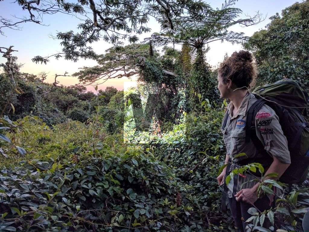
Hiking to the summit of Mount Elliot (1,218 m), Bowling Green Bay National Park is best done as a two-day trip to fully enjoy the summit and camping overnight in the rainforest. Though several people prefer to do it in one day.
Alan Simet, a well-known adventurer in his 80's who has summited Mt Elliot 39 times throughout his life, believes that the easiest and prettiest way to get there is via the Terraces. While a few members of the old Townsville Bushwalking Club members prefer the North Creek ridgeline route. Others have said the Alligator Creek route is the easiest.
Via The Terraces
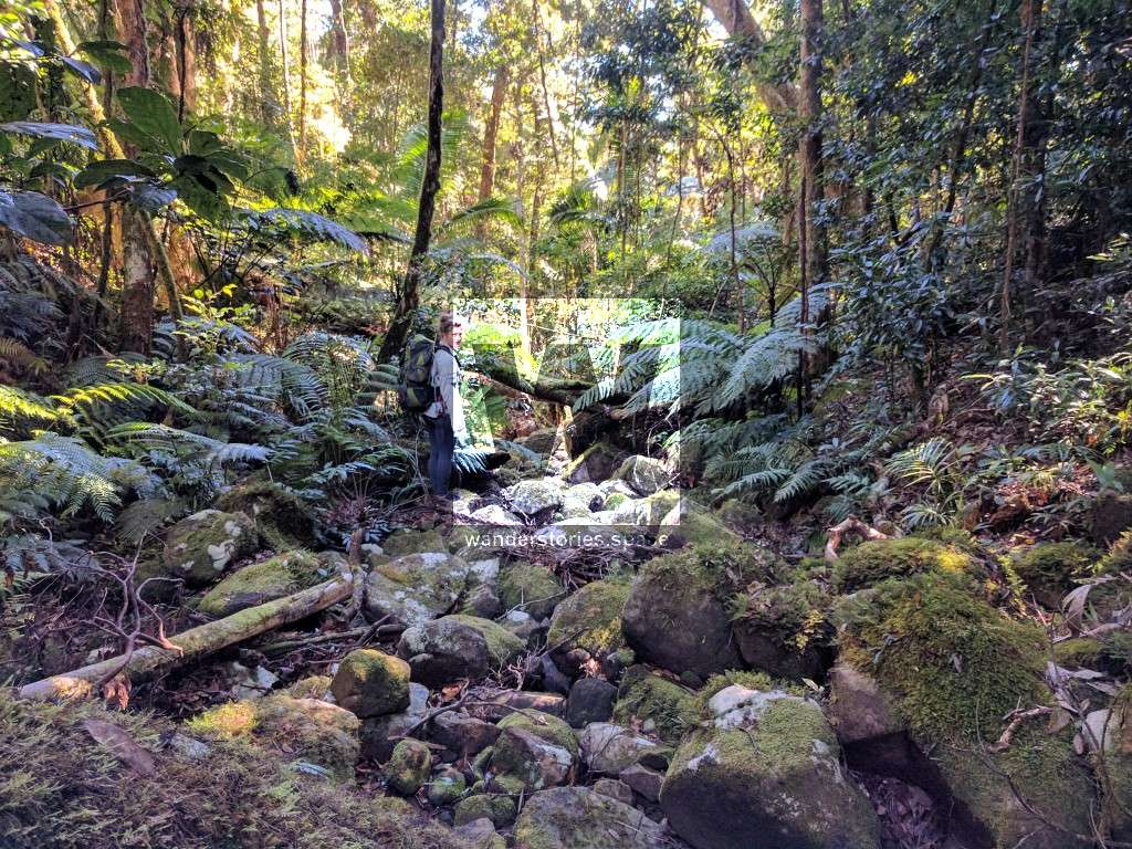
We started at Mountain View Lake Eco Park (where the Palm Creek Folk Festival is held) and rock hopped up via the "Terraces" (St Margaret Ck), past "high camp" as far as we could, taking one right fork, until we hit a massive cliff and waterfall, from there we climbed up to the right and along the ridgeline and then up onto the flat summit. We ended up camping up a few hundred meters away from the very peak because it was getting too dark to go on and we didn't want to walk with our headlights this time.
Note that access via Mountain View Lake Eco Park is no more.
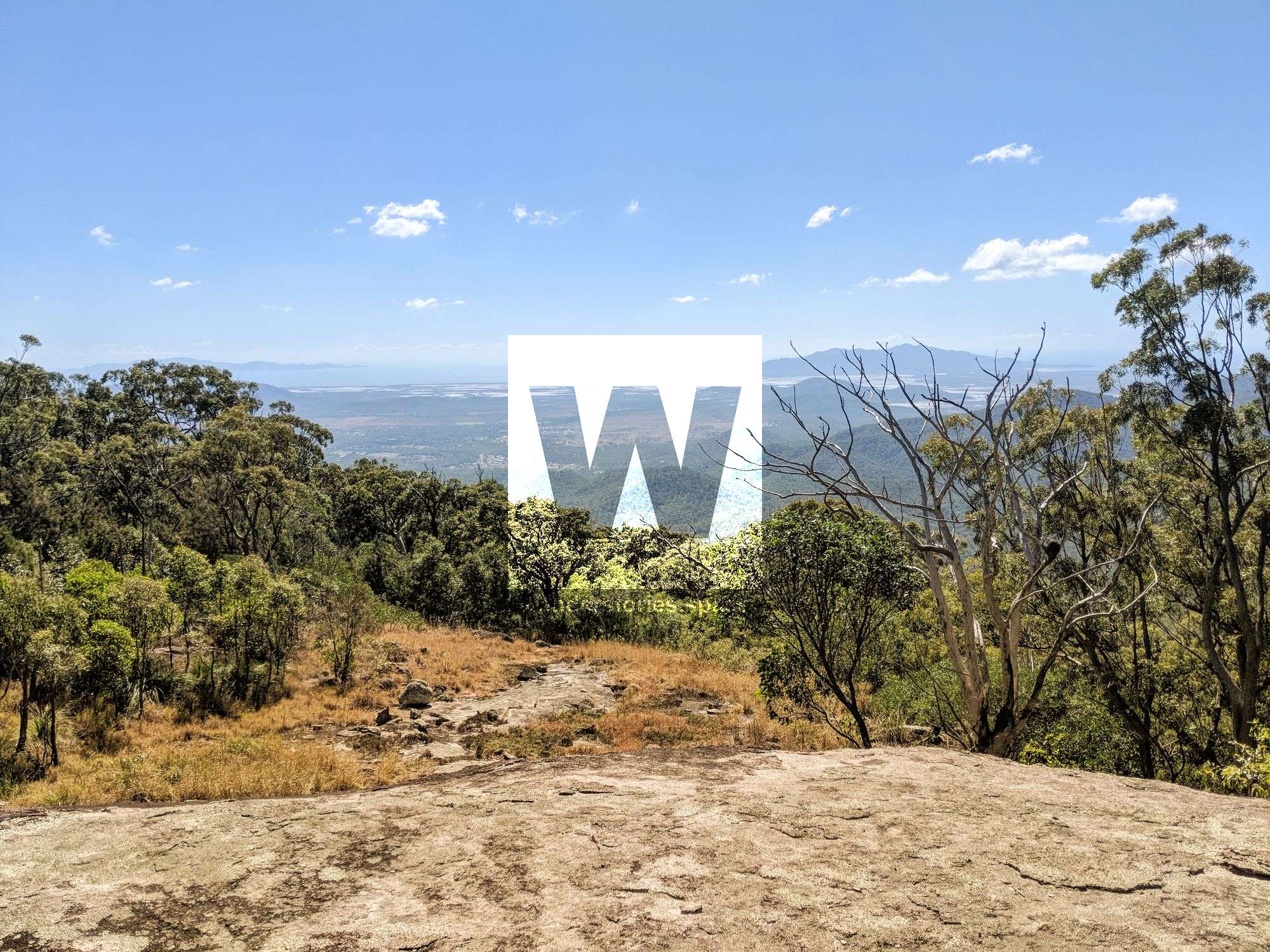
In the morning we made our way to the summit. Not much of a view, as expected, but the creeks are spectacular. The top is still battle damaged from Cyclone Yasi which makes it slow going as the vines have overgrown patches south of the summit.
After that, we headed down Alligator Creek going bush at the top of the alligator creek falls and back down into the creek and along the walking track, seeing wild horses and a kite along the way.
Via North Creek / Sandy Creek and ridgeline
In the 80s and 90s, this route was a popular and one of the easiest ways to the top of Mount Elliot with the Townsville Bushwalking Club. You simply walked up to the saddle between the two peaks and turned right. There was once a rough route up the ridgeline to the summit of Mt Elliot that was put in by Stefan Aeberhard.
Alligator Creek
Start at the recreational area at Alligator Creek to the base of the Alligator Falls, followed by a steep climb up the falls. It's an easier way to overcome the initial steep climb to 500 metres that surrounds the whole mountain than coming from Cockatoo Ck. However, Cockatoo Ck is more interesting than climbing the grasslands around Alligator Creek Falls. If you do summit Mt Elliot from Alligator Creek, there is a massive patch of wait-a-while well above to main falls which you will have to cut your way through.
Some hikers, like Stephen Donaldson, have walked partway up Alligator Creek before taking the ridgeline the rest of the way. You can still see a rough path from when the rough trail was made in 2006.
Cockatoo Creek
The crazy way to summit Mt Elliot is via cockatoo creek. Follow the creek up past cockatoo rock (a monolithic looking, huge rock above the exit of cockatoo gorge) and then up the ridge towards the summit. There are HUGE boulder fields near Cockatoo Ck that make this journey interesting.
TIP: Overnight on a bare rocky place called Cockatoo Rock. Then enjoy views of the Burdekin at about 1000 metres.
The Northerlies are warm and moist winds which, I suspect, is why the Northern side of Mt Elliot has typically denser vegetation. Cockatoo Creek and its tributaries have must have much more rainfall than Alligator Creek as the sides of Cockatoo Creek have more rainforests and than the dryer sides of Alligator Creek.
Major Creek
Majors Creek (public watercourse) and Cockatoo Creek form a straight line and cut the massive mountain into two. The valleys are filled with Lantana and Lawyer Cane. Be extra prepared when hiking from this direct and allow several days.
Via the Shoulder ridgeline
The shoulder can be approached via several routes. From the shoulder, follow the main ridgeline to the summit.
Interactive Map
Here's an interactive map of all the routes
Tips
- Lookup a bare spot on the maps and plant to overnight there - view onto Townsville or view more towards the south.
- You can't rely on mobile reception when hiking up there
- There is a photo of a man holding a baby nailed into a palm tree at the northern end of the plateau (also keep an eye out for an egg-shaped rock)
- There are two plane wreckages that I know of in Bowling Green Bay National Park, One in Major Creek valley and the other near Mt Storth/Saddle Mountain
- Secateurs can come in very handy on this hike, often the pace slowing down to a halt when cutting through the lawyer cane and vines (don't do this within National Park).
- If you plan to do it overnight (recommended), you will need a remote bush camping permit - Mount Elliot remote bush camp
- The best time to attempt this hike would be the dry season, observe the remnant streams.
- Do not trespass on private property.
Endemic Species
The riverine leaf-tailed gecko (Phyllurus amnicola) is endemic to the boulder-lined creeks of Mt Elliot at altitudes above 400m above sea level. Mt Elliot and its entire mountain range is also home to two other endemic herptiles; the skink (Glaphyromorphus clandestinus) and the southern-most occurring Australian microhylid frog (Cophixalus mcdonaldi). These three herps lie within the boundaries of Bowling Green Bay National Park.
Mt Elliot is also home to a special crayfish species that only live here and nowhere else in the world. (Euastacus bindal) is a small ~3cm crayfish only found above 850m altitudes on Mt Elliot. That is its natural range. It is a relic of previous climatic eras when the region was cooler and wetter. It only likes cool water so is confined to the mountain top. Unfortunately, this means that climate change (warmer water or drying creeks) makes it especially vulnerable. For this reason, it is listed as Critically Endangered under the federal government EPBC Act (Envt Protection and Biodiversity Conservation Act) and Vulnerable under the Qld government Nature Conservation Act. There is no recovery plan in place for this species because there isn't anything specific they can do to protect it from the issue that threatens it most – climate change.
Basically, they were only described 30 years ago and we know virtually nothing about them. There are several other related Euastacus crayfish species that are in the same predicament (only exist on 1-2 mountain tops) in north, central and south Queensland. The whole group are a relic from previous climatic eras.
What to bring
- Sleeping gear (tent or hammock)
- Water containers. Water to be collected from the creeks. Treat to sterilize (boil, UV, chemical, or filter).
- First Aid Kit and Personal Locator Beacon (PLB)
- Topographic map & compass / GPS unit
- Food for the two days
- Cooking utensils, gas stove. Open fires are prohibited.
- Secateurs for cutting through the rainforest as it gets really thick in places
- Torch or headlamp
- Warm clothing as it can get cold at night (weather dependant)
- Wet weather gear (weather dependant)
- Rubbish bags. All rubbish (including food scraps) must be carried out.
- Insect repellent
- A small trowel for burying faecal waste. Bury human waste and toilet paper at least 15 cm deep and 100m from campsites, tracks and watercourses to guard against pollution and the spread of disease.
This article, and all other articles, are for entertainment purposes only and are not to be used as a guide. Please see our Disclaimer for more information.