Elliot Springs and Bindal Ridge Tracks
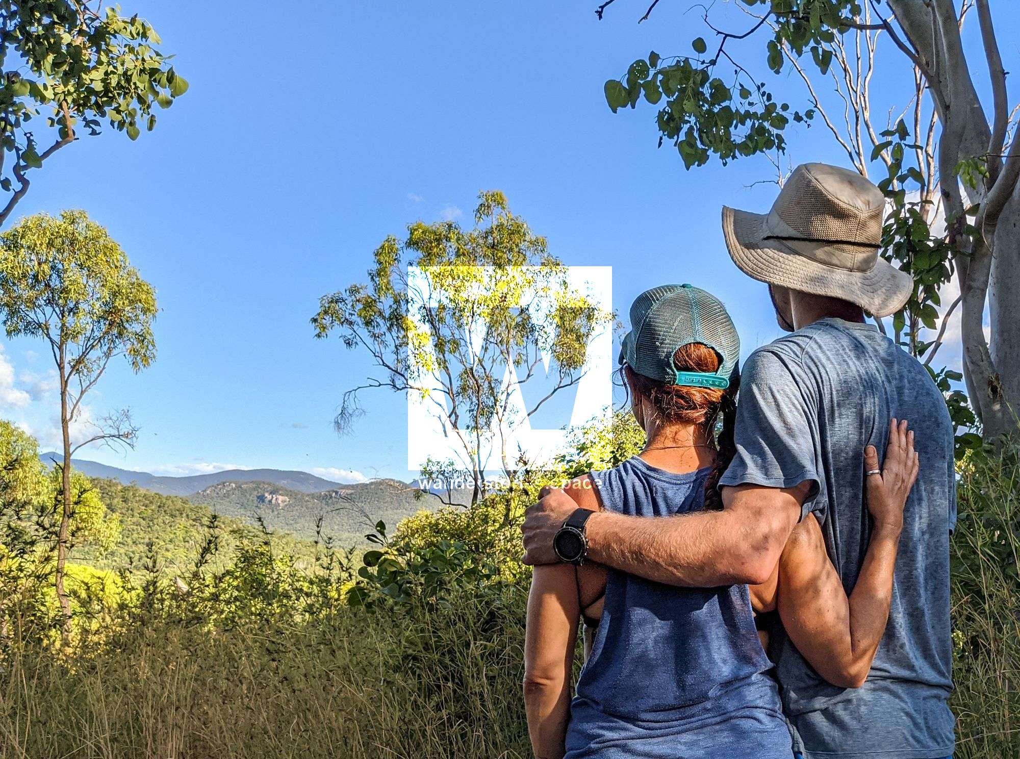
Elliot Springs sits cradled between the Muntalunga Range to the east, Mount Jack to the west and The Sisters Mountains to the south, with panoramic views to Mount Stuart and Mount Elliot massif.

Location - Townsville, North Queensland, Australia
Distance - 4.2 kilometres return
Duration - Allow 1-2 hours return
Grade - 3, easy to medium
The Townsville suburb of Elliot Springs is located on both sides of the Bruce Highway (city side of Billabong Sanctuary) and sits cradled between the Muntalunga Range to the east, Mount Jack to the west and The Sisters Mountains to the south, with panoramic views to Mount Stuart and Mount Elliot massif. It's 15 kilometres south-east of Townsville's CBD and close to Billabong Sanctuary and Alligator Creek.
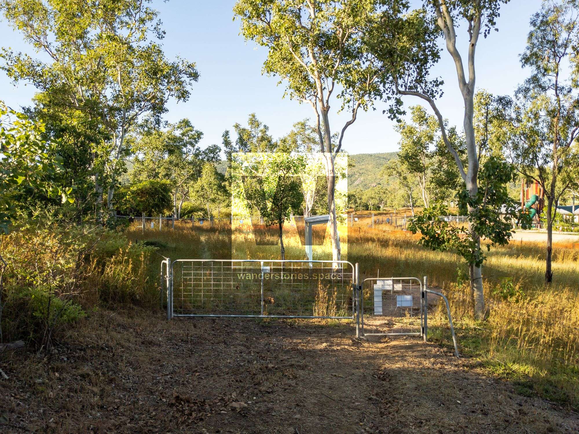
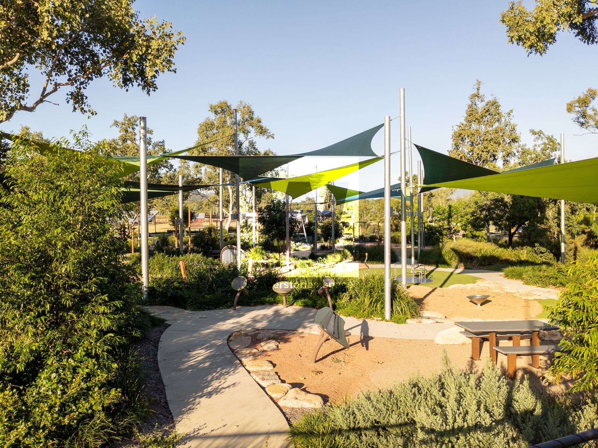
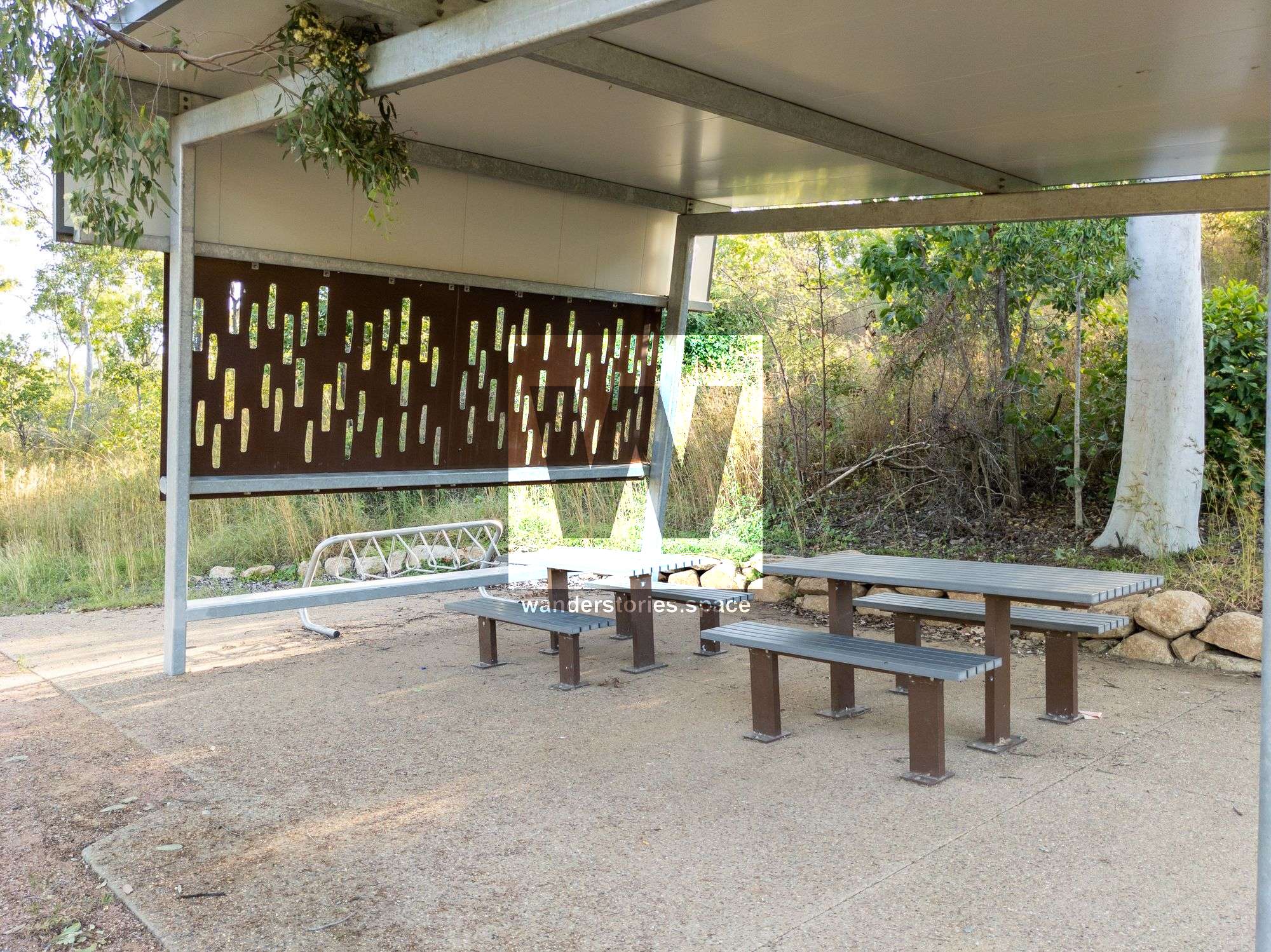
The Elliot Springs recreation park, Wadda Mooli Park (meaning 'welcome' in the Bindal people's language), is open to the public and located at the base of Bindal Ridge, a 234 hectare conservation zone. Wadda Mooli Park is also where you can start your 4.2 kilometre return walk to the top of the ridge and start the mountain bike trails.
The fairly extensive network of trails and footpaths link local parks, sporting fields, playgrounds, picnic, and barbeque areas, as well as the ridge walk, super park, and mountain bike tracks. The surrounding bushland reserves protect the seasonal creeks and ensure habitat for wildlife. You can explore rocky creek beds or head to the hills for hiking and mountain biking adventures in the natural bushland on the Bindal Ridge.
Interactive Map
Bindal Birri-Gubba Dreaming Gibba (Dreaming Tracks)
Gubulla Munda (Carpet Snake) is the totem for the Bindal Tribe of the Birri-Gubba Nation, the Traditional Owners of this land. Gubulla Munda holds sacred cultural and spiritual significance to the Traditional Owners.
Gubulla Munda Dreaming comes from the higher powers of mother earth. Gubulla Munda travelled through the water up to the dry land and rested. The perspiration of Gubulla Munda formed hills, mountains (including Bindal Ridge), rivers, and streams. Gubulla Munda travelled back down to the water and rested. Gubulla Munda moved through the waters the droppings formed the islands.
This reserve is managed as a natural area. It contains steep embankments and other natural features. Please note you may encounter wildlife and livestock. Users of Bindal Ridge are encouraged to download the free Emergency+ app prior to entering the area.
Moongun (Quoll) // Bindal Ridge Track
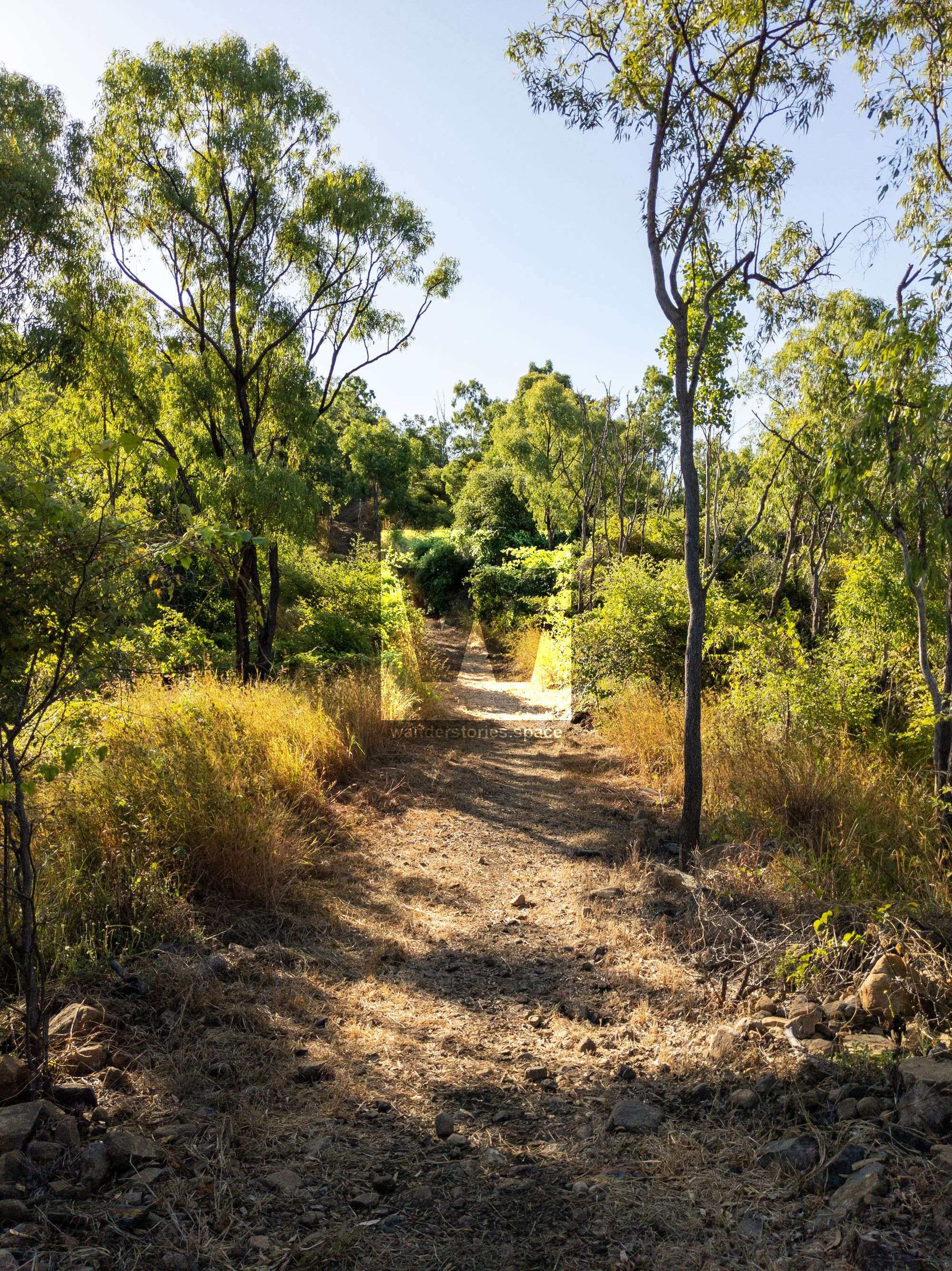
A class 3 walking track containing steep grades, loose surface areas, uneven steps and minimum infrastructure. Use with caution. Reasonable physical fitness is required. 4.2 kilometres return.
From signpost, picnic area, and bike rack, walk through gate and up wide track along the ridge - this is a shared zone up until the start of Gungy (Turtle) Track. From this intersection, the track is a dedicated walking track. Enjoy the breeze and views along the way before you arrive at the main lookout.
Mountain Bike Tracks
Pedestrians are not permitted on mountain bike tracks.
Easy - A single track with a moderate gradient and variable surface. Trail may have obstacles such as logs, roots, and rocks. Suitable for beginner or novice mountain bike riders.
Intermediate - A single track with moderate to very steep gradients, variable surface and obstacles. Trail may have obstacles such as logs, roots and rocks and possible sections of rocky or loose tread. Suitable for skilled mountain bike riders with a good standard of physical fitness.
Goodibun (Kangaroo) Mountain Bike
An easy 1.4 kilometre track, one-way loop anti-clockwise. The upper section is still under construction.
Goon Tha Loo (Emu) - under construction
An intermediate 5.2 kilometre track, one-way loop anti-clockwise.
Gungy (Turtle) - under construction
An intermediate 5.2 kilometre track, one-way loop anti-clockwise.
Lookout connection - under construction
This intermediate 200 metre track can be ridden in both directions and connections the lookout of the Moongun (Quoll) Bindal Ridge Track with the Gungy (Turtle) Track.
Wina (Fish) - planned
An easy 4.8 kilometre track, one-way loop anti-clockwise.
Facilities
- Bindal Ridge Walking Track
- Mountain bike trails and skills area
- Wadda Mooli Park
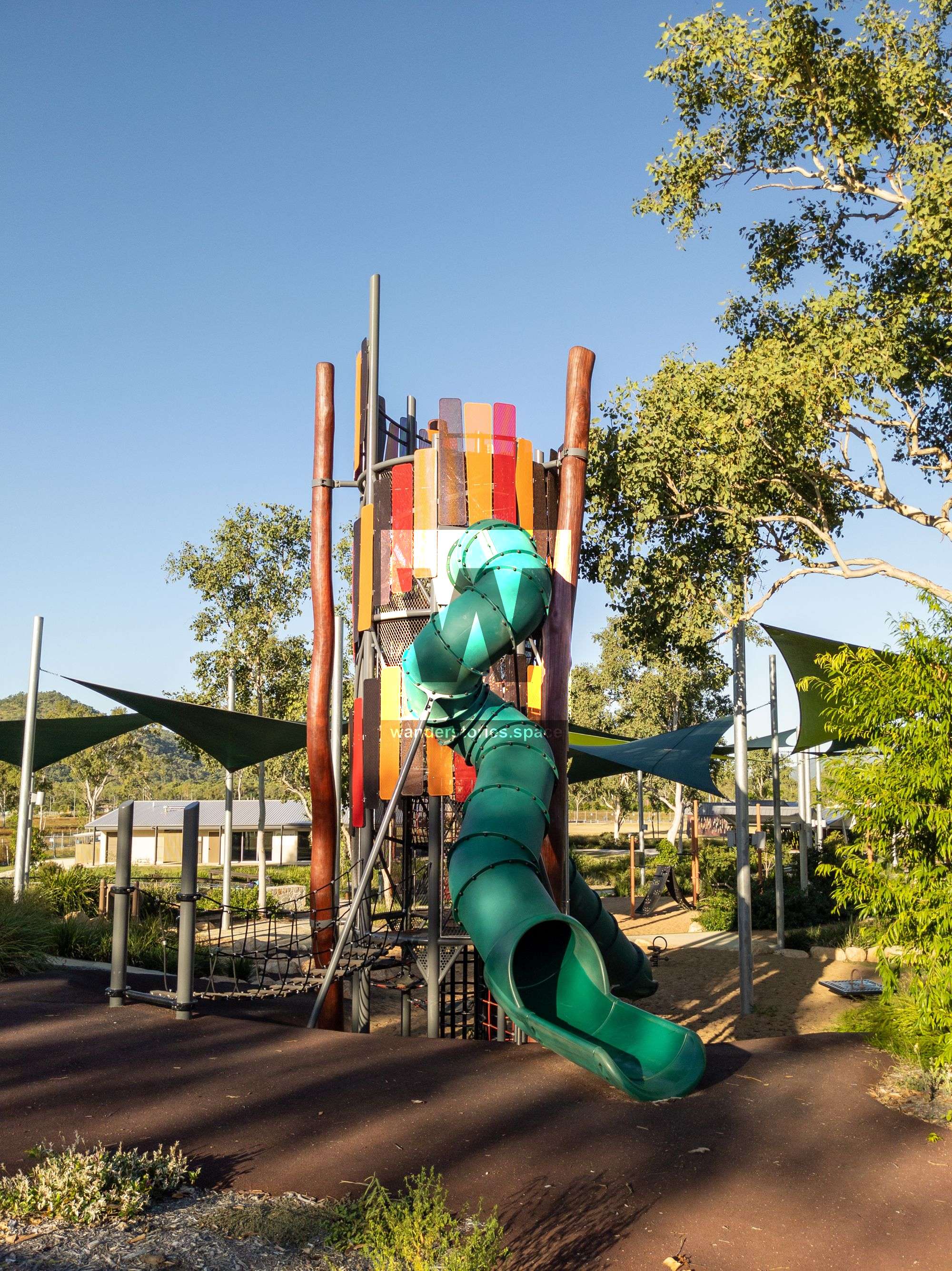
- A playground with ten metre high tree house
- Dog off-leash park
- Picnic Shelters and BBQs
Notes
- There is no water available on the tracks. Please fill your water bottle before you set off.
- Bicycles are not permitted on the walking track.
- Pedestrians are not permitted on the mountain bike tracks.
- Please stay on the track as shortcutting causes erosion.
- All flora and fauna is protected.
- Camping and lighting fires is prohibited.
- All rubbish is to be remove. Please follow the 'Hike It Out' and 'Leave No Trace' principles.
- Dogs must be kept on a leash in the reserve.
- Consumption of alcohol without a permit is prohibited.
- If you observe smoke, please don't enter the tracks.
This article, and all other articles, are for entertainment purposes only and are not to be used as a guide. Please see our Disclaimer for more information.