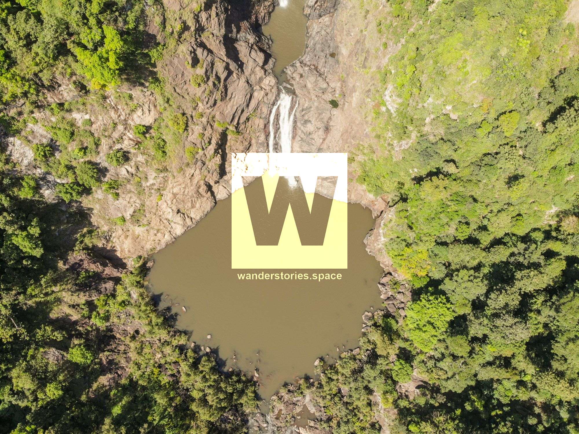
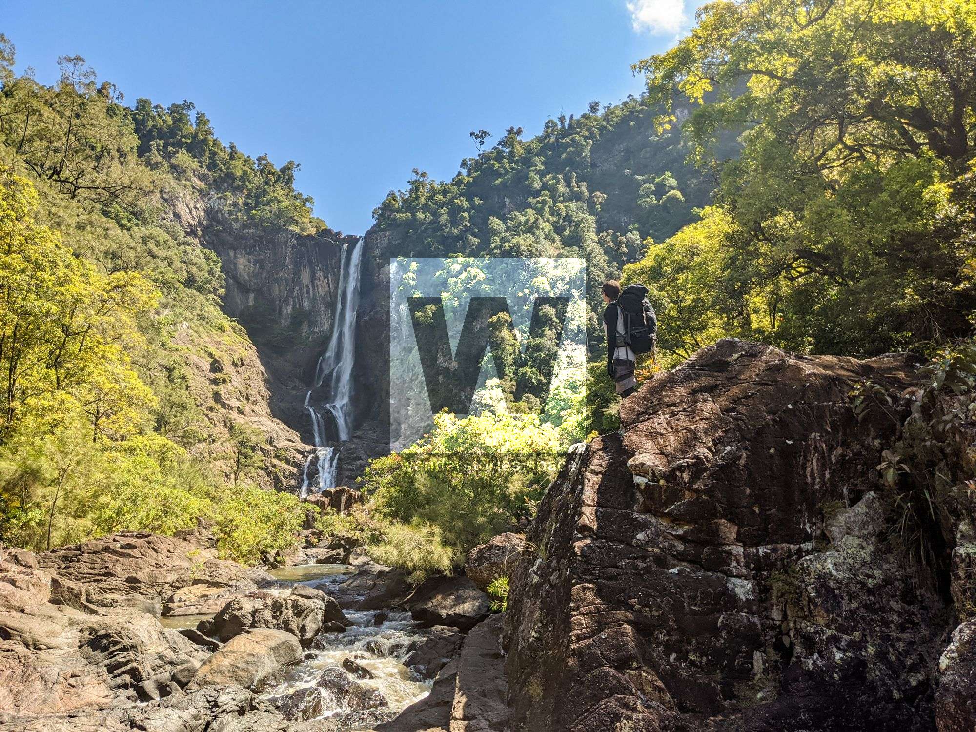
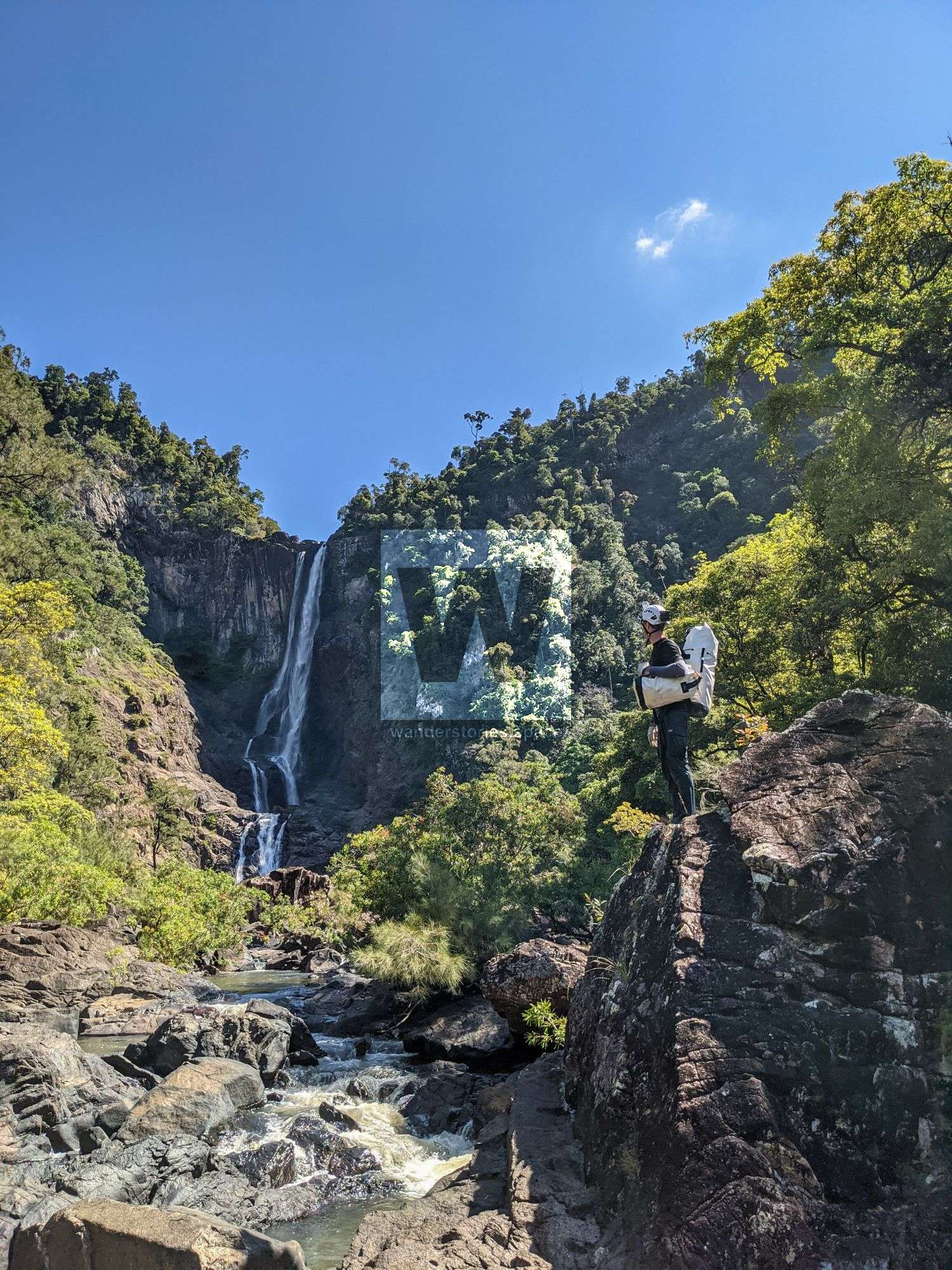
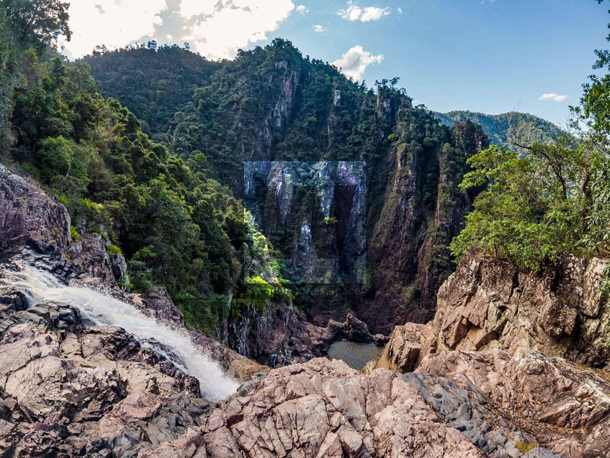
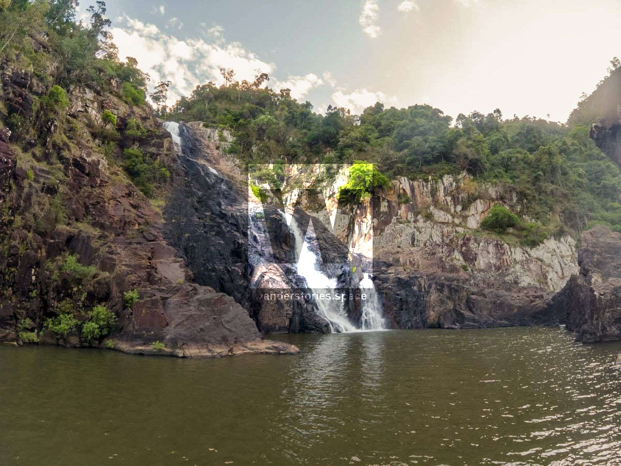
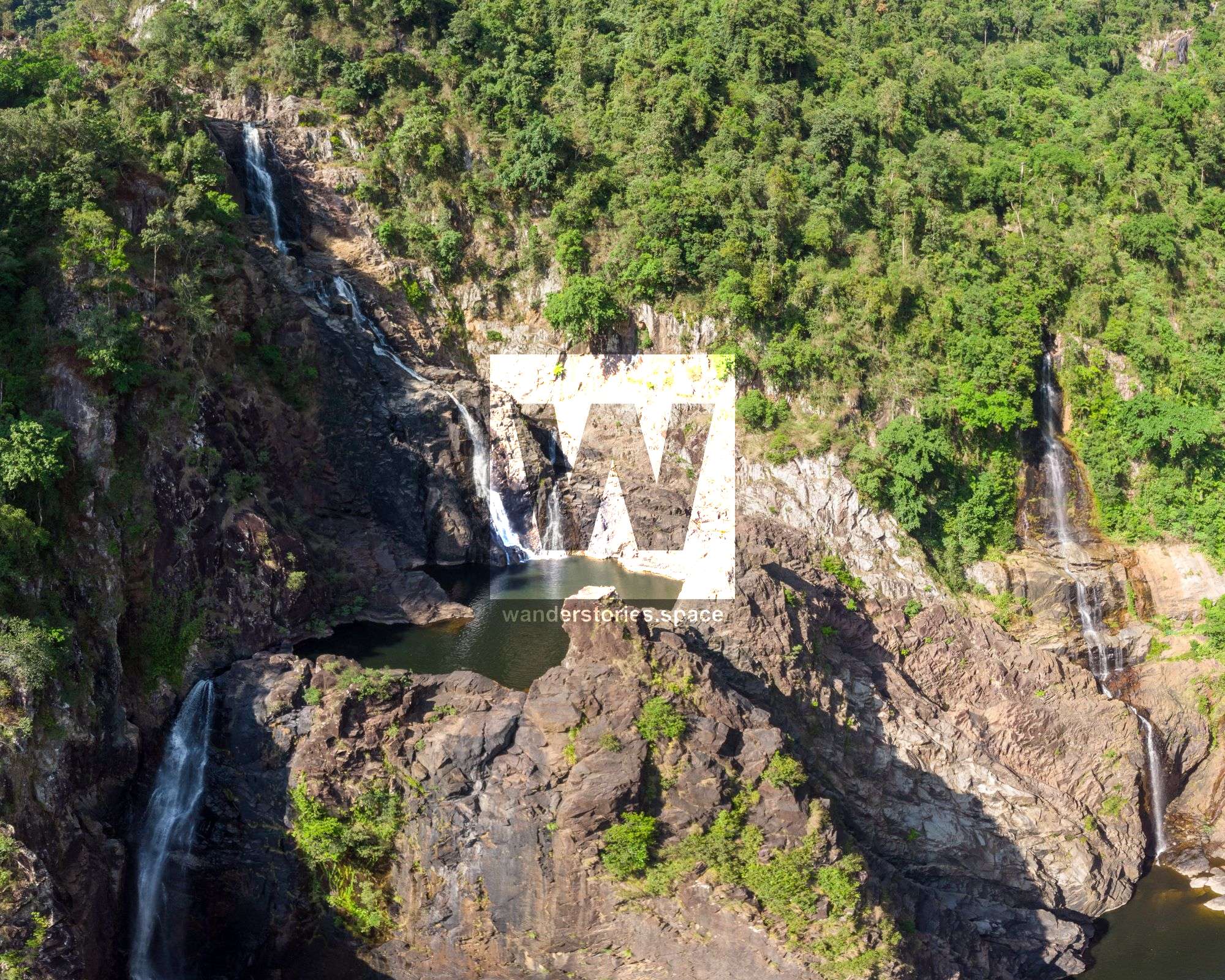
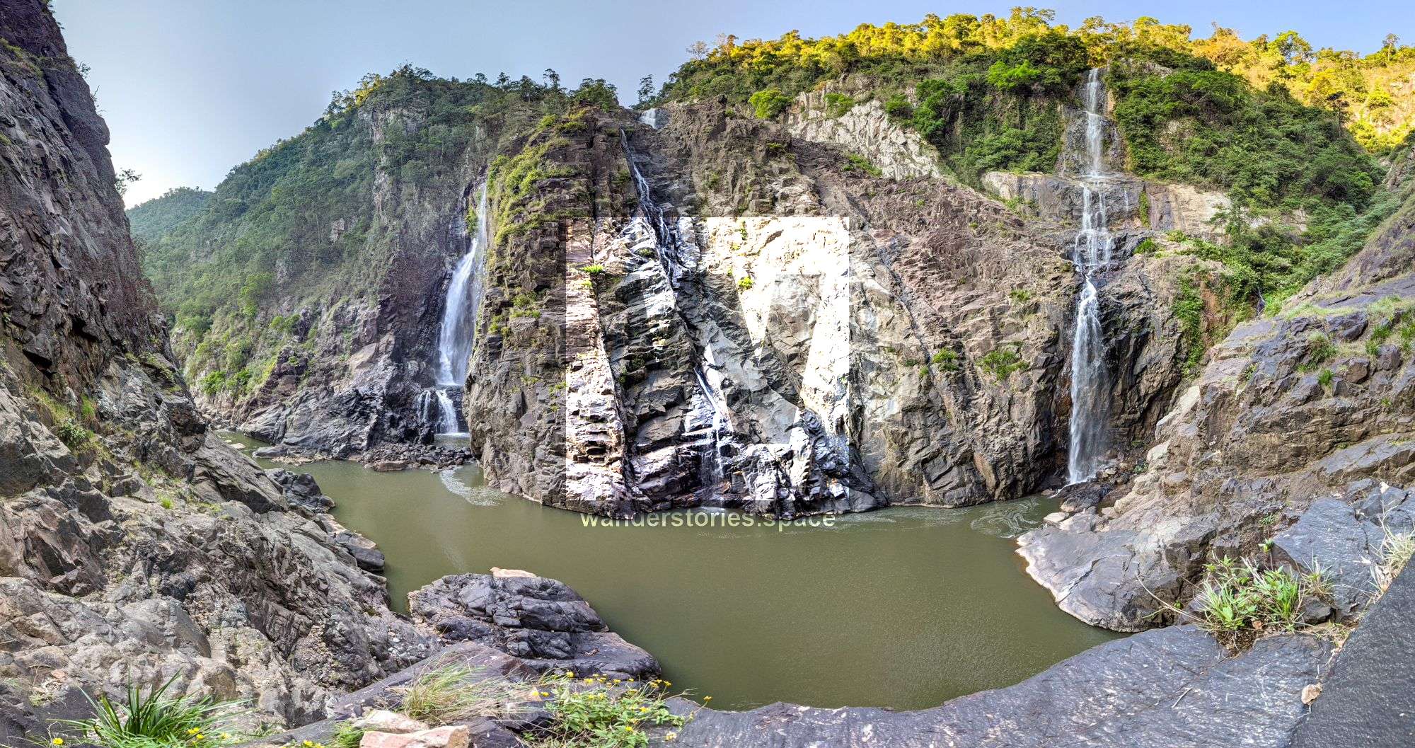
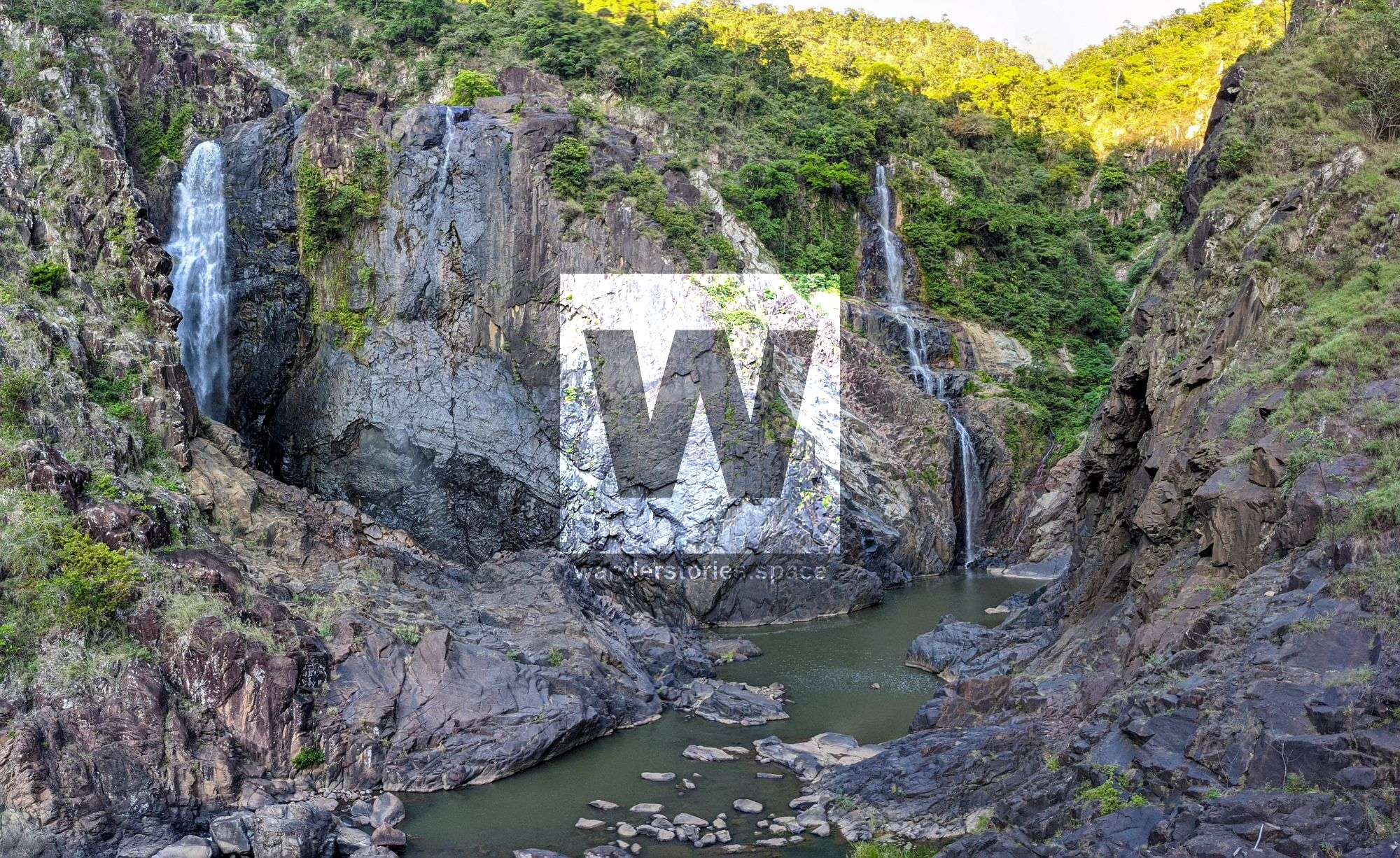
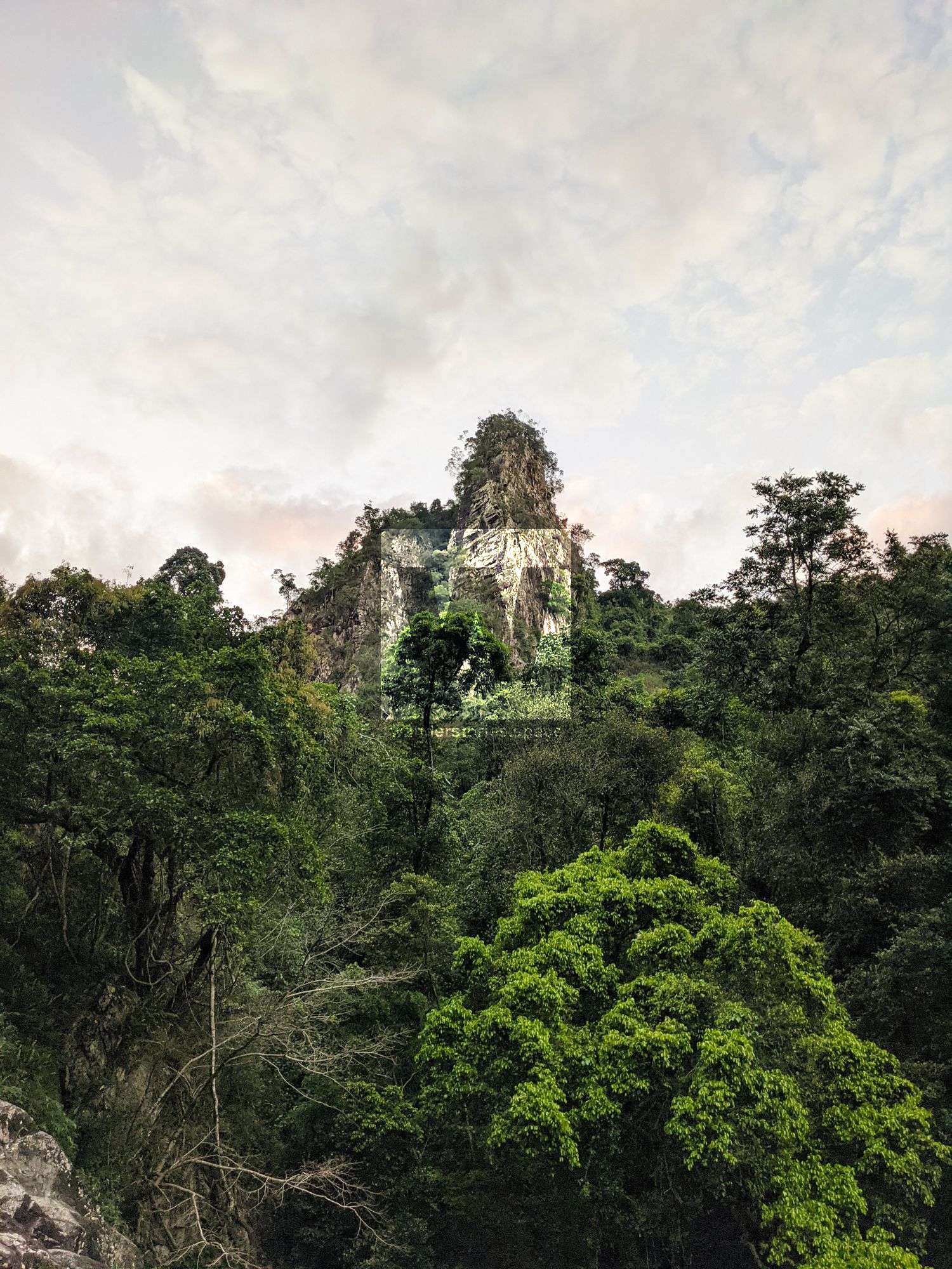
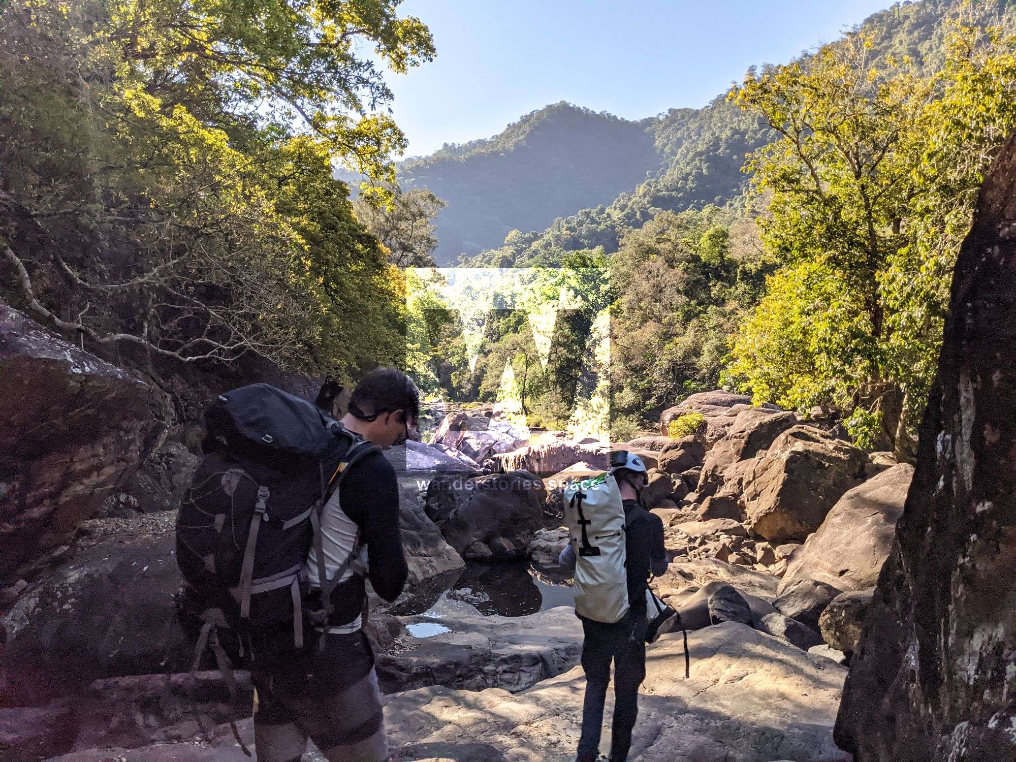
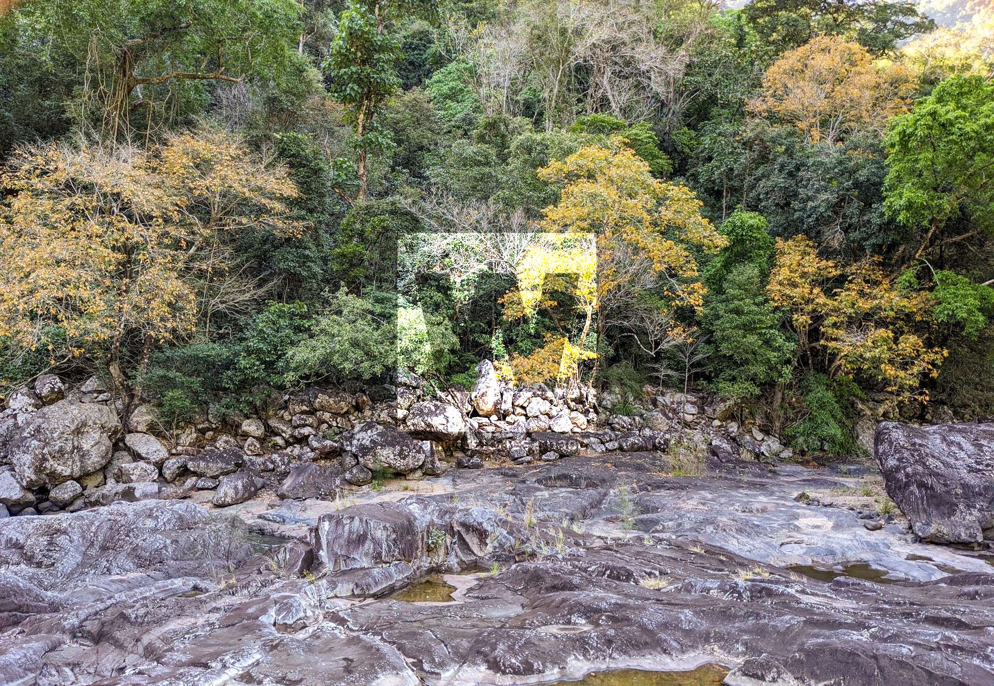
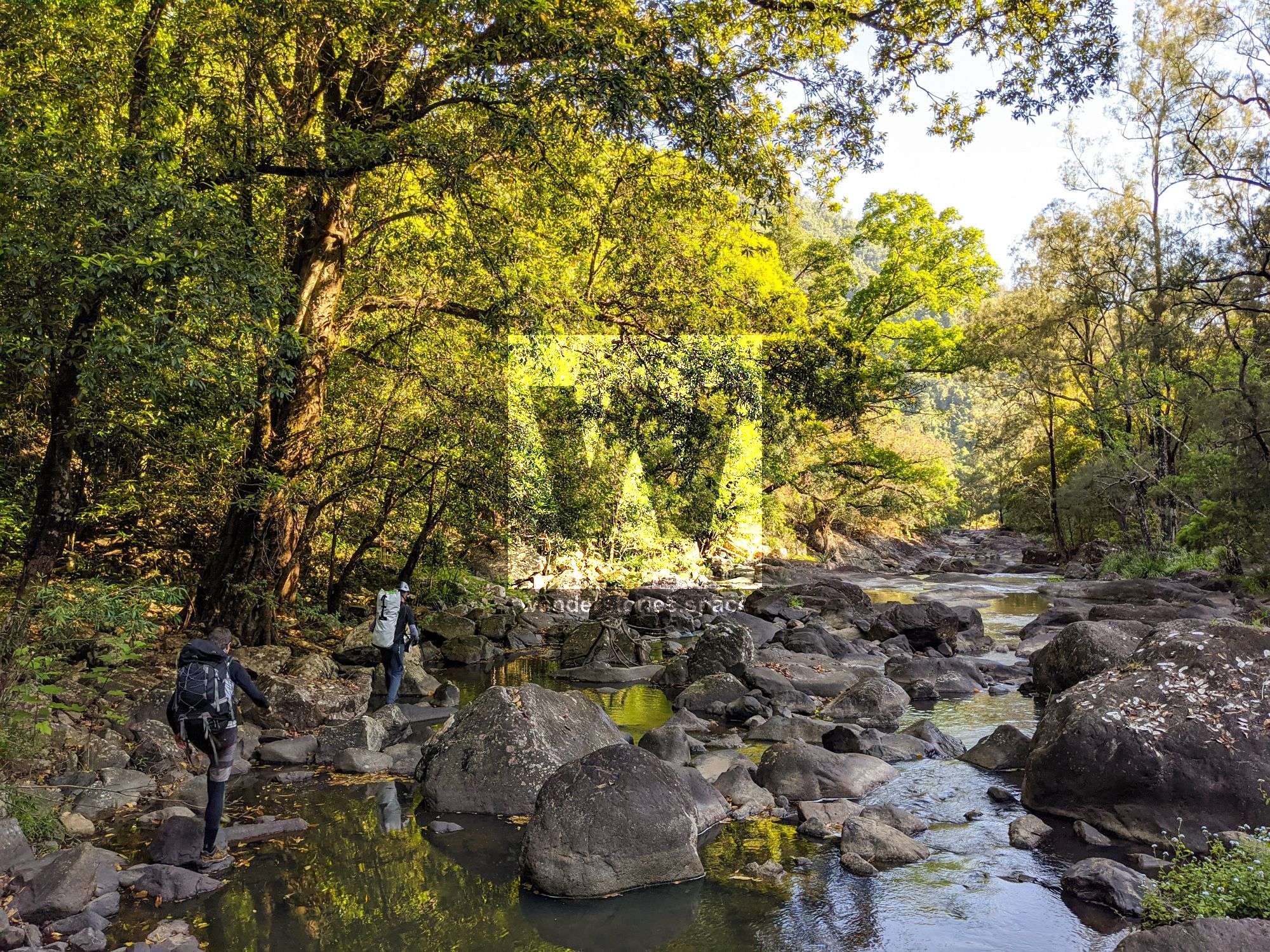
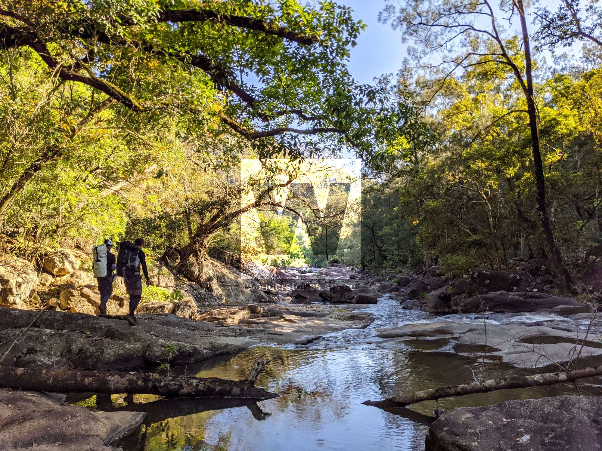
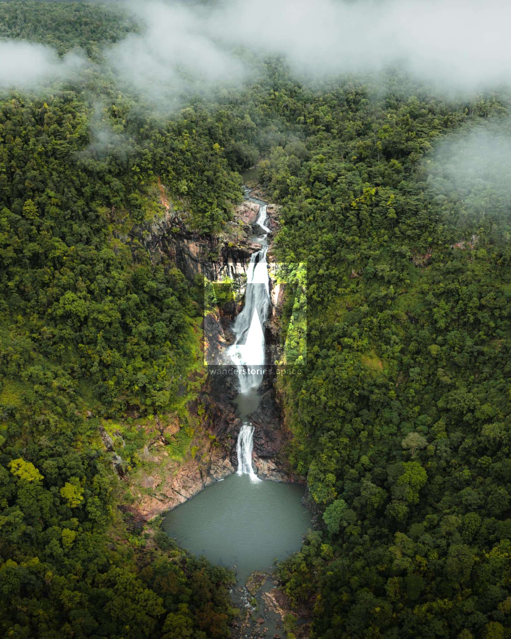
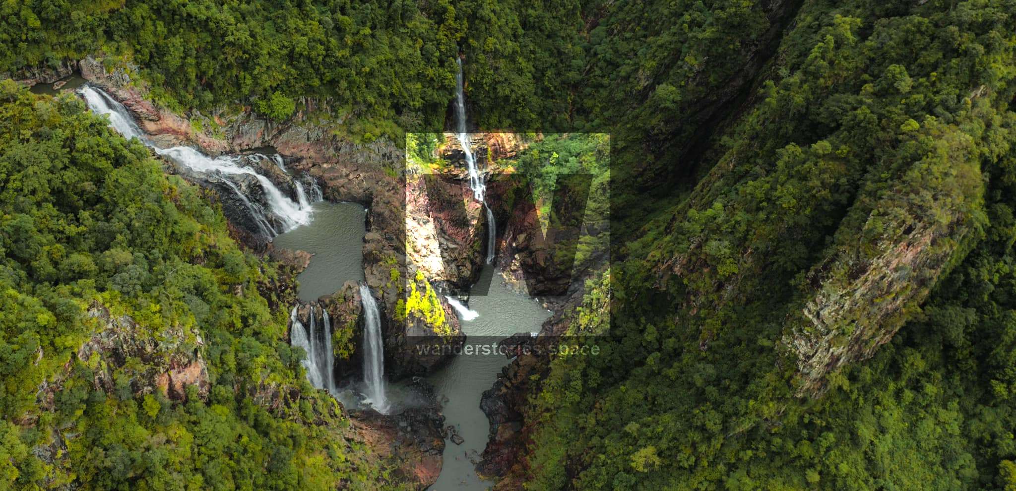
Garrawalt Canyon, Garrawalt Creek
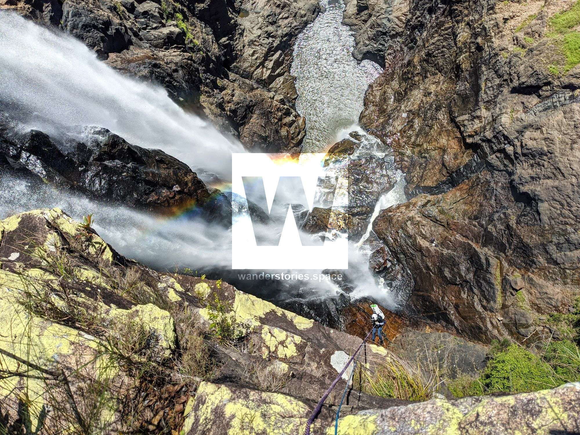
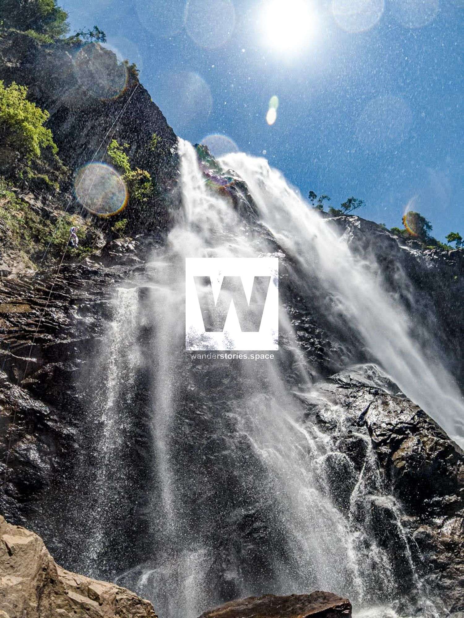
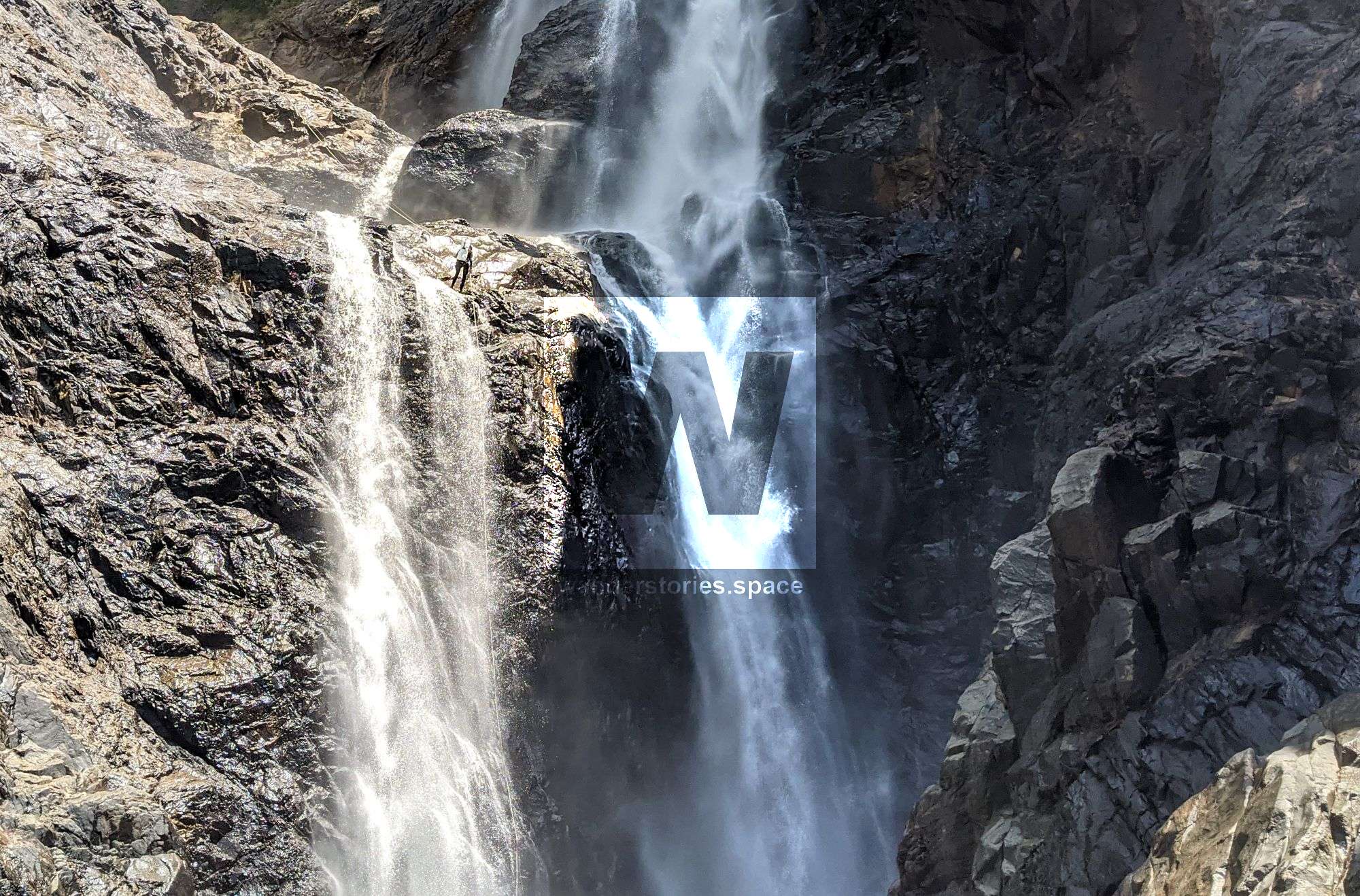
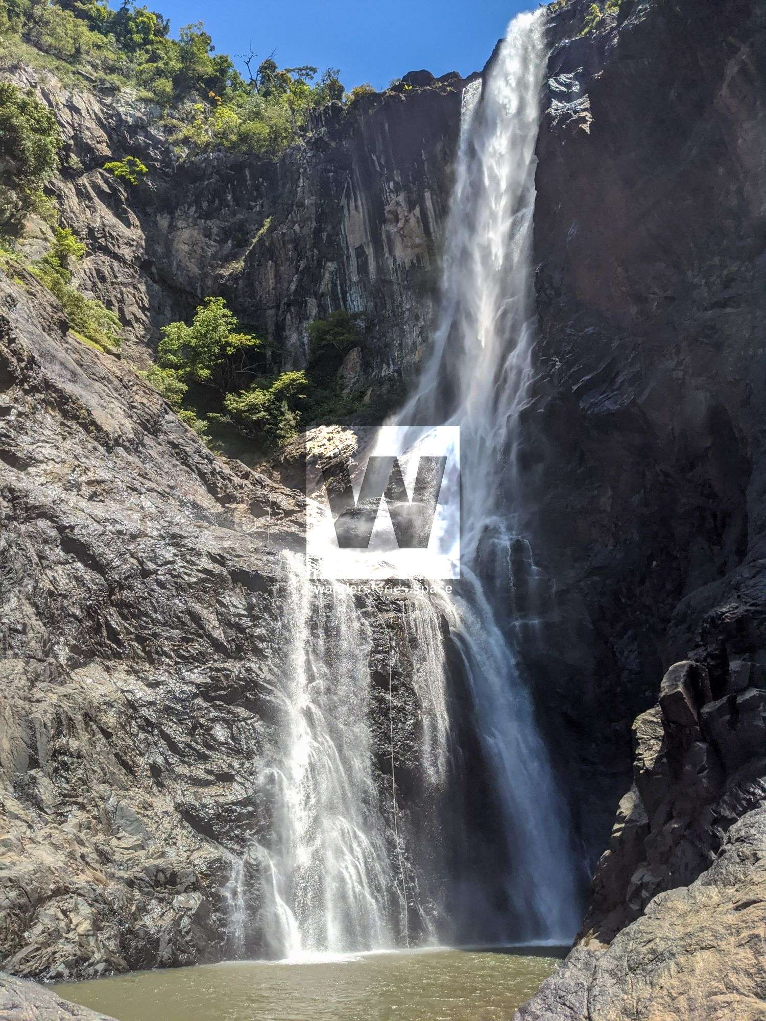
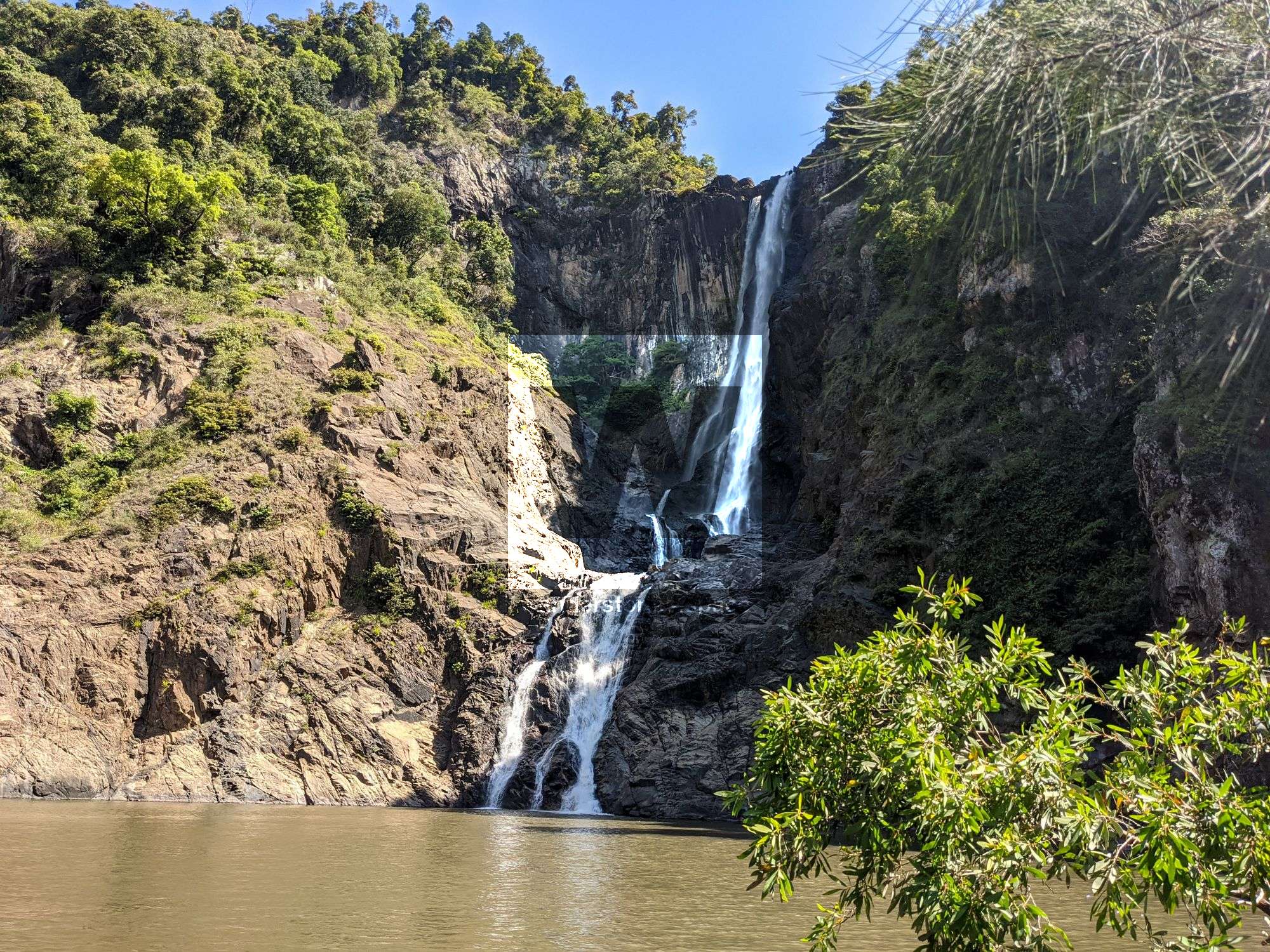
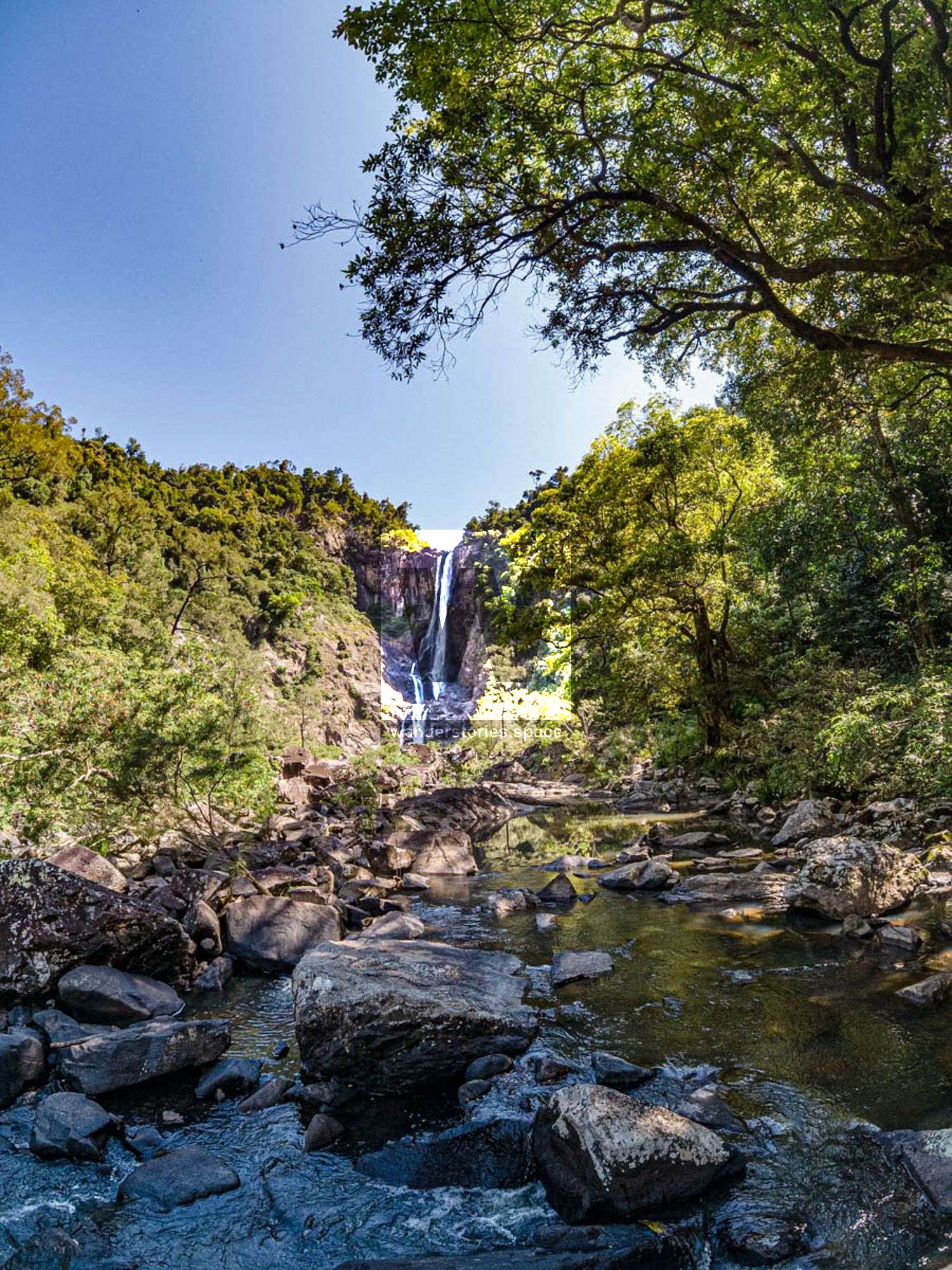
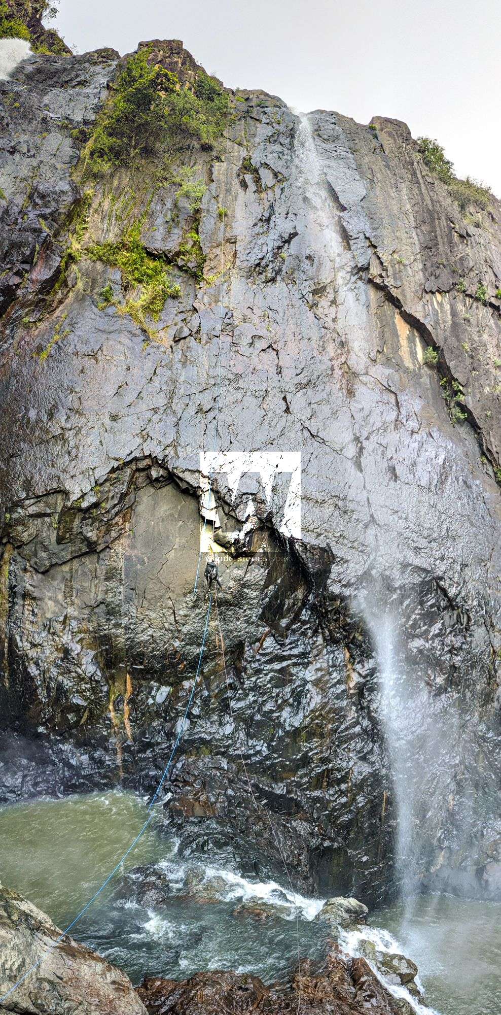
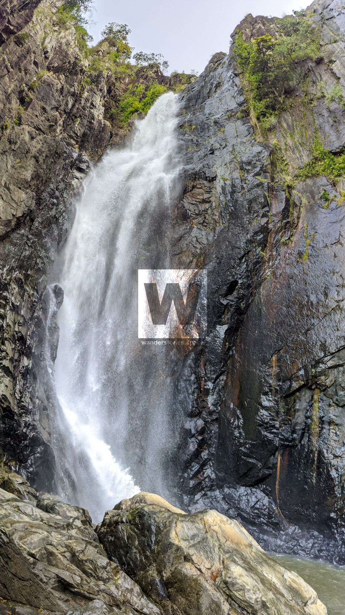
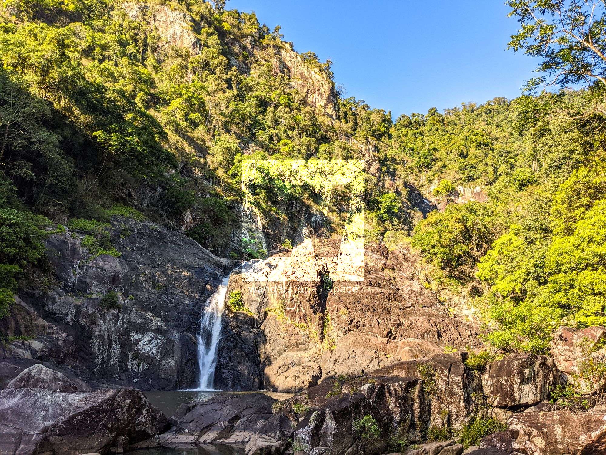
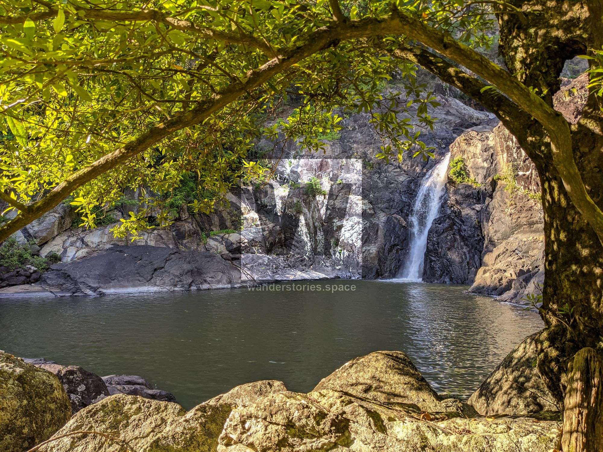
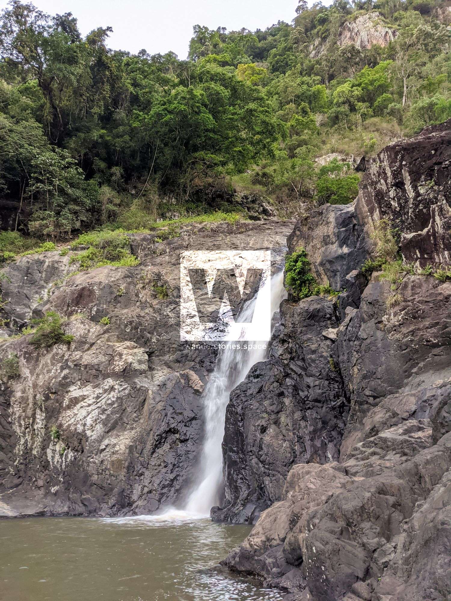
Garrawalt Falls is impressive enough to look at, let along rappel down them. This majestic canyon provide long drops, rappels through water, and plenty of pack swims. This canyon will not disappoint.

Garrawalt Canyon
Location - Girringun National Park, North Queensland, Australia
Grade - V4/5 A4 IV/V **** (French Grading System)
Approach - 3-5 hours depending on route
Descent - 6-9 hours for 4-6 people
Exit - 4-6 hours depending on route
Total time - Allow at least 2 full days on first trip
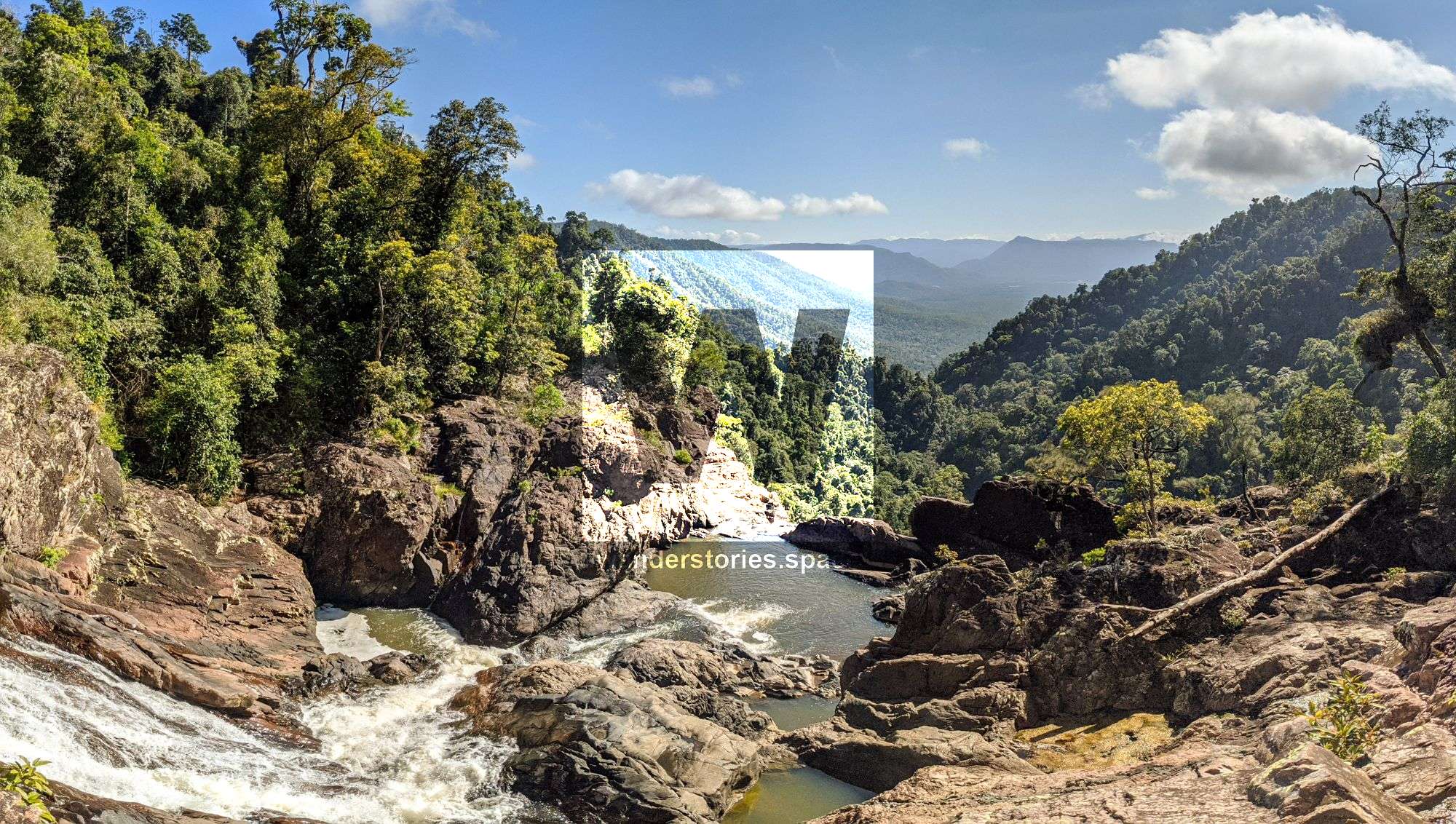
Full course - ~20 km one-way trip
Elevation loss - ~560 metres
Flash flooding level - High
First descentists - 2020 Luen Warneke, Jake Cosby, and Brendan Moore
Garrawalt Falls is impressive enough to look at, let along rappel down them. This majestic canyon provide long drops, rappels through water, and plenty of pack swims. This canyon will not disappoint.
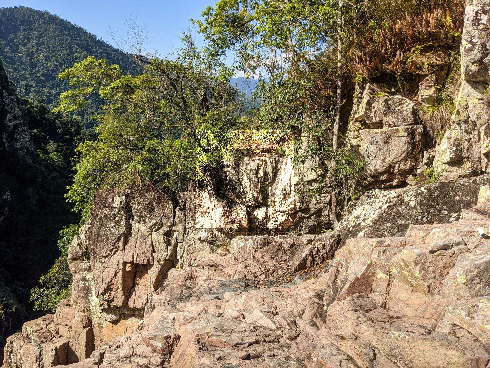
Approach
See the 'How to get to Garrawalt Falls' article.
Interactive Map
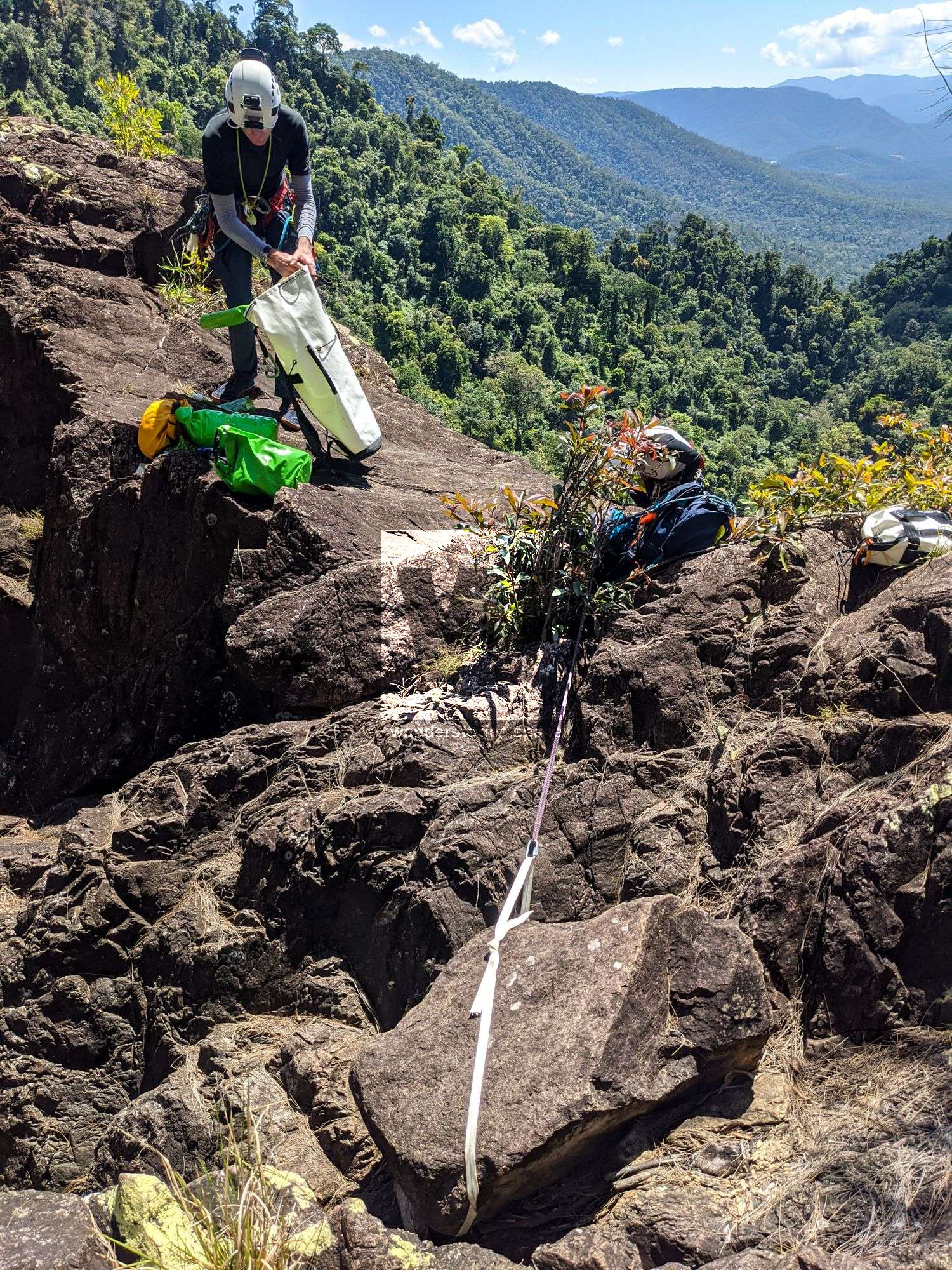
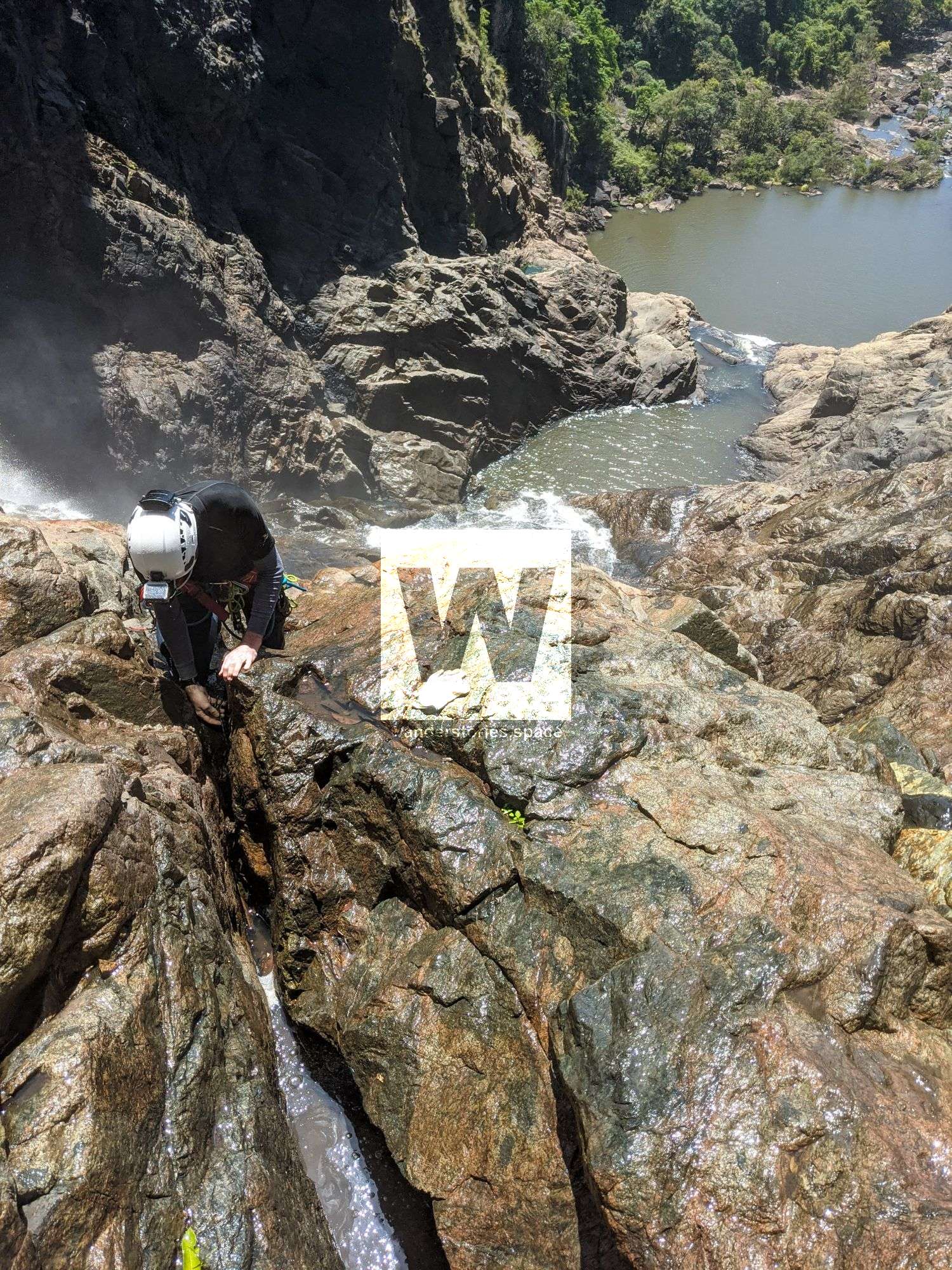
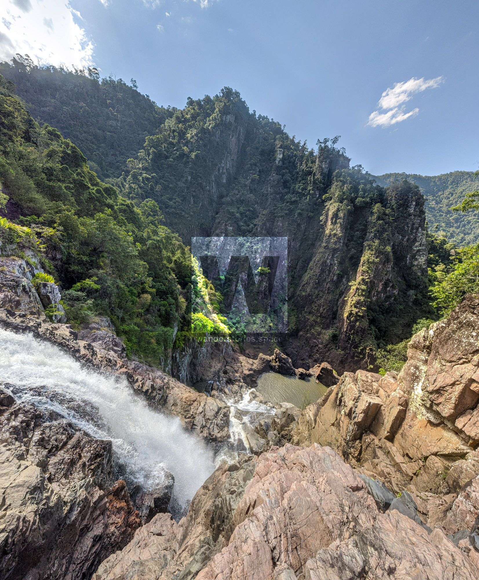
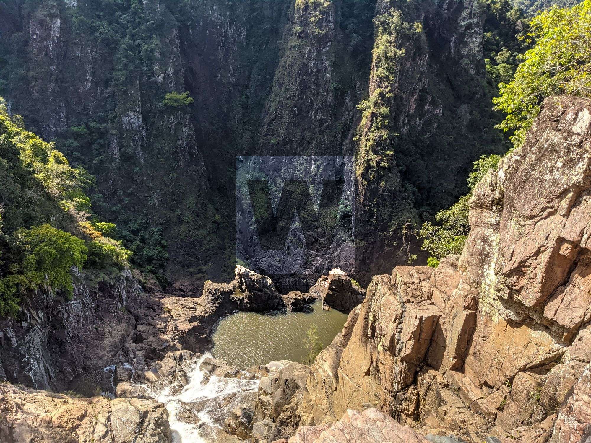
Rappels
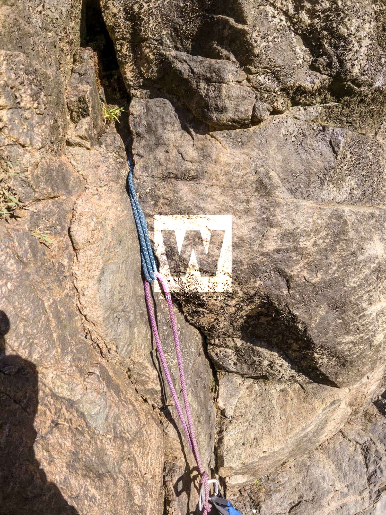
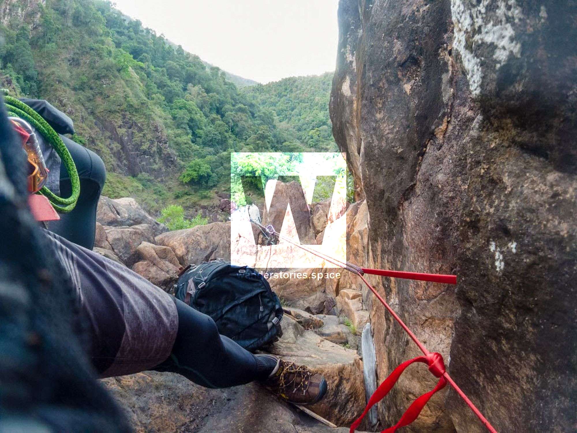
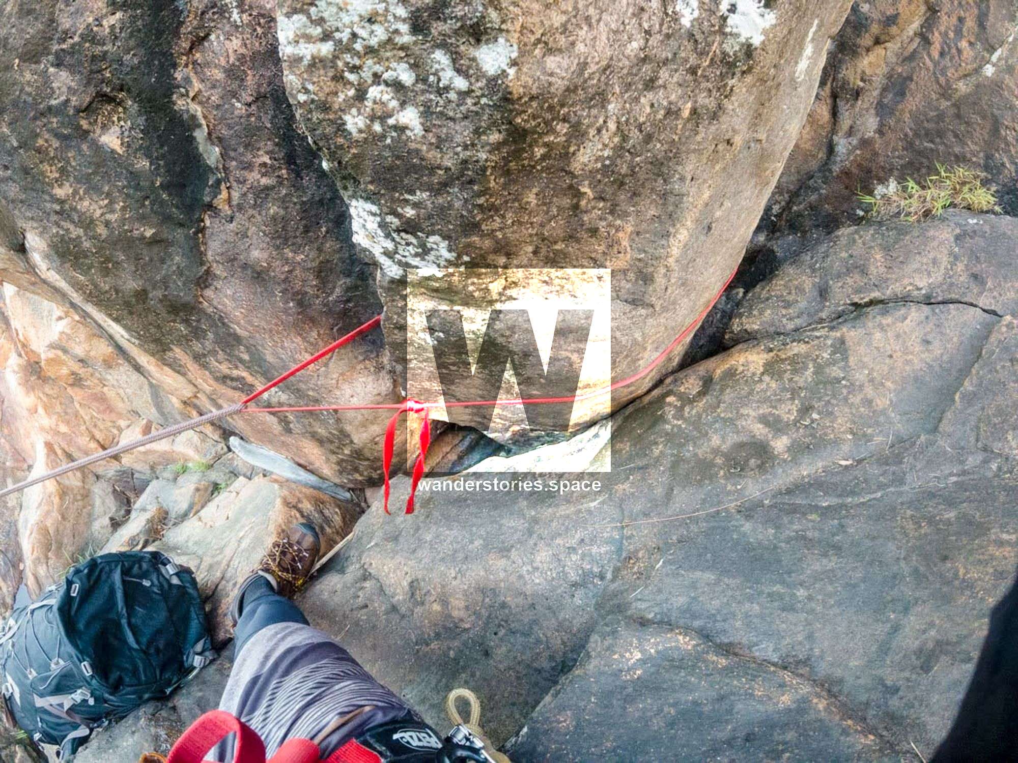
The canyon has some large drops and some advanced rigging (knot blocks) required.
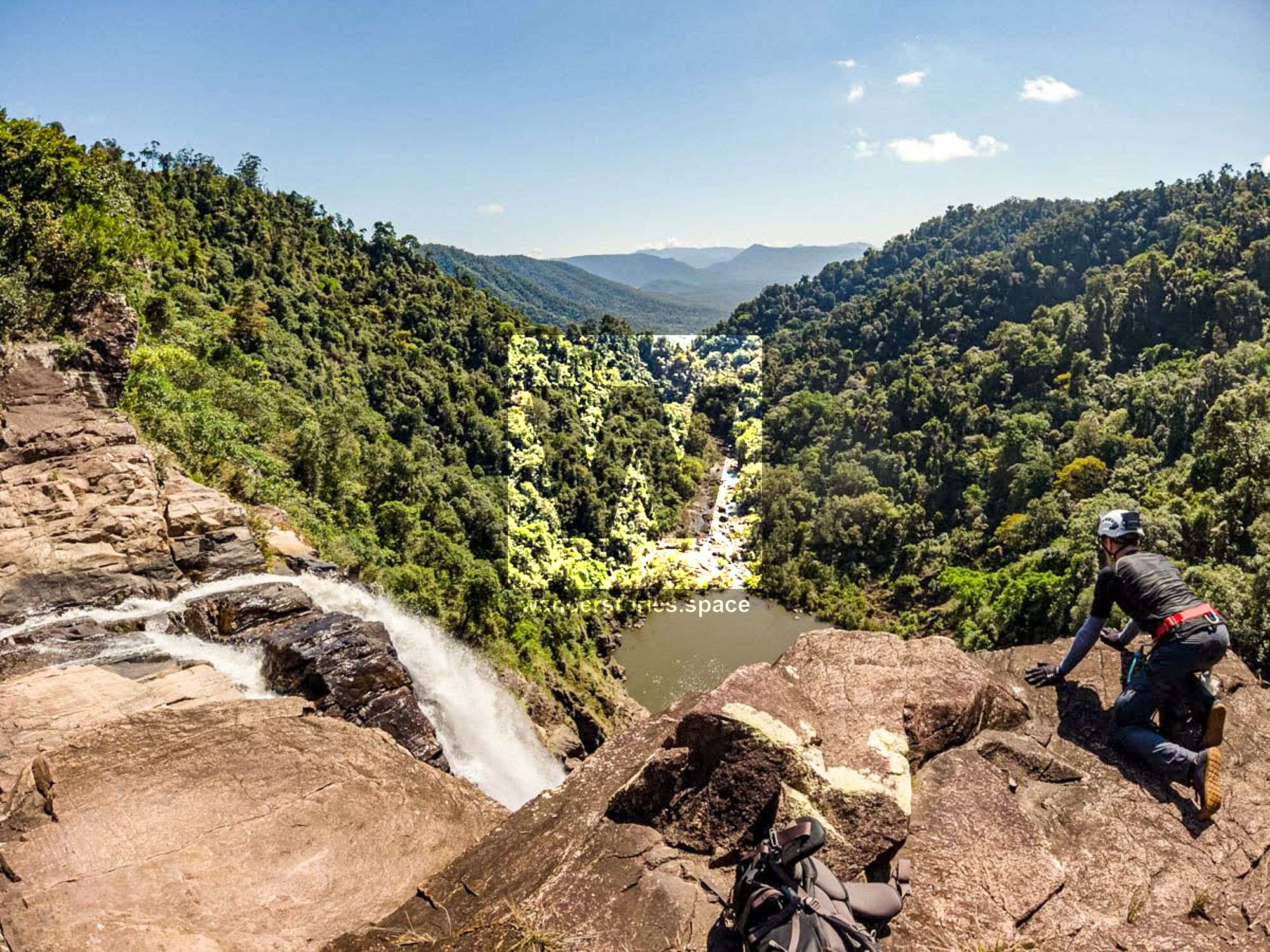
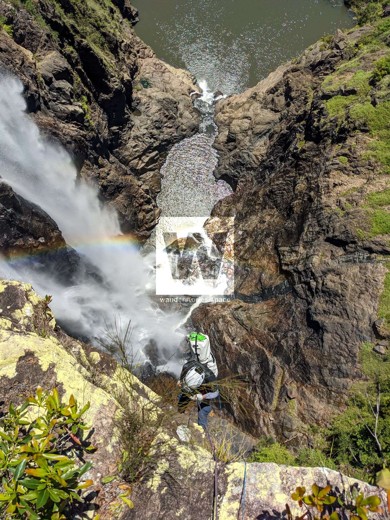
R1 80m NA-TR Garrawalt Falls
Last bail point
Option 1: Boulder (closer to edge)
Option 2: Tree
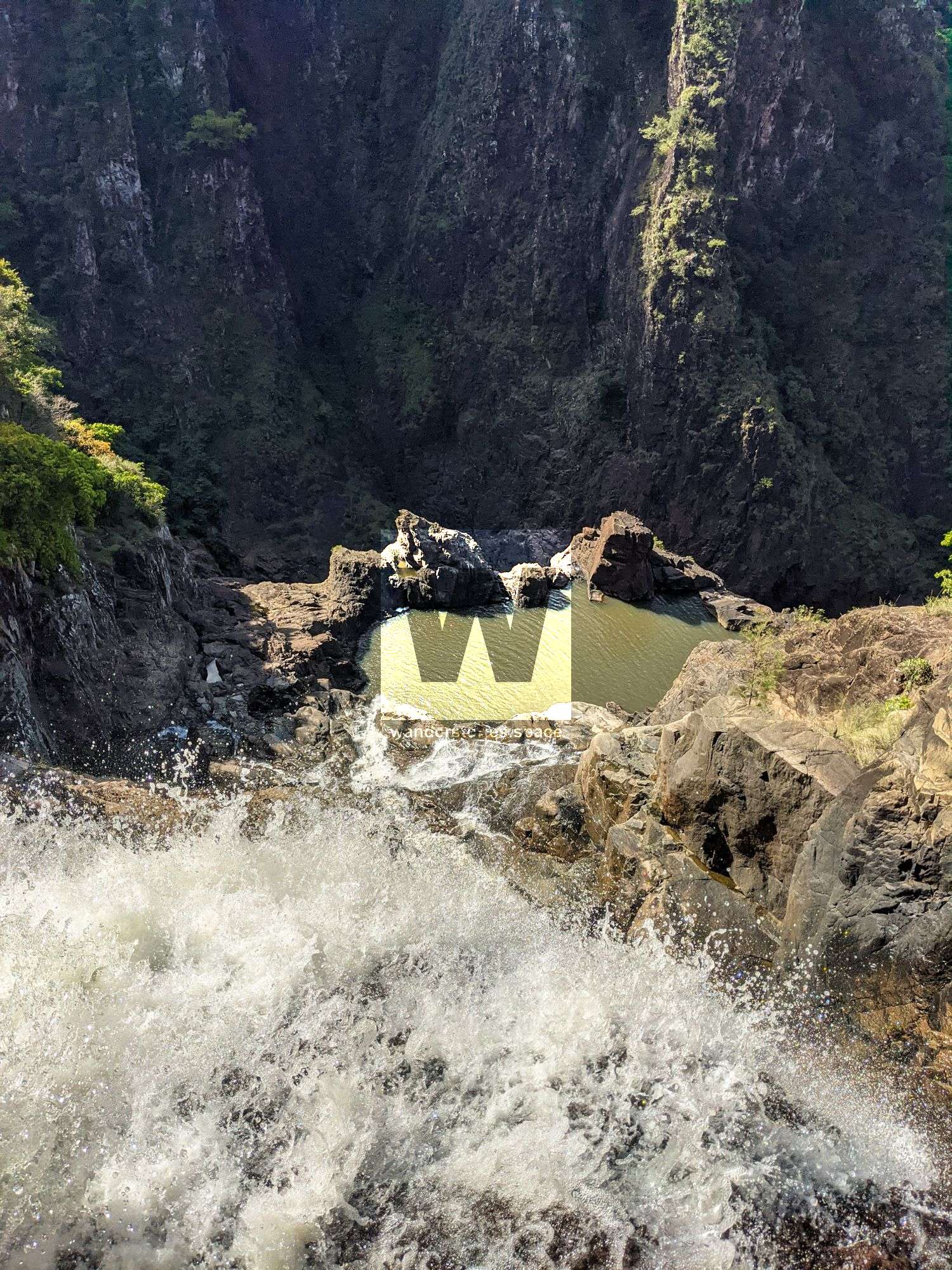
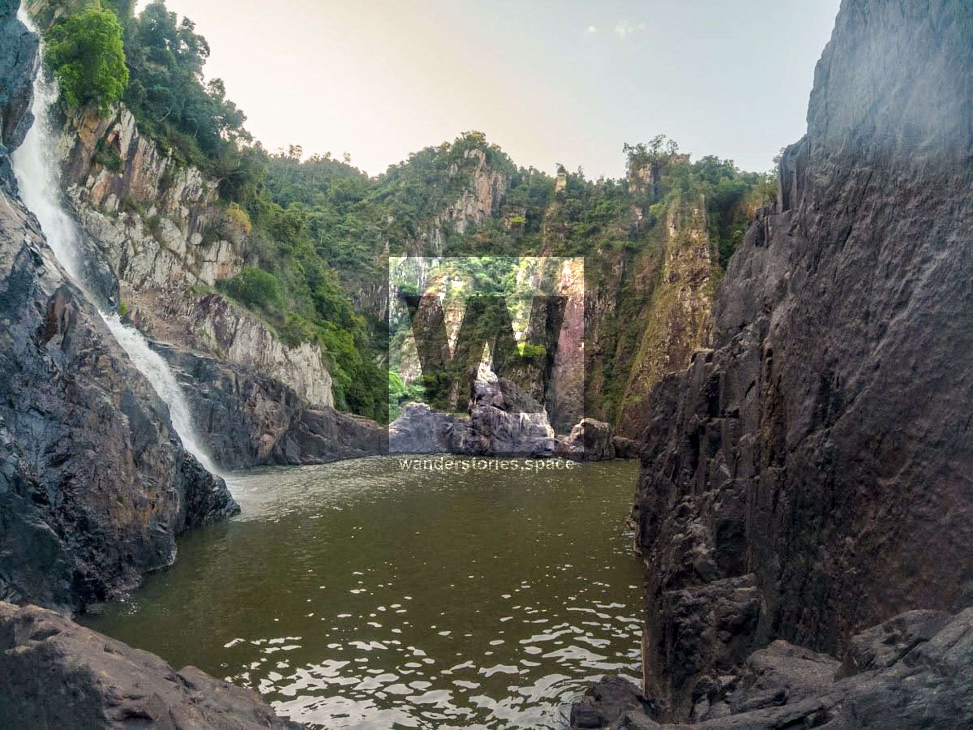
R2 55m NA-TR
Option 1: Crack system - Knot block and chock stone. Rappels into lower of the two pools.
Option 2: Boulder - rappels directly into flow and pool.
Option 3: Potentially scramble out to tree line for tree anchor.
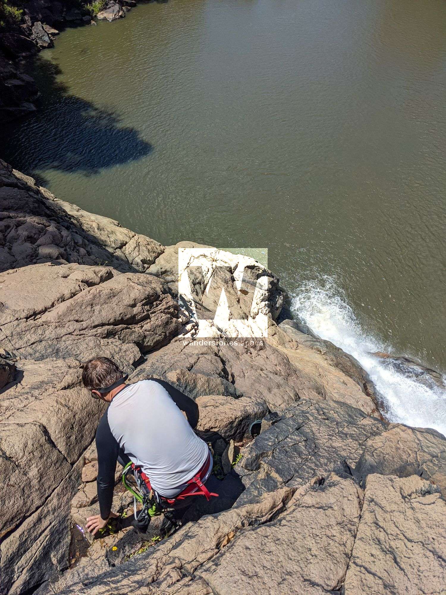
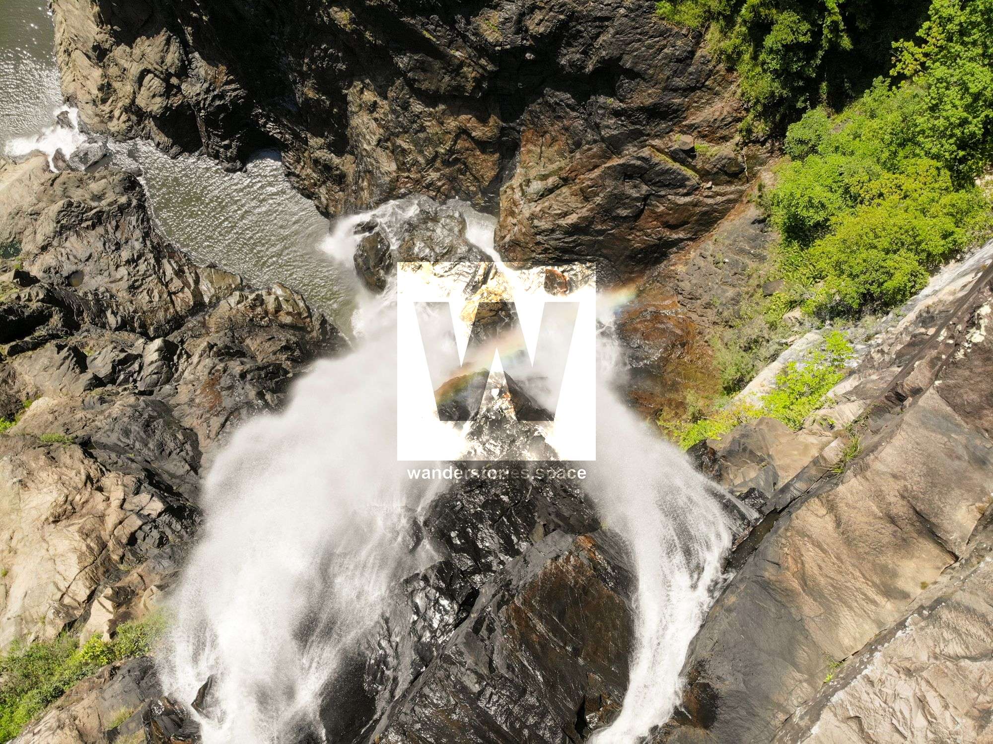
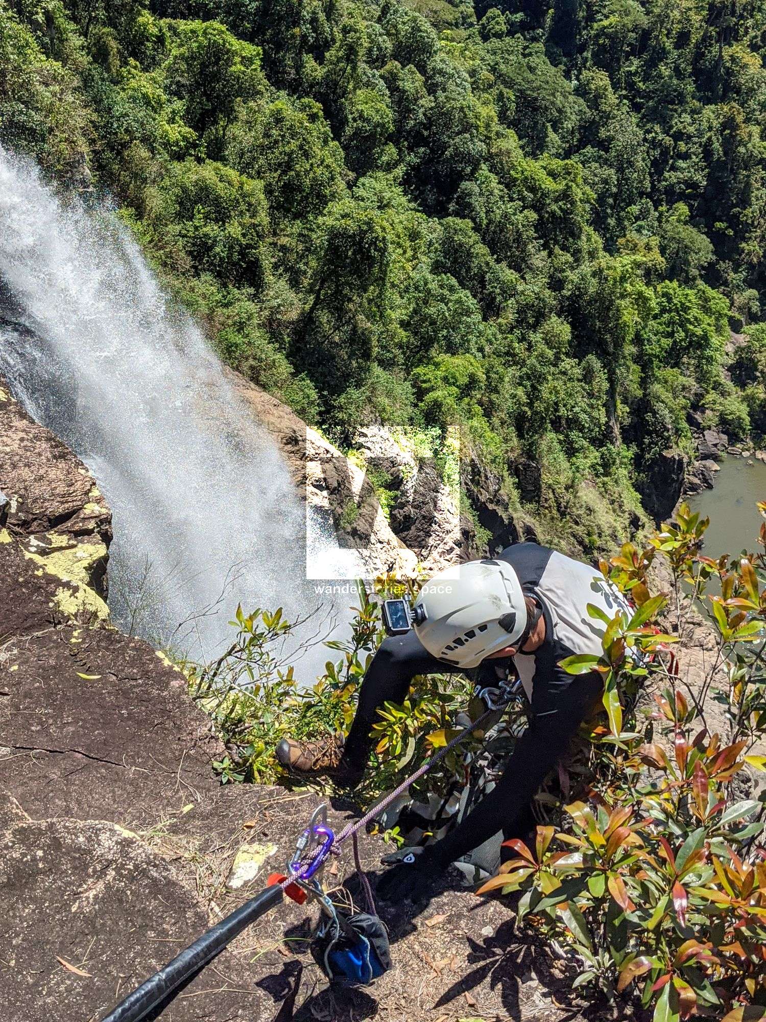
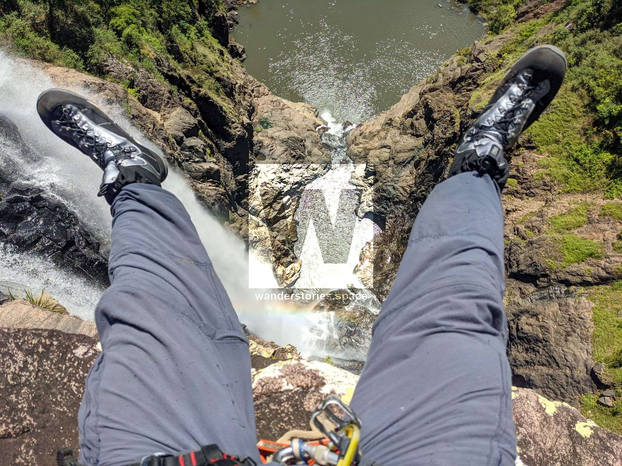
R3 30m NA-TL Amphitheater
Scramble down to the cliff edge close to the waterfall to a solid crack system knot block. Slightly awkward to load the rappel.
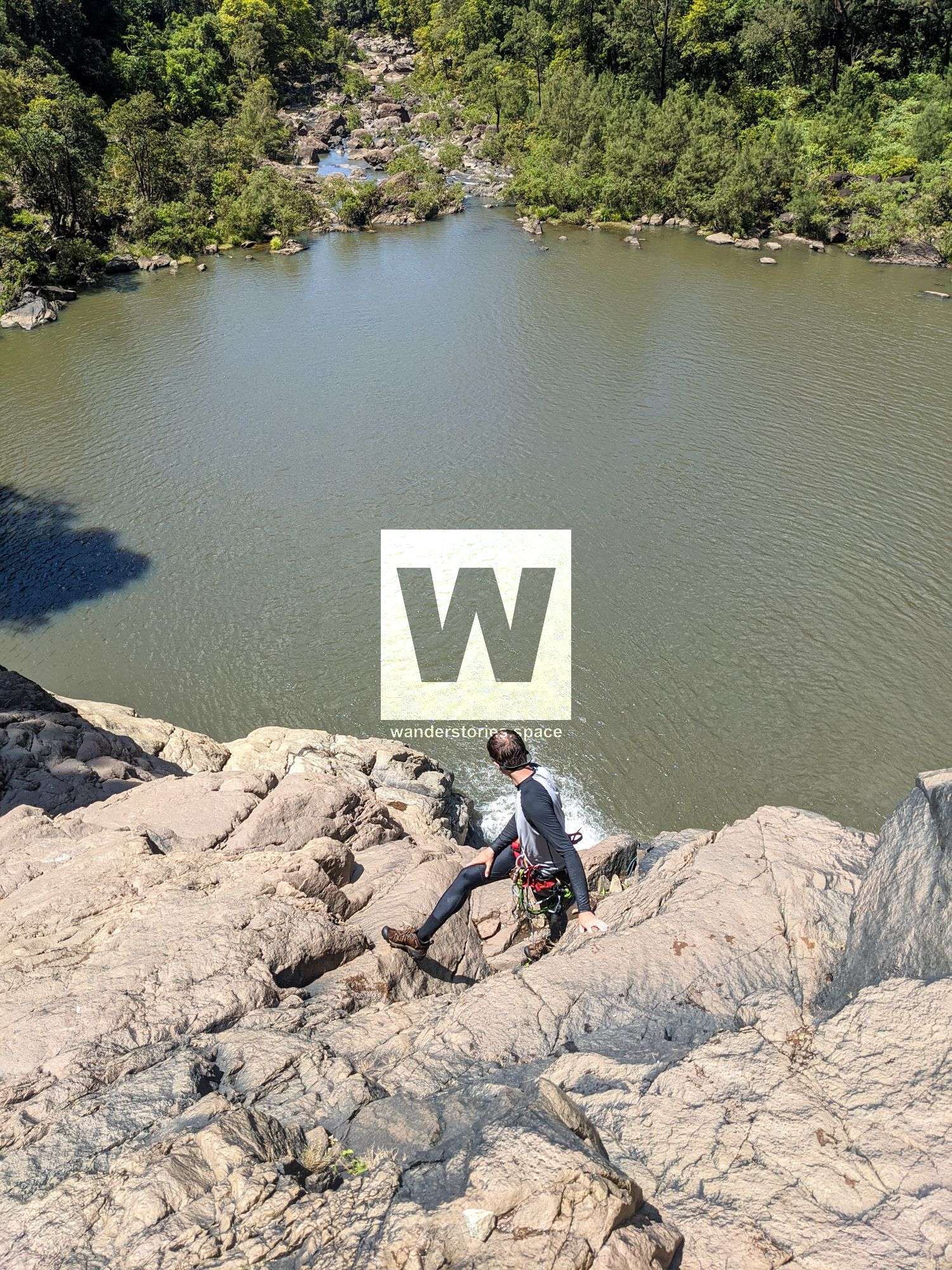
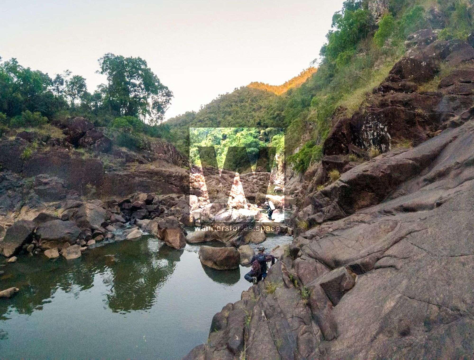
Pack swim out and across the pool.
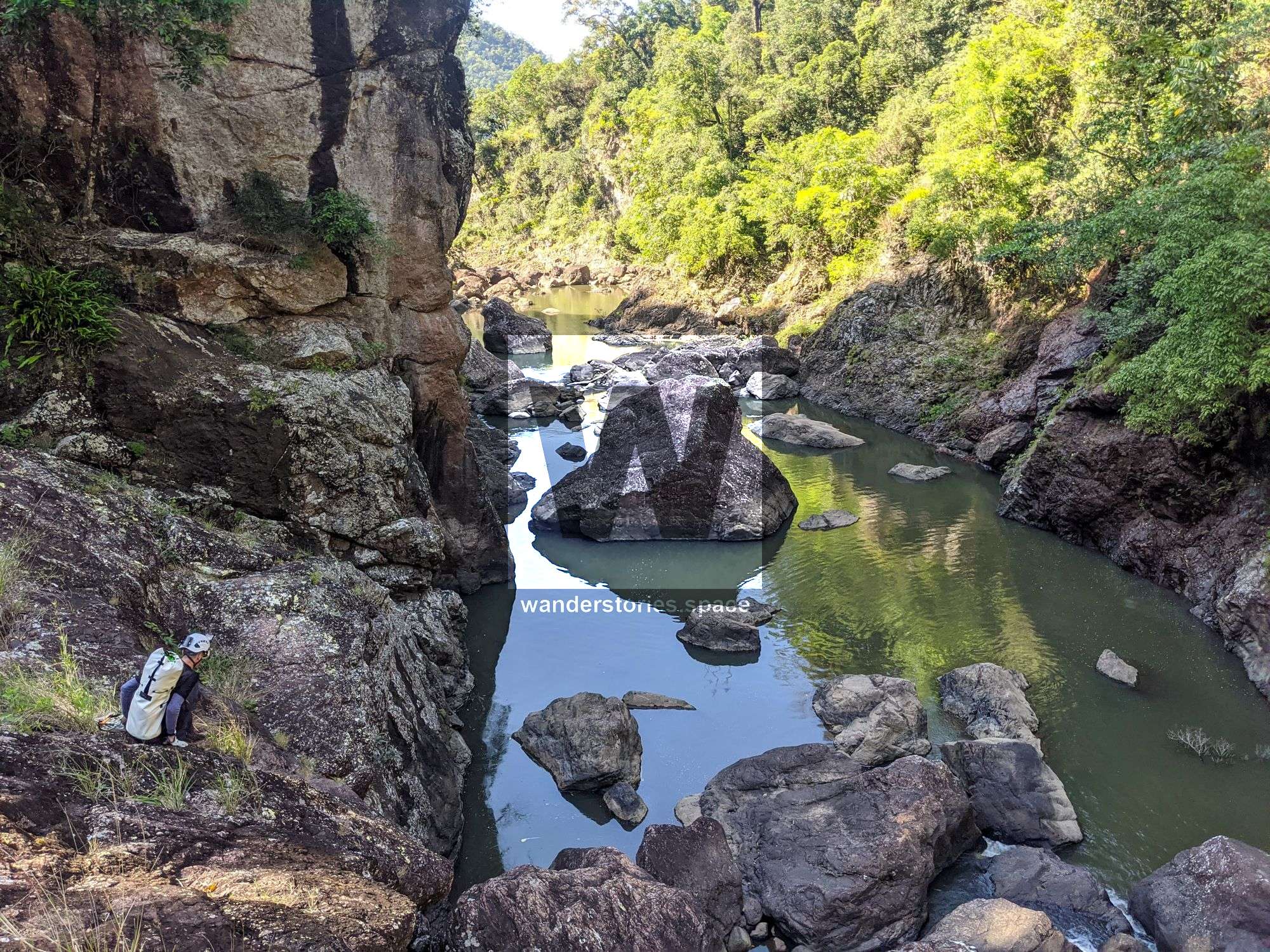

Rock scramble / down climb / pack swim to the top of the Lower Garrawalt Falls.
Can possibly bail out here through the rainforest???
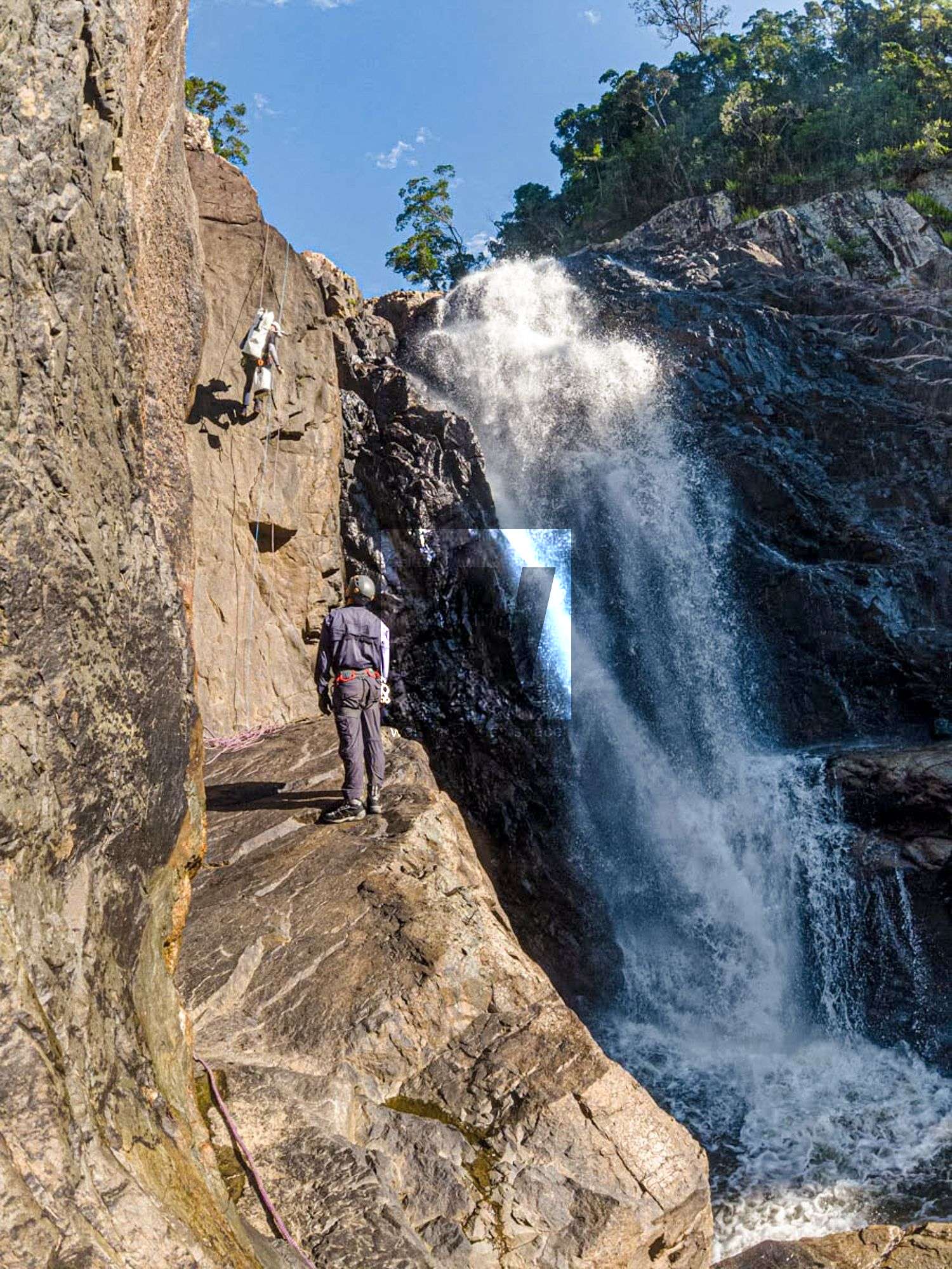
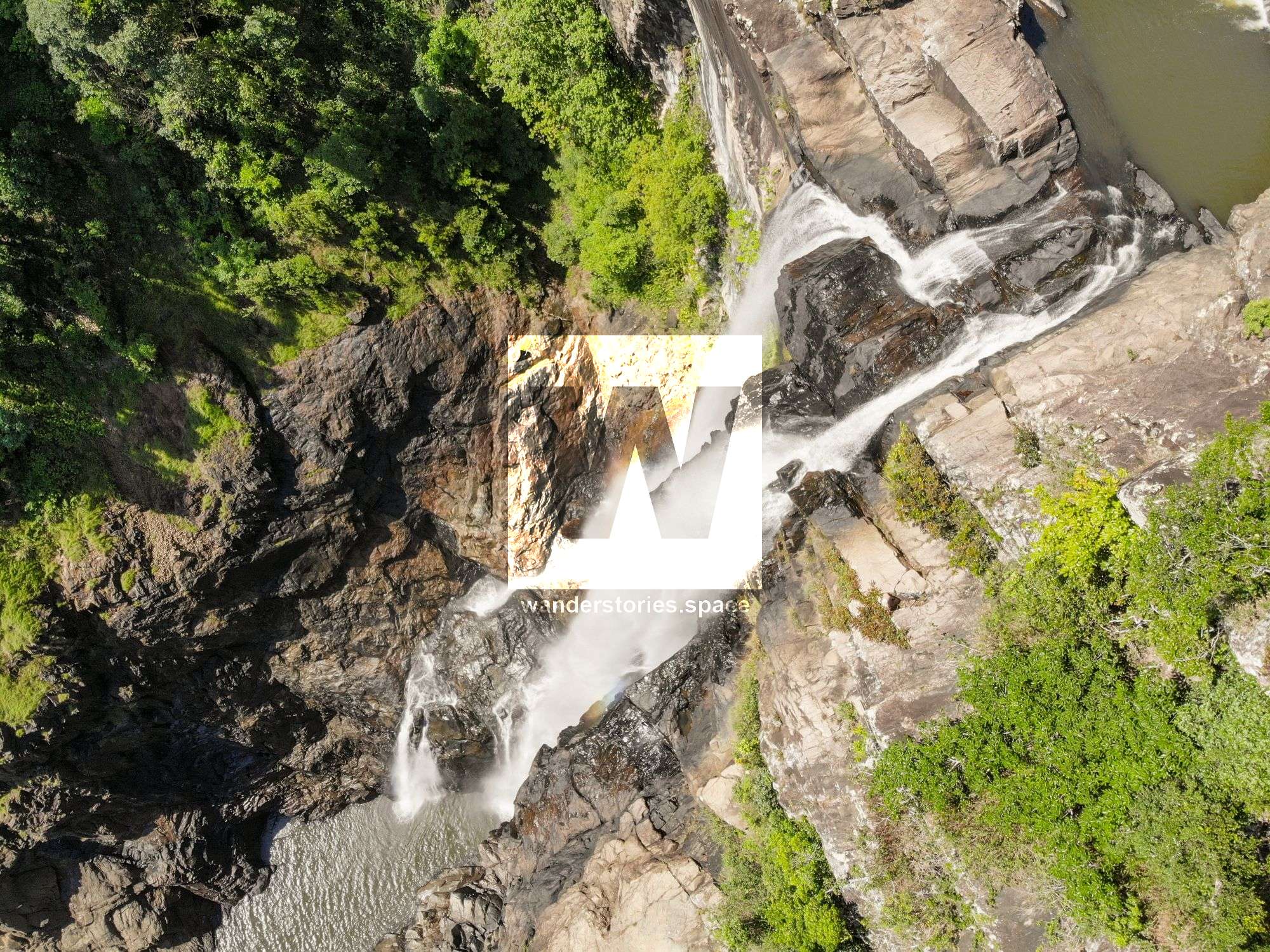
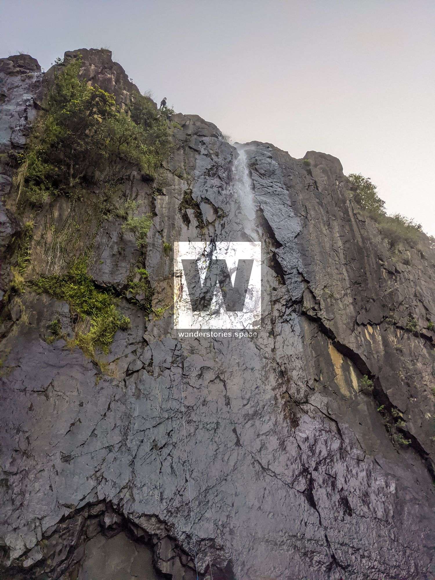
R4 15m NA-TR Lower Garrawalt Falls
Tree to high ledge on River Right. Walk around ledge to R5 knot block just around the corner.

R5 NA-TR 50m
Option 1: Bomber crack knot block.
Option 2: Possible scramble out and around right and up to tree.
Swim across the large pool and to the right of the big protruding block.
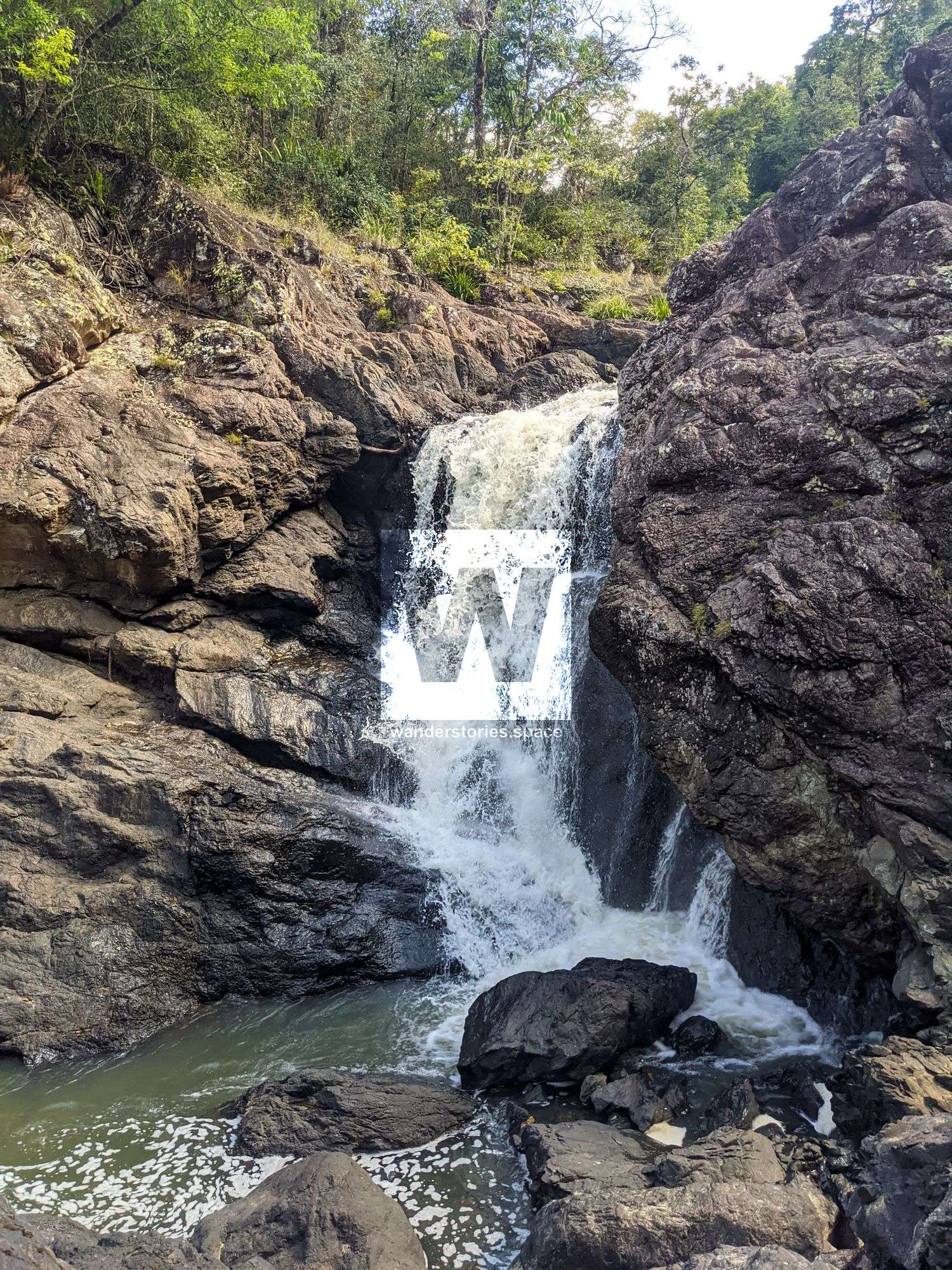
R6 60m NA-C
Thread boulder and rappel to top of smaller falls. Then cross the stream and scramble to higher ground.
Scramble downstream 100m to next rap.
R7 Last waterfall
Scramble down left side. Zig and zag back and forth to get down this slab. Do not attempt if raining.
Exit
Walk out along the creek overflow sections and/or follow the cow the tracks. See more details in 'How to get to Lower Garrawalt Falls'.

Watch for crocs in the lower creek.
Notes
Your team should have good navigation skills and appropriate experience.
Find your local canyoners and ask for beta on the FNQ Canyoning Facebook group.
WHAT YOU WILL NEED
- Experience in abseiling (there are some technical challenges)
- Enough rope for the longest rappel
- Rappel devices, prusiks, and webbing
- Rope protectors
- Grippy shoes on smooth, wet granite rocks
- Helmet
- Backpack
- Food and snacks for the trip
- About one litre of water to hike to the top and a way to sterilise your water from the creek
Anchoring notes
There are various natural anchors throughout the canyon, however, it is not unusual to come across damaged trees, especially after large flooding events. Please use sound judgement when considering previously installed anchors, like tape slings, ropes, and other textiles. There are no bolts in this canyon.
Surfaces
Along the route there are various sections of wet, slimy, and dry rock, as with all canyon environments. Please be mindful of your traction and regularly test your grip throughout the route as you cannot rely on the colour or texture of the rock to determine its safety against slippage. Take caution when near cliff edges.
Experience
No responsibility or liability is taken for any harm, death or loss of property resulting from the use of this article. You must carry anchor building materials, be experienced and use your own judgement when canyoning. Flooding events can strip anchors and change the canyons layout and conditions. Improper and insufficient experience will result in serious injuries or in many cases death. Always respect all signs you encounter and take everything in you brought with you.
Please read the Beginners' tips for canyoning in North Queensland article.
See our general disclaimer that includes canyoning.
Canyoning Topo
This canyoning topo is for illustration purposes only.
TO BE UPLOADED - ASK
Legend
X / XX - Single and twin bolt anchor.
NA - Natural anchor such as a tree or rock.
TL / TR / C - True left, true right and centre when looking downstream.
R1-8m / R2-6m - First rappel and its height in metres, second rappel and height.
Optional - These rappels can be avoided by exiting prior or walking around.
Please note that an activity permit may be required in national parks.
If this information is outdated or you would like to make a correction, please contact us.
This article, and all other articles, are for entertainment purposes only and are not to be used as a guide. Please see our Disclaimer for more information.