Saddle Mountain and the RAAF Mosquito plane wreckage
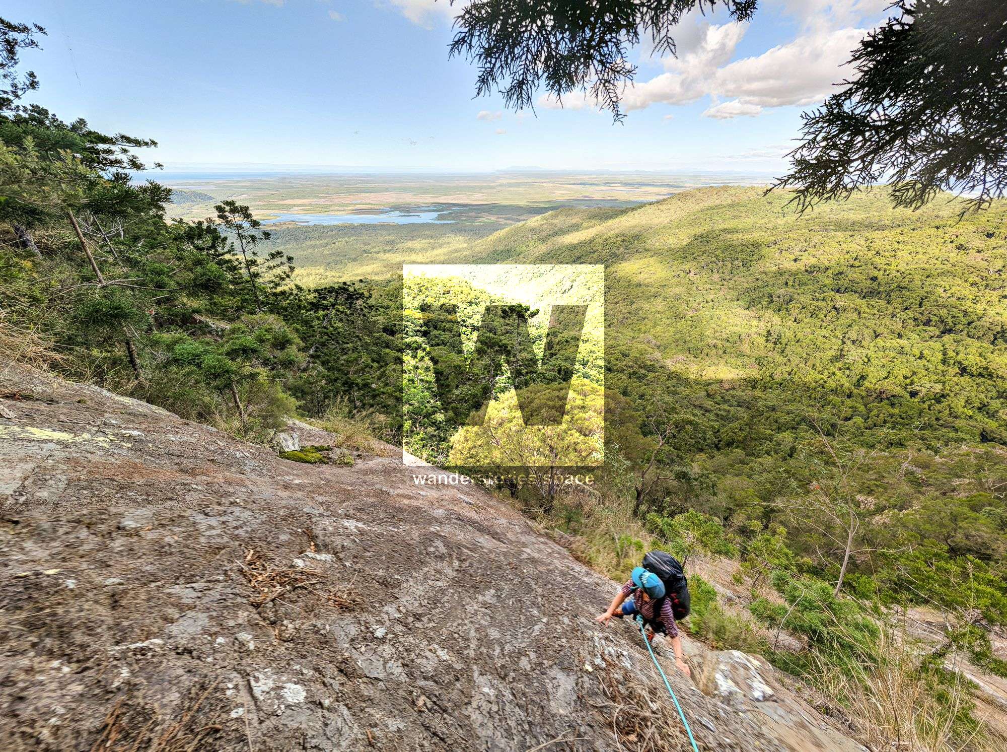
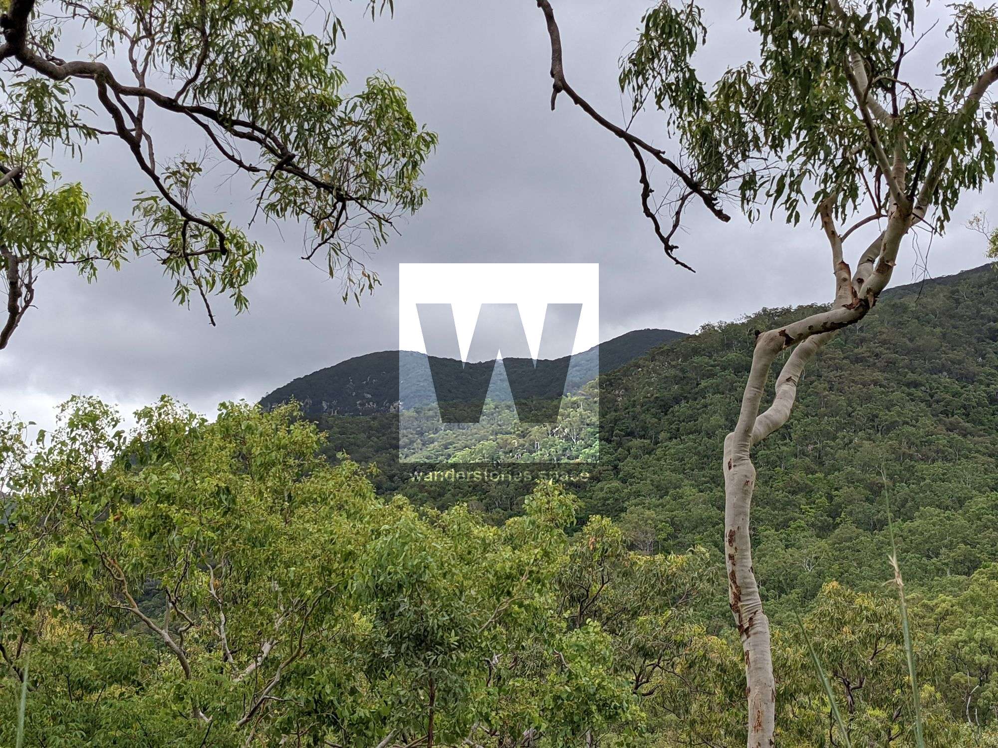
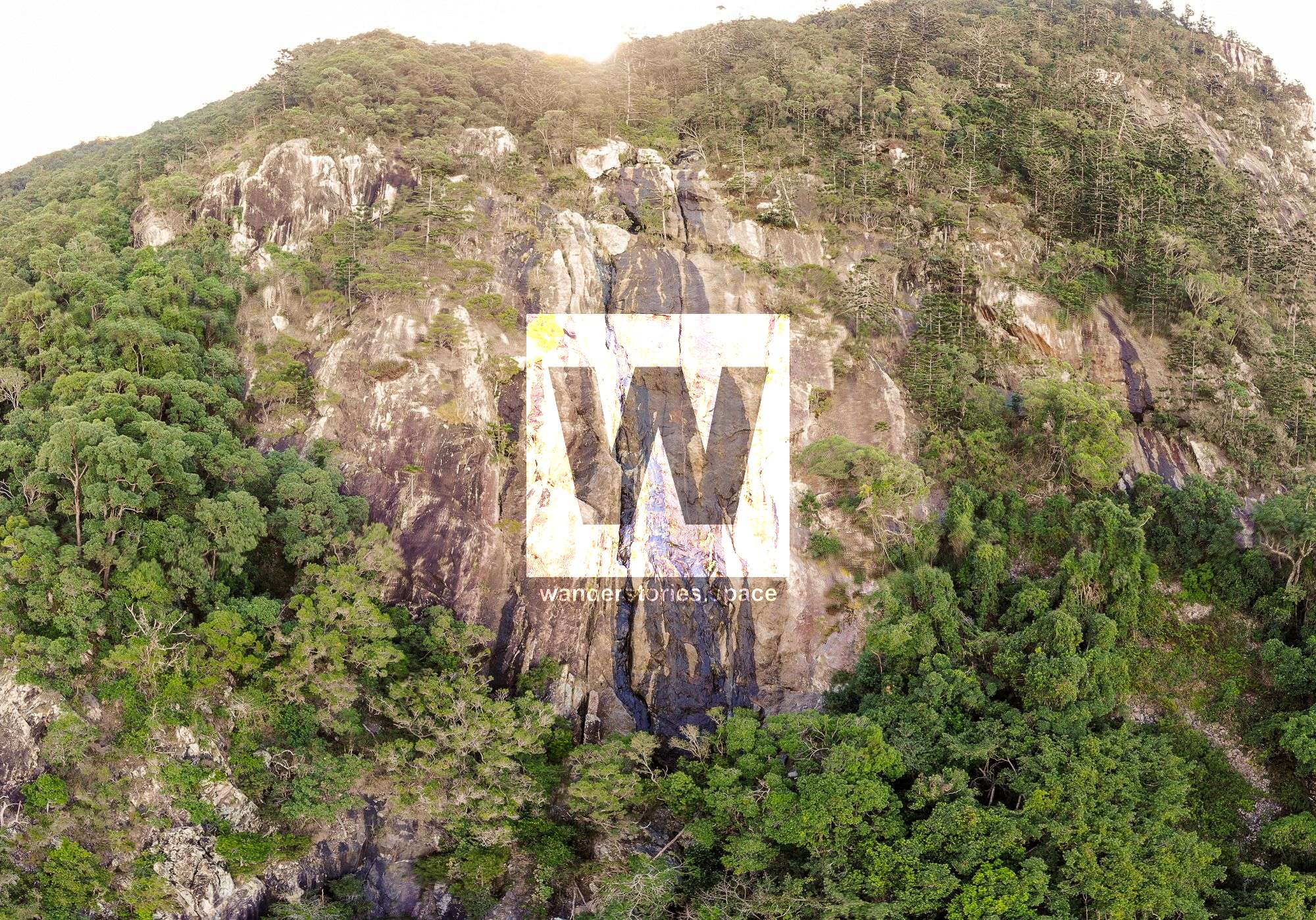
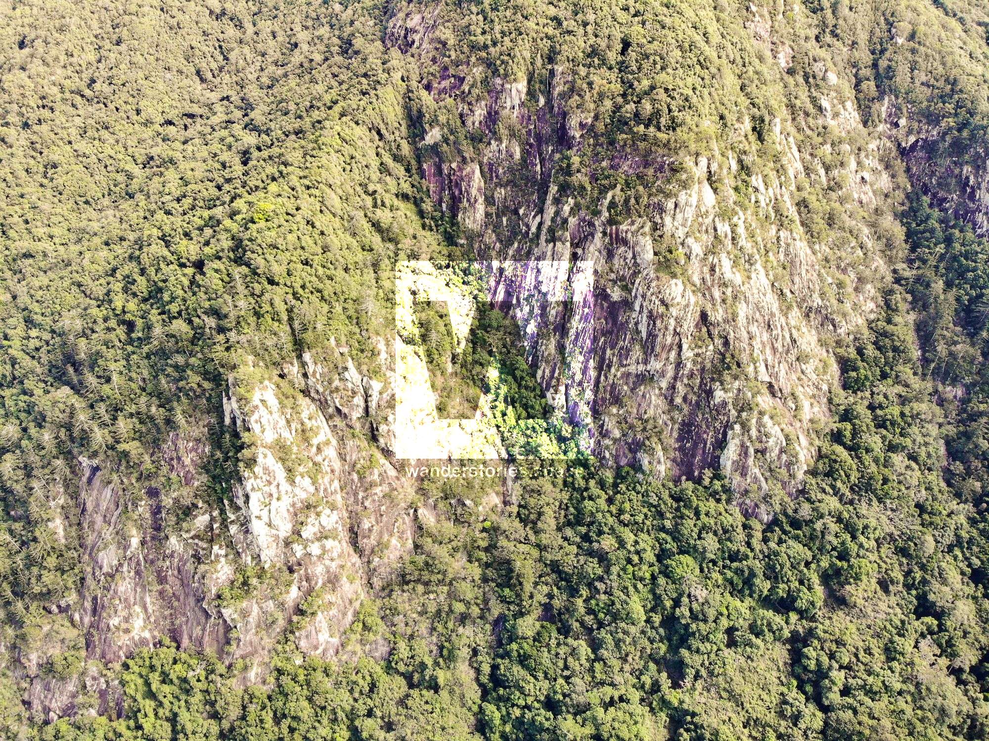
Saddle Mountain is located in Bowling Green Bay National Park. It rises 882m, and the eastern face is essentially a 1km horizontal cliffline that you can see from the main road. It truly dominates the landscape. Challenge yourself to find the WWII plane wreckage once you reach the top.


Location - Bowling Green Bay National Park, North Queensland, Australia
Difficulty - Grade 5
Distance - 11 km return, depending on route
Time - 8-12 hours, depending on route
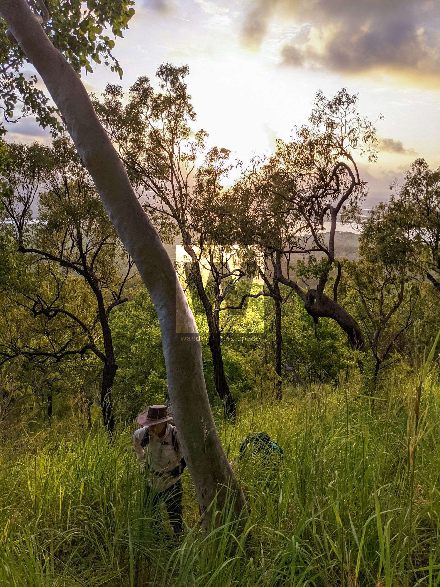
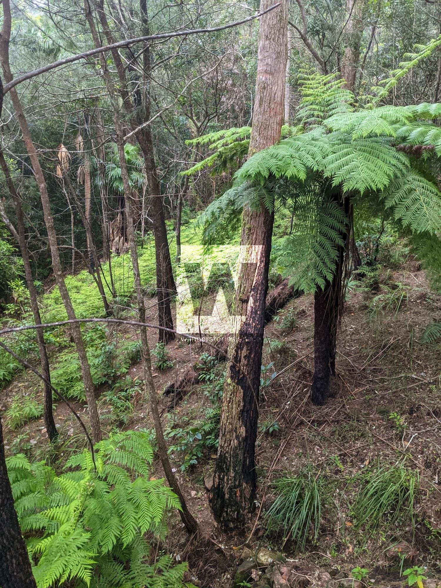
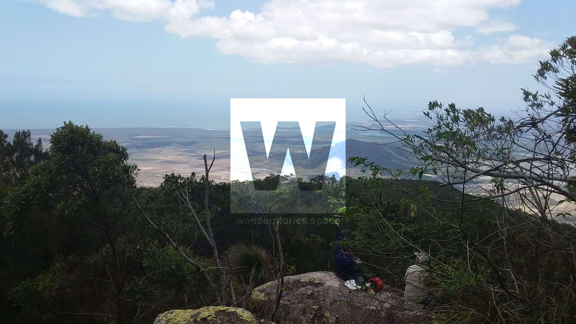
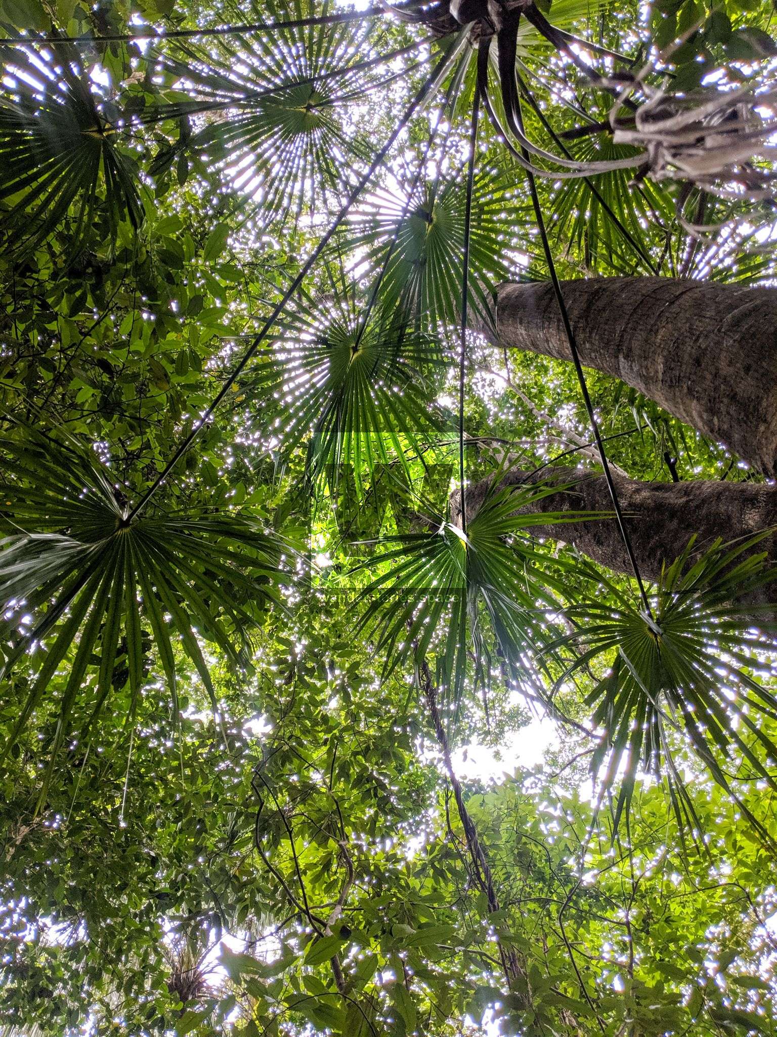
Saddle Mountain, once known as Little Elliot, is located in Bowling Green Bay National Park. Its peak rises 882 metres above the surrounding area, thus truly dominating the landscape. The eastern face of Saddle Mountain is particularly interesting, as it is essentially a one-kilometre horizontal cliffline that you can see from the main road, which really makes this area stand out from other peaks in the region. However, in other ways, the summit of Saddle Mountain is similar to most of the other peaks in the Mount Elliot area. It is comprised of densely vegetated rainforest and canopy, and unfortunately, once you reach the top, there really is no view to enjoy. Instead, once you reach the top, challenge yourself to find the WWII plane wreckage.
RAAF Mosquito reconnaissance aircraft
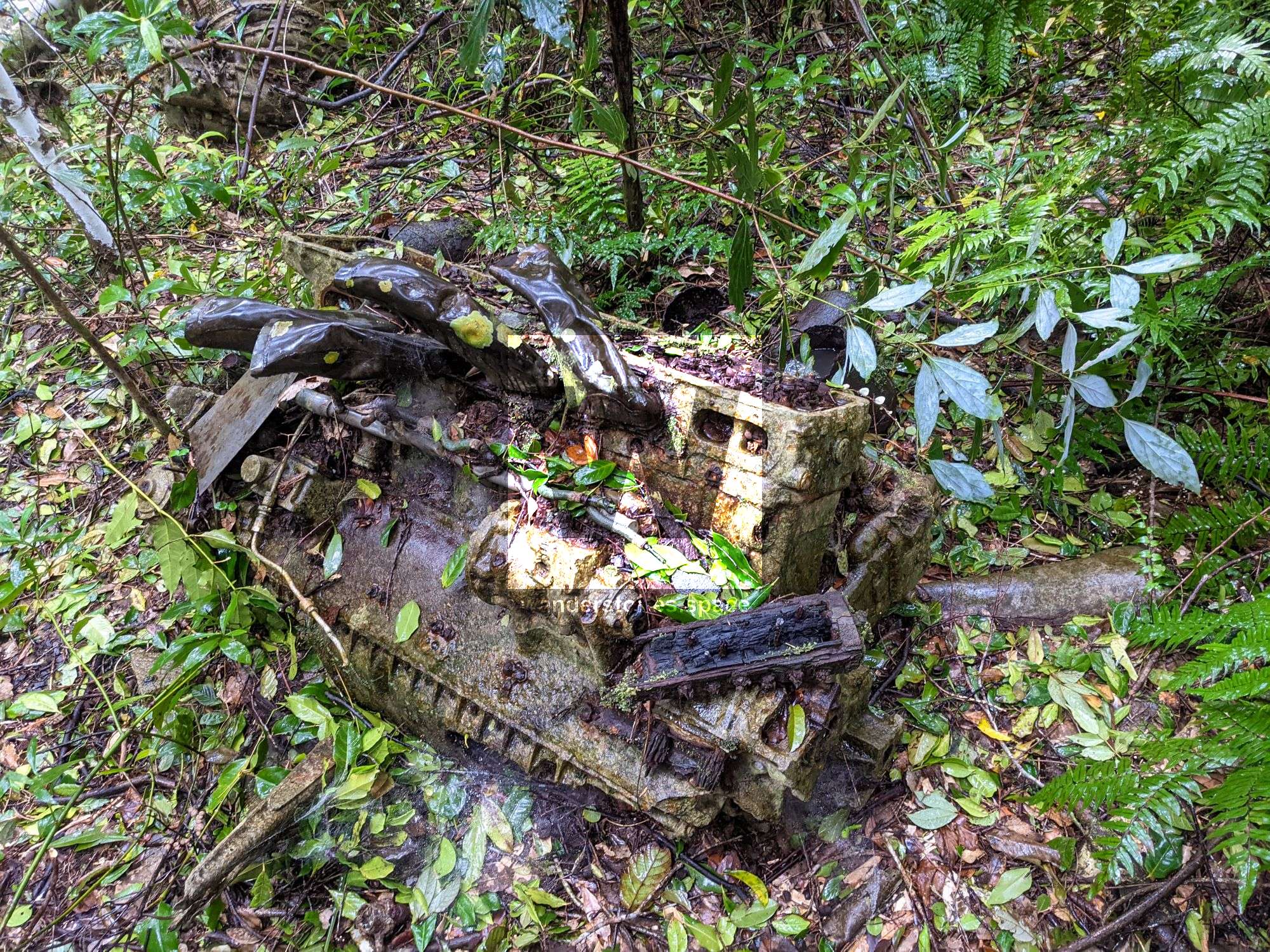
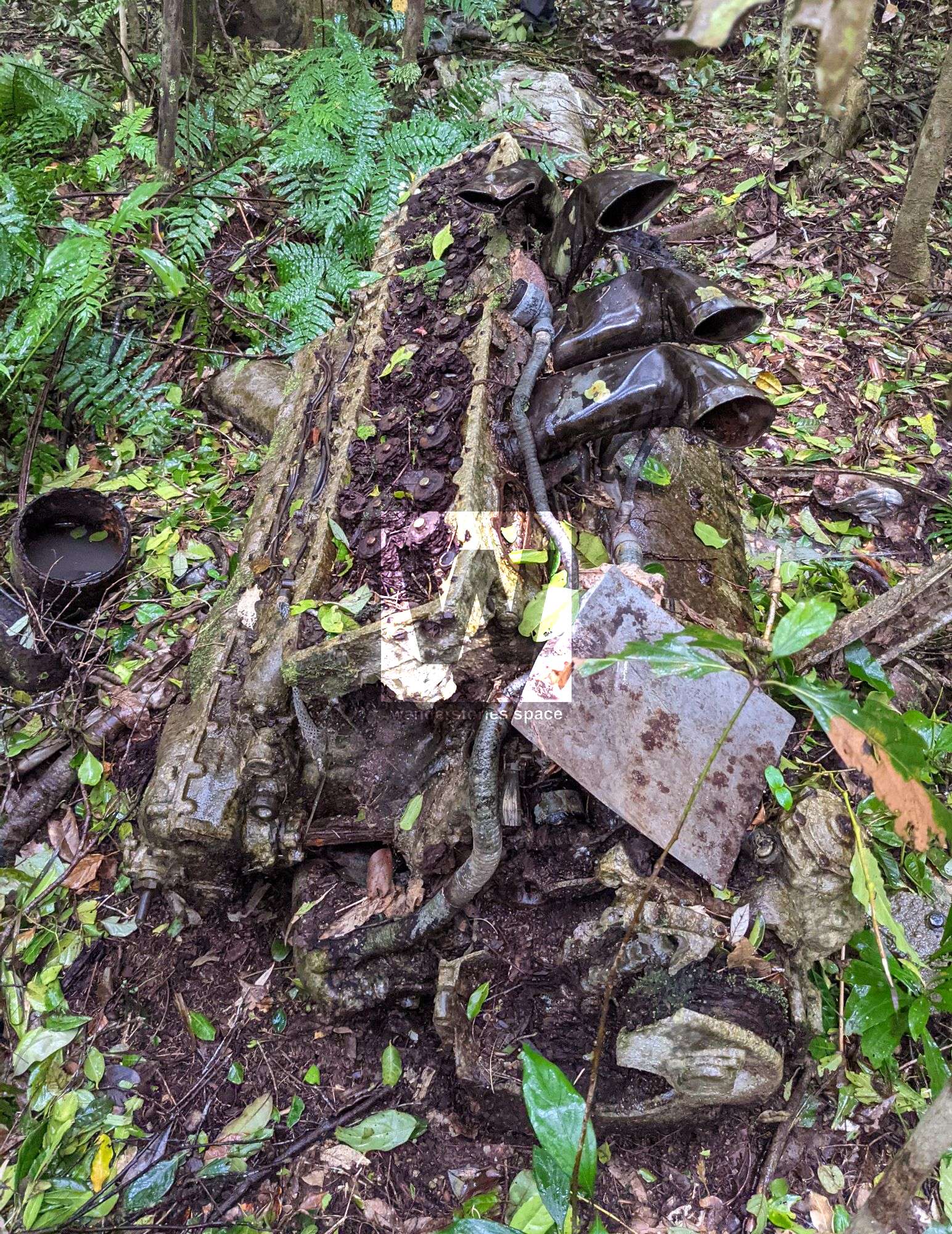
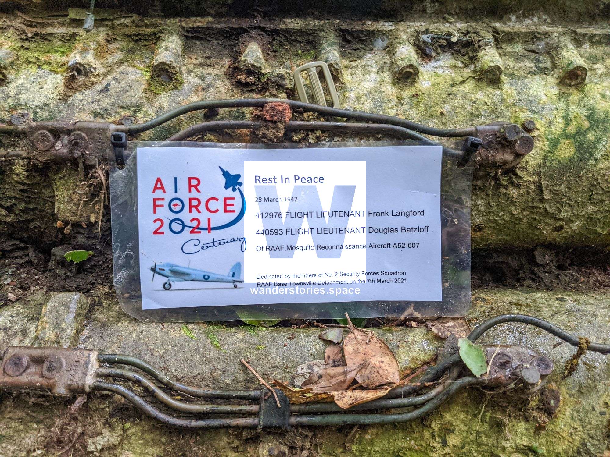
On 25 March 1947, a Royal Australian Air Force (RAAF) 'de Havilland Mosquito' reconnaissance aircraft A52-607 crashed into the top of Saddle Mountain. On the day of the crash, three flares were seen on the mountain. Five days later, on Sunday 30 March 1947, the wreckage was sighted about 30 metres from the summit by a RAAF Avron Anson – a British twin-engine aircraft model – in an air search. Several attempts were made to reach the crash site, but all were hindered by bad weather and issues with navigation. The following day, on 31 March 1947, at 10:30am, the RAAF search party reached the plane and found two bodies.
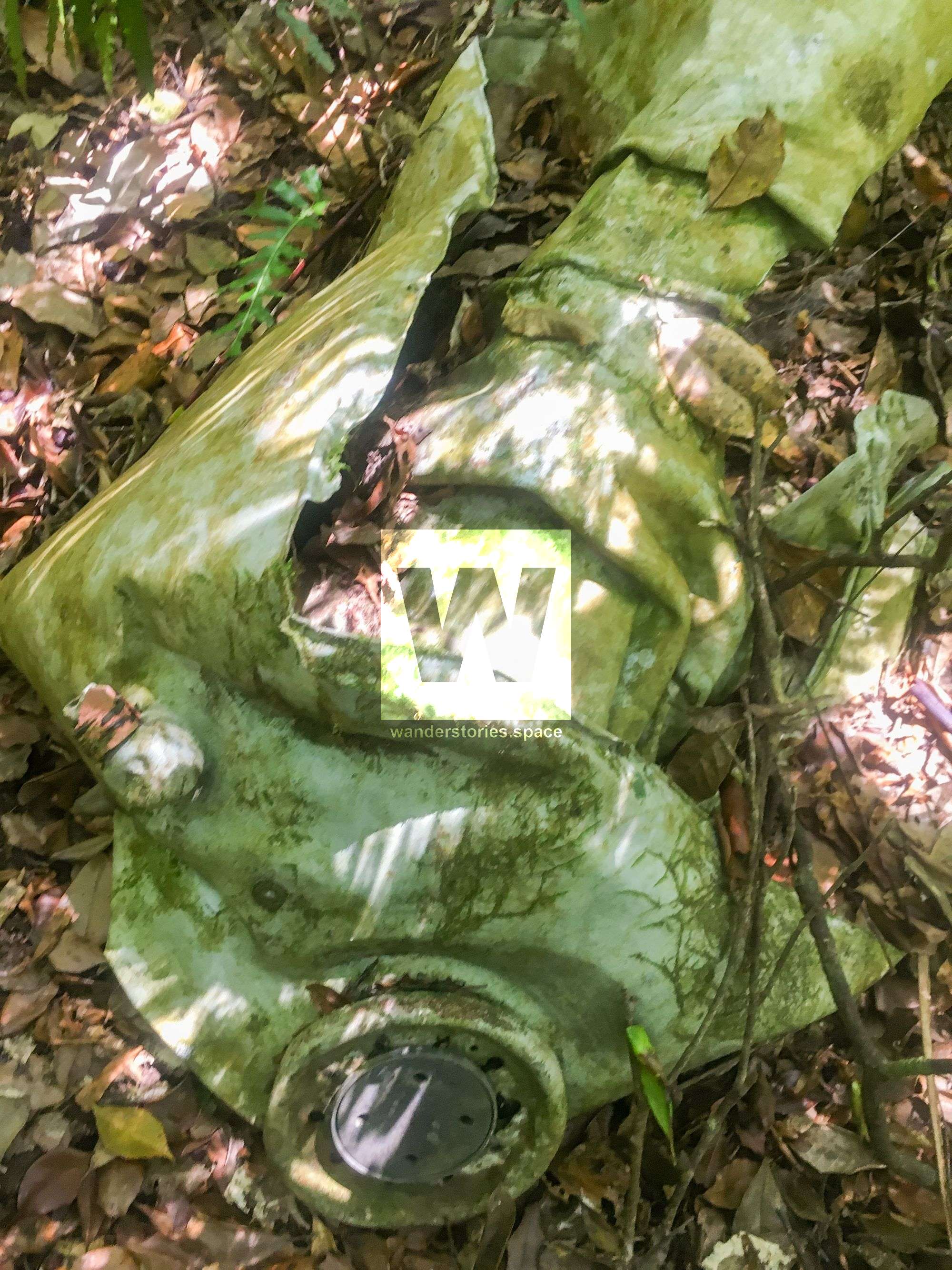
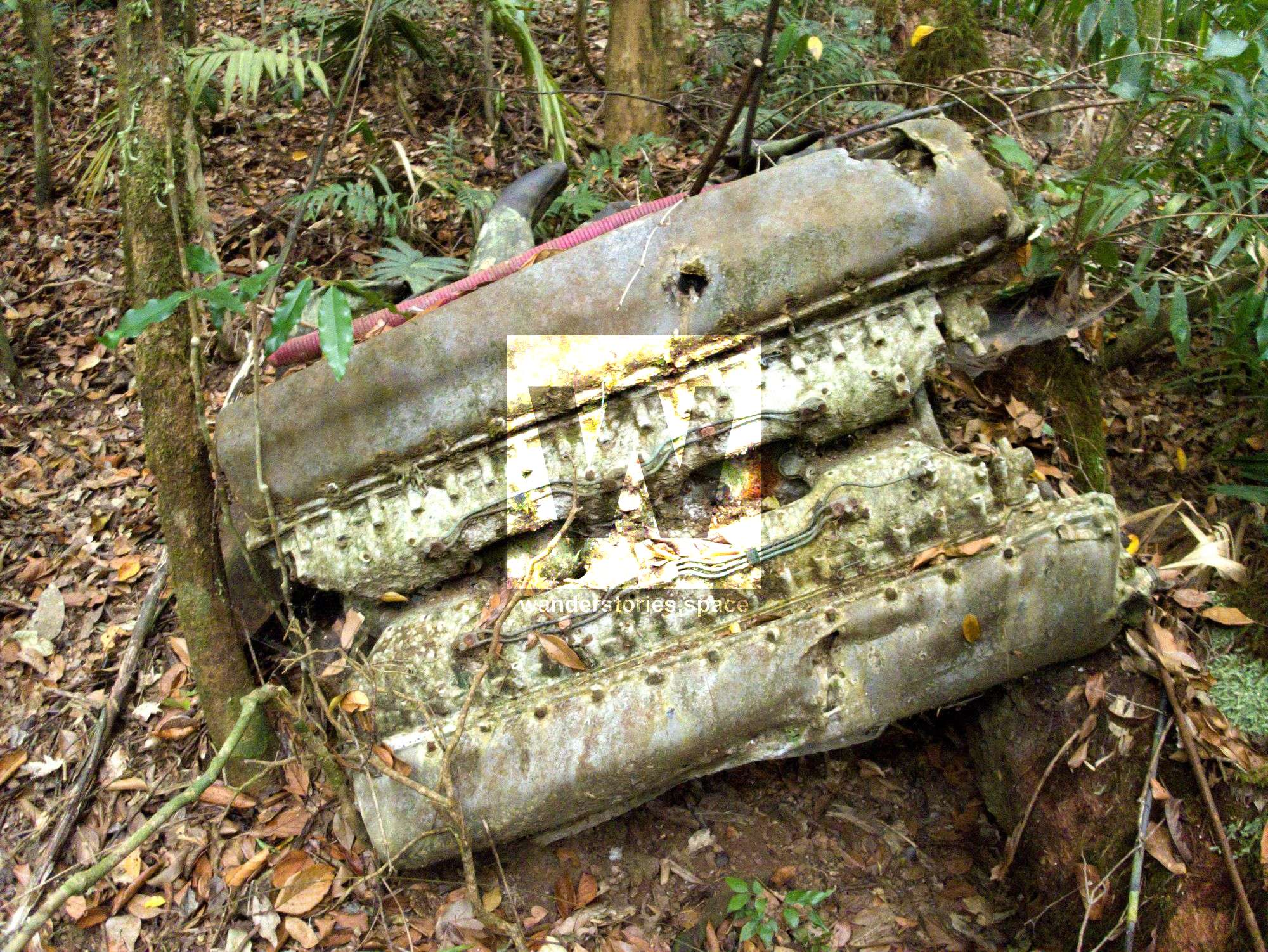
Evidence suggests that the aircraft crashed into Saddle Mountain at more than 300 kilometres per hour. Trees were ripped out and cut through for more than 140 metres. The pilot died upon impact, and apparently the co-pilot, after crawling to a nearby stream, also died some time later. Unfortunately, it is thought that the plane would not have crashed if it had been flying a mere 30 meters higher.
The crash site is located at -19.44687, 147.0145 about ten metres below the ridgeline.
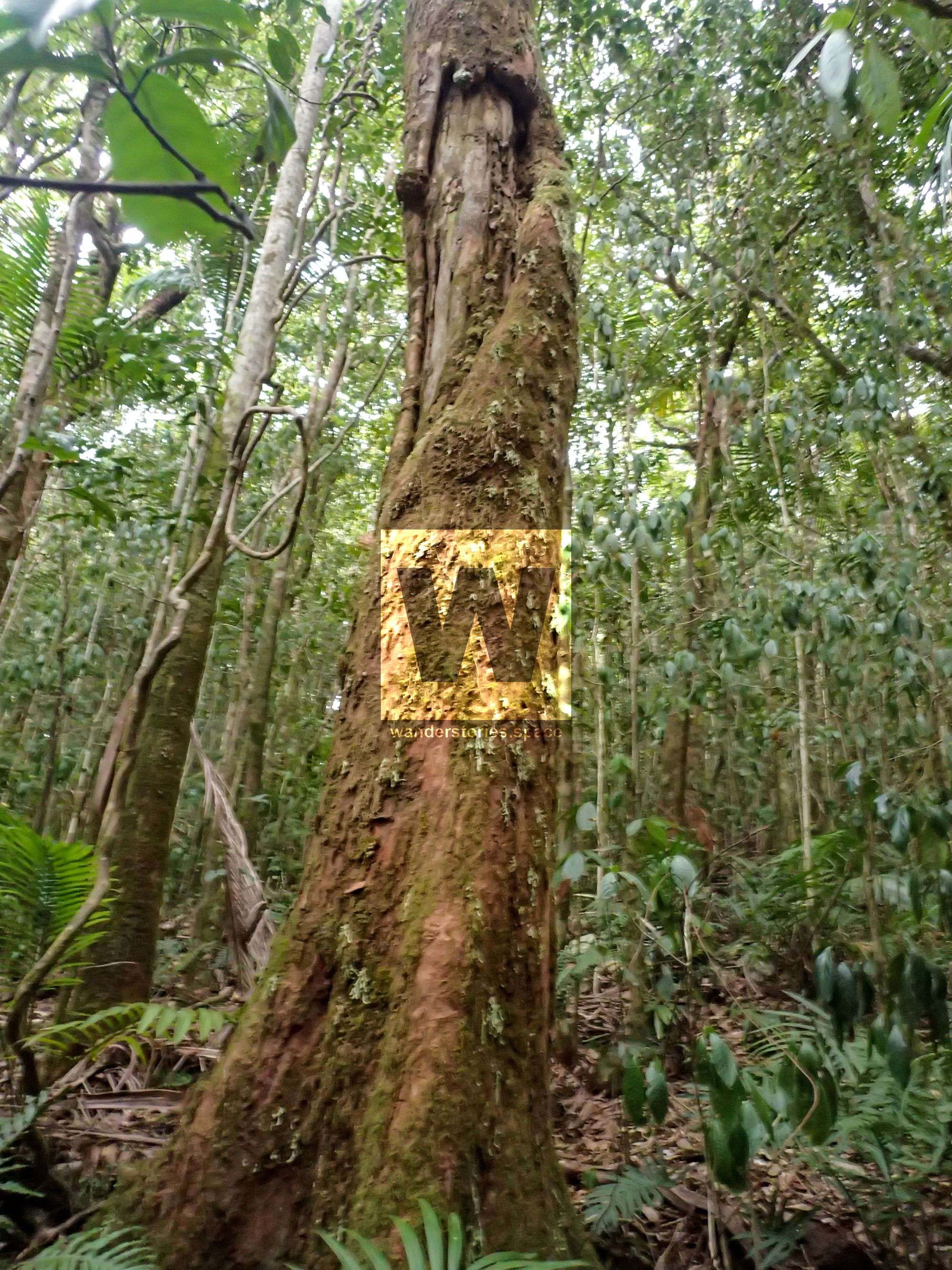
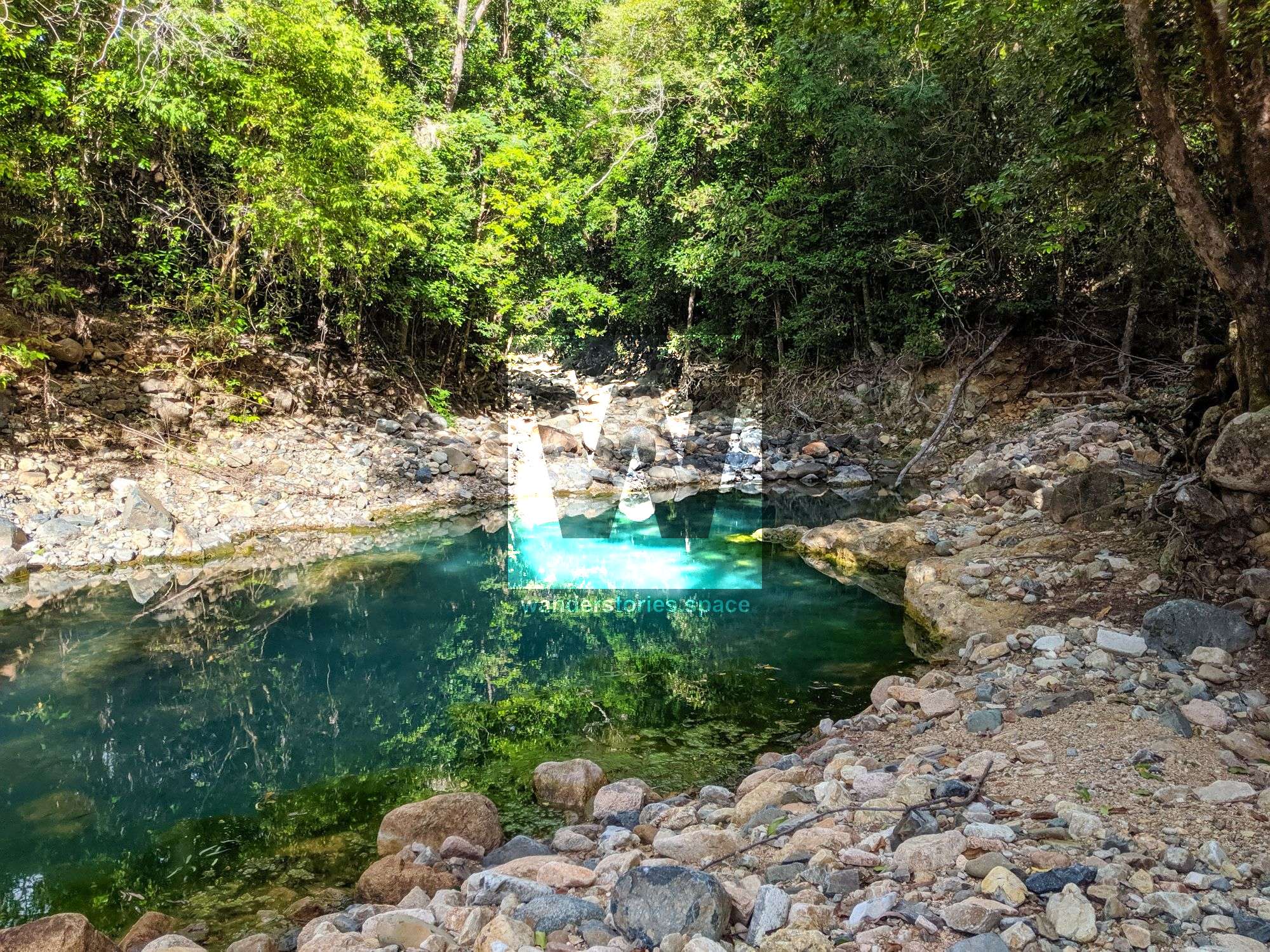
Near the wreckage, you will see a big, leaning rainforest tree that had fallen over at some point. Despite falling, it did not die, and, to this day, keeps growing upwards, despite its vertical root plate. If you follow the right side tributary of Emmet Creek all the way up, you can see debris from the plane wreckage that has since been washed into the gully. Whichever route you take up to the summit, it will only be about a five minute walk down to the wreckage.
Alan Simet, a well-known adventurer that was most active during the 1970s, 80s, and 90s and a few other soldiers from Townsville walked to the crash site in 1996. They found the frame of the co-pilot's seat near the stream along with flare tape, both of which were still intact after all this time. Apparently Sid Beck, an aircraft recoverer and a museum curator, has also recovered bits and pieces from the crash site. There's a memorial in Giru's Lions Brolga Park in remembrance of the crash and a propeller at the RAAF Base Townsville Museum, which was recovered from the crash site.
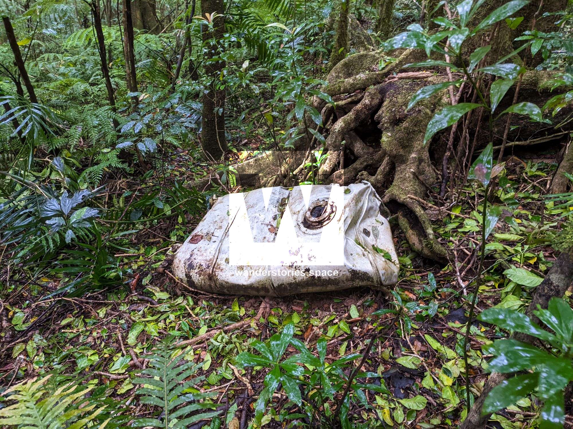
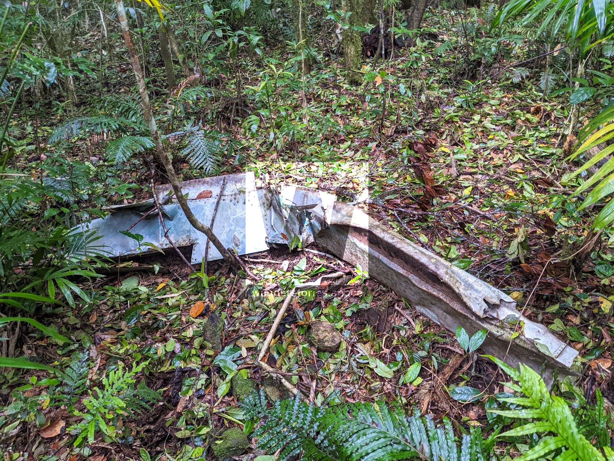
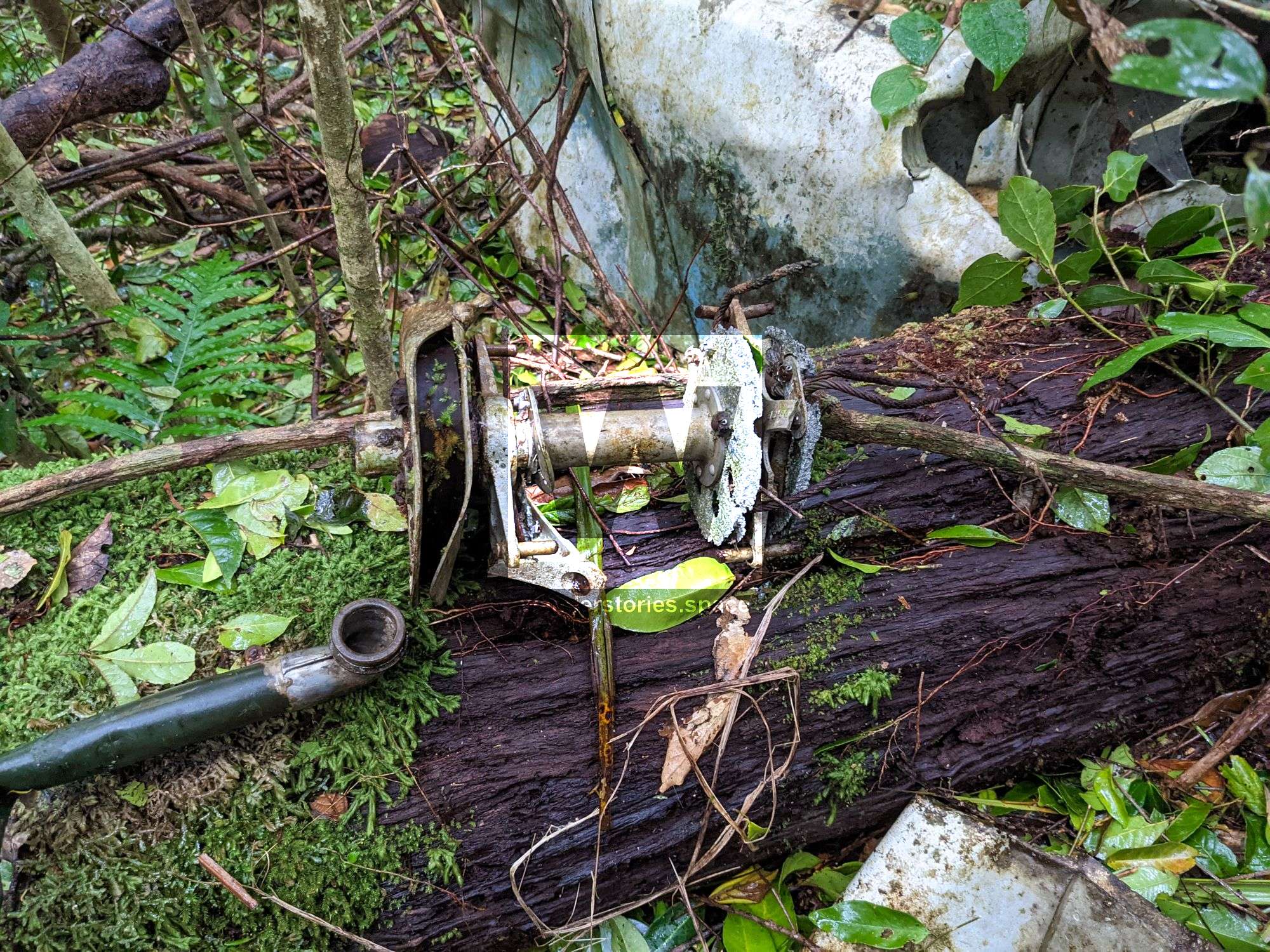
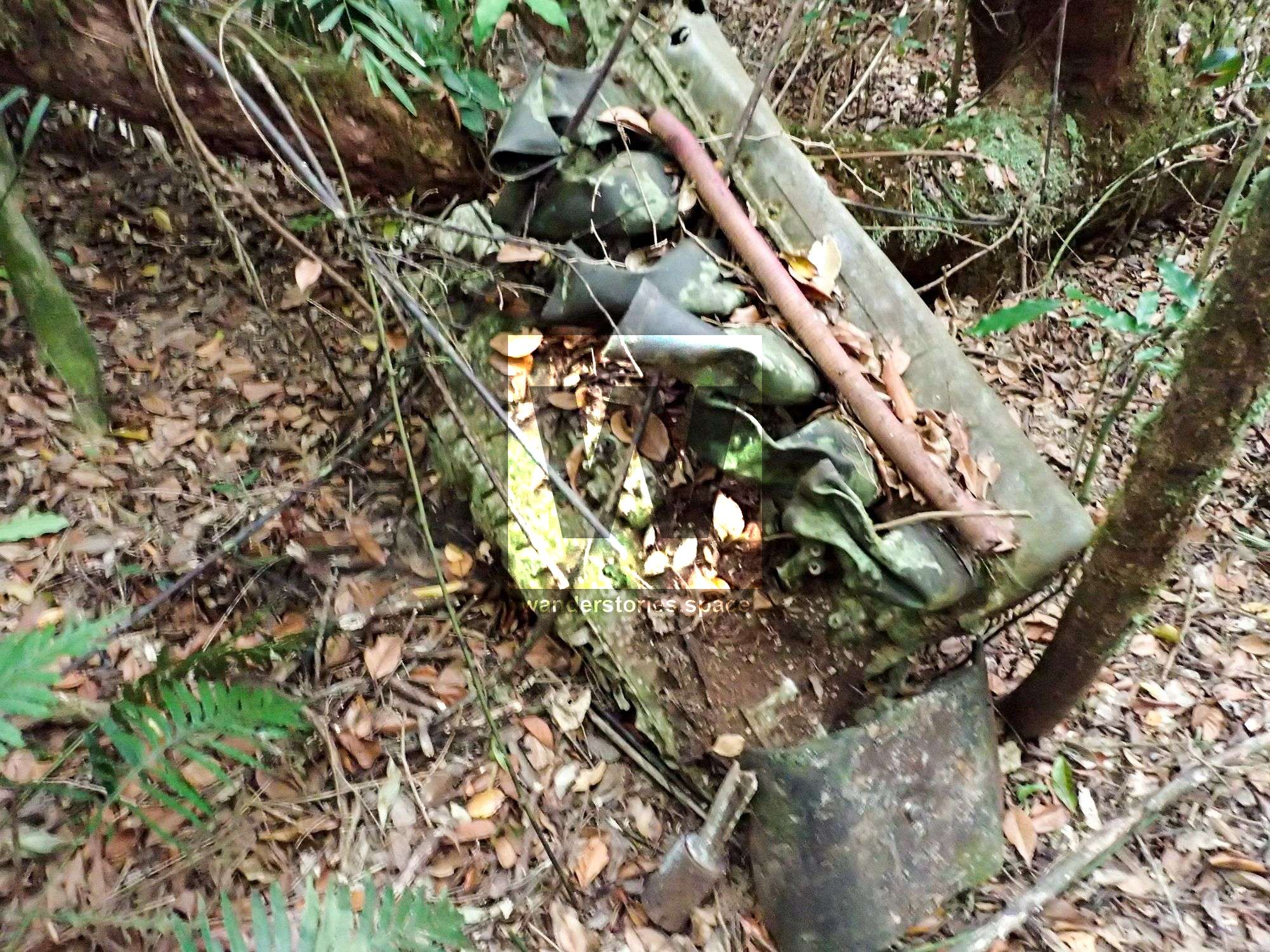
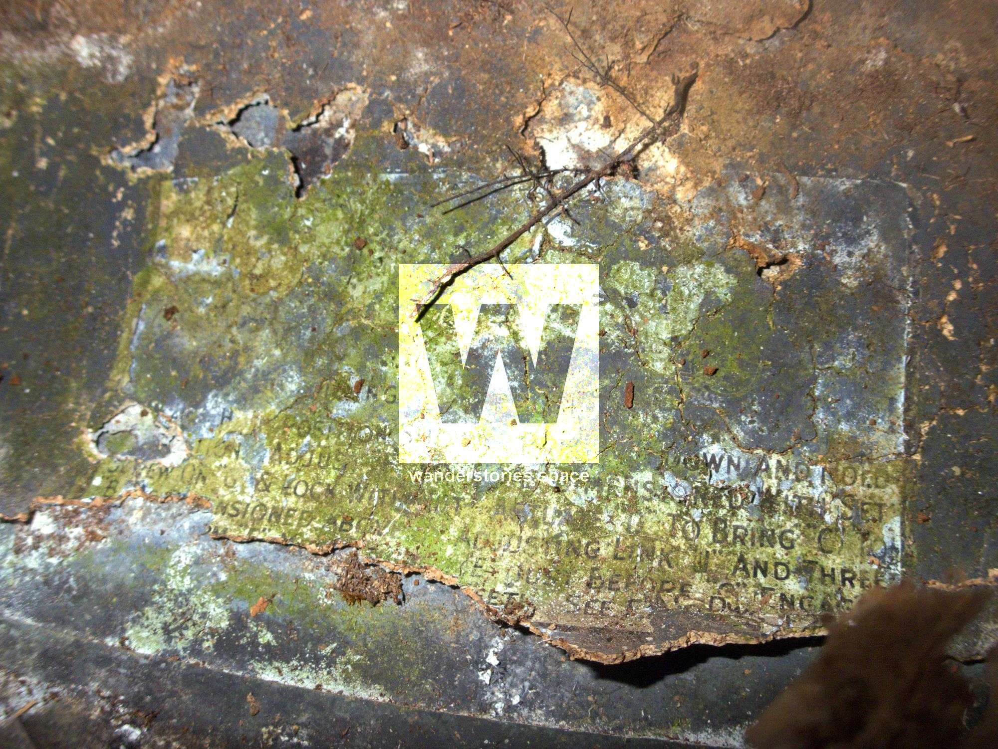
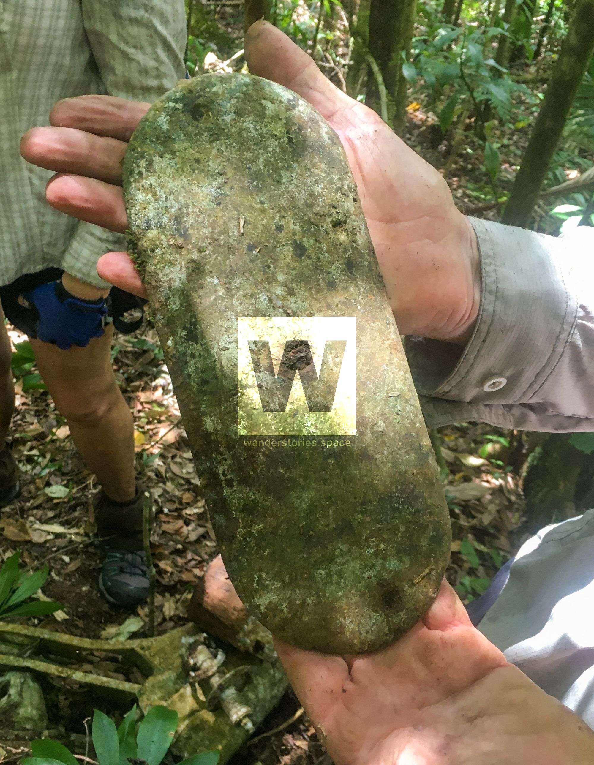
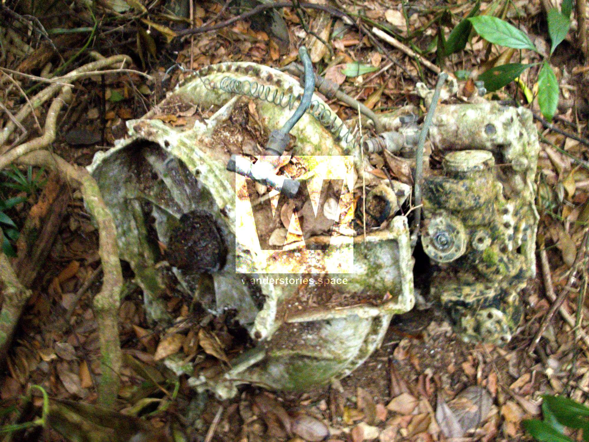
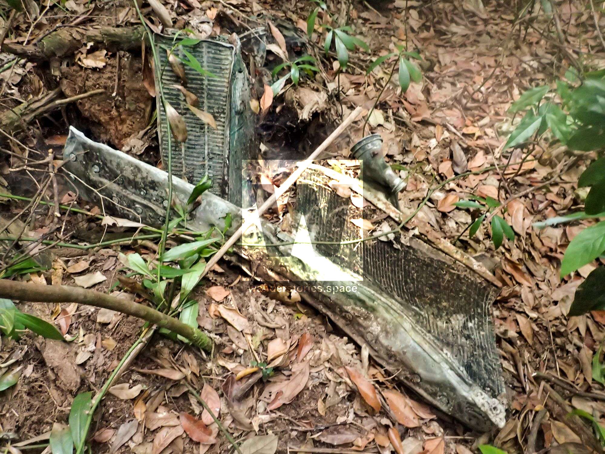
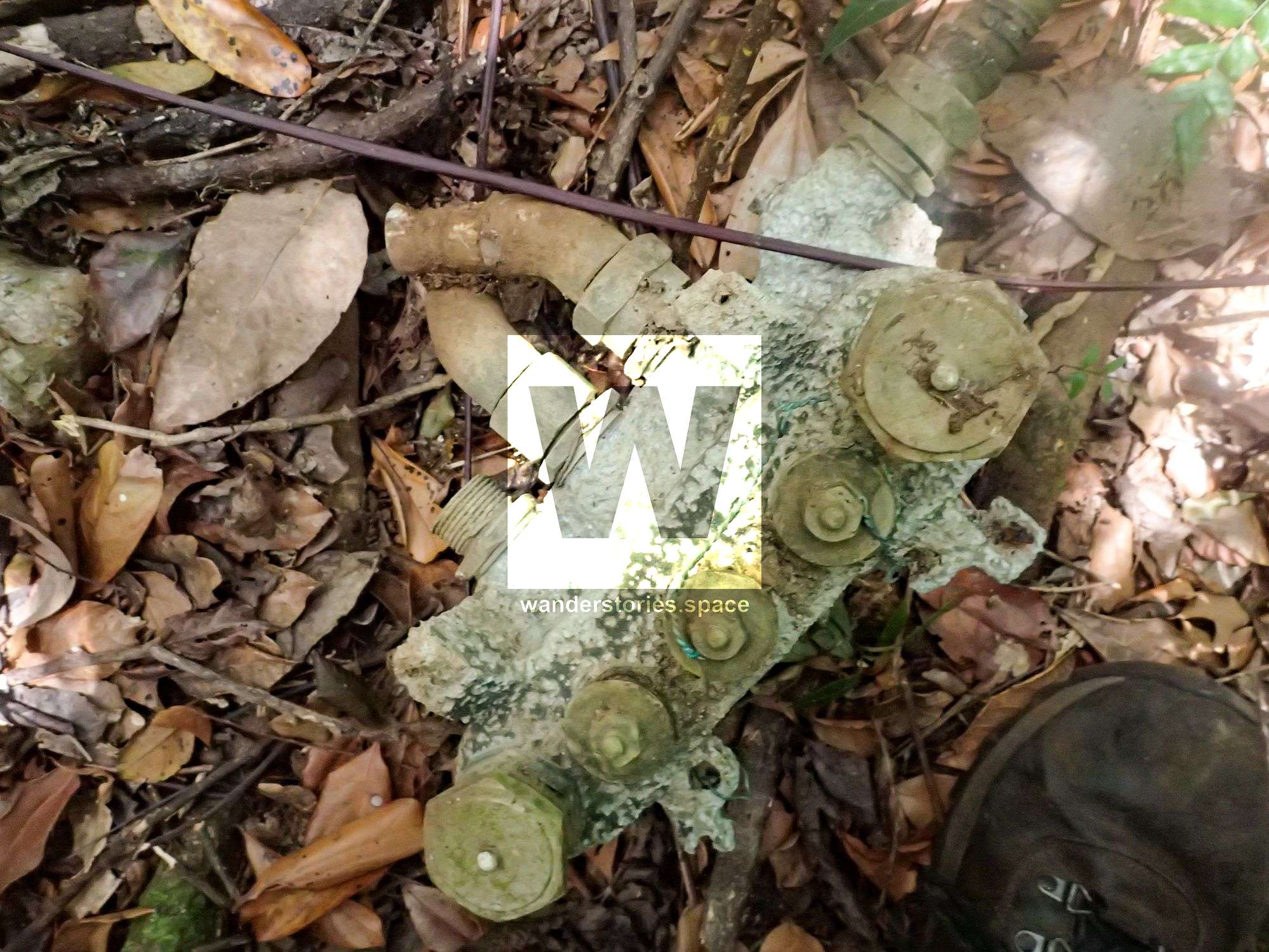
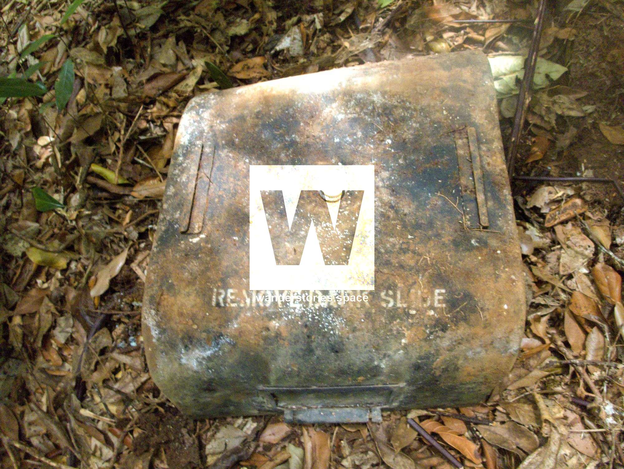
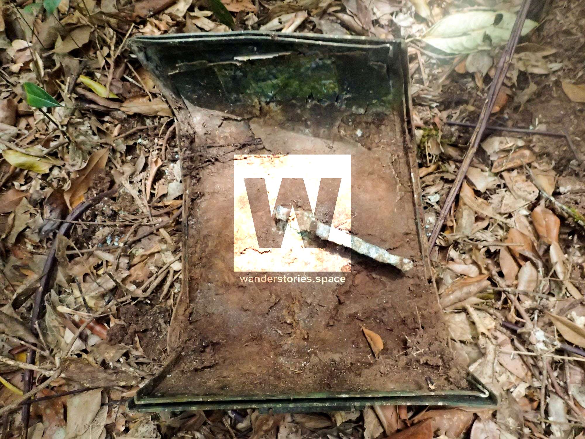
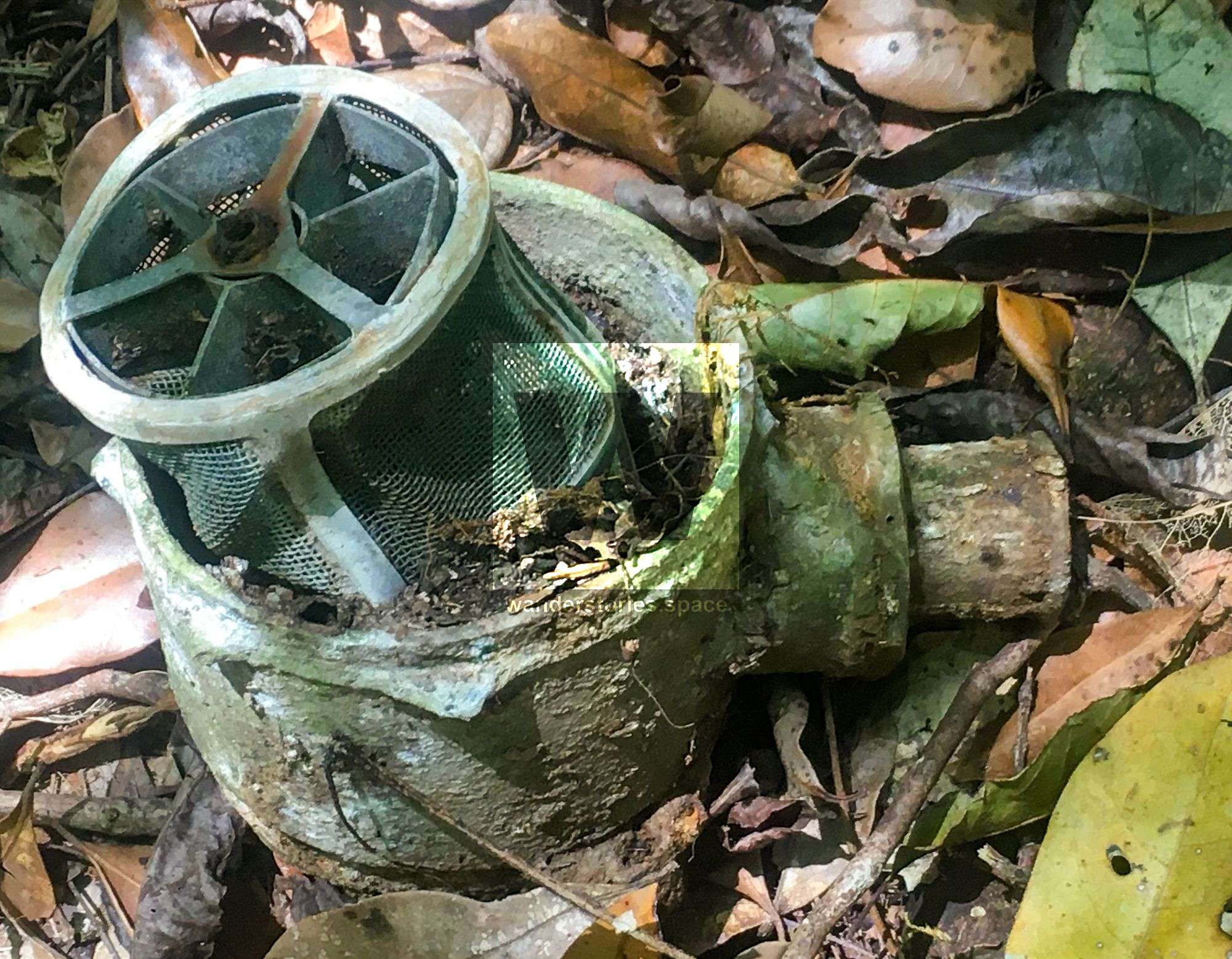
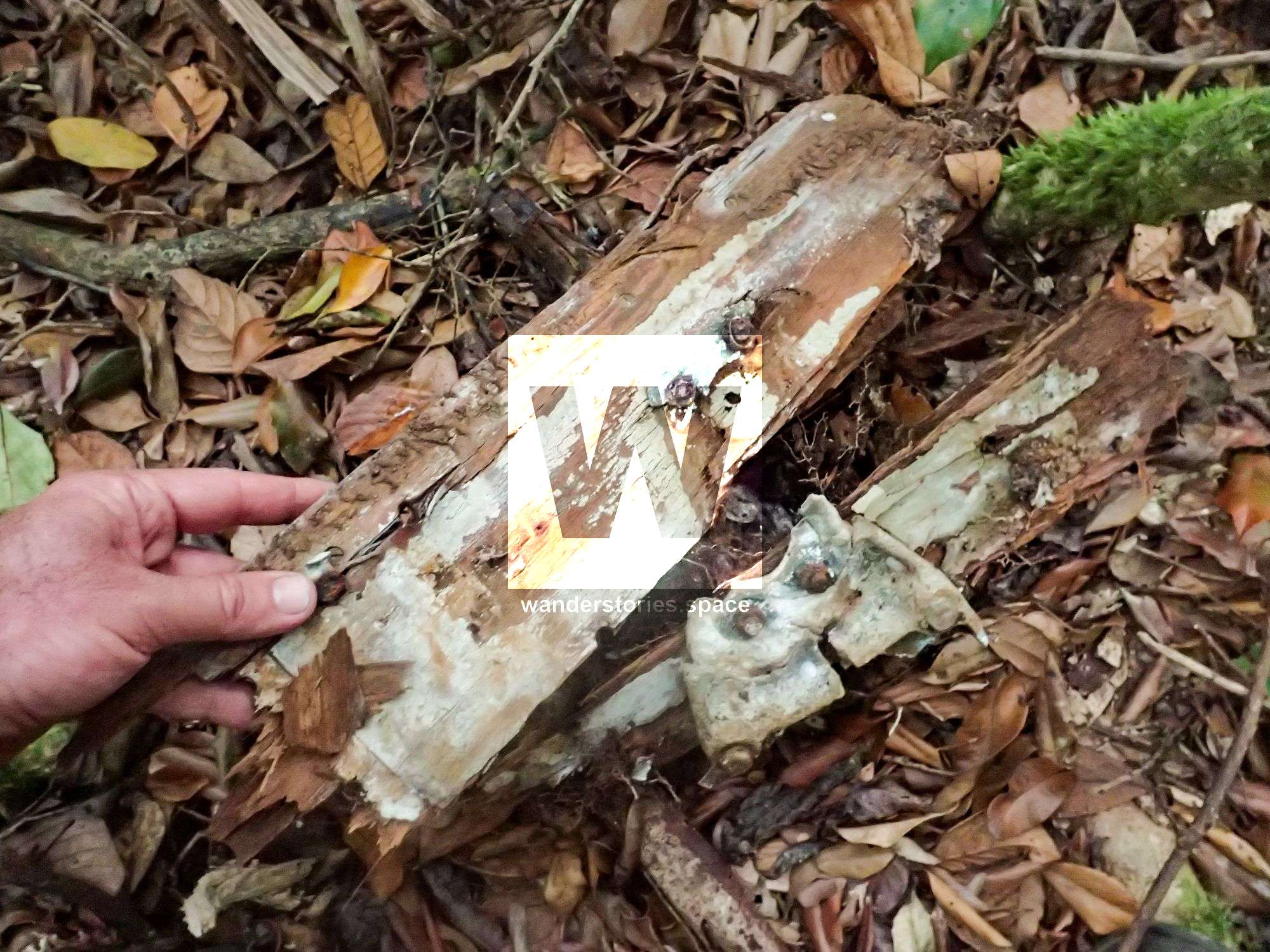
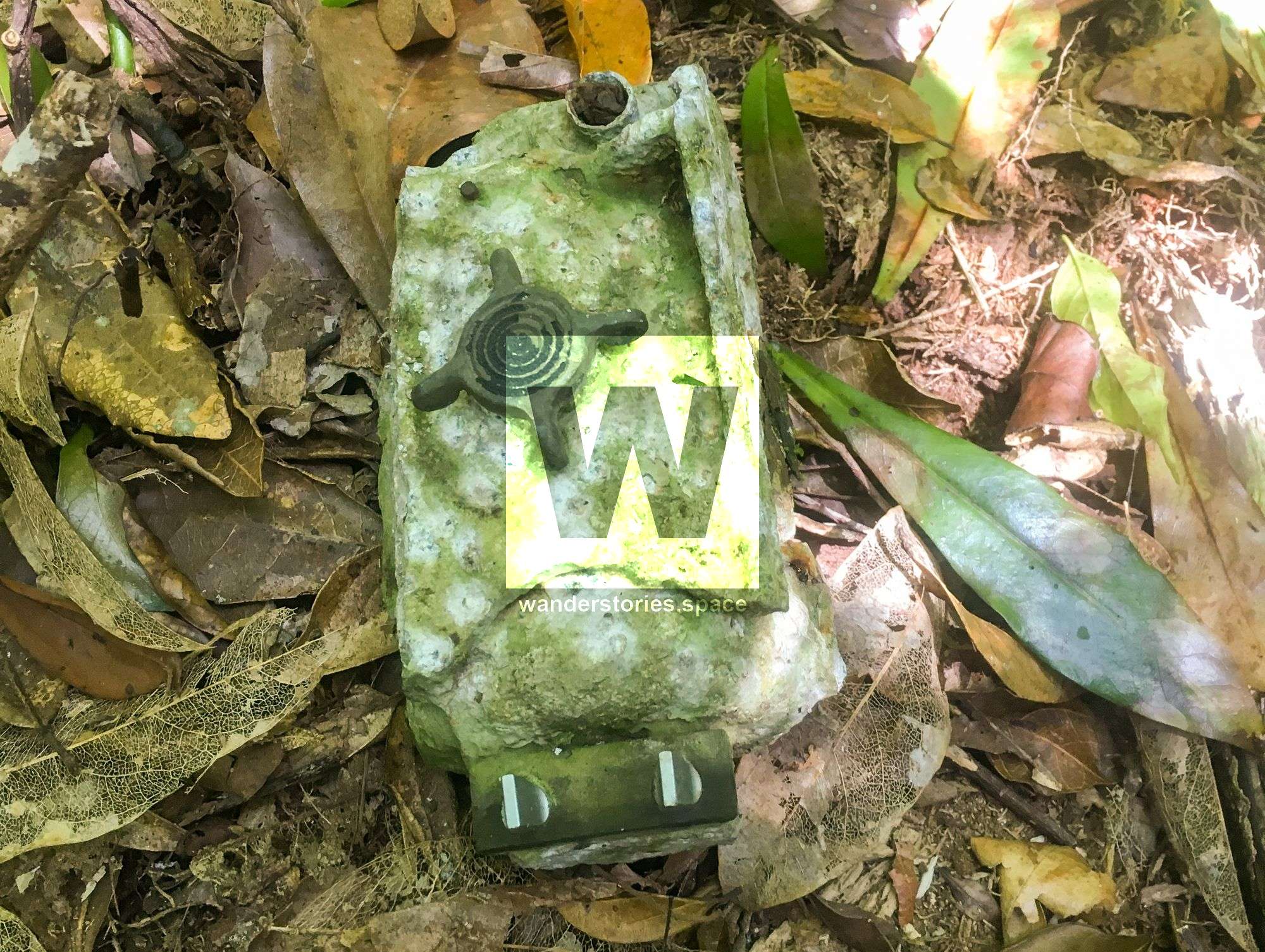
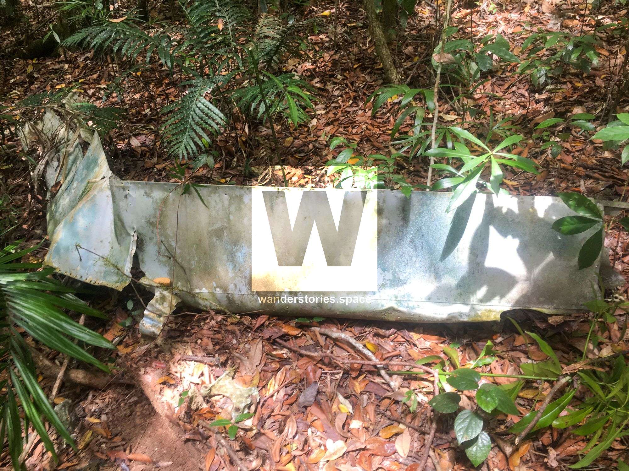
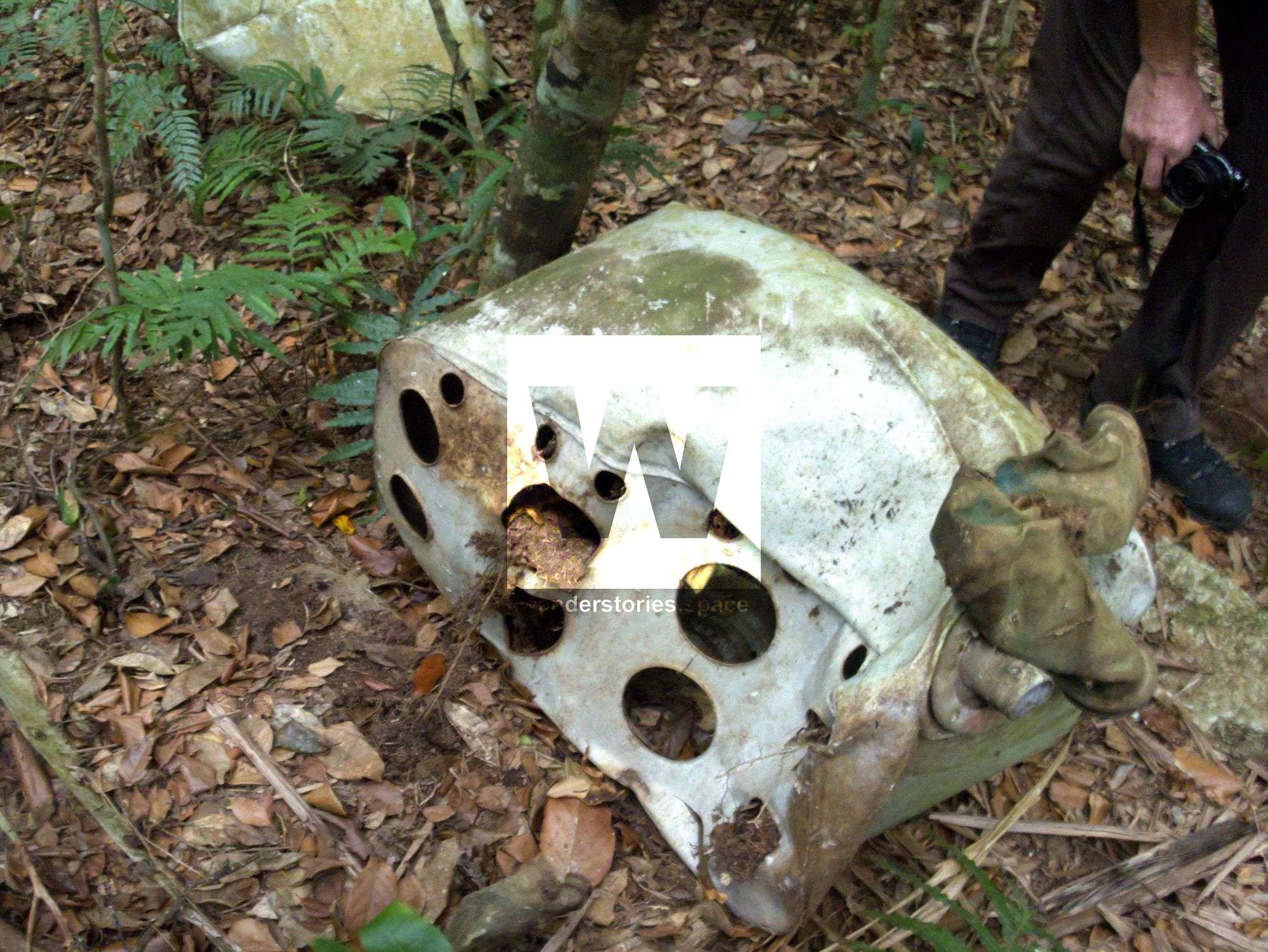
Today, not much remains of the plane wreckage. Only two of the motors, a few small bits of metal, a wheel, various electronics, and wiring can be seen, all of which are strewn across a 20 metre radius. Most of the remains are tarnished, weathered, and now blend in quite well with the surroundings.
We would like this historic site to be remembered, and we would like the relics and artefacts to stay at the site and not fall victim to collectors and trophy hunters. There are few places remaining like this in Australia, let alone the world, to explore that have not been pillaged. There is no reason to remove objects from any of these sites. Please be responsible, respect the history, and respect the importance of this site for future generations. Take photos and leave only footprints.
The Routes
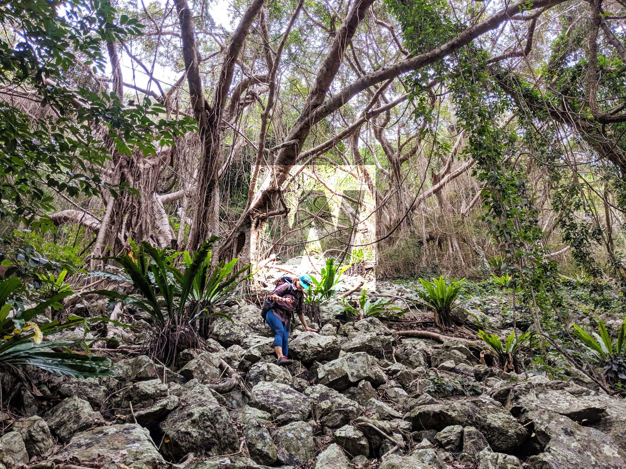
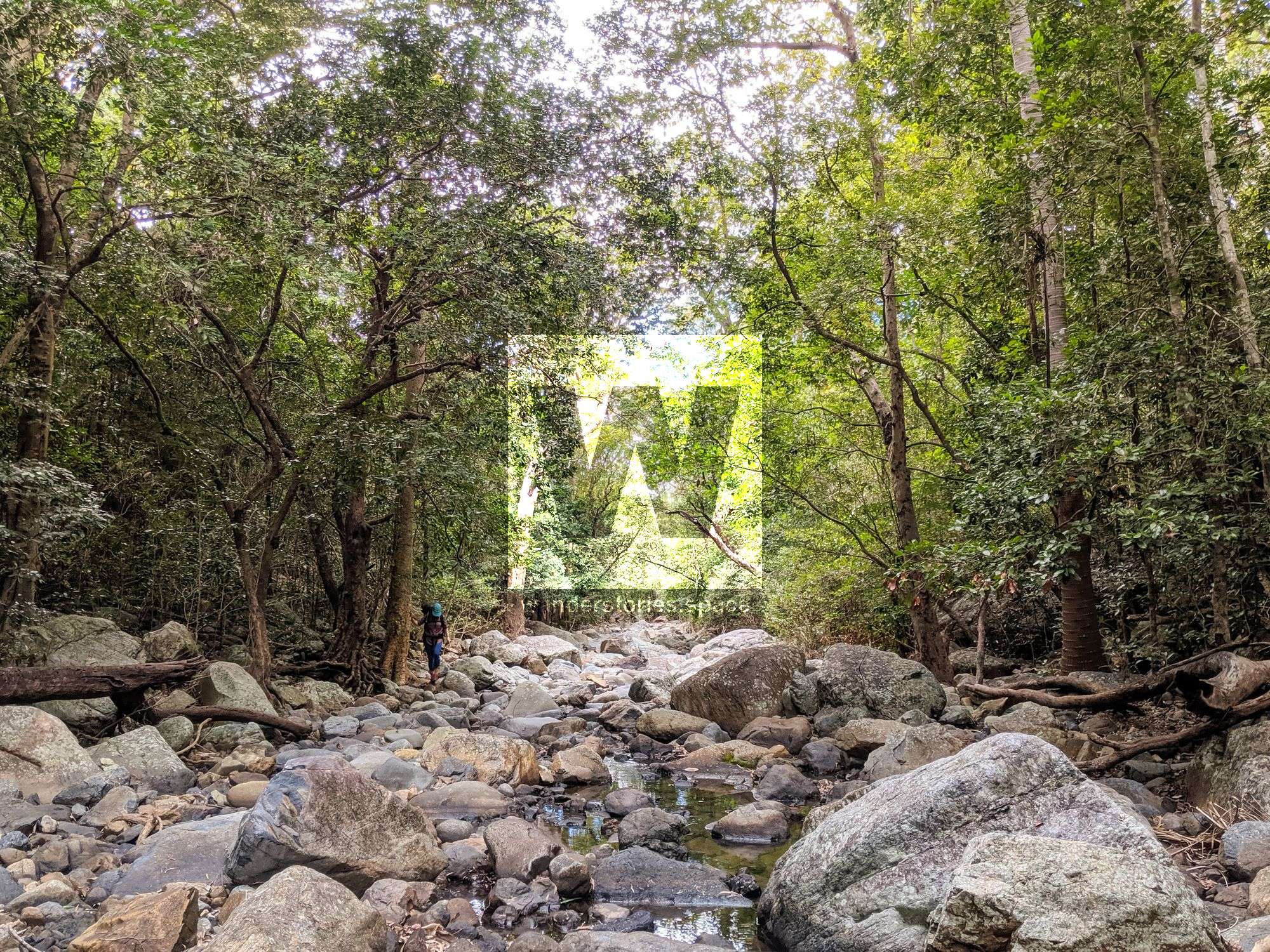
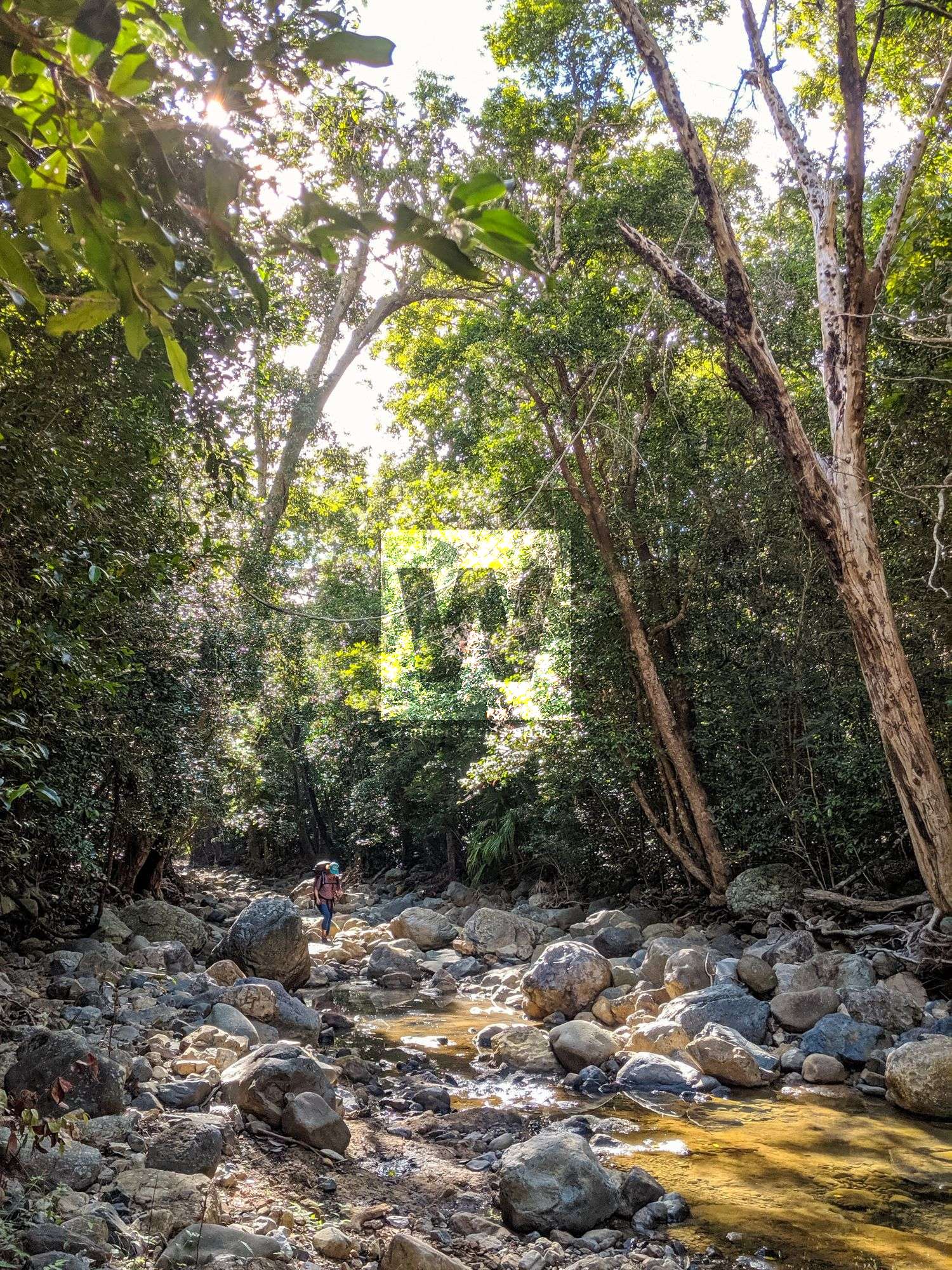
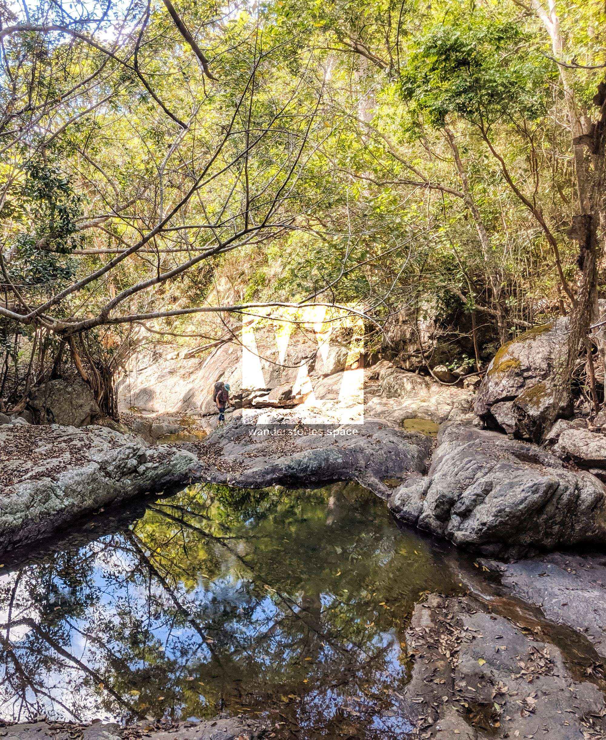
There are several ways to summit Saddle Mountain; however, the North East Ridge and the Emmett Creek Ridgeline are the most common routes. The Emmett Falls and Eastern Face routes are possible, but far more challenging and technical. The Killymoon Creek route is the longest route.
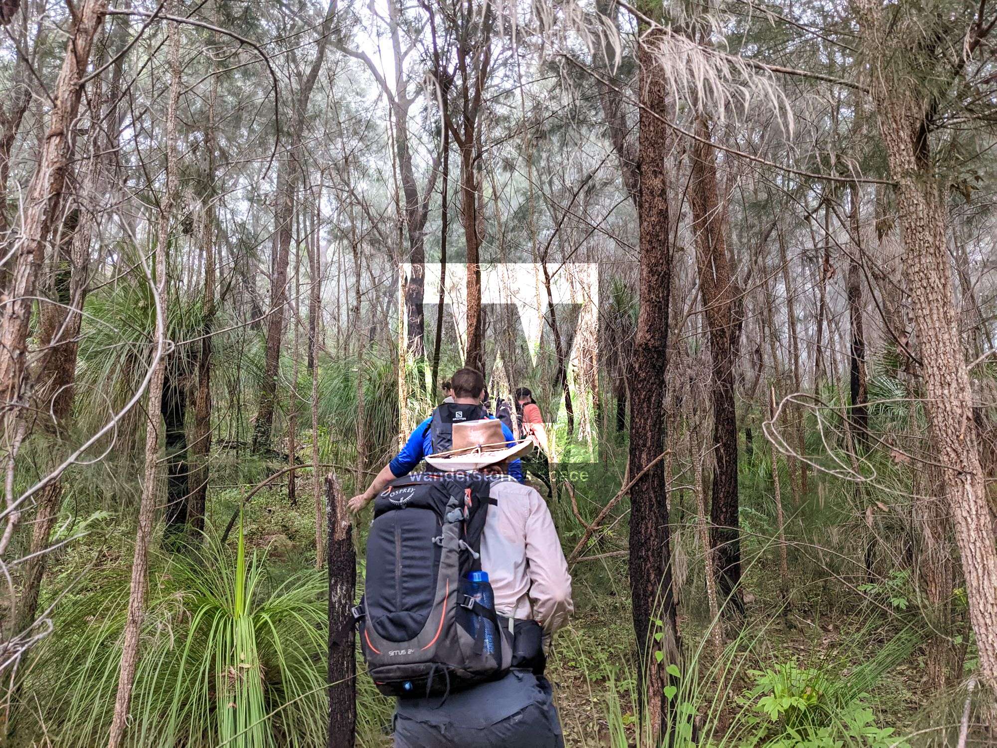
North East Ridge Route
Park your car on the western side of the highway and the north side of Emmett Creek. From here, make your way up the ridgeline though the bushland before reaching the rainforest. Most hikers will then summit the false peak and descend before continuing up toward the main peak. There are a few great vantage points along this route that provide superb views across Giru and Mount Burrumbush (Feltham Cone). Note that the land beside the Bruce Highway is Wongaloo Conservation Park and permission is required to traverse the first 600 metres.
Emmett Creek Ridgeline Route
This route is a personal favourite of Alan Simet and many others. Starting from the highway, make your way up the creek, rock hopping over boulders. Take the left fork, and then make your way up to the saddle. Once at the saddle, follow the ridgeline up towards the summit with the possibility of an easy walk down to the crash site.
Emmett Falls Route
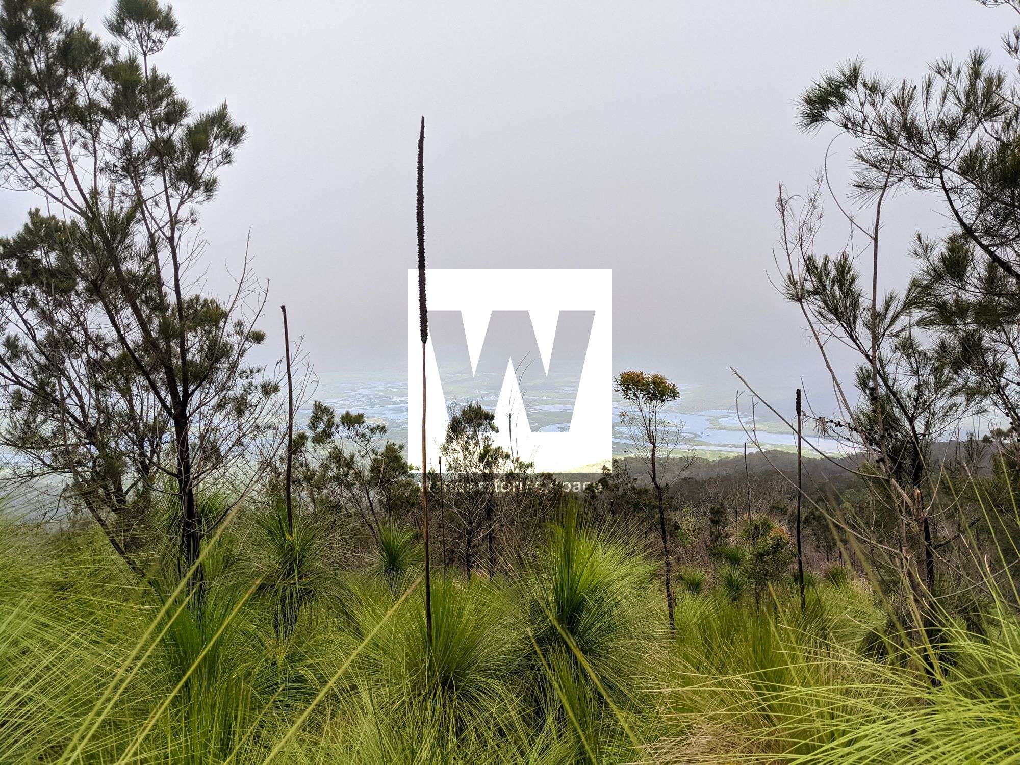
This route involves scrambling, if not full on rock climbing. Follow Emmett Creek, take the right fork, and then you will reach Emmett Falls, which is a 50 metre cascading waterfall. Scramble up the right side of the waterfall, and you will be rewarded at the top with a spectacular view over Wongaloo Conservation Park, Bowling Green Bay Conservation Park, Corrick Plains Nature Refuge, and the Coral Sea.
Eastern Face Route
The eastern face route involves rock climbing up or abseiling down but also rewards you with views over the wetlands, saltpans, and mangroves on the coastal plain. View the Saddle Mountain routes on theCrag for more information if you choose to ascend or descend via this route.
Killymoon Creek Route
Another route is via Killymoon Creek, but this route is slightly longer than others. Follow Emmett Creek into the upper reaches before taking a right into the headwaters and high slopes of Saddle Mountain. From here, the route then joins the North East Ridge to the false peak. You will pass the saddle before reaching the true summit.
Mackenzie Creek Route
Mackenzie Creek is also an option, however, the less popular choice.
Via Mount Storth
It is possible to do both of these summits in a day. A car shuttle is recommended.
Interactive Map
Here's an interactive map of the area including POI and the different routes.
Top Tips
What you bring will depend on how long you plan to stay along your journey and your preferred method for camping and sleeping. Given that there are water sources, it is only necessary to bring enough water for the hike in to the first water source. However, water purification tablets or systems are strongly advised. It is also recommended, as with any difficult trip, to bring a first aid kit and PLB. Most of the area has no mobile phone reception.
The rocks can be very slippery when wet. Take care when rock hopping. If you have not previously navigated in rainforest with GPS or map and compass, go with someone that is experienced. Smartphone GPS features can be very unreliable in the rainforest, especially in valleys, and phones can get wet or die unexpectedly leaving you in a dire situation. Print the maps, and laminated them, Take a compass as well, just in case. Secateurs can also be helpful in clearing the paths (don't do this within National Park).
What to take
- Backpack
- 1-3 litres of water per person for the hike in (refill in creeks)
- Snacks, food, depending on how long you stay
- Butane gas cartridges for use with the camping stove
- Sleeping/camping attire
- Camera
- Reliable footwear
- First Aid Kit and PLB
- Secateurs
- Compass, GPS, and other navigational devices/resources
- A water filtration or sterilisation system if you are not comfortable drinking creek water
This article, and all other articles, are for entertainment purposes only and are not to be used as a guide. Please see our Disclaimer for more information.