Mount Storth
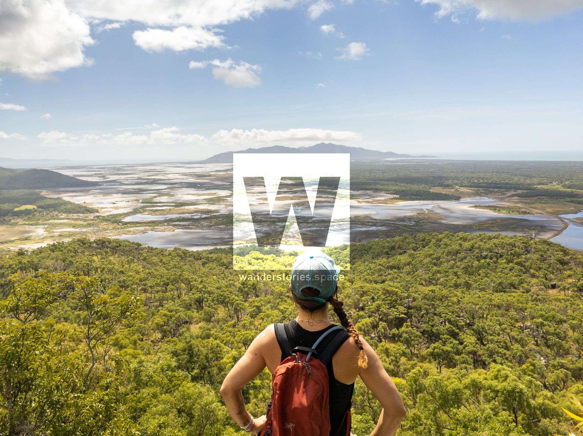
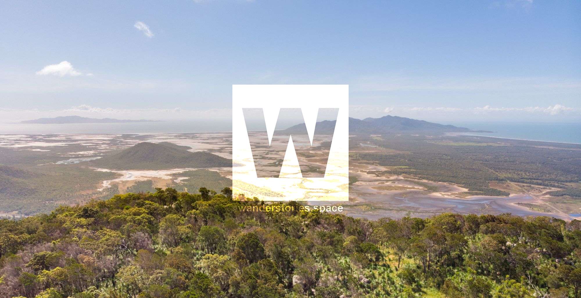
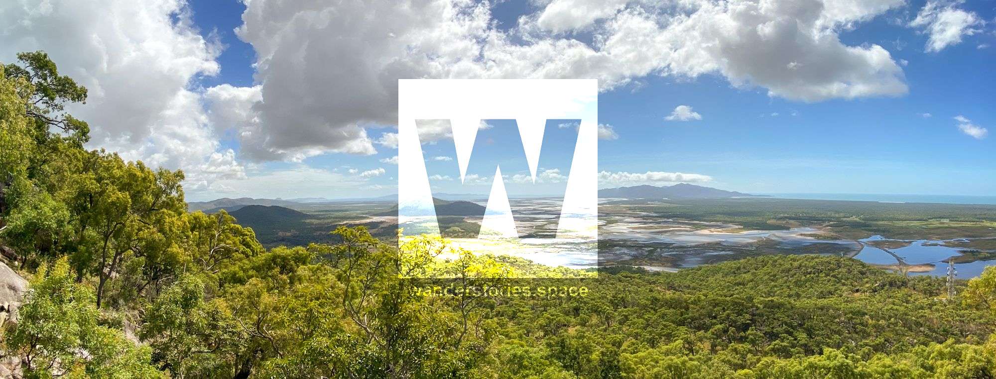
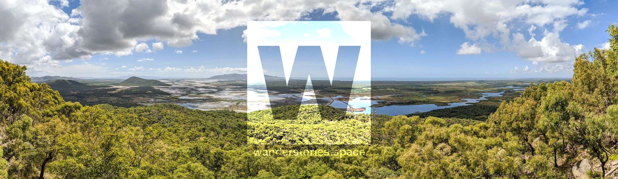
Mount Storth provides views out to Cape Cleveland and the surrounding countryside. These views and the close proximity of this summit to Townsville City are most certainly what makes this hike particularly attractive.


Location - Bowling Green Bay National Park, North Queensland, Australia
Distance - 15 kilometers return, depending on route
Time - Allow 8 hours return
Grade - 4/5, steep in some parts, depending on route
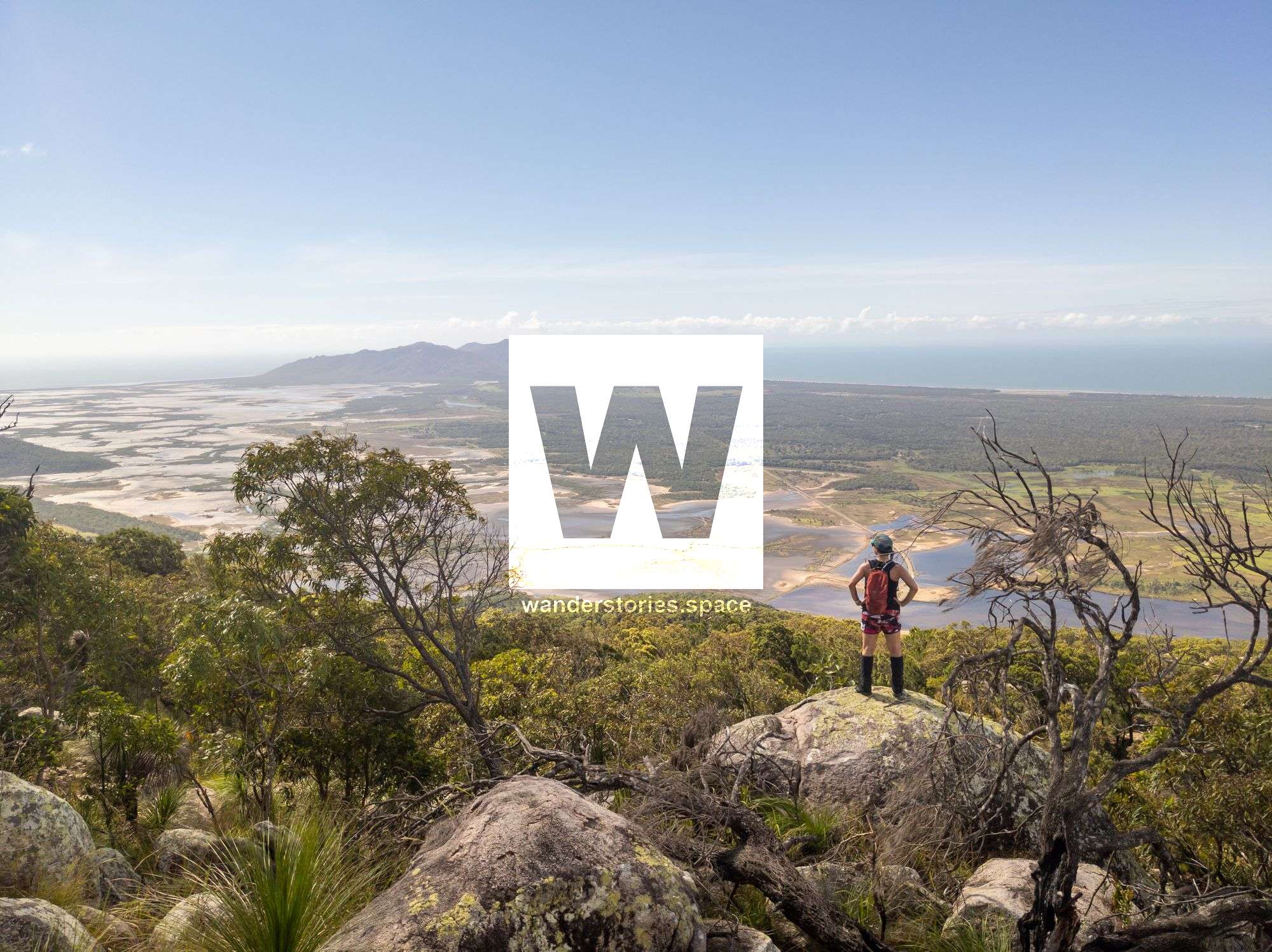
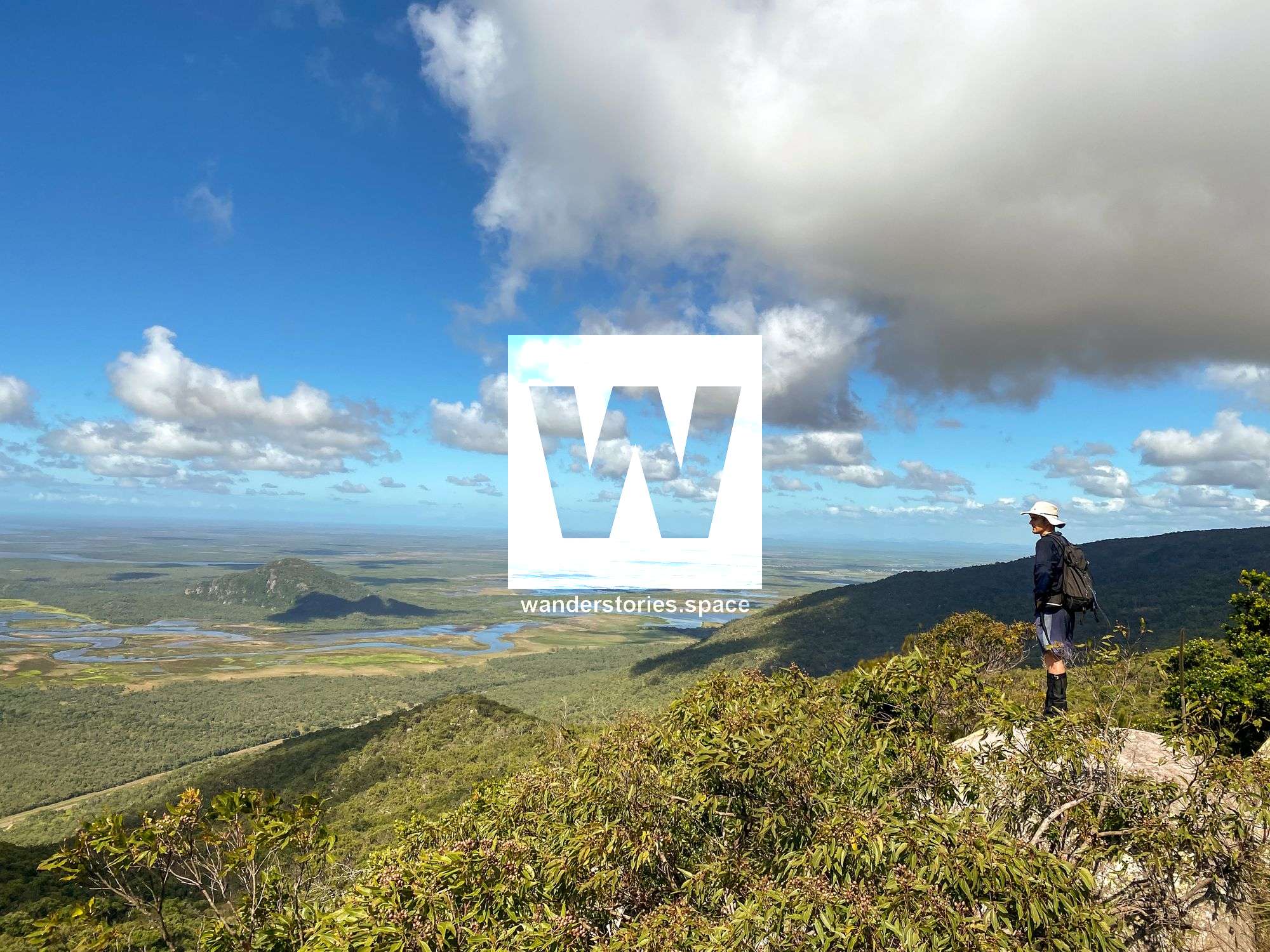
Mount Storth, at an elevation of 632 metres above sea level, provides stunning views out to Cape Cleveland and the surrounding countryside. Mount Storth is right next to Saddle Mountain, and both peaks are split from the main Mount Elliot range by Alligator Creek valley. These views and the close proximity of this summit to Townsville City are most certainly what makes this hike particularly attractive. See also Mount Cleveland.
There are several ways to hike this mountain, including several ridges or, if you are a creek dweller, via a tributary of Killymoon Creek. You even can have a bit of both worlds by hiking up the ridgeline and down the creek or visa versa. Or tick off both the mountain summits in a big circuit along the ridgeline that joins the two.
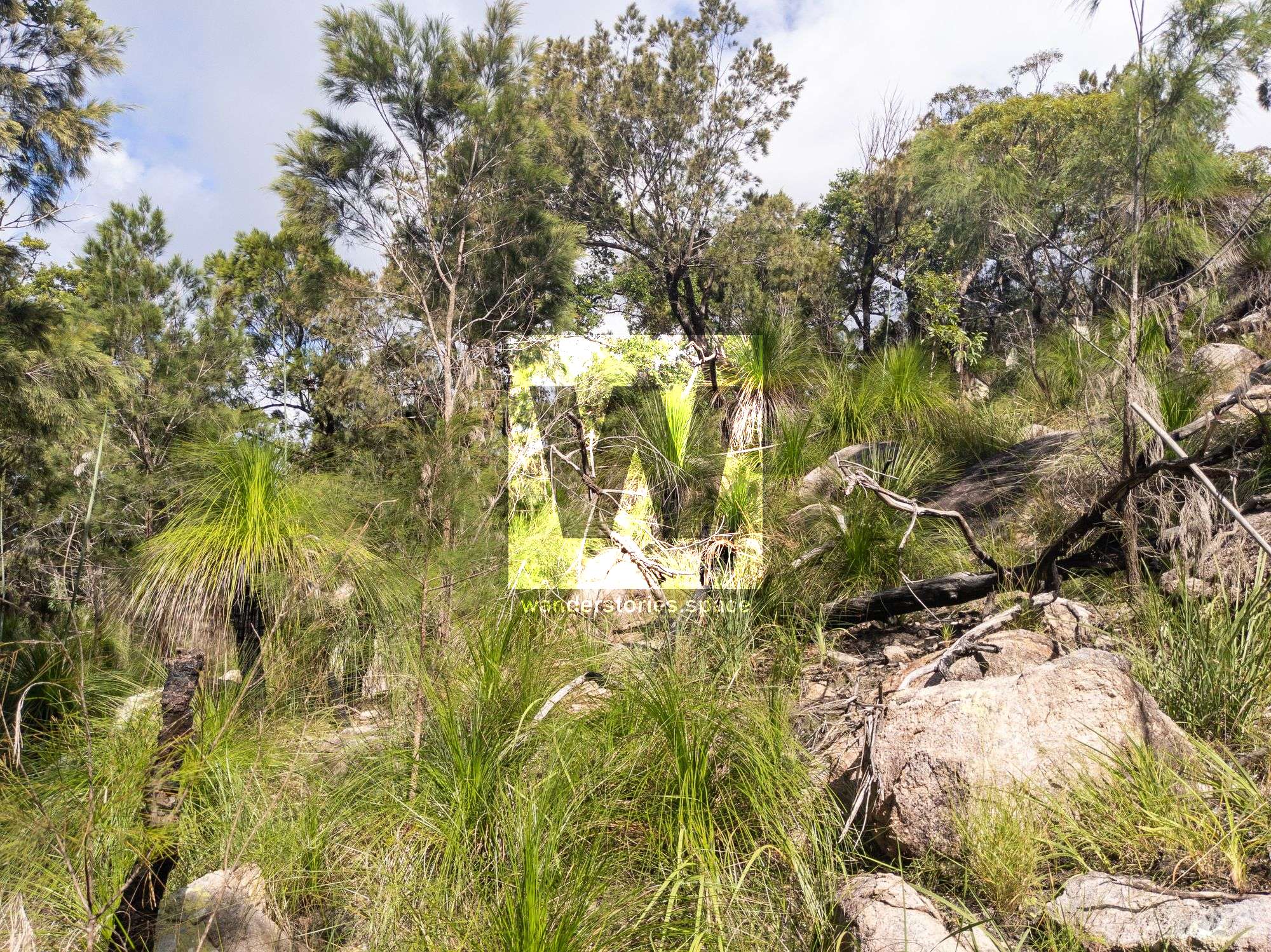
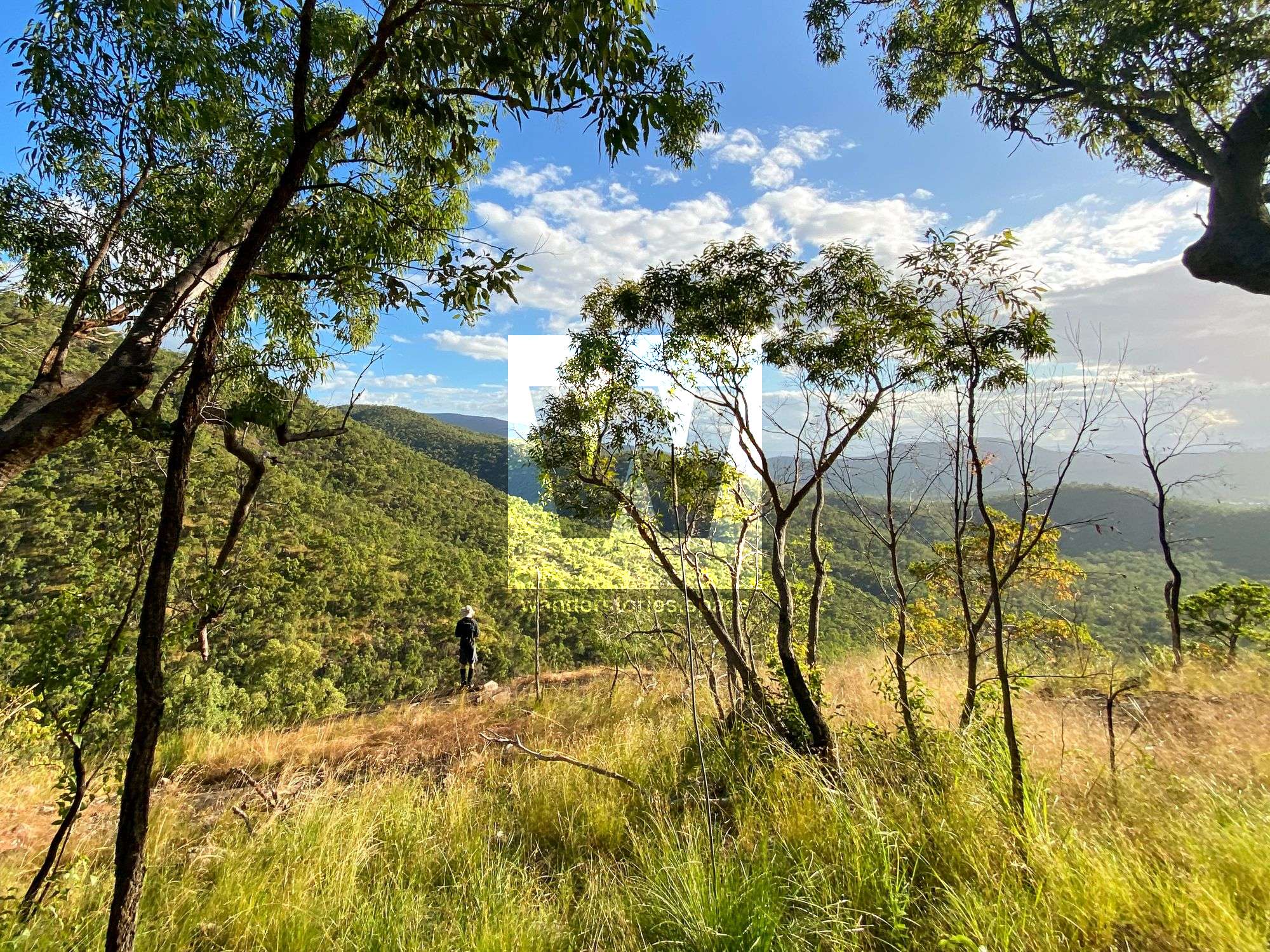
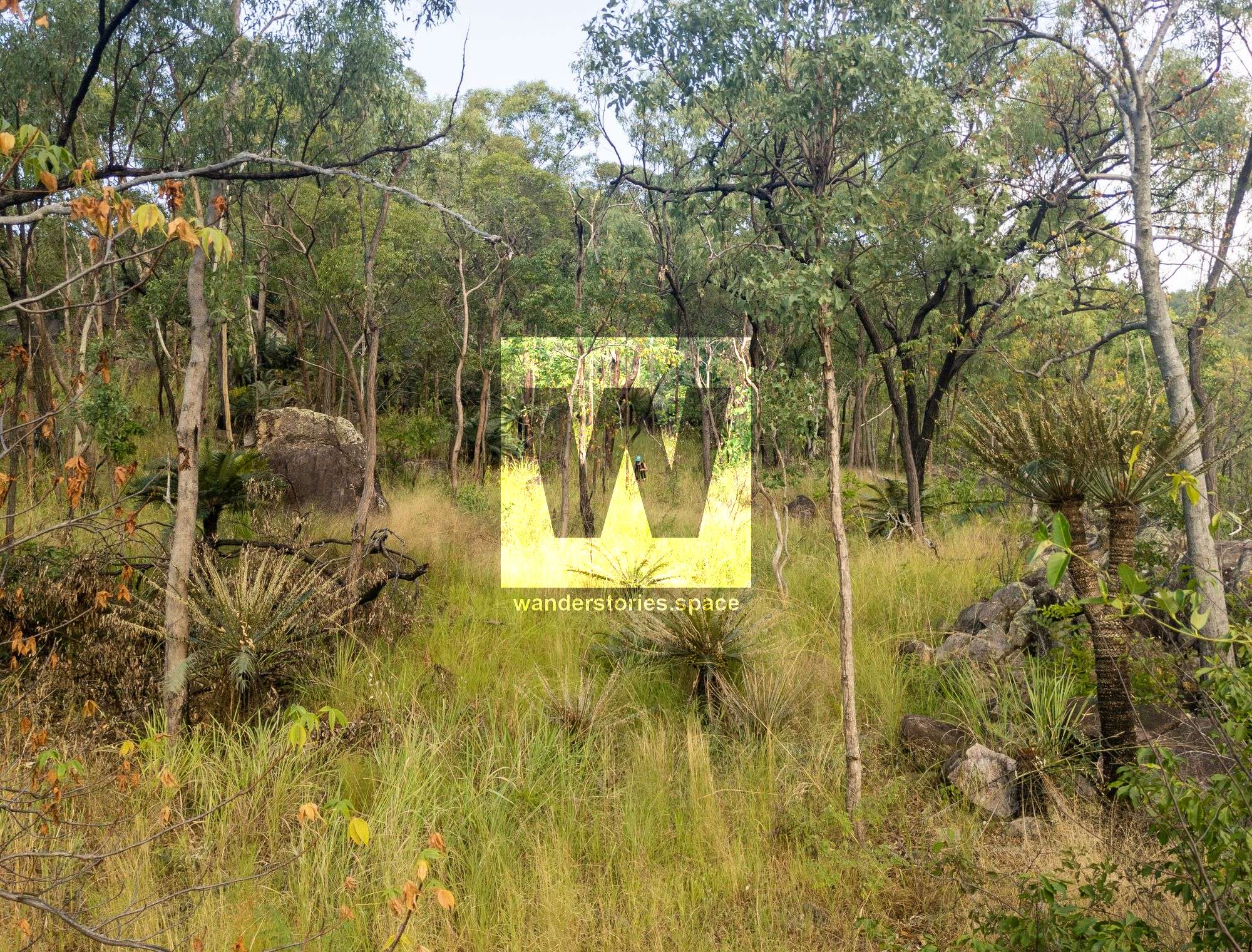
Along the way, you will encounter vegetation that shifts from grasses, ironbark, and other gum trees to grass trees, cycads, and she-oaks as you traverse the higher altitudes. You will also notice some small pockets of fern along the way. You may encounter a few snakes, spiders, and wallabys along the way as well.
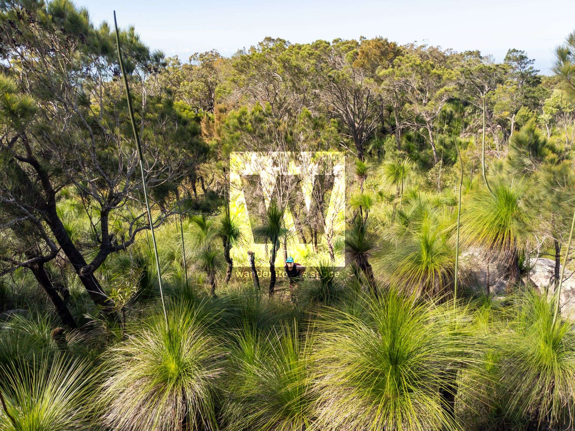
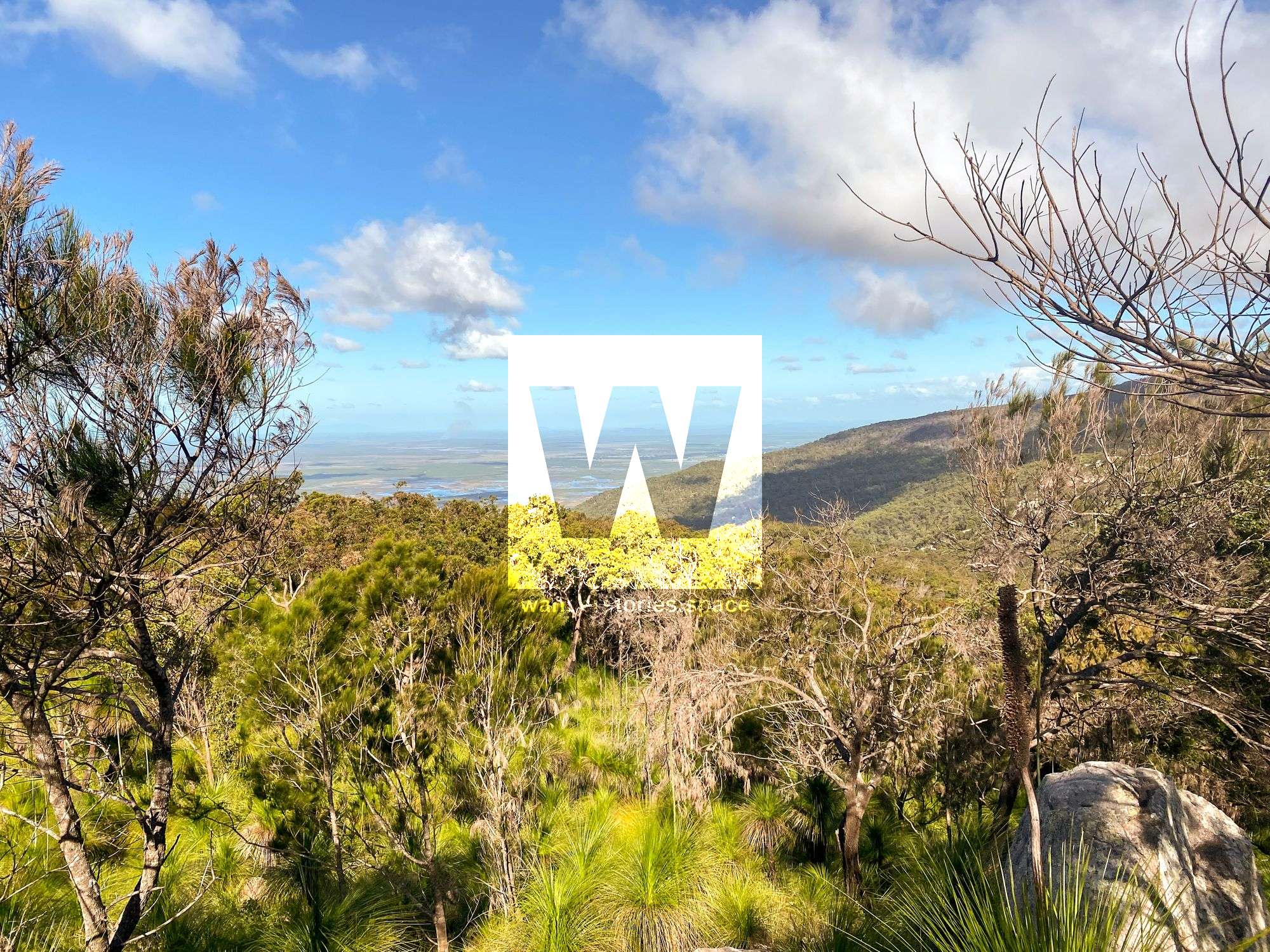
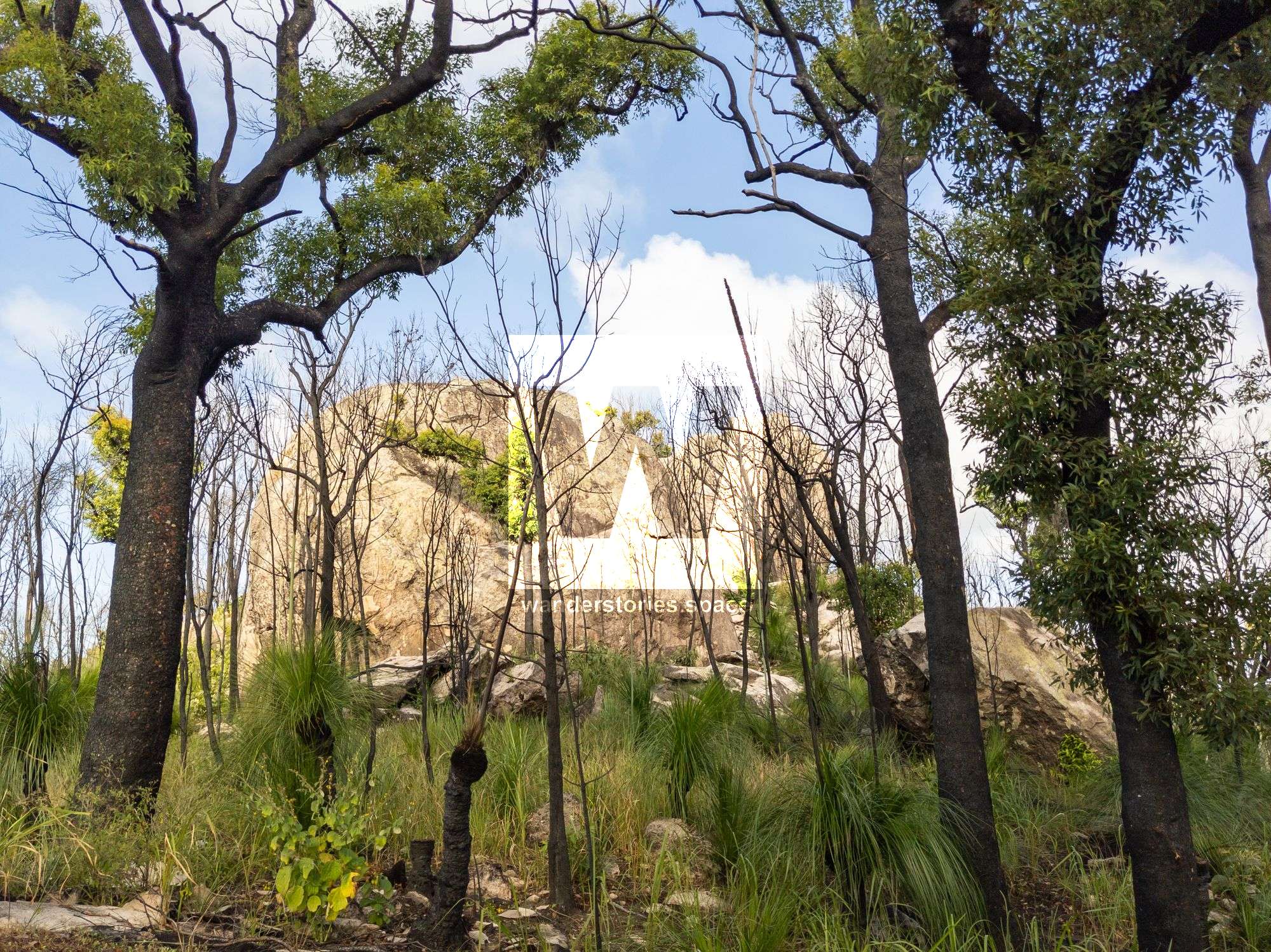
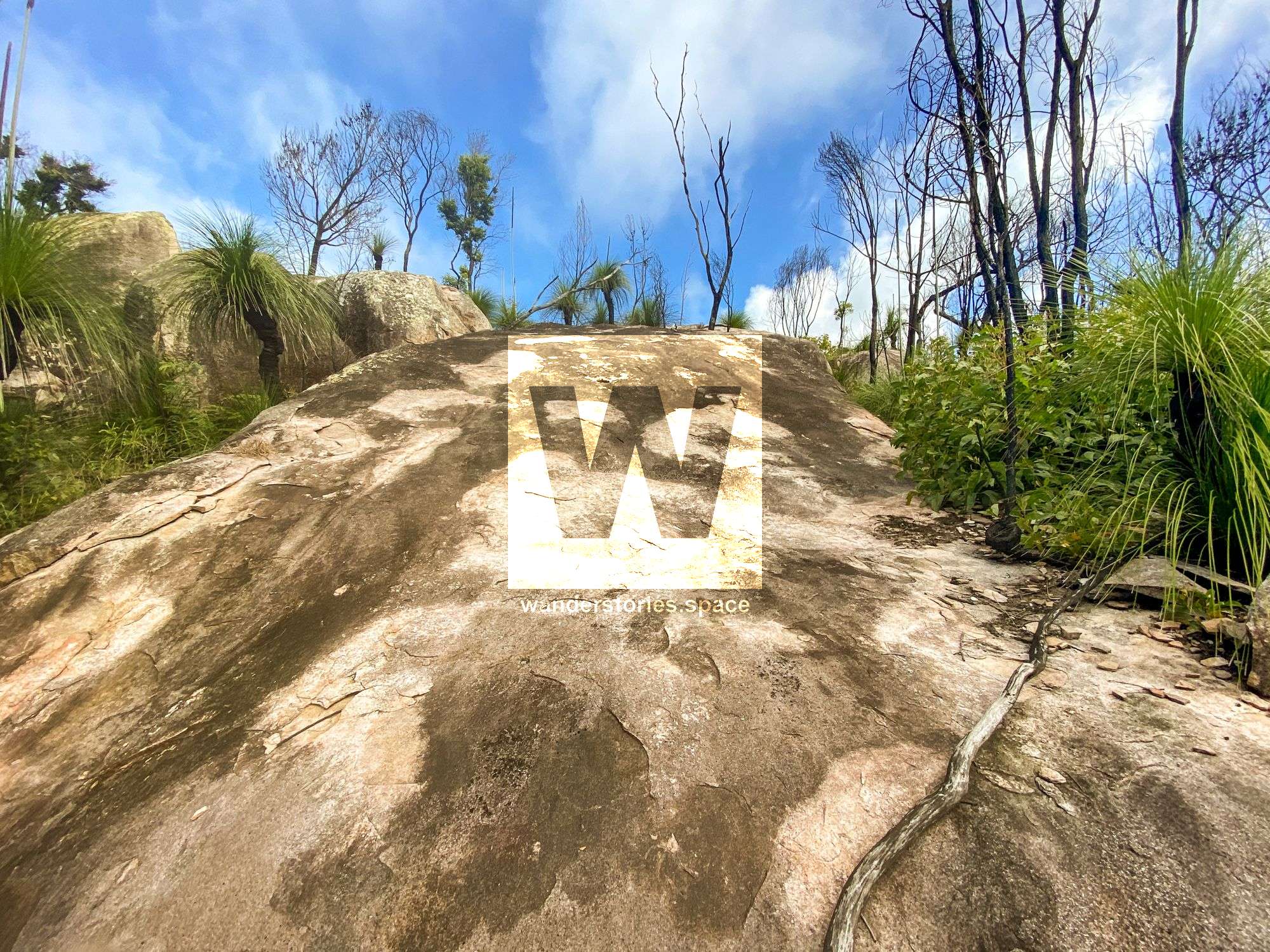
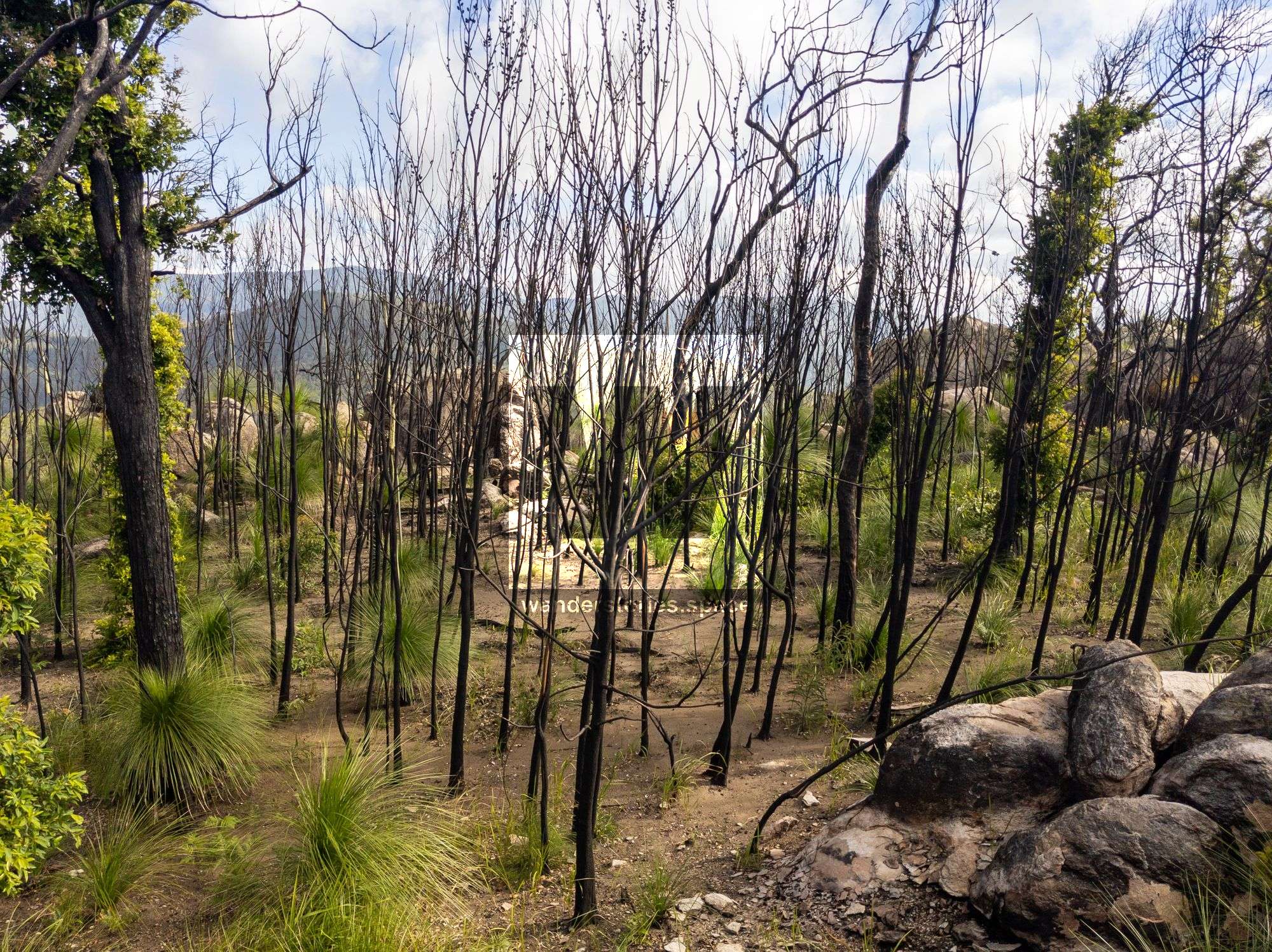
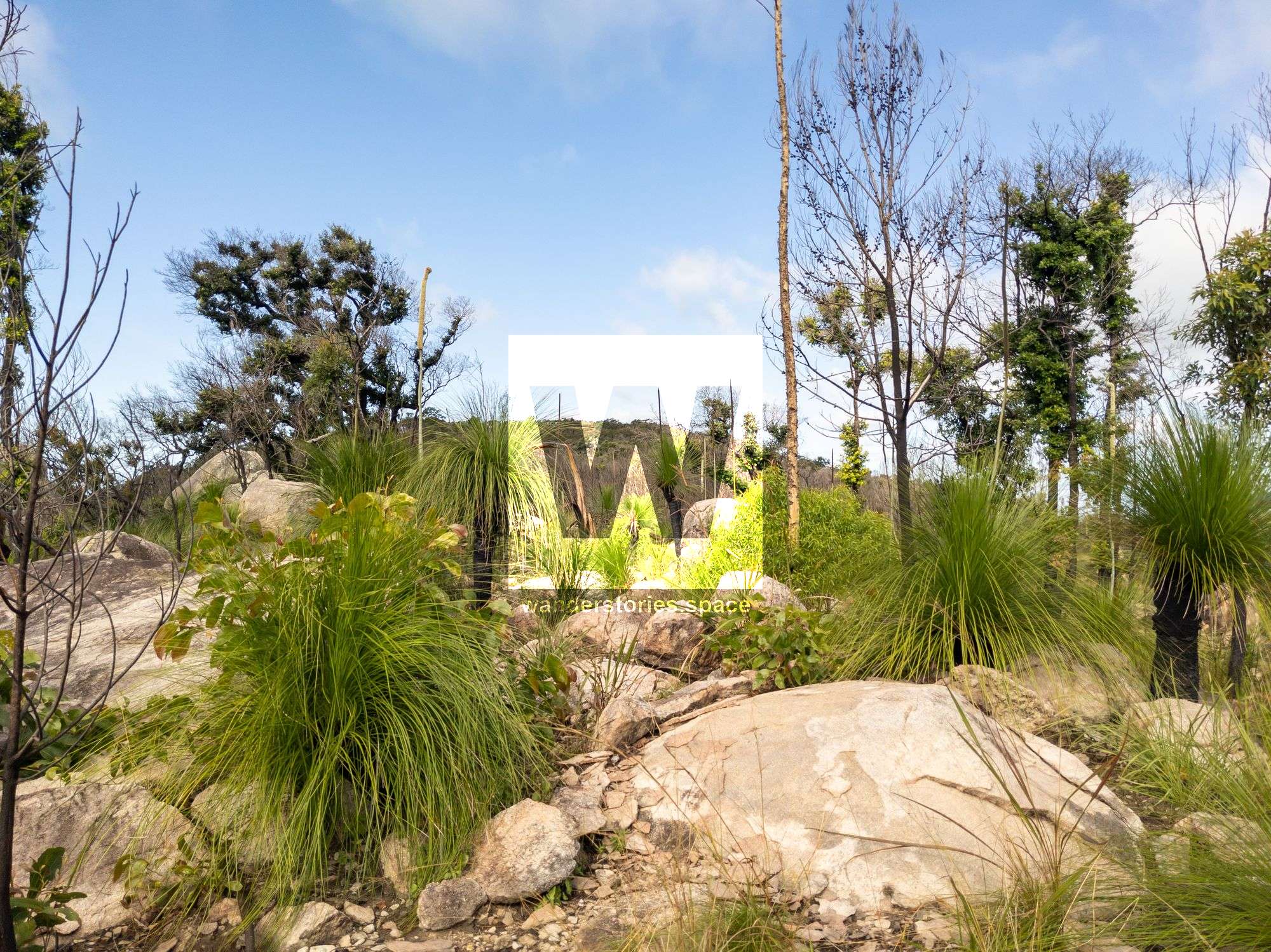
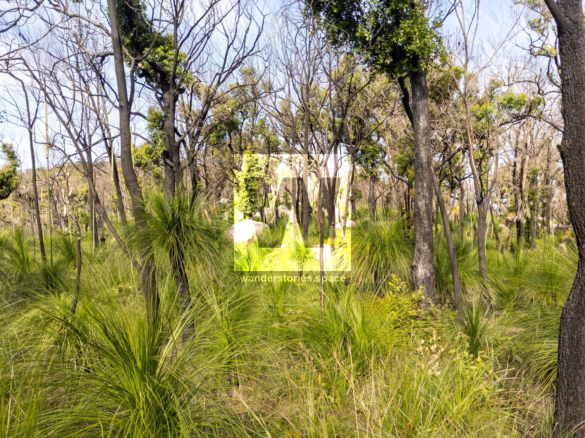
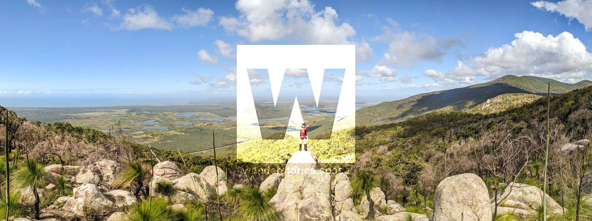
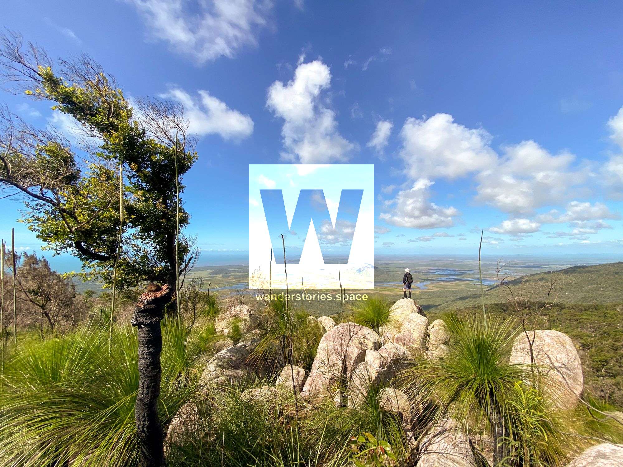
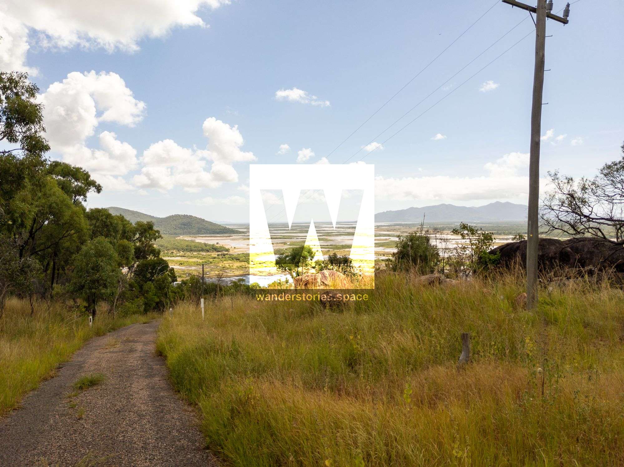
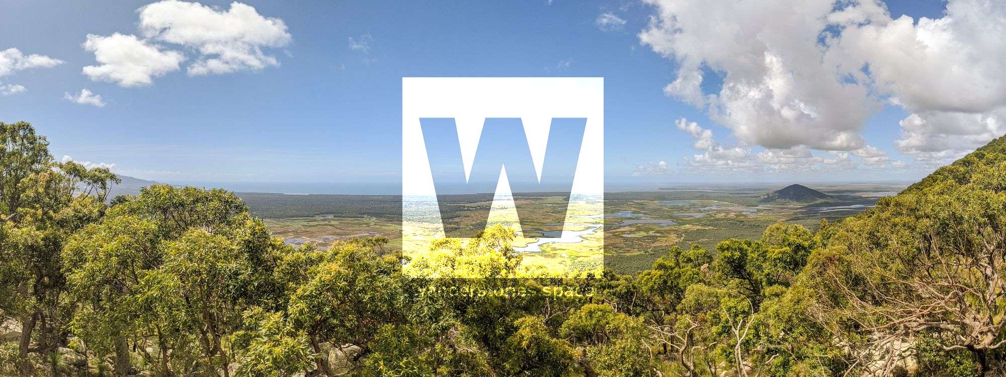
The best time to hike Mount Storth is after a burn off, especially during the cooler months of the year. The ridgelines provide stunning view as you traverse the landscapes. Many rocky outcrops, granite boulders, and slabs provide grand views out across the landscape. Some of the better views from near the summit are marked on the interactive map below.
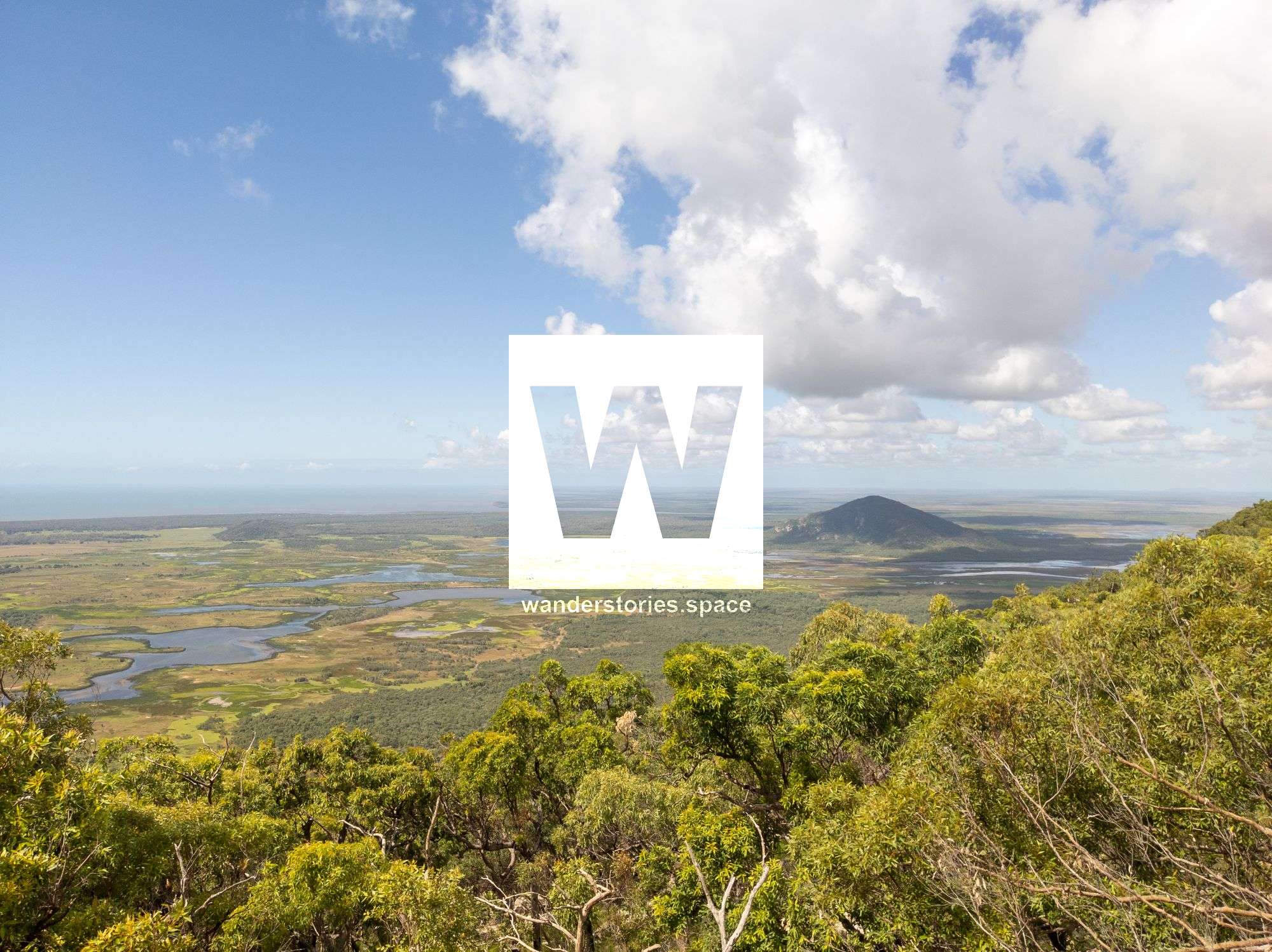
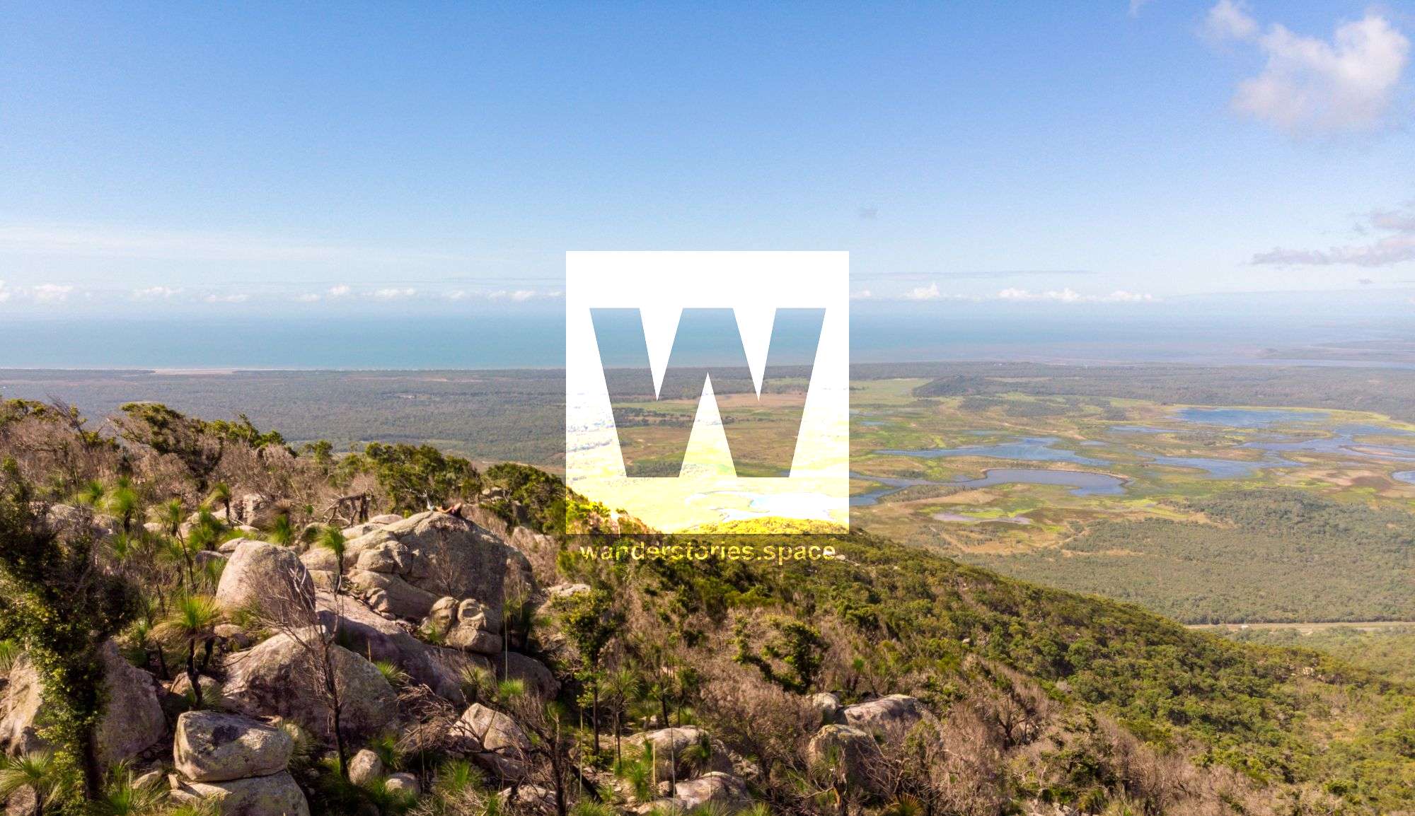
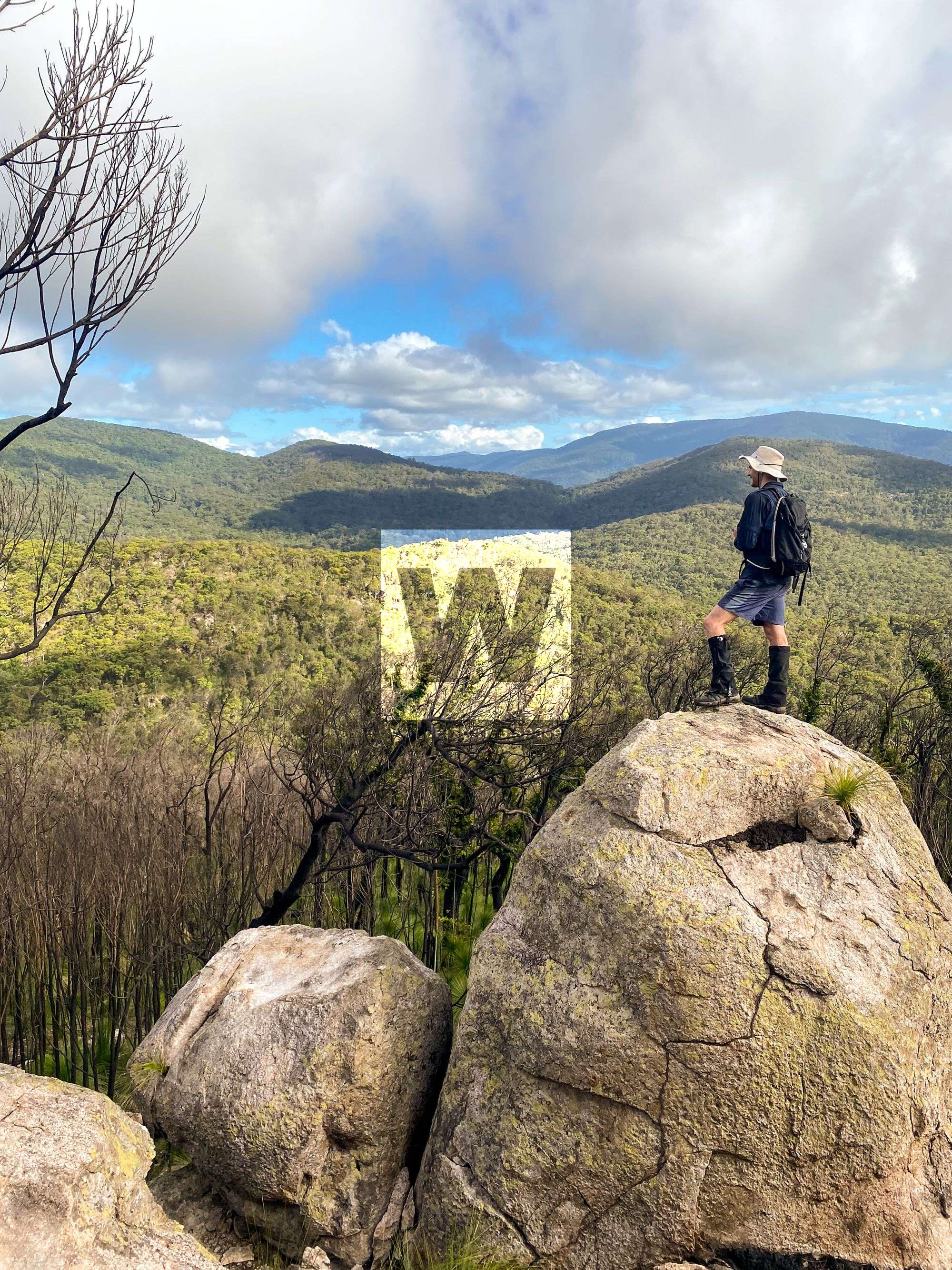
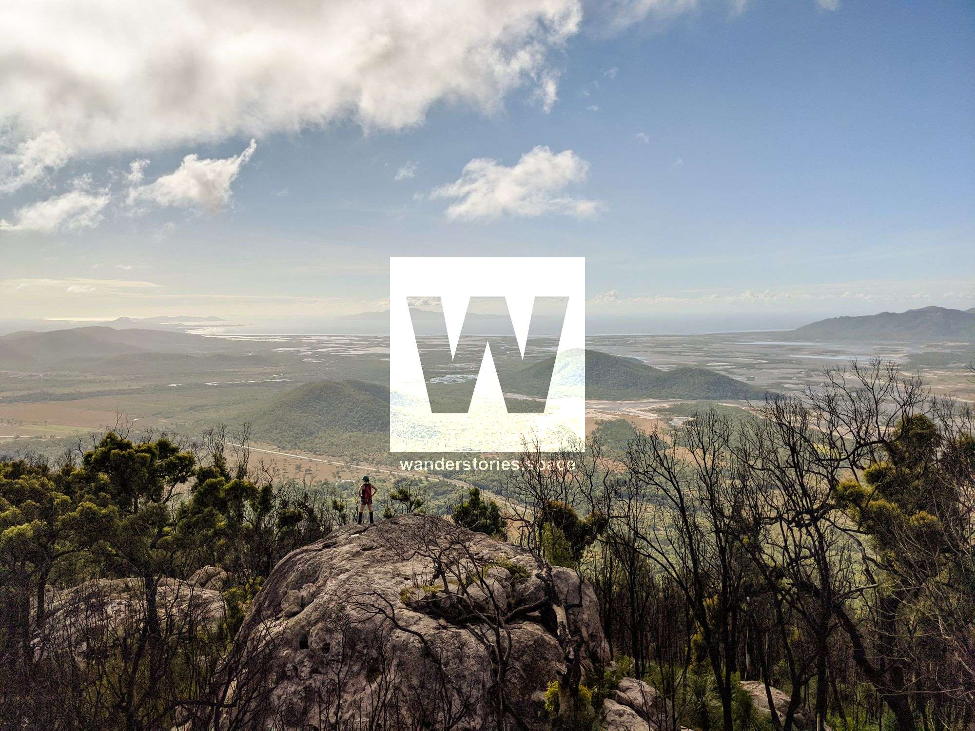
Indeed, many will agree that the best views are not at the summit, but in the surrounding 20-50 metres before you reach the summit. So, take some time to enjoy the journey and the numerous vantage points you encounter along the way. Once you reach the summit, however, it is merely marked by a few smaller boulders; no rock cairn or trig point to be seen.
Please note that there is significant Aboriginal art and history in this area, and so please mindful and respect Australia's cultural background. Follow the 'Leave No Trace' principles, and deseed your boots and clothing before hiking in the area.
What to bring
- Water (3 litres per person)
- Protective clothing – long pants/gaiters and long-sleeves are recommended
- Food and snacks
- Waterproof dry bags
- Insect repellent
- First Aid Kit (including electrolytes) and PLB
- Camera
- Phone
Interactive Map
How to get there
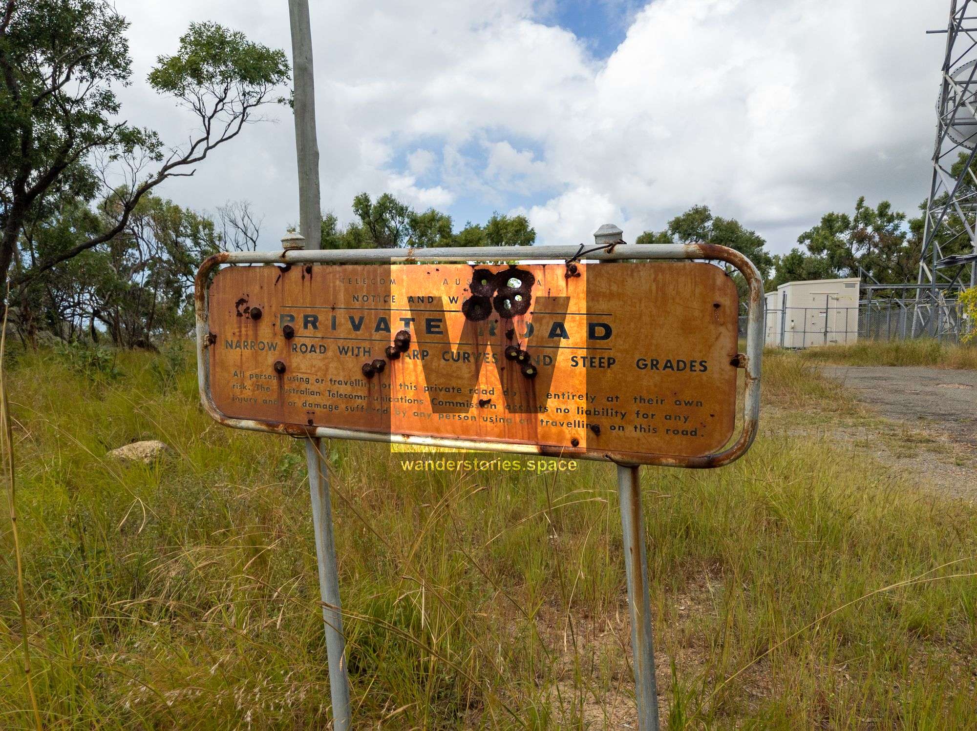
Note that some of these routes are best accessed via private property, like the Townsville Gun Club, but can also be accessed via Killymoon Creek when the creek is flowing. Note that some members of the Townsville Bushwalking Club also have property that backs onto Killymoon Creek.
You may choose one of these routes to hike to the summit and a different one for the descent.

North Ridge
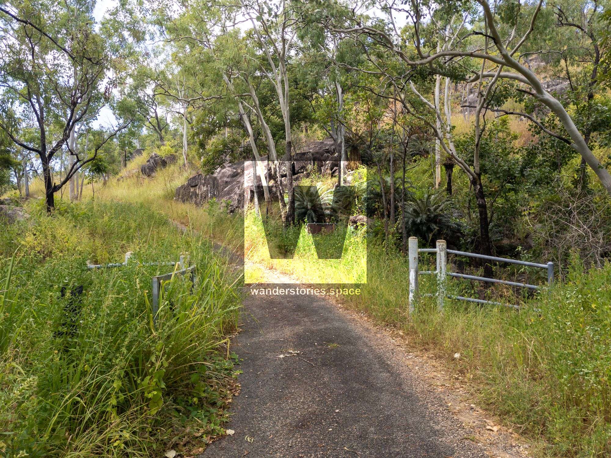
The fastest, yet steepest, way to hike to the summit is via the service road from the highway. Park at the gate and hike up along the service road to the towers, which will be about 1.3 km. At the towers, start hiking up through the bushland approximately 1.7 km to the summit. Look for the numerous rocky outcrops and lookout points along the way.
Western Ridge
This route will take you past many opportunities for views atop rocks and outcrops. Start at the Townsville Gun Club or at the property adjacent to Killymoon Creek; both are private property requiring permission. From the base of the range, follow the prominent ridgeline for about 3.4 km up to the summit.

Dribble Creek
Dribble Creek is a Killymoon Creek tributary. Follow this stream for about 4 km, contouring around to the minor ridge to continue to the summit.
South Western Ridge
This route also starts near Killymoon Creek. Cross the Dribble Creek and then hike up the steep, prominent ridge for about 5 km. You will cross a saddle and then ascend to the summit.
Killymoon Creek
Killymoon Creek is also an option. If you go in the right season, you will be rewarded with a few small falls and swimming pools along the way.
Mackenzie Creek
Mackenzie Creek is also an option, however, the less popular choice.
Via Saddle Mountain
You also have the option to do both Mount Storth and Saddle Mountain in a day. See the Saddle Mountain article for routes.
This article, and all other articles, are for entertainment purposes only and are not to be used as a guide. Please see our Disclaimer for more information.