Benham's Track (Telegraph Line) and Saddle Track
Benham and Saddle Track were the original pack horse trails from the coast up the range to Cloudy Clearing (now Paluma) and dates back to the late 1800s to early 1900s.


Location: Paluma Range National Park, Queensland, Australia
Region: Wet Tropics, North Queensland
Grade: 5, hard, steep incline and elevation gain
Duration: 5 hours one-way, depending on route
Distance: 8.5 km one-way, depending on route
Maximum elevation: 950 m
Start: Mango Tree carpark (a.k.a. rockslides carpark)
Finish: Paluma Township
This day trip will give you a glimpse of history while you enjoy an easy-to-navigate route through Paluma Range National Park. These packhorse tracks are some of the earliest trails that were initiated from the bottom of the range up to Cloudy Clearing, which later became Paluma. Benham's Track is actually the first European track to Paluma. Shown as 'Saddle Road' and 'Nolan Road' (possibly the start of Benham's Track) on QTopo, these tracks once provided access to Cloudy Clearing (Paluma) – possibly starting in the late 1800s – before the construction of Mount Spec Road commenced in 1931 (completion in 1936).
Arthur Benham was the first settler at Cloudy Clearing (Paluma), spending most of his life prospecting and mining tin in both Cloudy Clearing (Paluma), Mount Spec, and Hidden Valley. He is credited with blazing the track from Cloudy Clearing (Paluma) down to the coast, a track that also connects with Bullocky Tom's Track at the 'Mango Tree'. Even today, the 'Mango Tree' is a common reference point and landmark for those visiting Paluma. This famous 'Mango Tree' was likely first shown on a 1977 map of what was then called Waterview Parish and marked the junction between Big Crystal Creek and Nolan's Gully and as part of Bullocky Tom's Track. This map also showed a track from the 'Mango Tree' to 'The Saddle' on the range road above the Little Crystal Creek bridge. This track may have encompassed Benham's Track, but it's not entirely clear. In fact, it may be that the entire track from the 'Mango Tree' all the way to the Mount Spec area and then to Hidden Valley was once or may still be called Benham's Track, but it depends on which map you reference and from when.
Ultimately, these historic tracks join up before they meet up with what has been called the Windy Corner Track (Culvert 2). This means that these tracks were the first to connect the coastal plain with the tin mining area around Cloudy Clearing (Paluma).
A telegraph line was installed from the 'Mango Tree' to Cloudy Clearing (Paluma) and dates back to the 1940s; this was the primary mode of communication from the outside world during this time. This was also why some of these historic tracks did not become obsolete when Mount Spec Road was built. Indeed, the segment of Benham's Track from the 'Mango Tree' (Nolan Road) was maintained due to the telegraph lines.
It has been referenced that many, if not most, of the tracks around Mount Spec and Paluma were originally following old Aboriginal trails but used in the late 1800s and early 1900s – as mentioned above – by European pioneers. Indeed, it is challenging to figure out the origin of some of these historical tracks, and many are becoming more and more difficult to locate over time, as they have not been needed for decades upon decades. Some still exist as dotted lines on various maps, but names change, and that also makes it hard to locate them, especially based on historical maps alone. Some tracks are overgrown and in danger of disappearing altogether, but others have been re-established and maintained by local walking groups. However, there are some exceptions, and for very good reasons.
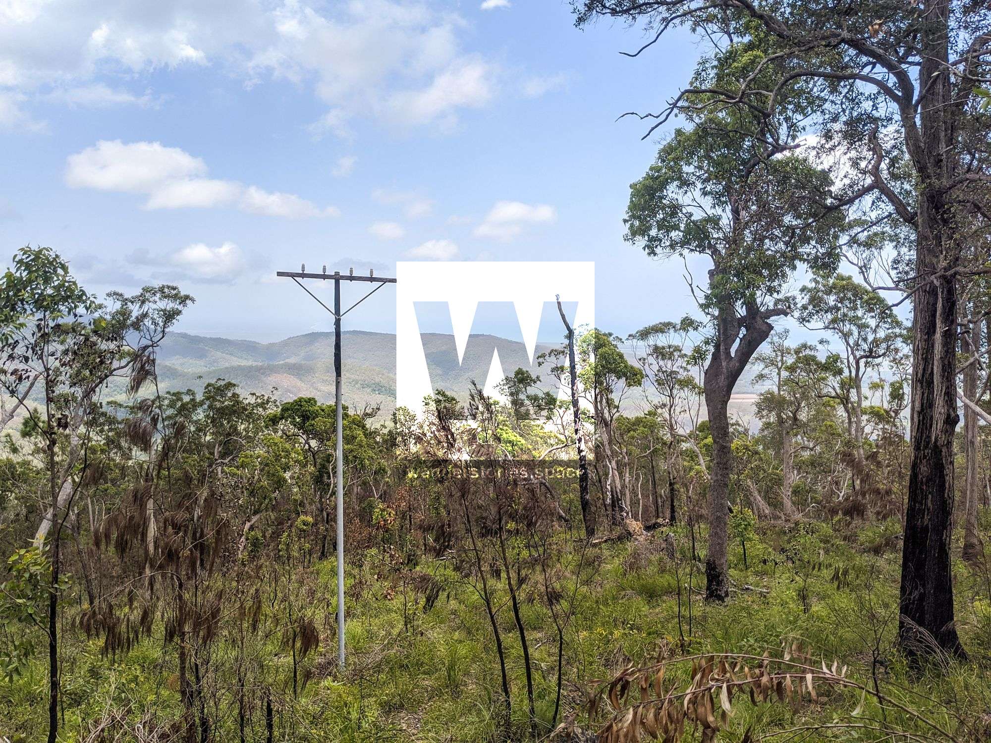
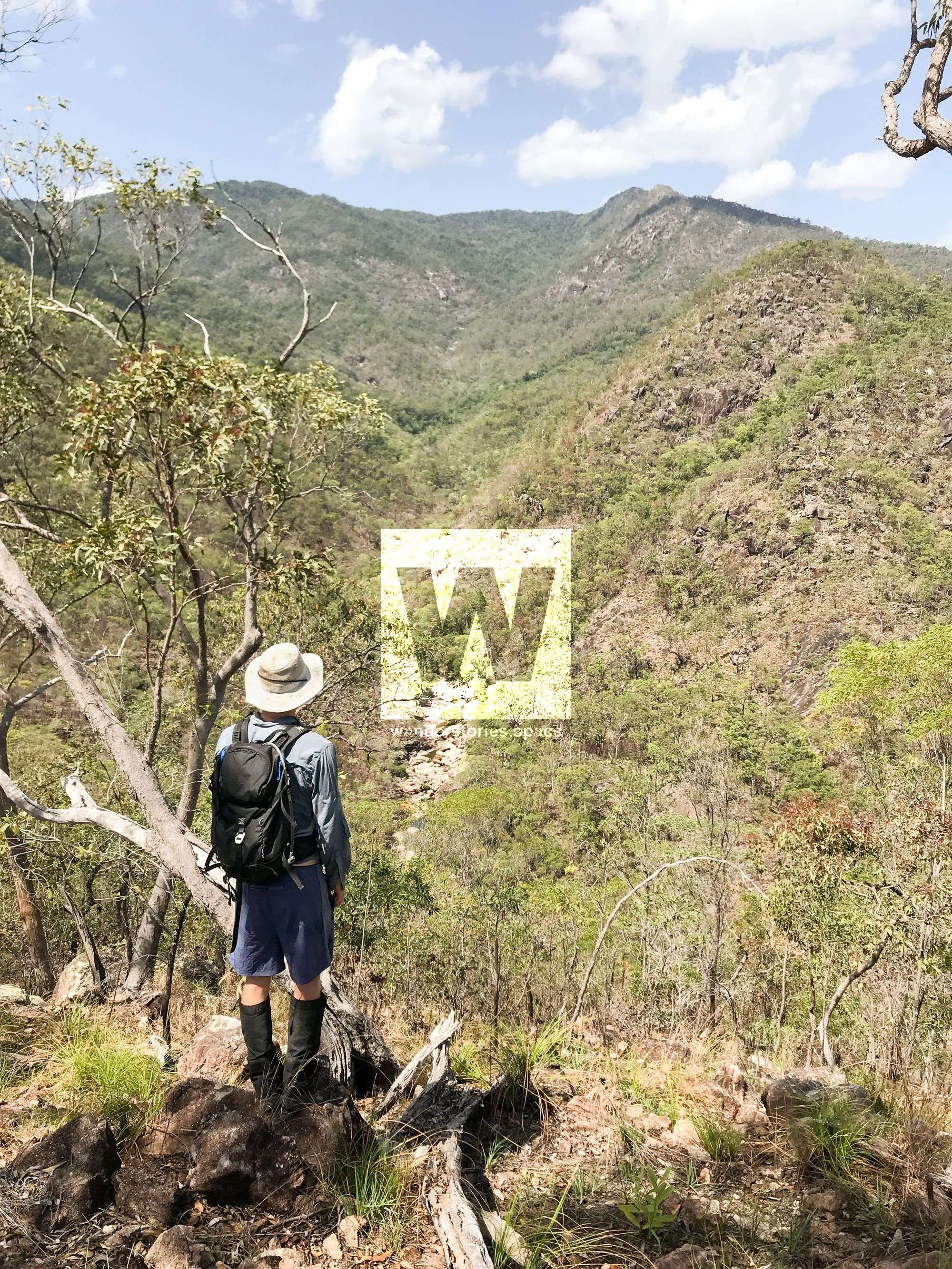
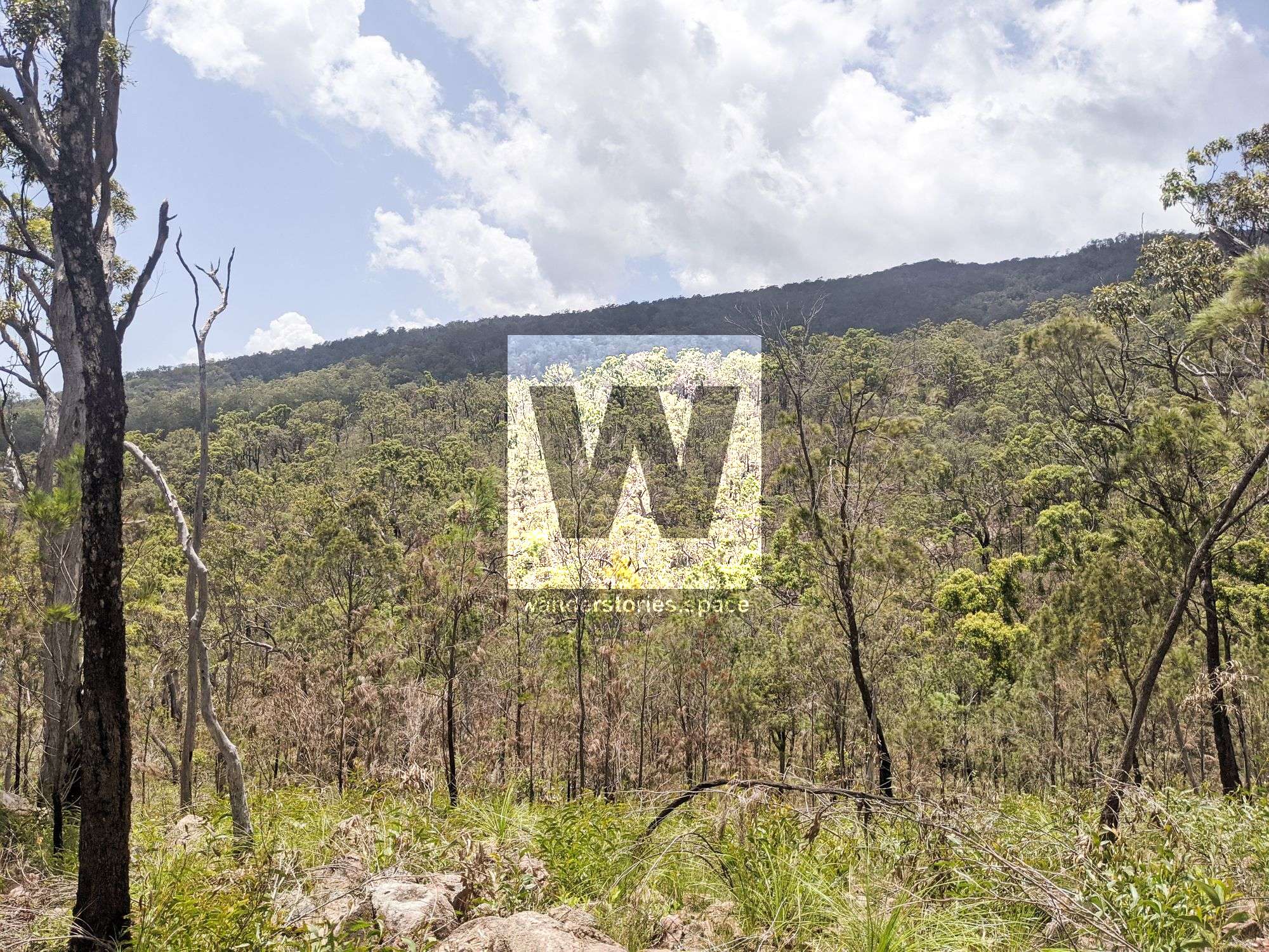
Benham's Track from the 'Mango Tree' to Paluma is relatively overgrown, is not maintained, and will likely never be open. The bottom half is in open forest country and would need a lot of work to keep it open, as the grass would obliterate the track after every wet season. However, the open countryside allows for several views and lookouts along the way.
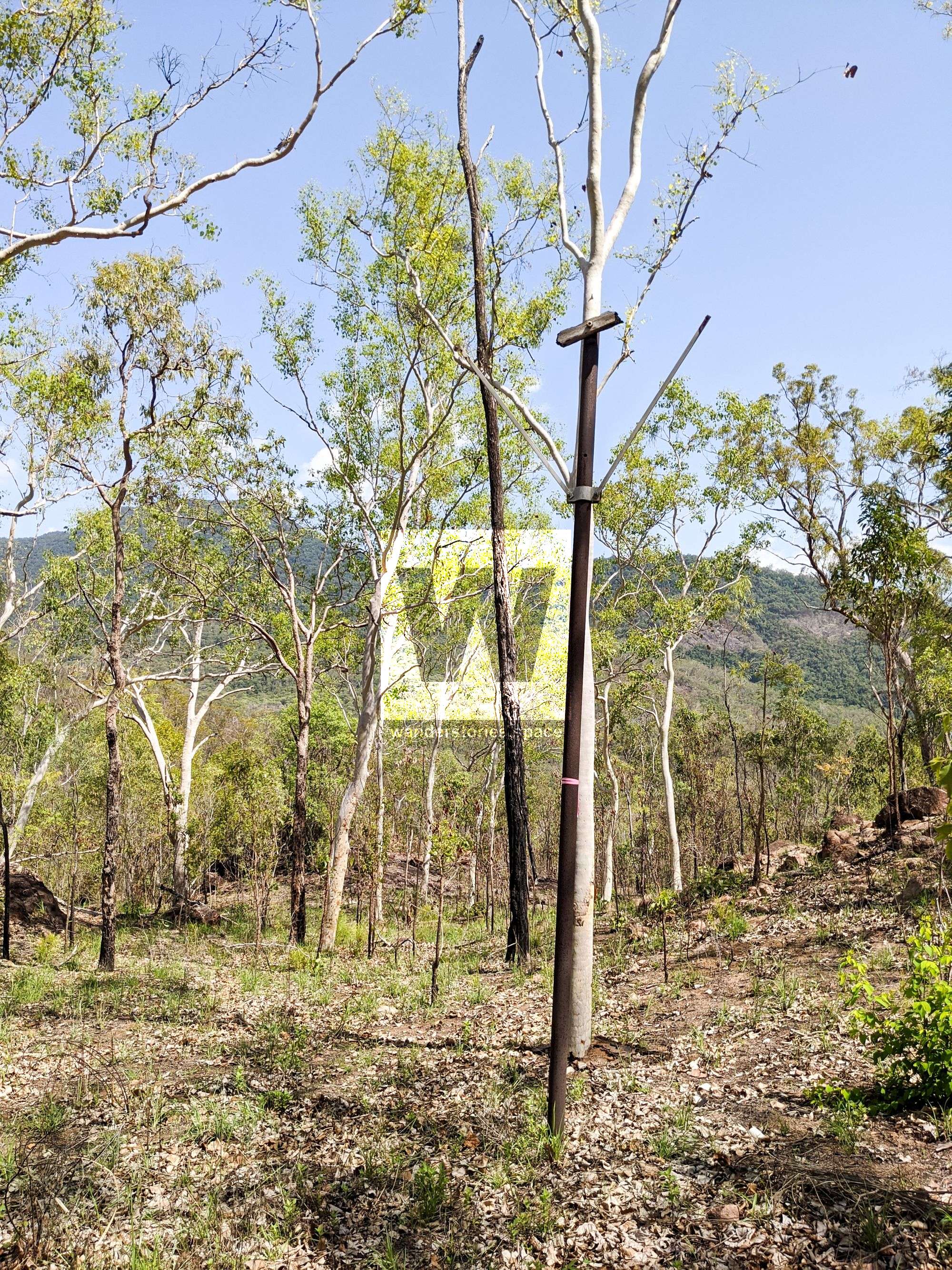
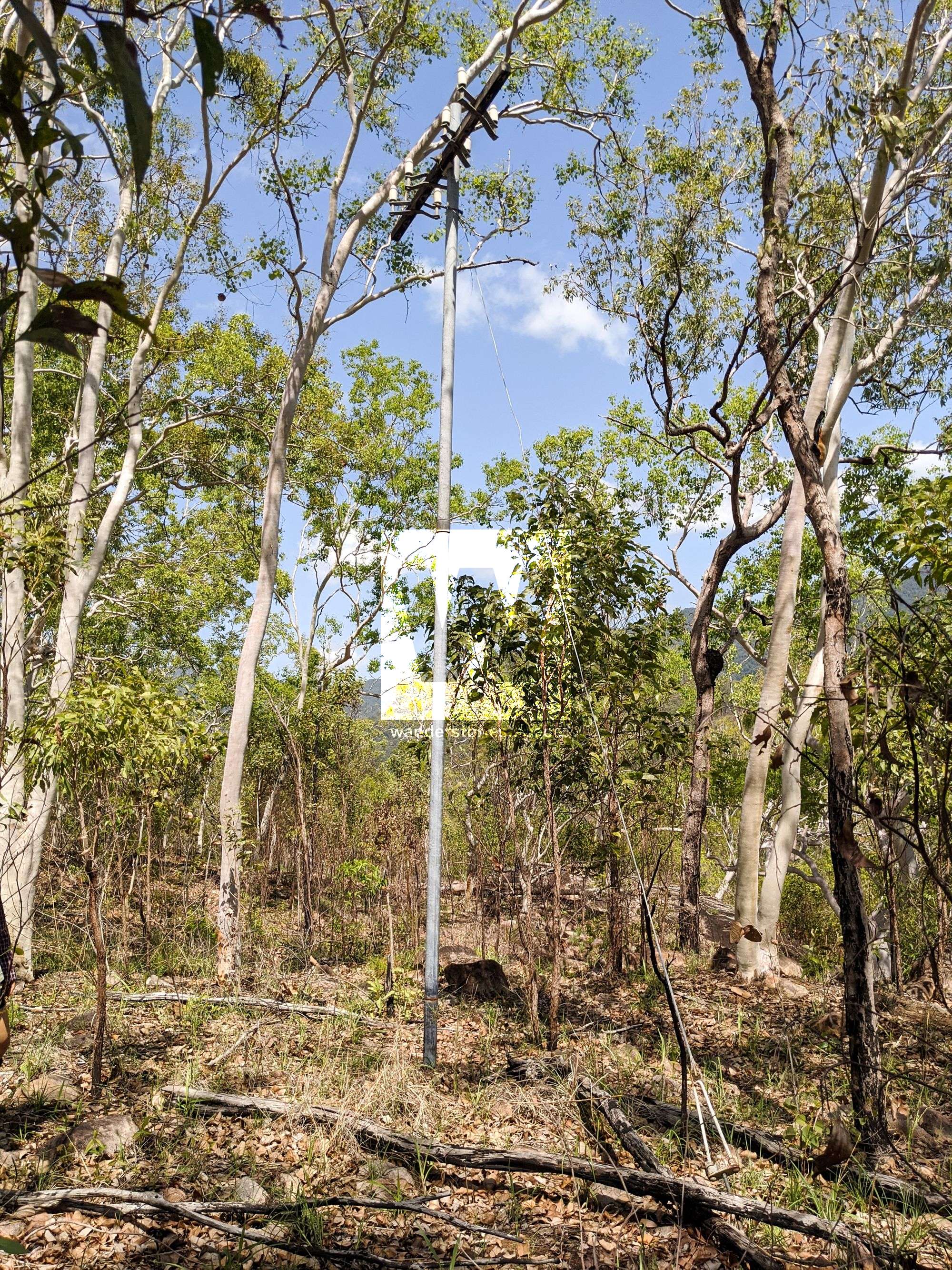
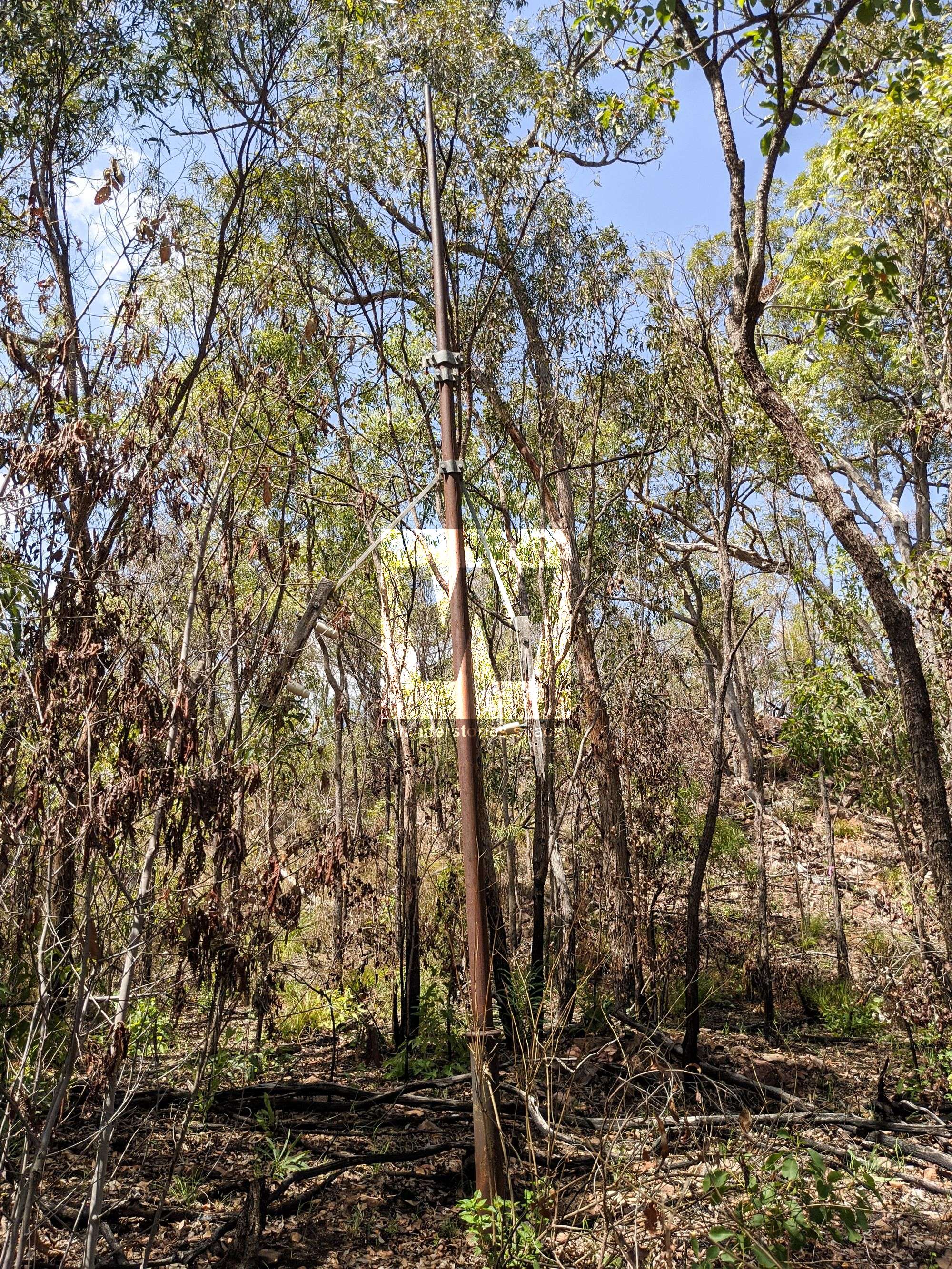
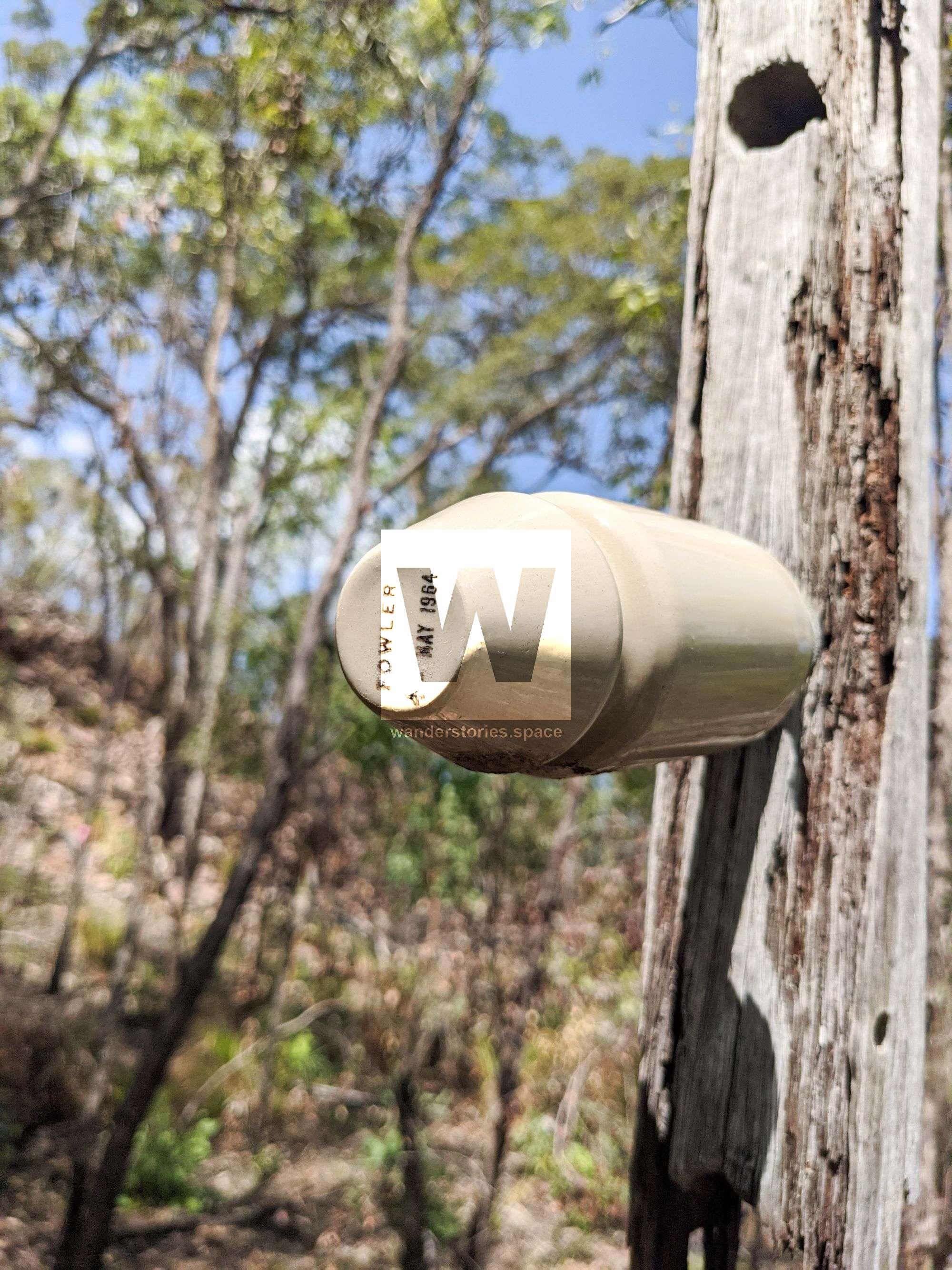
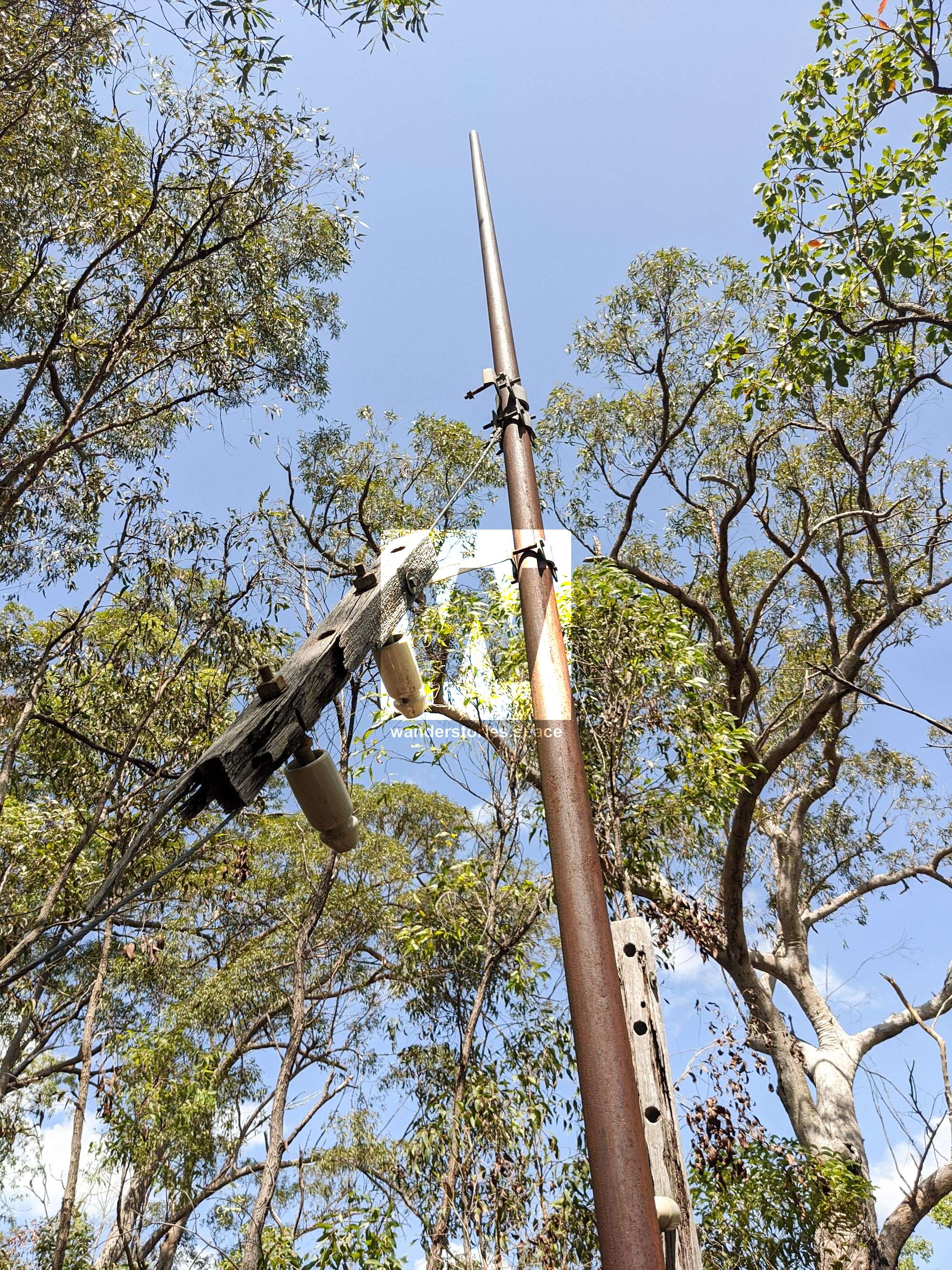
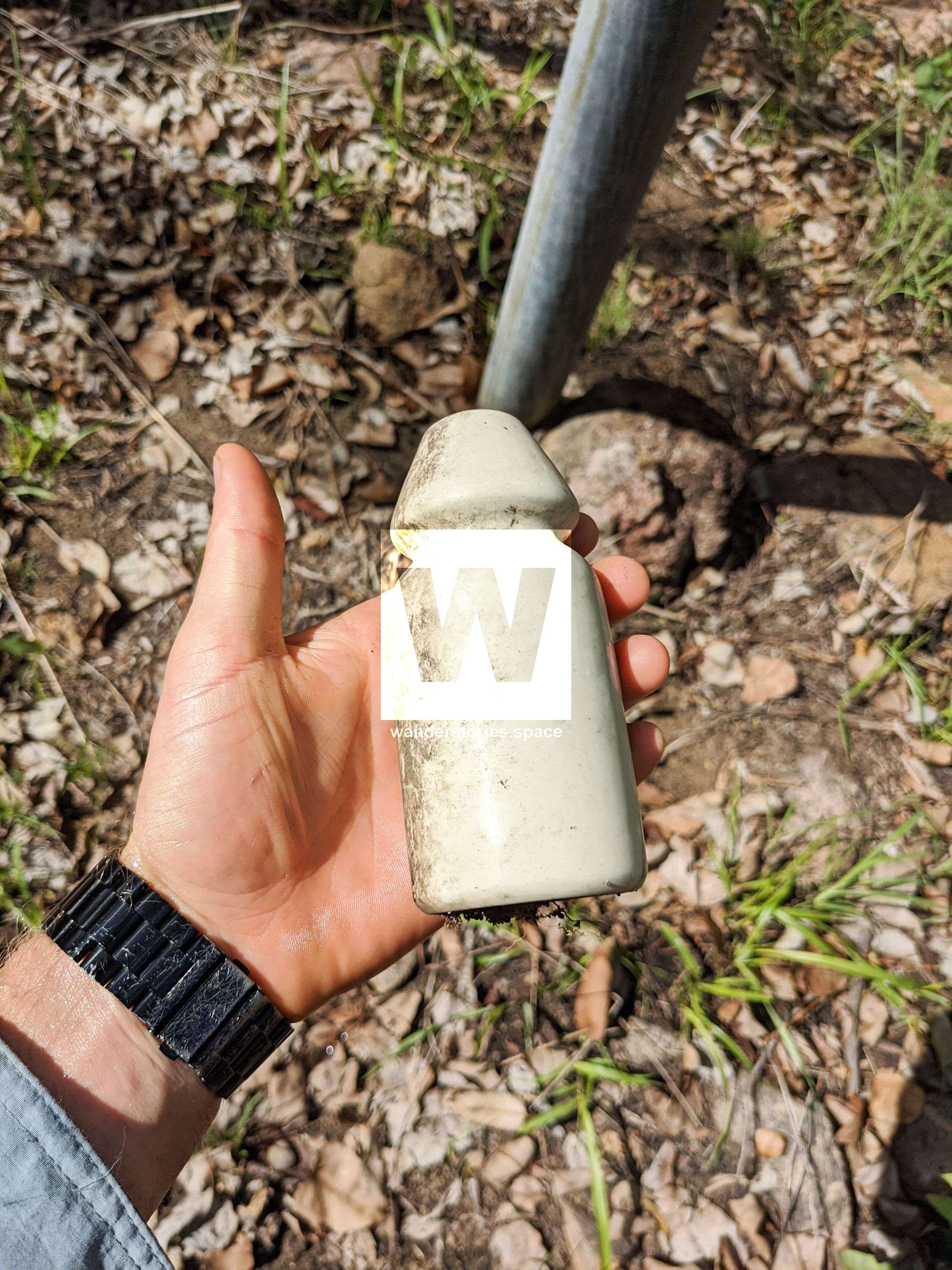
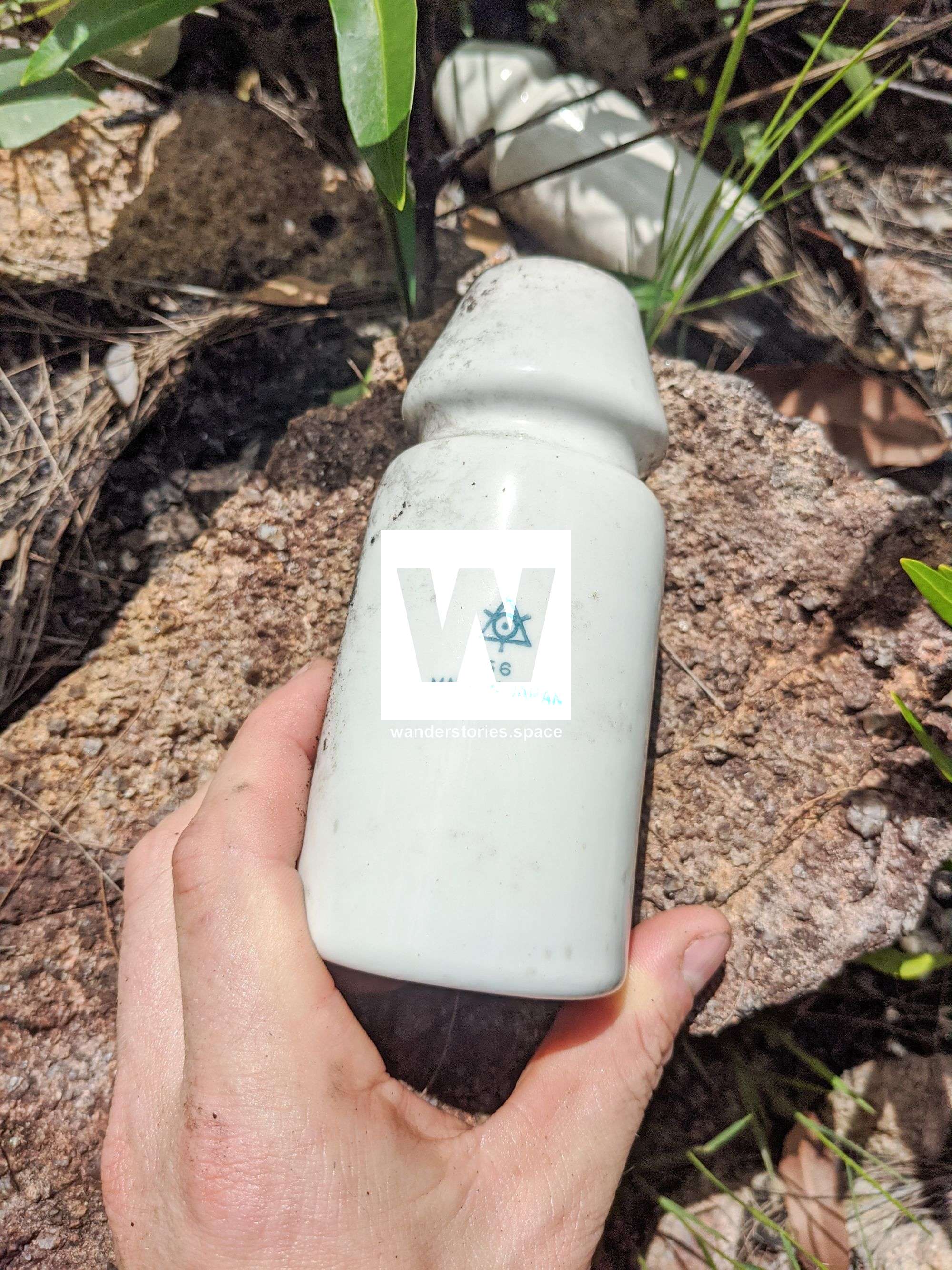
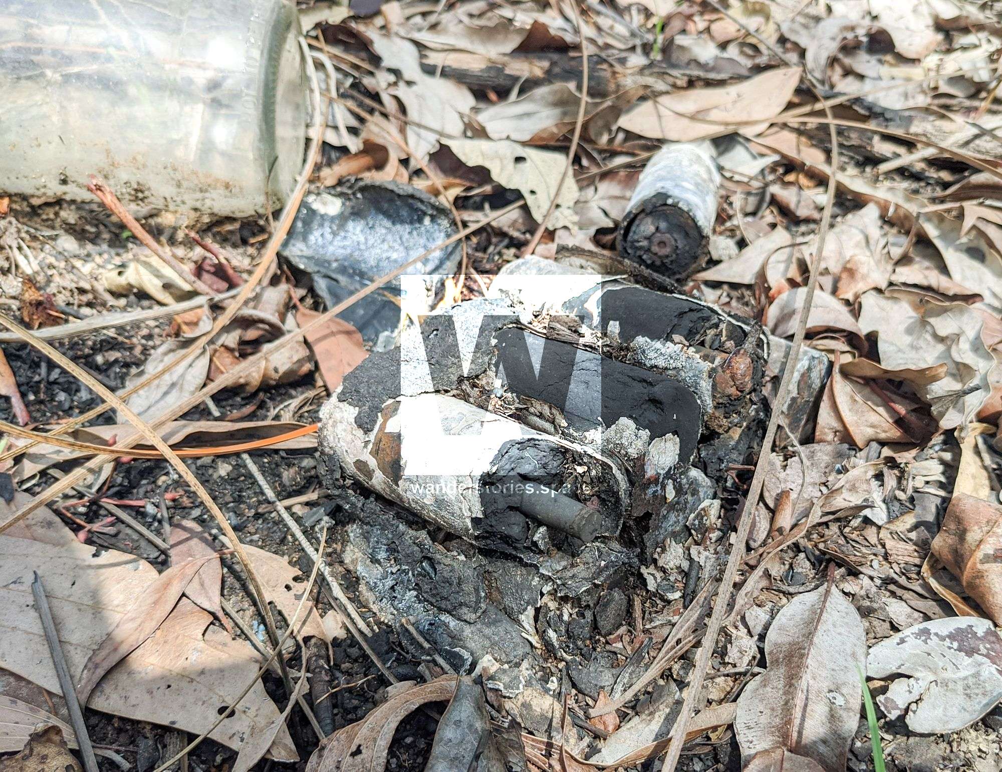
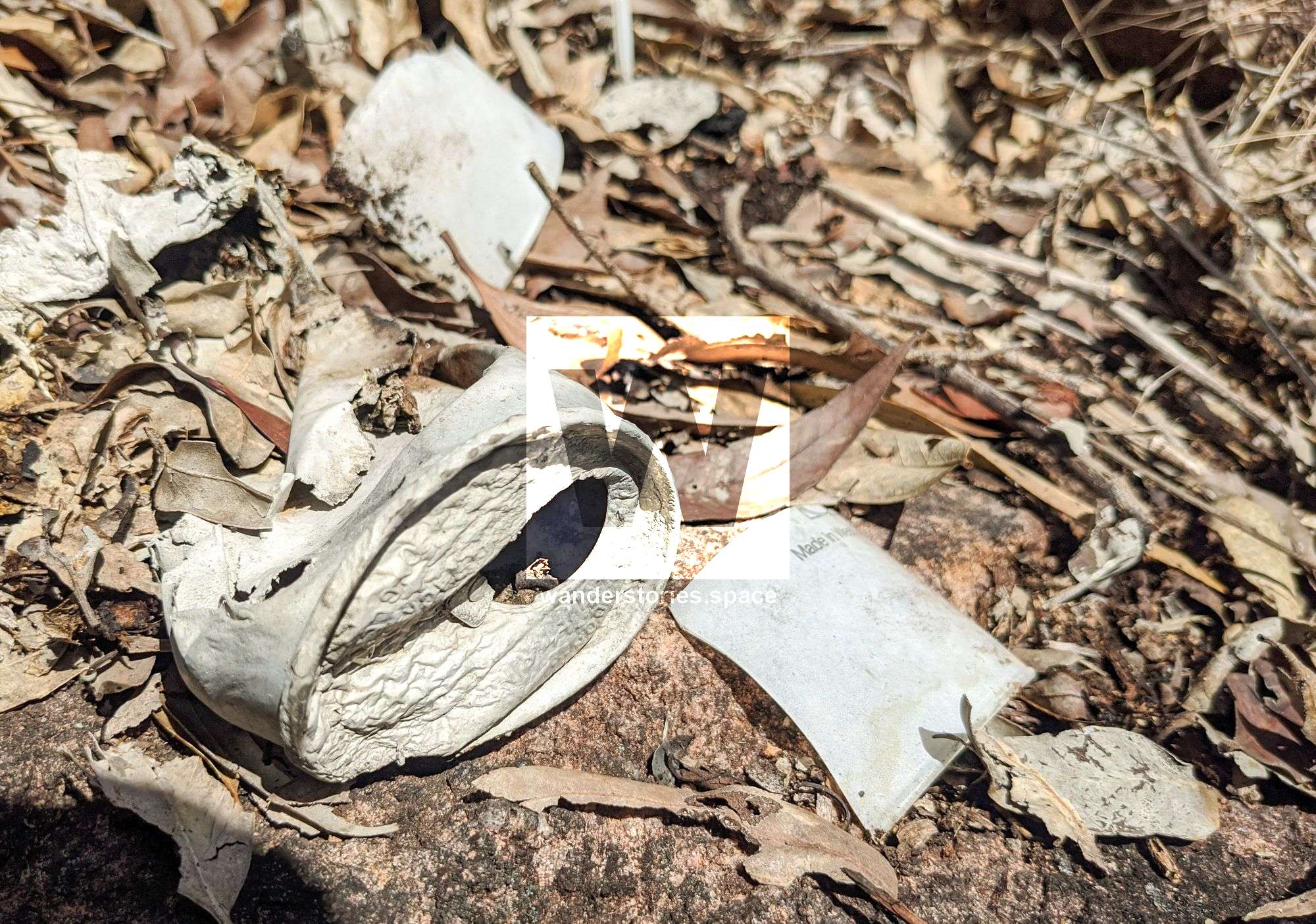
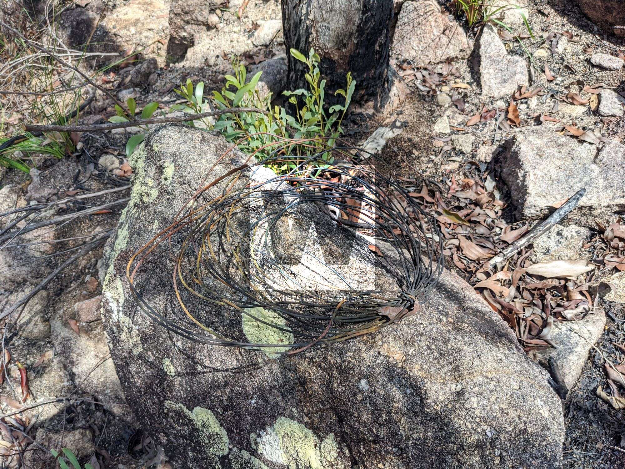
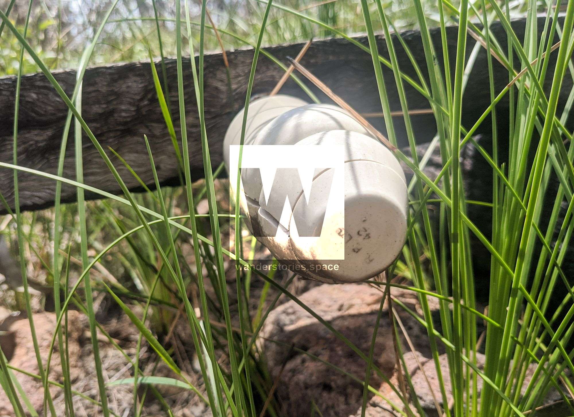
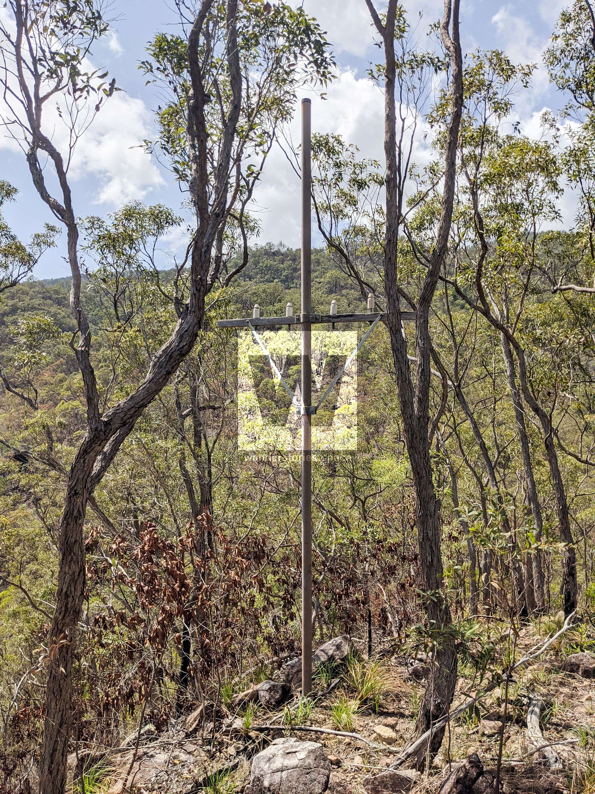
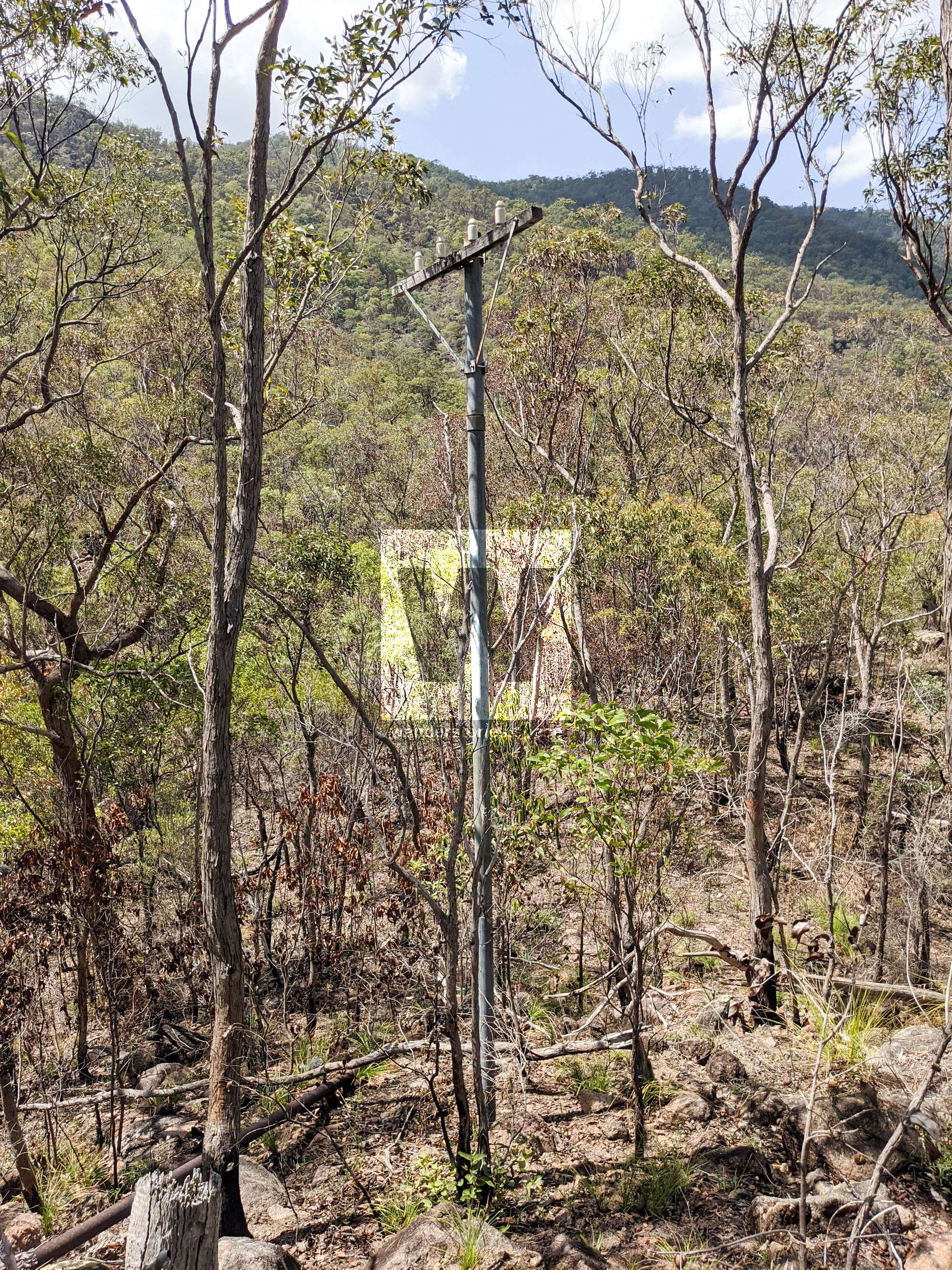
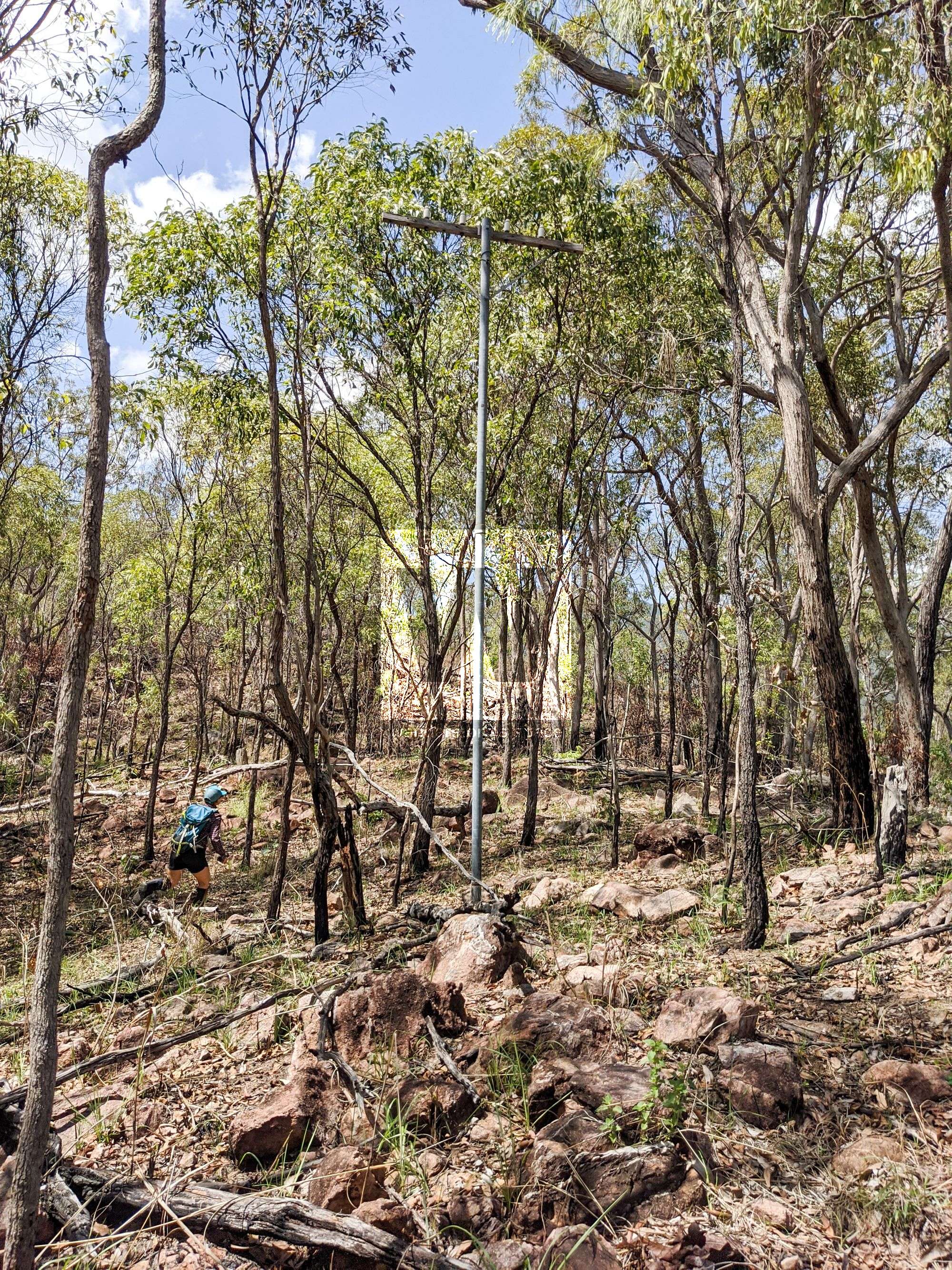
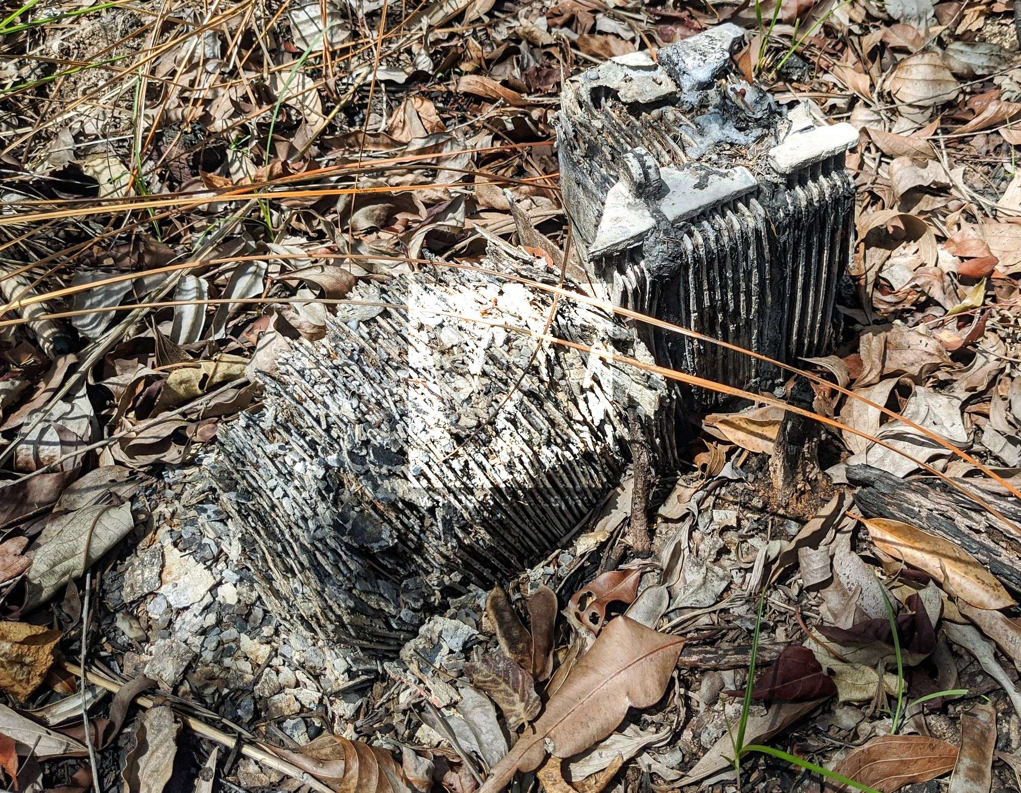
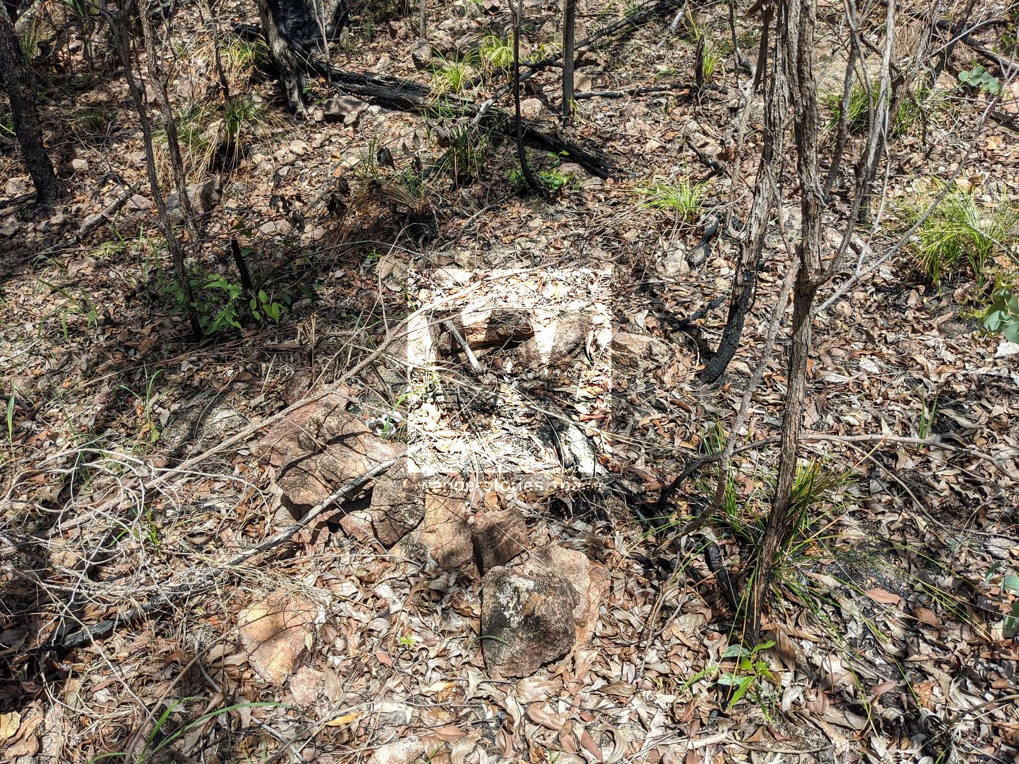
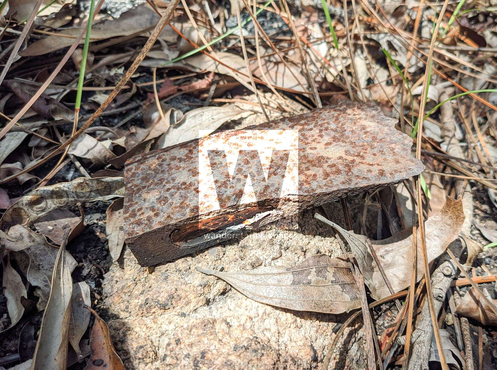
Many of the wooden telegraph poles have been burnt over the years or have started to deteriorate; however, there are some galvanised steel posts and ceramic insulators that can still be seen along the route. In fact, many of these ceramic insulators and steel support brackets left behind can now help mark the trail. There are also many hardwood tree stumps remaining that can also help with the navigation. You may also notice that many of the poles have rocks piled up around them, assumingly to keep them standing. The ceramic insulators have 41 and 42 inscribed, and it can be assumed that they are the manufacture dates. The seemingly newer insulators have "56 Made in Japan" or "Fowler 4 - May 1964" printed on them.
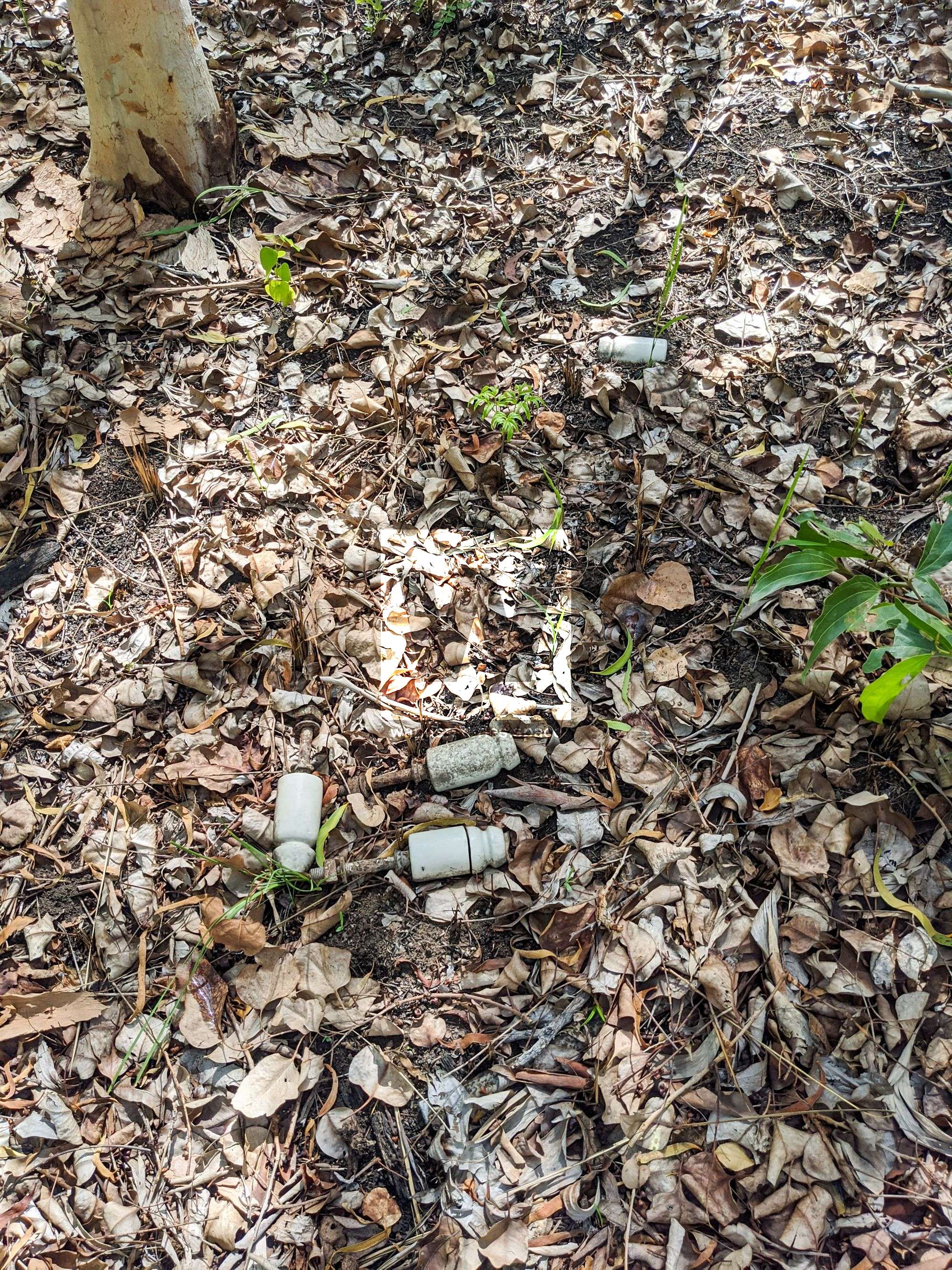
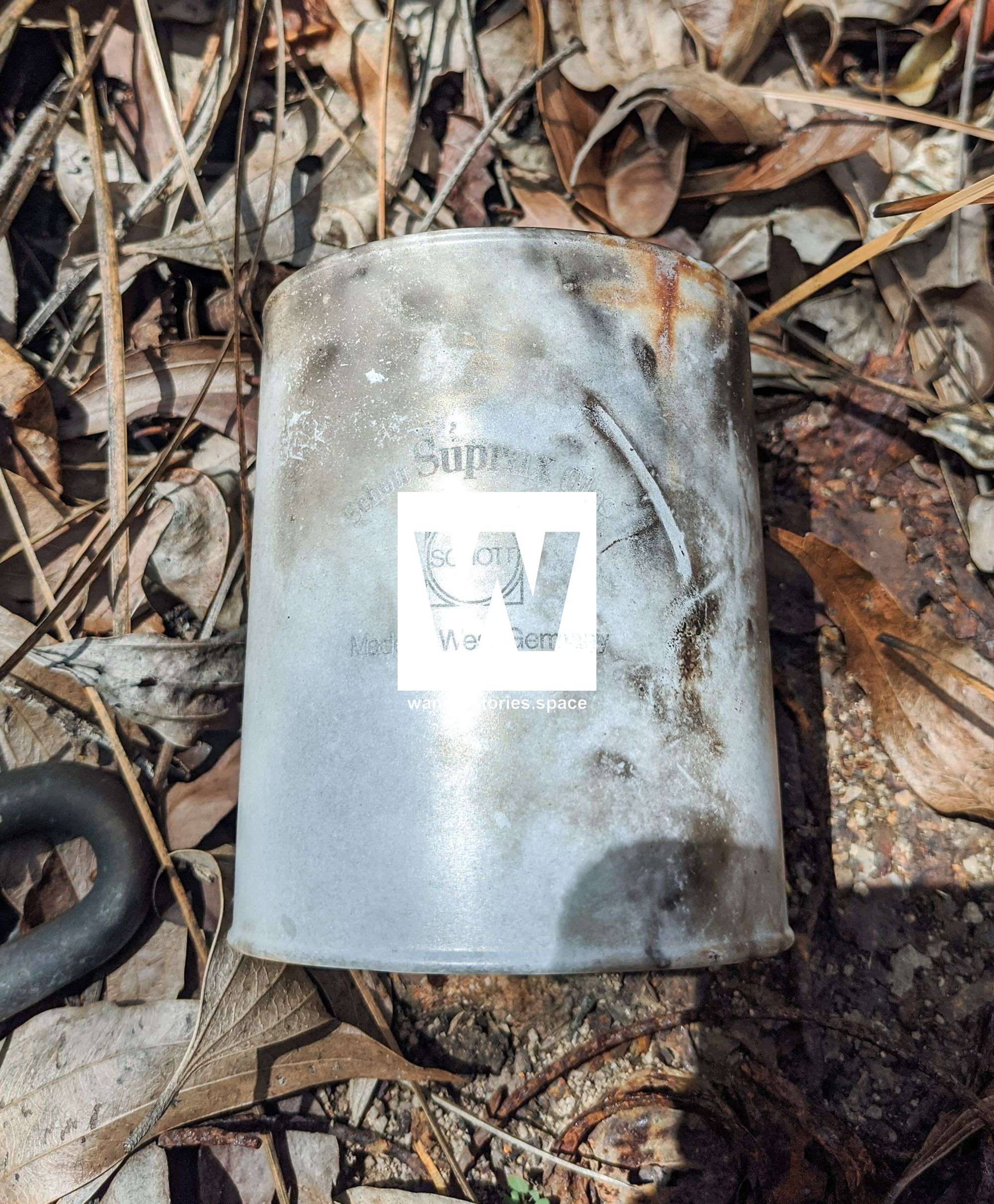
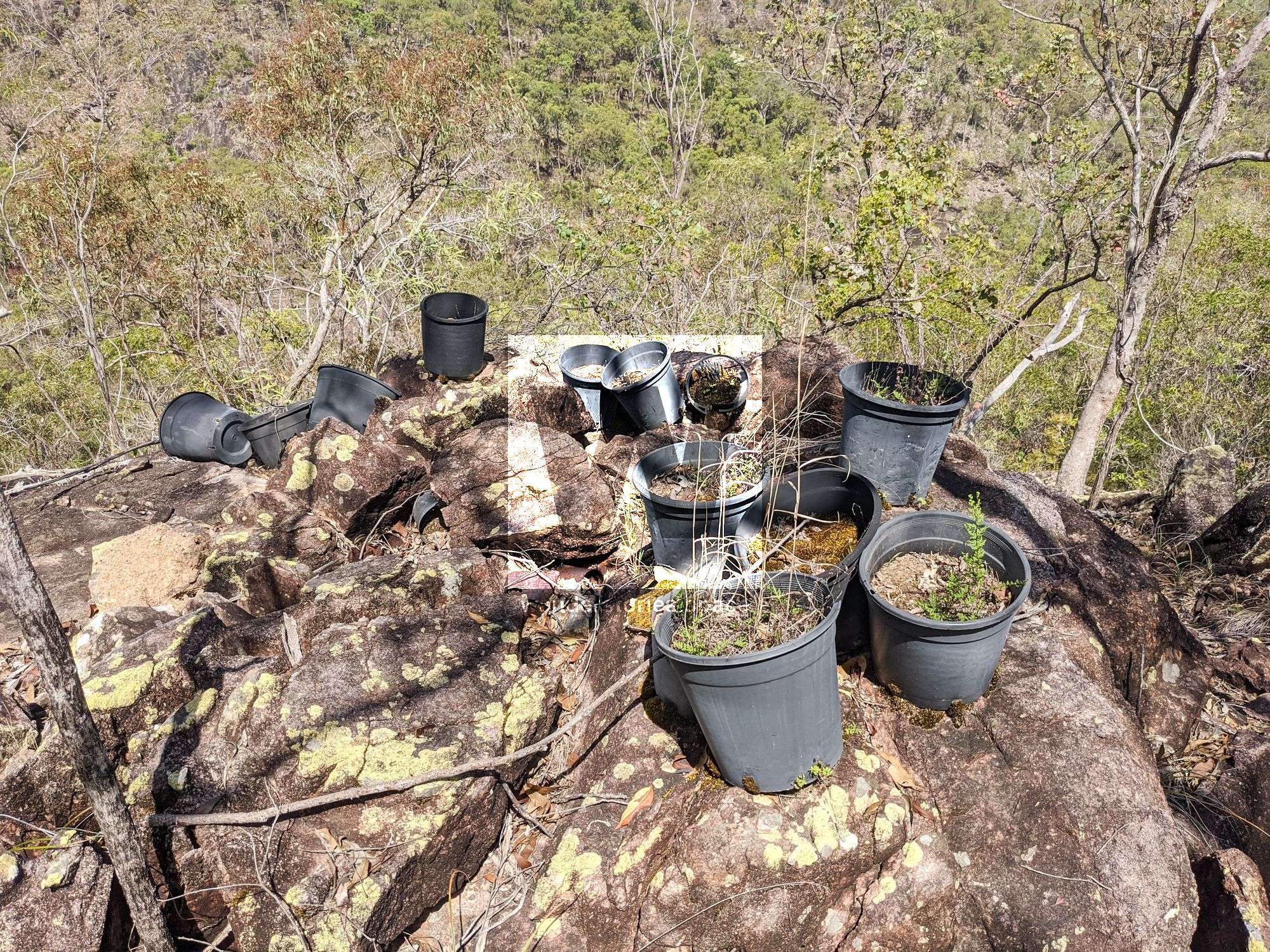
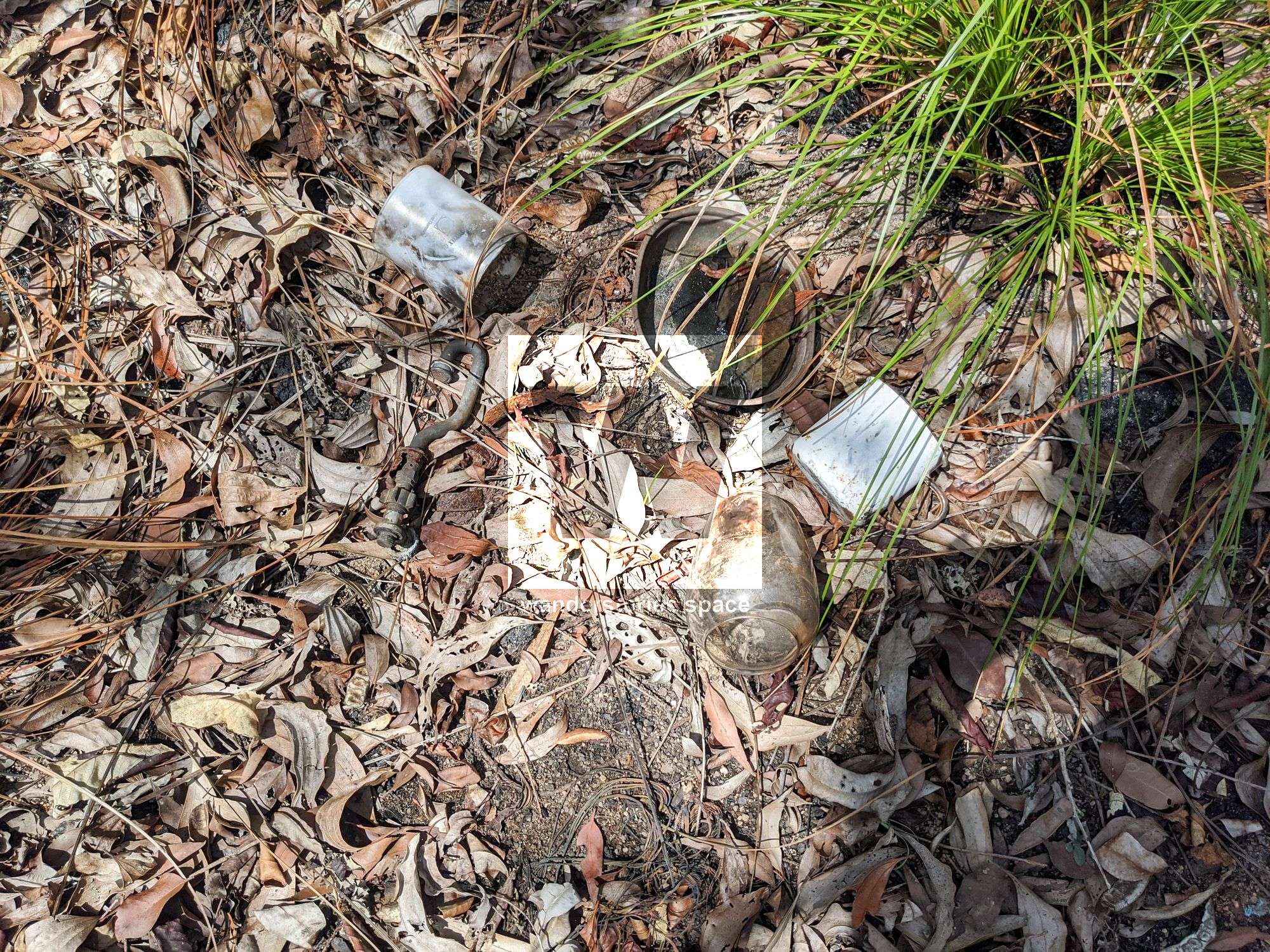
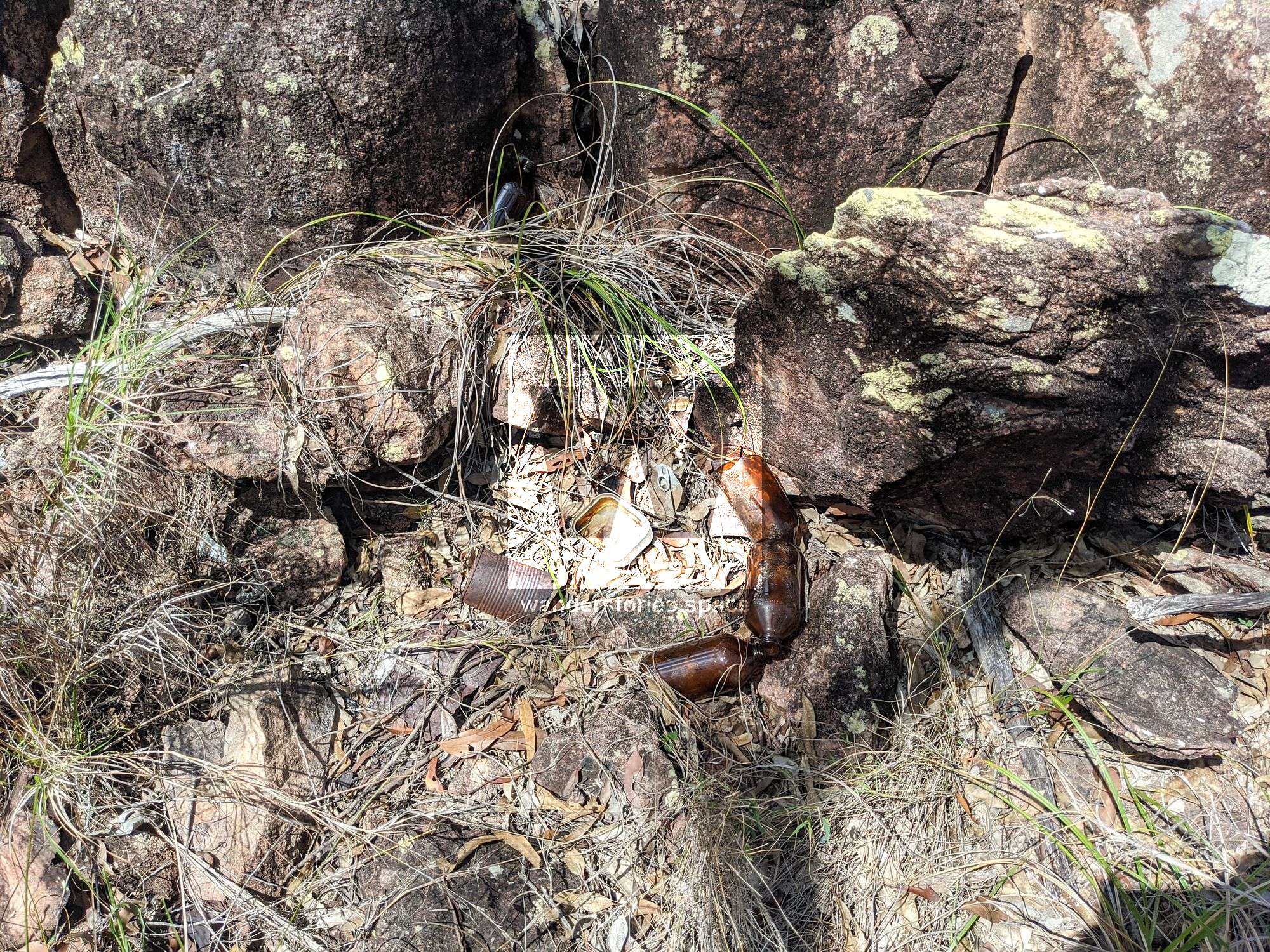
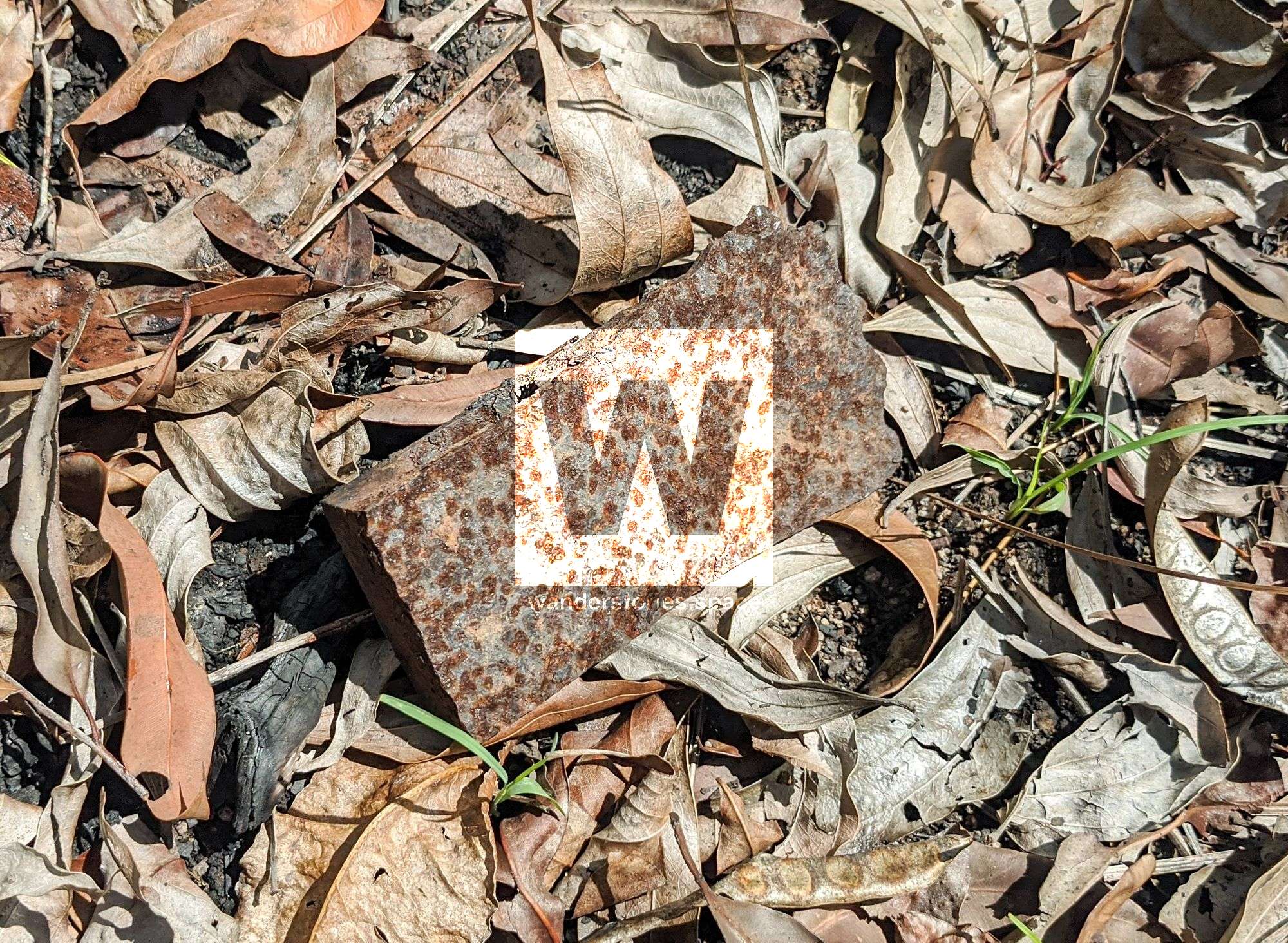
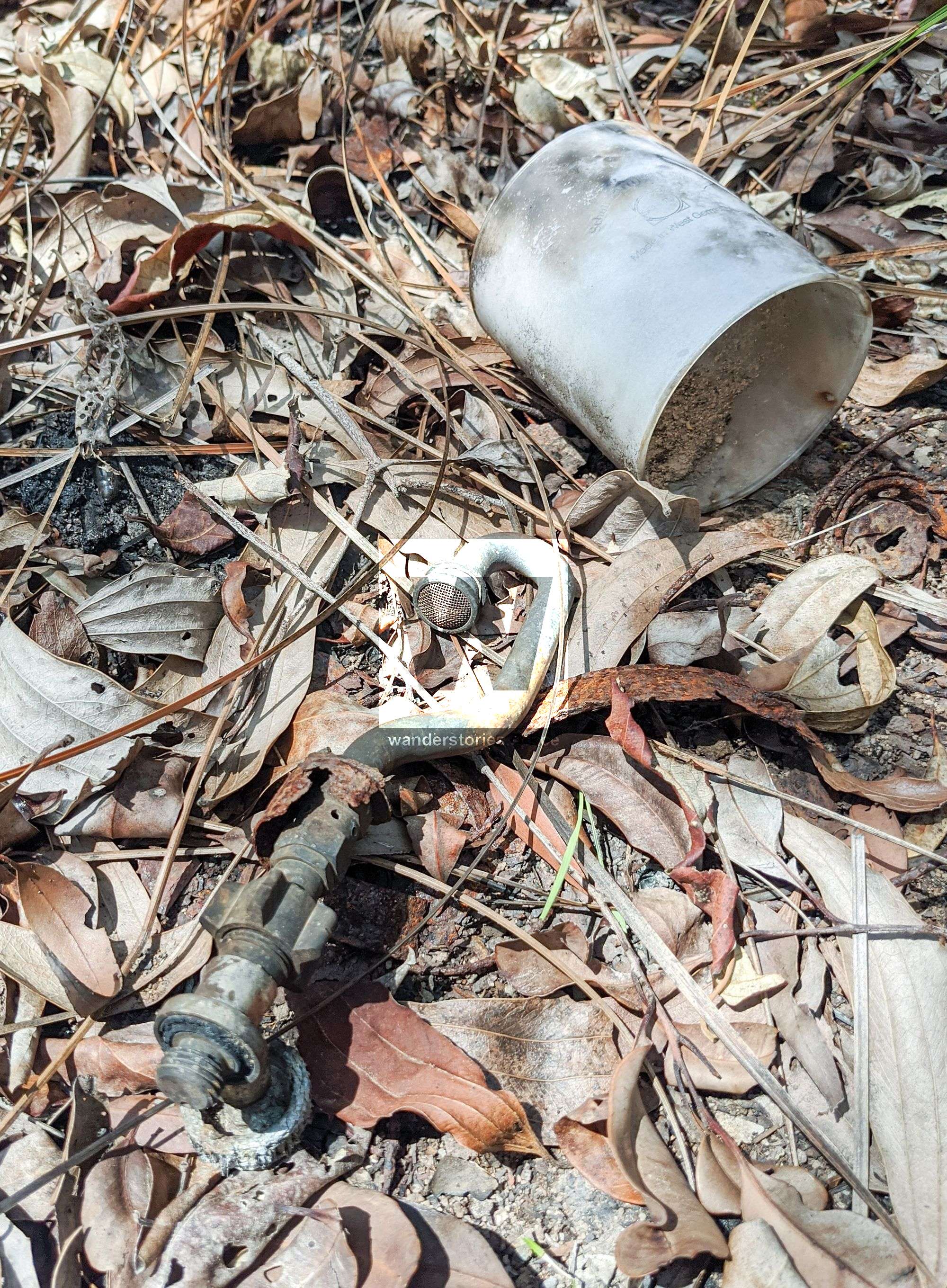
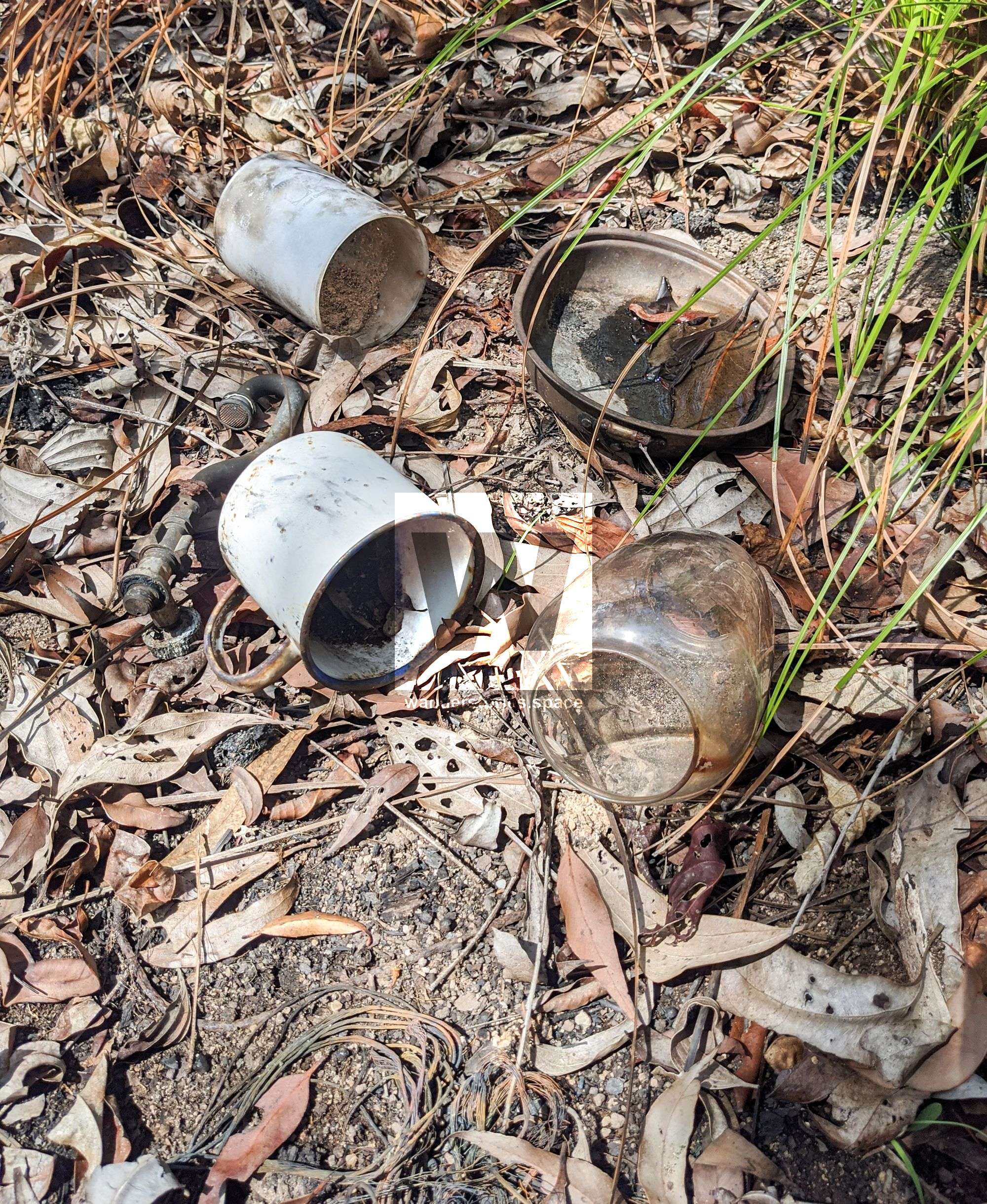
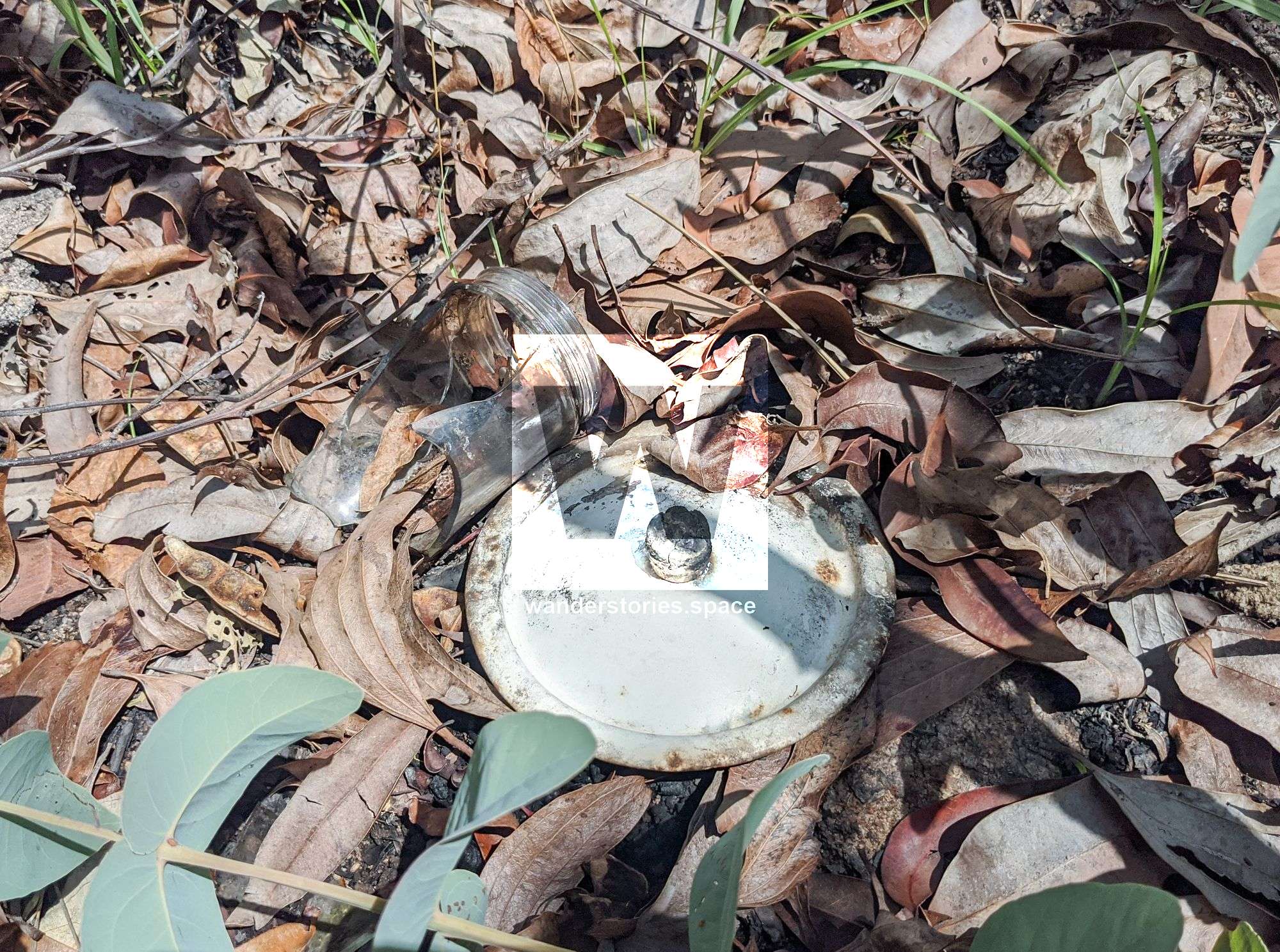
You may also come across an old work camp that still has numerous artefacts and relics in the vicinity. An old fire pit can still be seen at one of the work camps as well as an intact pannikin, a billy can lid, batteries, an oil lantern, a rusty axe head, and plastic plant pots. There are some bottle dumps and rubbish left behind from the old days, including a glass cup that has "Schott Suprax Glas - Schott - Made is West Germany" printed on the side of it. This historical hike is something special, as you can enjoy a relaxed hike while spending time finding old artefacts and relics.
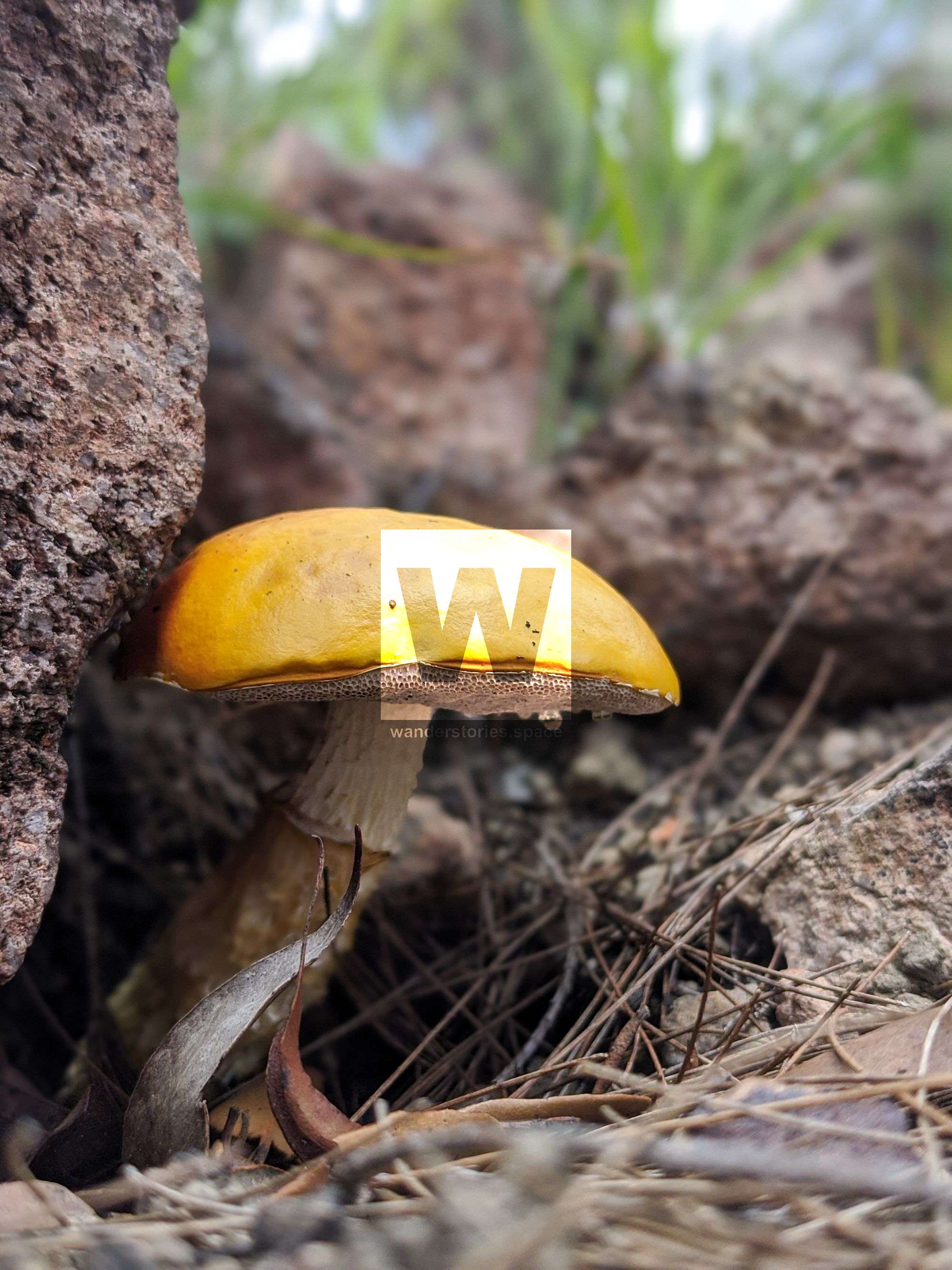
Old blazes in the trees are visible numerous places along the old pack horse trail, namely in the rainforest sections. These were the original way a trail was marked - and now this technique is frowned upon. You may come across turpentine trees (Syncarpia glomulifera) and sheoaks (Casuarina spp.), as well as the usual wait-a-while/lawyer cane (Calamus australis), and barbed wire vine (Smilax australis) higher up in elevation within the rainforest section. In the rainforest sections, you may also come across bowers of a tooth-billed catbird (Scenopoeetes dentirostris), boars (Sus scrofa), etc.
The top half of The Saddle track is entirely in the rain forest and follows the ridge line, with not much of the original track visible until you get to the flatter sections near the top. From the top, follow the divot (quite obvious to some) to The Saddle. Below The Saddle, the track would have followed the ridge down through the farm to the mouth of Ollera Creek, back when all supplies came in by boat.
Route Plans
There are several ways to hike this trail.
- Starting at the 'Mango Tree' car park (approximately two kilometres past the Crystal Creek Paradise Lagoon Camping Area), ascend the ridge to Mount Spec Road. Cross the road, and continue on through the rainforest to Culvert 2. Follow the Windy Corner Track, which is part of the PRB Track, to Mount Spec Road and then onto Paluma Village. As you approach the village, there is an old mine shaft tunnel a few metres from the road. This was part of the tin mine – Cloudy Clearing Mine – which is now abandoned.
OR...
- Starting at the 'Mango Tree' car park, ascend the ridge to Mount Spec Road. Walk down the road (left) to Mountain Creek. Descend the creek down to Spiegelhauer Road. Walk the road back to the 'Mango Tree' car park.
OR...
- Park at The Saddle, and ascend the old Saddle Track to Culvert 2. Bear in mind that this track may be difficult to follow. Then, descend Benham's Track to Mount Spec Road, and then walk about along the road to The Saddle.
OR...
- Do any of the above in reverse.
What to bring
- Three litres of water
- Appropriate clothing and footwear
- Hat and sunscreen
- Morning tea, lunch, and afternoon tea
- Snacks and electrolytes (if required)
- Camera
- First aid kit and PLB
- Insect repellent
Interactive Map
Here's an interactive map of the hike. Telegraph pole waypoints are numbered from 1 at the bottom to 48 near Mount Spec Road. Suffixes for each waypoint (e.g. TP19-F or TP20-FW) indicate if the pole is Fallen and laying on the ground, and if the pole was made of Wood. All standing poles are steel. Some fallen poles are only detectable from a few scattered insulators and brackets.
Unfortunately, all the poles coordinates were not recorded due to human error. If you compete this walk and can provide more details to this article, please contact Wanderstories.
Notes
We would like this historic site to be remembered, and we would like the relics and artefacts to stay at the site and not fall victim to collectors and trophy hunters. There are few places remaining like this in Australia, let alone the world, to explore that have not been pillaged. There is no reason to remove objects from any of these sites. Please be responsible, respect the history, and respect the importance of this site for future generations. Take photos and leave only footprints.
A special thanks to Charlie Allen, Jamie Oliver, and Wilfred Karnoll.This article, and all other articles, are for entertainment purposes only and are not to be used as a guide. Please see our Disclaimer for more information.