Hikes on Mo'orea Island, French Polynesia

Location - Mo'orea, French Polynesia
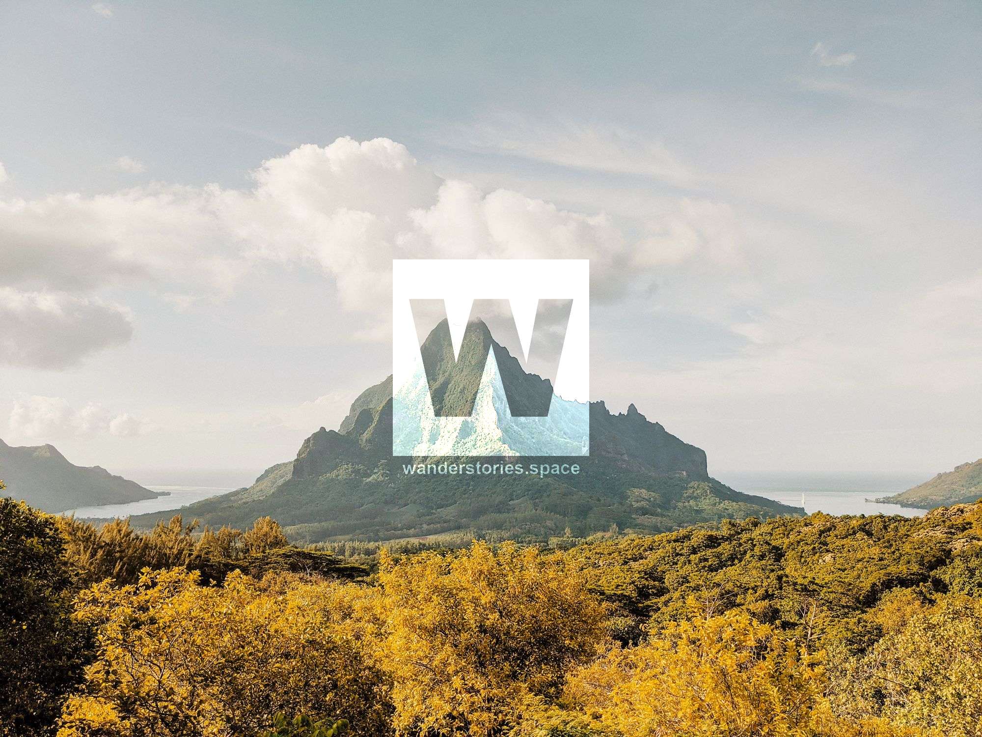
Many of the hikes on Mo'orea start in the lush Opunohu Valley where you are surrounded by unique mahogany trees, giant bamboo, and tropical flowers. In the north, Mount Rotui overlooks picturesque Location - Mo'orea, French Polynesia Bay and the settlements around Cook's Bay. Inland, hiking trails wind through the rainforest on the slopes of Mount Tohivea where the main viewpoint is Belvedere Lookout which has panoramic views of the island's peaks and Tahiti beyond. Belvédère is considered the hub of the trail network. Situated in the centre of the island, most trails can somehow be connected with this point.
The extensive trail network is marked with signposts that were installed in 2016. There is a map on the road to Belvédère Lookout that consists of both cycling and hiking trails in the area. Take insect repellent and plenty of water - it's hot, humid, and there are plenty of insects. It also tends to be muddy, especially during the rainy season. Strongly consider a dry bag for your electronics. Avoid the rainy season.
Interactive Map
1. Mount Mou'aputa
Distance: 7 kilometres out-and-back
Elevation gain: 580 metres
Difficulty: Strenuous
Location: East side of the island near Afareaitu Waterfalls
Mount Mou'aputa (830 m), commonly written as Mouaputa, is the fourth highest peak on the island of Mo'orea and is something surreal. There is a hole through the tip of this mountain and a 360-degree panoramic view at the summit that is well worth the effort.
2. Mount Rotui
Distance: 8 kilometres out-and-back
Elevation gain: 900 metres
Difficulty: Strenuous
Location: Near the Hilton Moorea
A strenuous but scenic hike, the Mount Rotui (899 m) trail takes you along a razorback ridgeline that is just a metre wide in some places. The summit of Mount Rotui offers views of the twin bays that you will never forget. Summiting Rotui will take half a day.
3. Afareaitu Waterfalls (’Āfareaitu Cascades)
Distance: 1.6 kilometres out-and-back
Elevation gain: 160 metres
Difficulty: Easy
Location: East side of the island
There are many waterfalls in the Afareaitu area, however, two better and main tourist attractions are Vaioro Falls (a.k.a. Afareaitu Waterfall) and Putoa Falls (a.k.a. Atiraa Falls). Both are worth it even when they are just trickling in winter.
4. Three Pines Pass (Col des Trois Pinus)
Distance: Approximately 3 kilometres out-and-back
Elevation gain: 150 metres
Difficulty: Easy to moderate
Location: Trailhead is located at Belvedere Lookout
The pass of the three pines, a.k.a. Three Firs Pass, is a short but enjoyable hike that leads up to three pine trees overlooking the pineapple fields, Mount Routi, and the vast greenery of Opunohu Valley. A hike to Three Pines Pass is a great way to spend a few hours on Mo'orea.
5. Three Coconuts Pass (Col des Trois Cocotiers)
Distance: 6.5 kilometres out-and-back
Elevation gain: 280 metres
Difficulty: Moderate
Location: Trailhead is located at Belvedere Lookout
Coconut Trees Pass, or sometimes referred to as The Pass of the Three Coconuts, is Mo'orea's most popular hike. It's common to start at Belvédère Lookout before hiking along part of the crater to the edge of the volcanic funnel. From there climb to the Three Coconuts Pass where you may enjoy magnificent panoramic views of the ancient volcano. The pay-off is superb views from the ridge between Mount Mou'aroa (a.k.a. Shark's Tooth), Mount Tohive'a (a.k.a. Tohiea), Mount Mou'aputa, Mount Tearai, and Mount Rotui. See also the trails from Vaianae and Haapiti to Three Coconuts Pass.
6. Vaiare Pass (Col de Vaiare) - Vaiare to Paopao
Distance: 11 kilometres
Elevation gain: 655 metres
Difficulty: Strenuous
Location: Trailhead is located on the east side of the island in Vaiare
A slightly more strenuous route is the two-hour walk from the village of Vai'are (where the ferry terminal is located) to Paopao in Cook's Bay or onto Belvédère Lookout. The route ascends to a ridge that delivers grand views of Mount Orohena (2,241 m) on the island of Tahiti, as well as the whole interior of Mo'orea. After about an hour of climbing, you'll make it to the ridgeline and your efforts will be rewarded with views out to both sides.
7. Uufau Pass - Ha'apiti to Amehiti
The pass between Mount Mou'apu and Mount Tautuapae provides another possibility of crossing Mo'orea south to north. The trails start at an easement about a hundred meters from the Pension Linareva and is also known as the Linareva Pass.
7. Magic Mountain (Montagne Magique)
Distance: 3 kilometres out-and-back
Elevation gain: 200 metres
Difficulty: Moderate
Location: West side of Opunohu Bay
Magic Mountain offers extensive views of the coastline, towns, and coral reefs of Mo'orea. The lush vegetation covering its slopes extends into the valley, providing superb photographic opportunities, with rich greens and light blues dominating the landscape.
8. Mount Ahutaa
A steep climb up the sideline takes you to Mt Ahutaa. This can be done as a circuit.
9. Peak Uui (Pic de l'Uui / Pointe des Goyaves)
Located on the northwest tip of the island, this hike slows ascends along a creek and then makes its way towards the ridgeline. There are views south (Crête Vue Sud) along the ridge and at the Crest Jul (Crête Juil) before arriving at Uui Peak. Return via the same path.
The trail follows the ridgeline under the pine trees. Ropes are installed to assist on the steeper sections. The ridgeline sharpens to a narrow ridge with steep drop-offs on either side. Once at the top, views out to the west of Mo'orea can be seen including Tetiaroa and Maiao.
10. Route des Ananas
The Pineapple Route. This dirt road connects Opunohu Bay and Cook's Bay inland. The trail traverses through pineapple fields and small creek crossings and provides some views of the surrounding countryside including Mount Rotui.
11. Belvedere Lookout & Natira'a Roa Hike
Distance: Varies (Approximately 11 kilometres from the Opunohu cut off)
Elevation gain: 250 metres
Difficulty: Moderate to strenuous
Location: In the pocket of Opunohu Bay
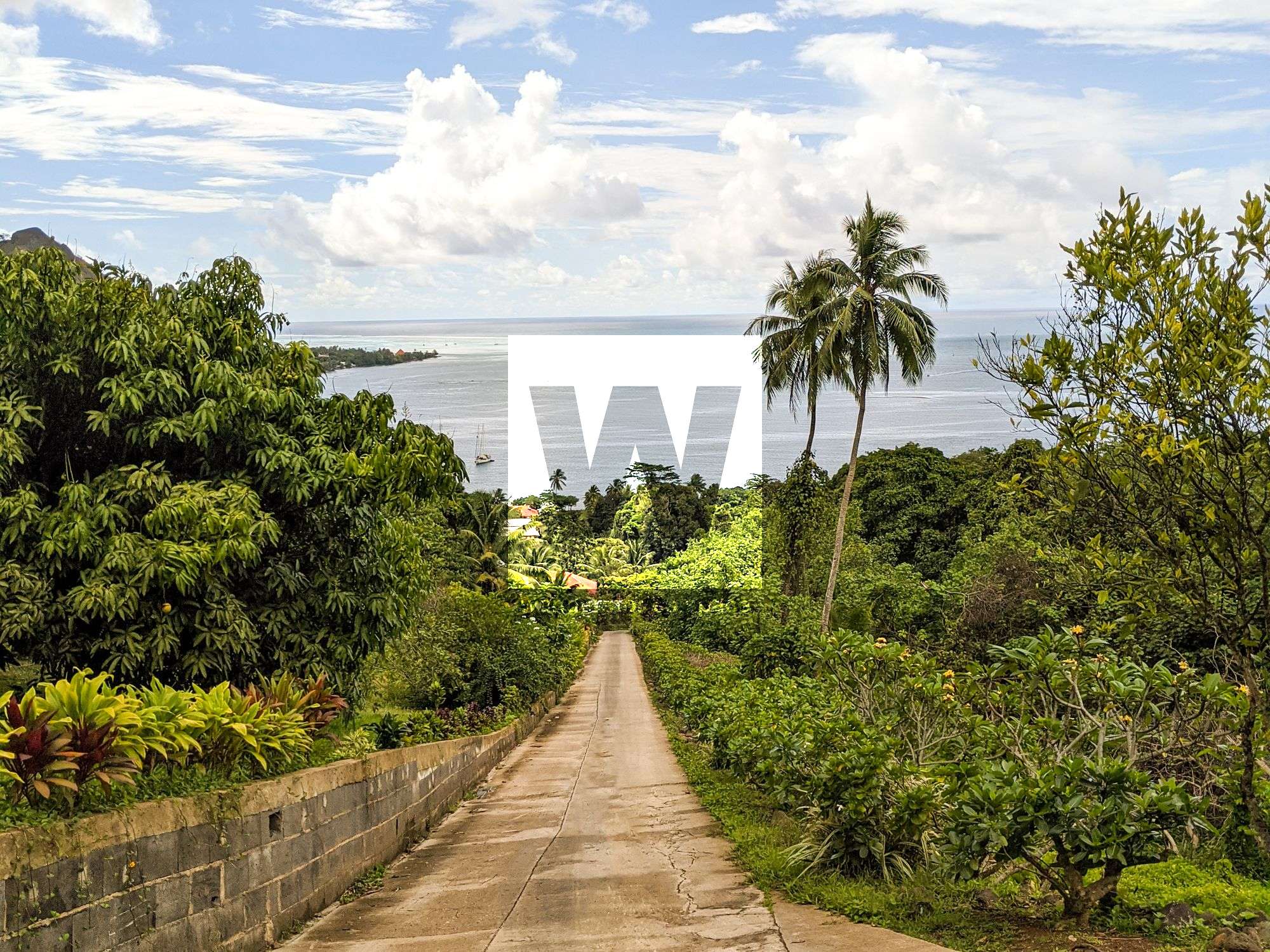
A great way to walk up to Belvedere Lookout. The easy hike takes you through a thick mape (Tahitian chestnut) forest, before emerging into a clearing with mountain views. You then walk back down along the main road, passed the Lycee Agricole (agricultural school) - where you can stop for some fresh juice or ice cream - and a few giant bamboo trees. Take the road that heads up to the Belvedere and when you reach the bridge over the river, park the car. There, you'll find numerous trail signs on the side of the road. The hike will take 3-5 hours return.
12. The Ancient Trail
This trail takes you along Archaeological Sites where you will see the Marae Titiroa, Marae Ahu-o-Mahine and Marae Fare Aito. Starting in the pineapple plantations, this hike takes you through dense jungle to viewpoints of sharp, intricate peaks and past the agricultural college (Lycée Agricole). The ancient trail then heads uphill on the old track to Belvedere where several ruins of Maraes as pastec before arriving at the Belvédère Lookout. From here, you can either head onto the Three Pines Pass or the Three Coconuts Pass for an extended hike.
13. Vaiare - Teavaro, Teavaro - Temae, and Temae Ridgeline Hikes
If you liked the view from Toatea Lookout, you'll love the view from the summit of Temae ridge. It's short and steep - but it's worth it once you reach the top. From the top, you have views over the Sofitel Resort and Temae Beach. To your left is the lake and the airport and to your right is the northern coastline of Moorea and the island of Tahiti.
14. Ha'apiti - Vaianae - 'Ātihā – Ma'atea – Haumi – Afareaitu – Vai'are
Ma'atea: The track passing through orchards of bananas, oranges, papayas, and grapefruit before the track beings. The trail then traverses mape (Tahitian chestnut) before ascending to the pass. The pass also allows access to 'Ātihā (Atiha).
Haumi-Afareaitu: some sections are encompassed with high ferns. Before arriving at a banana plantation.
15. CRIOBE to Mo'orea Tropical Garden
This peaceful property is perched on a small plateau where you can purchase homemade organic jams, dried fruits, vanilla, delicious ice creams and freshly squeezed juices. On Friday and Saturday, the Polynesian lunch menu is on offer. From the property, the lagoon views are fantastic. There is a short walk that can be done around the garden and to a small waterfall. A longer trail connects the Tropical Garden with Opunohu Bay near Route des Ananas.
16. Toatea Lookout Point
Distance: Varies (Approximately 1.9 kilometres roundtrip from Sofitel Resort)
Elevation gain: 60 metres
Difficulty: Easy
Location: Near Sofitel Resort and Temae Beach
Toatea Lookout has a great view over the Sofitel's overwater bungalows and our to the reef break.
17. Lycee Agricole Opunohu
Discover the tastes and agricultural heritage of French Polynesia at Lycee Agricole Opunohu, an agricultural school including a vegetable and fruit garden. With fresh seasonal produce to choose from, as well as a number of homemade juices and preserves, the gardens emphasize sustainability and tropical flavour combinations, teaching their methods and motivations to visitors. Take a self-guided tour of the grounds to see the ordered wilderness in which the produce grows, and enjoy a smoothie or sorbet under the shade of a palm tree. Pick up a jar of your favourite jam to take home.
A small shop at the local agricultural college sells jams in local flavours as well as honey, coffee, fruit juices and ice cream. If you've got itchy feet, there's a small network of walking trails that lead through the estate, in the basin of the caldera. These are detailed in leaflets that are available at the shop. The longest loop takes a little over two hours to walk. From the college, the road continues inland and up to various marae (archaeological sites) and finally to Belvédère Lookout.
I hope those endorphins will kick in and you will have a blast!
This article, and all other articles, are for entertainment purposes only and are not to be used as a guide. Please see our Disclaimer for more information.