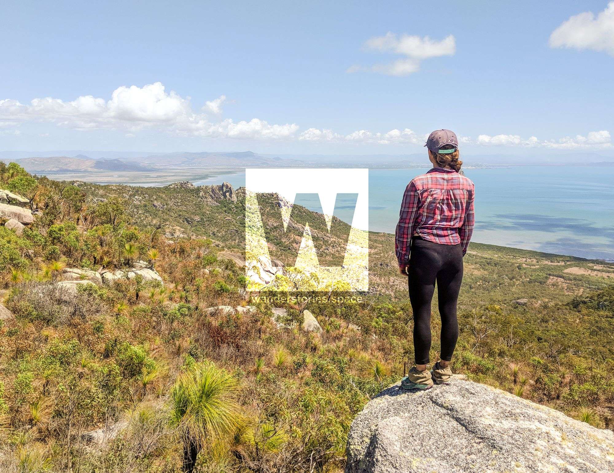
Summiting Mount Cleveland
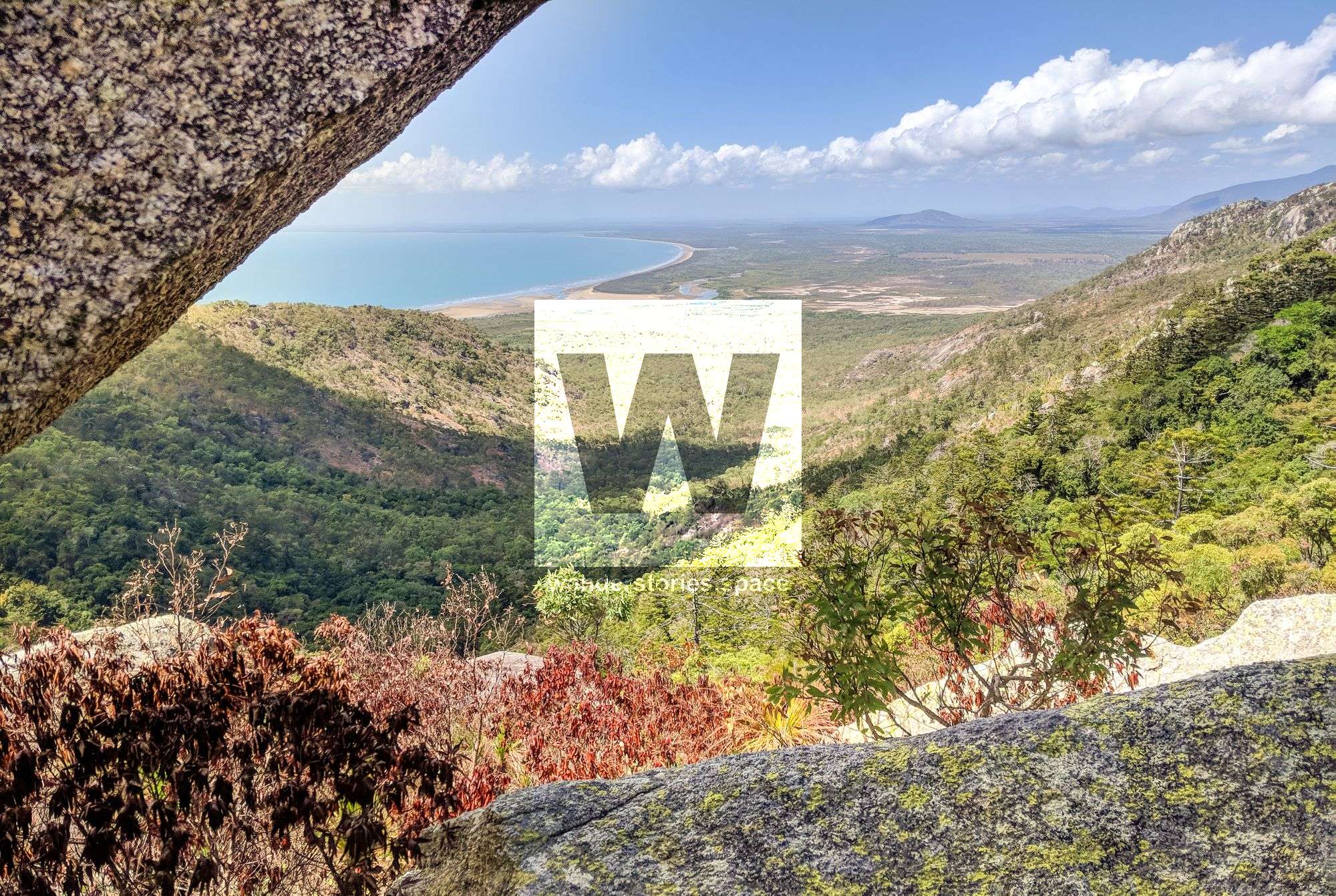
Mount Cleveland rises 558 metres above sea level and makes for a perfect day walk where you can enjoy views of both Townsville and Chunda Bay from both sides of the Cape.


Location - Bowling Green Bay National Park, North Queensland, Australia
Distance - 13 km loop; approximately 7 km return
Time - Approximately 8-9 hours for the circuit; allow 4-6 return just for the summit
Grade - 4/5
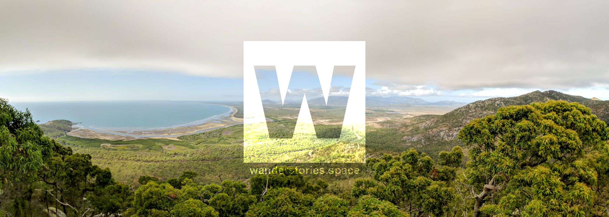
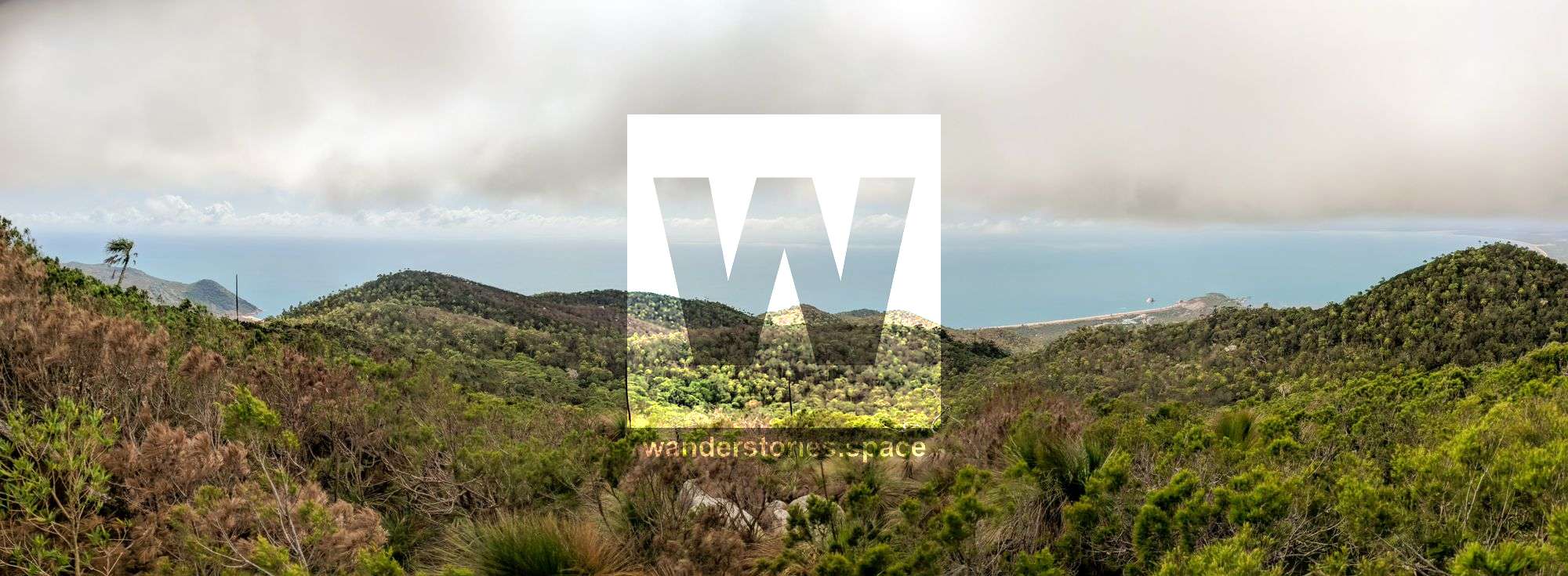
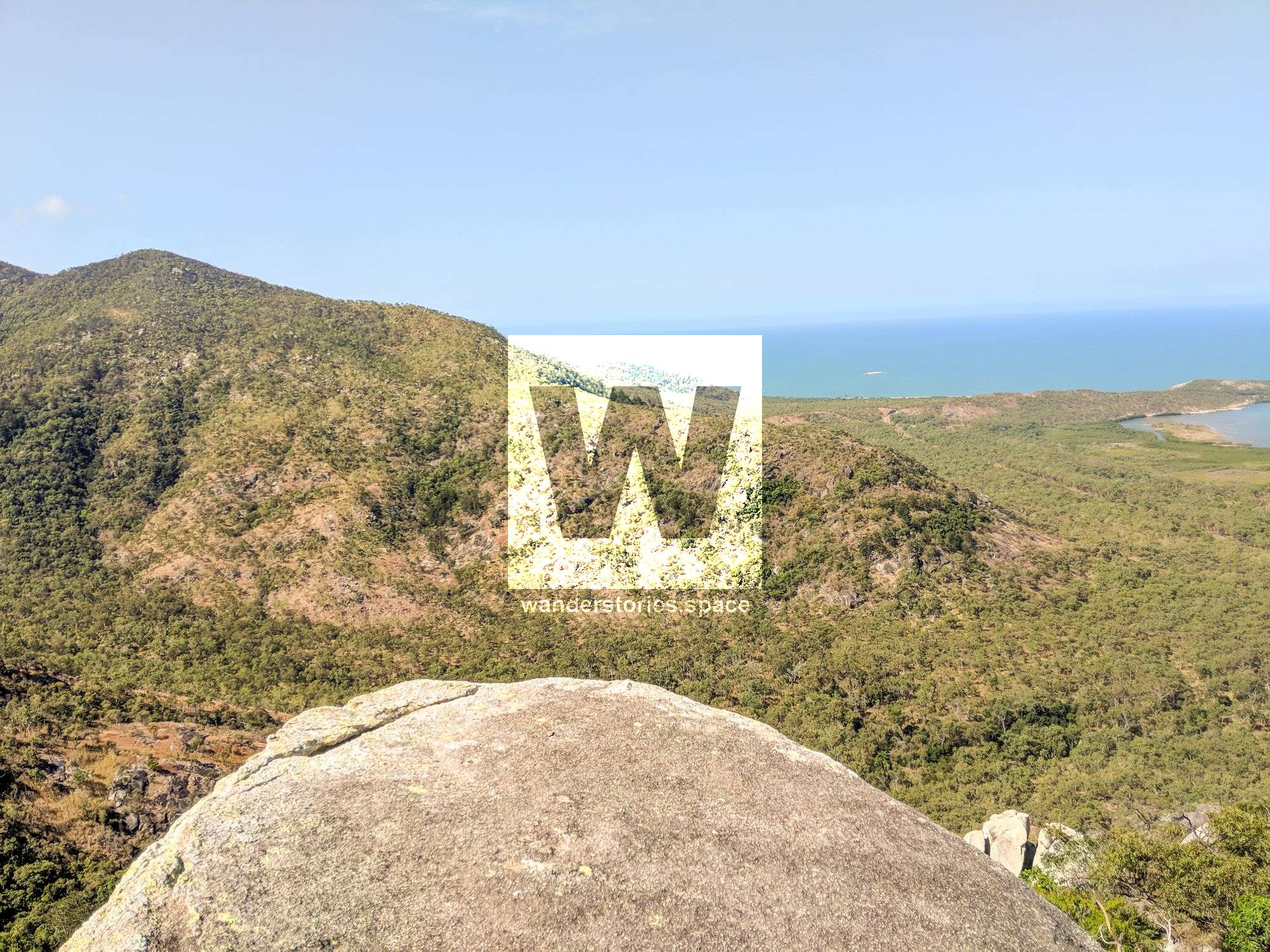
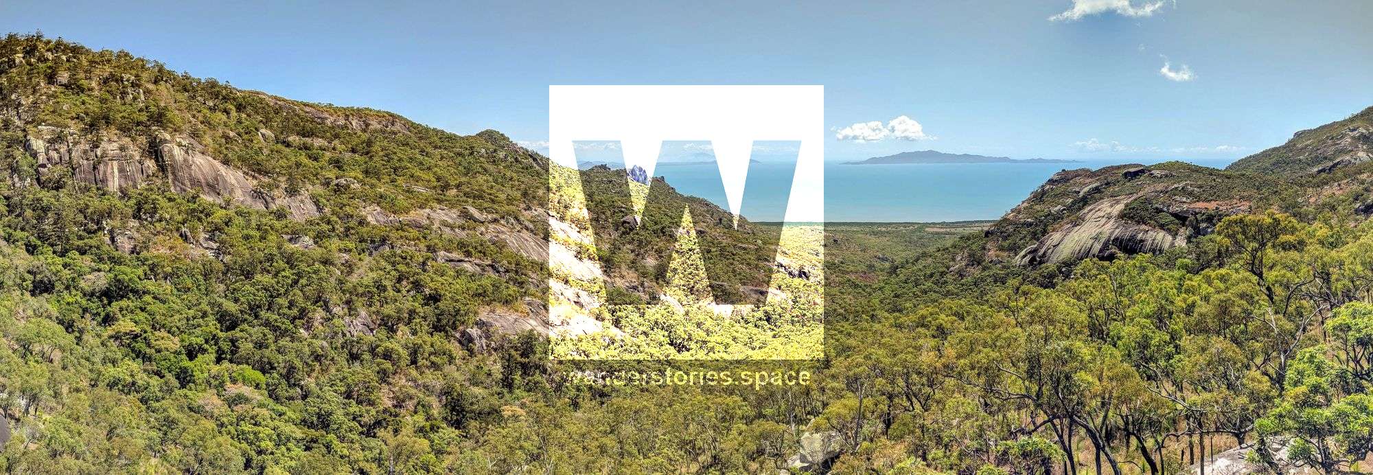
Located in Bowling Green Bay National Park on Cape Cleveland, Mount Cleveland rises 558 metres above sea level and is the highest point on the cape. The suggested 13 kilometre circuit makes for a perfect day walk where you can enjoy views of both Townsville and Chunda Bay from both sides of the Cape.
When you reach the summit, you can take in the views and check out the old rusty remains of a trig point. In case you didn't know, trigonometrical stations (i.e., trig points) are beacons that are often at the top of peaks that used to be used for triangulation and navigation purposes. Today, they are often kept intact, as they can be useful navigational aids for hikers.
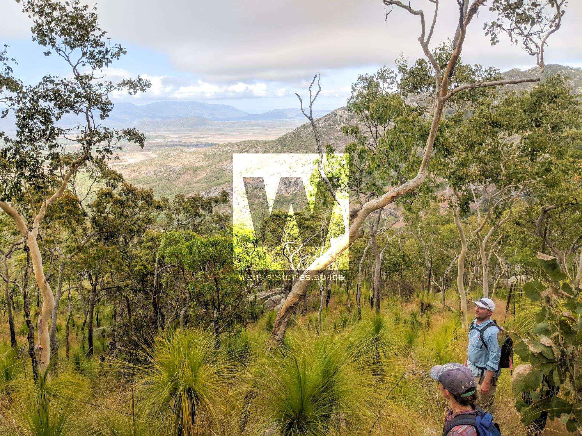
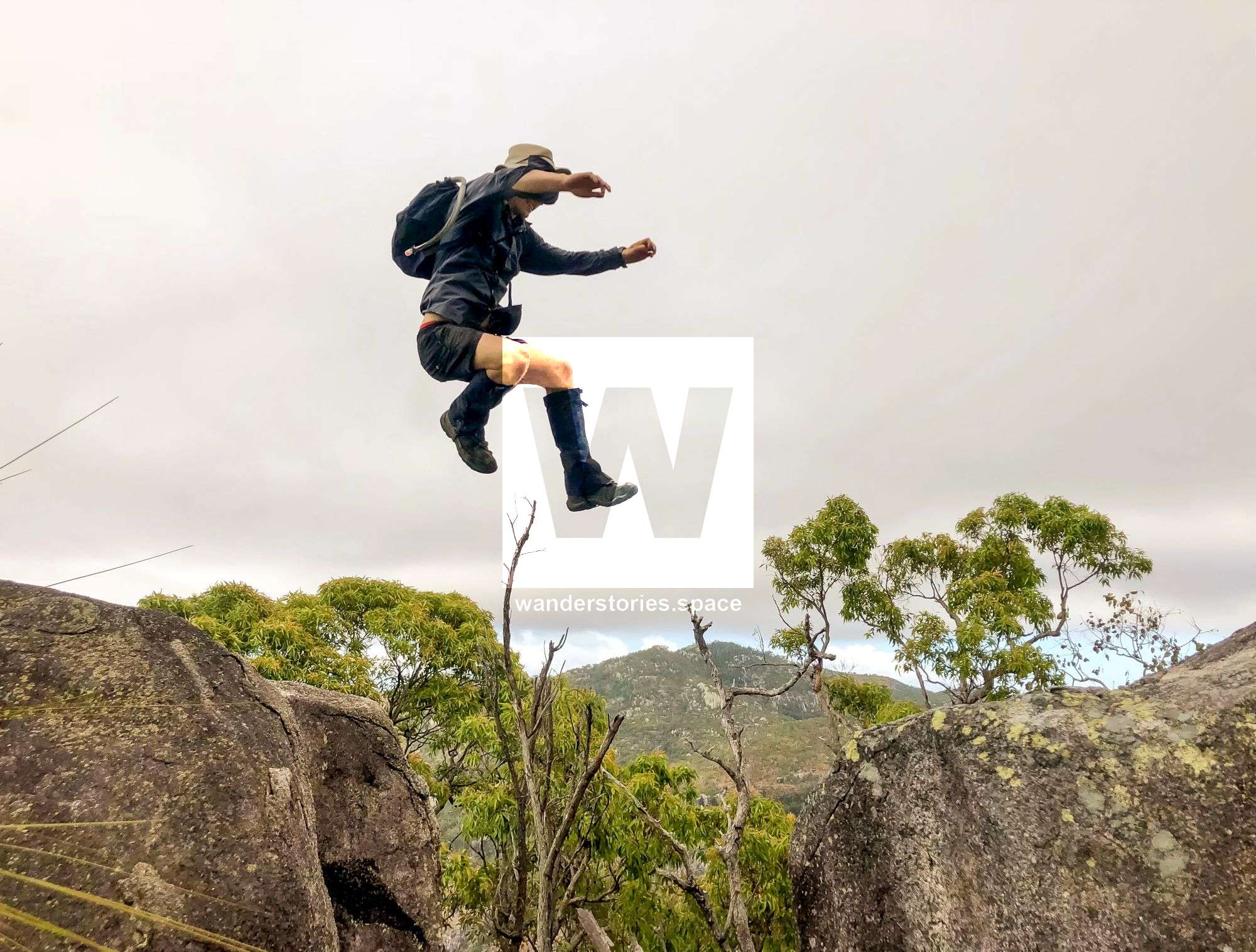
The route is all off-track, cross-country bushwalking. Long grass, rocks, and scrub to navigate and walk through. Steep elevation gain, loose soil and rocks, and uneven terrain, with obstacles hidden underfoot in long grass. Spear grass and other grass seeds may be prevalent. Tangled barbed-wire vines with sharp thorns to trip and cut the unwary. Apart from that it is a pleasant hike up a mountain. The reward is views over the coast and bay. Grass trees flowering encourage the seasonal butterflies. A small section of lantana, bramble, and vine thickets guard the false peak. She-oaks (Casuarina) are more prevalent towards the summit.
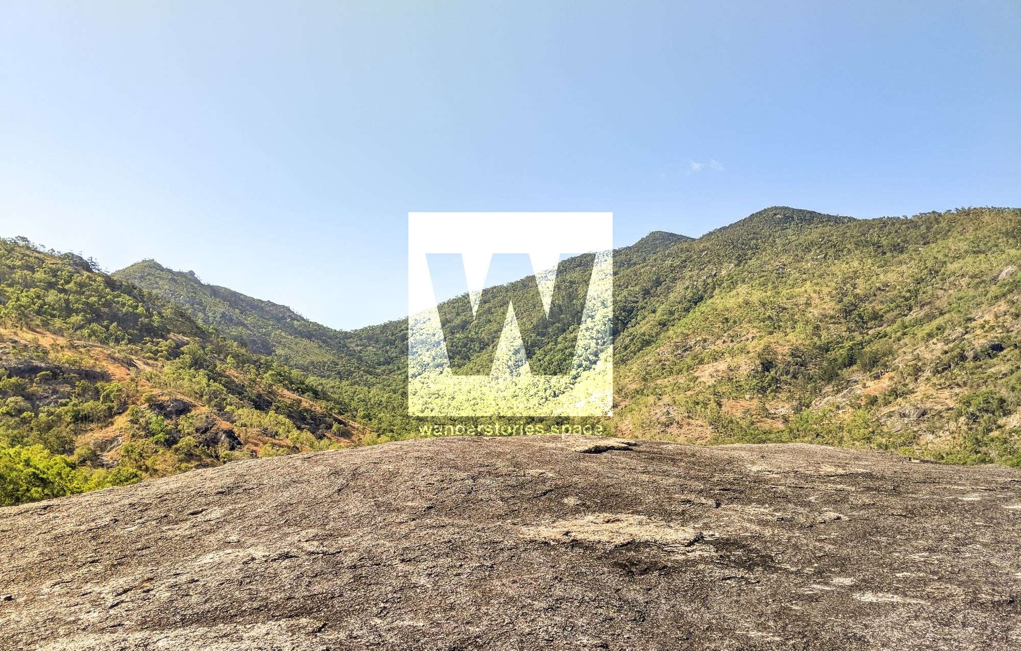

Vegetation is mostly bushland, with a lot of exposed rocky outcrops comprised of granite and covered with lichen. There are at least two species of shrub that are endemic to this area. Be mindful, however, there are a few gympie gympie (i.e., stinging tree) near the creek beds.

As you approach the top, the bushland closes in a bit, and you may feel encapsulated by the trees and wind-twisted vine thickets. Cabbage tree palms (Livistonia australis) are near the summit.

Animal life can include wallabies, an array of bird species, including birds of prey (e.g., kites, sea eagles), and you may spot the sun-skink (Lampropholis mirabilis) that is endemic to the area as well.
On the inland side of the cape, you will find more exposed rocky outcrops. On the point, you'll find cliffs. Really enjoy the views as you walk the ridge line; looking west toward Townsville, you'll see landmarks like Castle Hill and Magnetic Island in a completely different light.
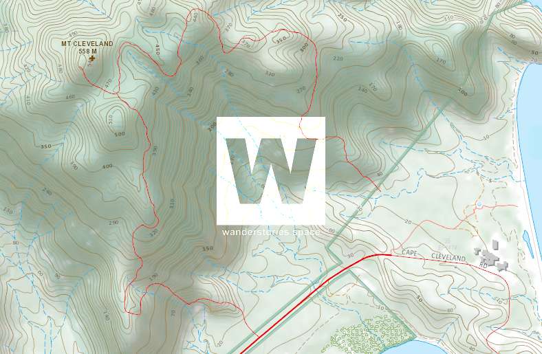
Interactive Map
Here's a suggested route; The ridgelines in this type of terrain are more open and are easy to traverse than ascending via creeks.
How to get there
Drive south of Townsville, and turn left onto Cape Cleveland Road (the AIMS turn off). Continue out to the Cape to the base of the mountain. You'll see the suggested car parks on the interactive map above.
- The Dark Blue car park and route may be the easiest to the summit. You will pass a few ancient rock cairns along the way.
- The Red car park and route follows the main ridgeline to the summit and gentle, however, you must first navigate the boulders at the start of the ridge.
- The Lime Green route connects Mount Cleveland with the Western Ridge.
- The Orange route is the Western Ridge.
- The Light Gray routes make for a good choice to connect the Cape Cleveland Lighthouse with Mount Cleveland. The Townsville Bushwalking Club did the North Ridge in 2019.

What to take
- At least 3 litres of water, 4 litres is recommended - No refill during the day
- Electrolytes are recommended.
- Food and snacks
- Hat and sun protection
- First Aid Kit and PLB
- Insect repellent and a headlamp are also recommended
- Recommend long sleeve clothing / gaiters, gloves due to the bush bashing
- Change of clothes for the trip home.
- Sturdy footwear recommended
This article, and all other articles, are for entertainment purposes only and are not to be used as a guide. Please see our Disclaimer for more information.