A few local gems to explore while in Townsville
Looking for a different after work mini-adventure? Some wicked waterfalls? Or, a more robust weekend adventure? Townsville has a lot to offer! Find out more here, as well as how we at Wanderstories are helping to inform and inspire our awesome adventure community.


Looking for a different after-work mini-adventure? Some wicked waterfalls? Or, a more robust weekend adventure? Townsville has a lot to offer!
Local tracks to do before and after work
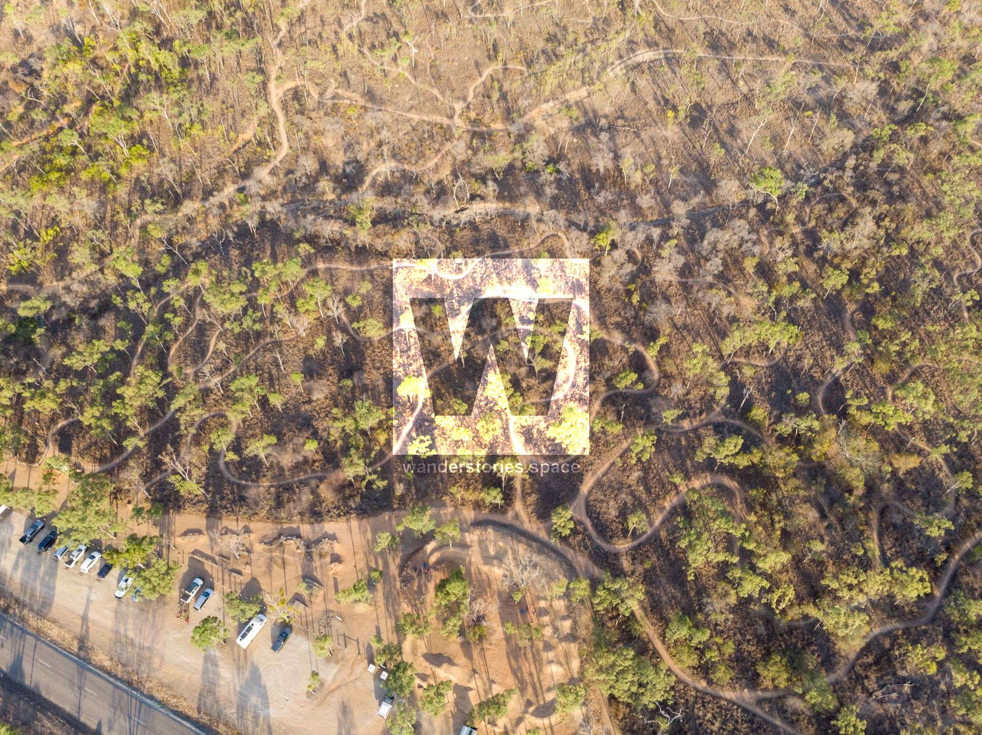
Douglas Hills
Distance - Approximately 3.5 km return
Time - Approximately 1 hour return
The James Cook University Walking Track, commonly known as the "JCU Stairs", is made up of 493 well-maintained steps. Brave these steps spanning beautiful bushland, and you'll be rewarded with stunning views at the summit including the Mount Stuart foothills, James Cook University, Castle Hill, Townsville City, and the ocean. Kangaroos, crickets, spiders, and other little critters are common along this short, enjoyable walk.
Free parking for the trail is located behind the JCU Western Campus on Endeavour Drive. There, you'll find signage indicating the start of the walk.
Getting to the first peak via the stairs will take about ten minutes. Once you reach the first peak, the path continues to a higher peak called "Top Summit". While there are multiple trails to Top Summit, take care, as these trails can consist of loose gravel, rocks, and washouts. Be mindful, especially when descending.
At the Top Summit, take a moment to sit down (yes, there are seats!), take in the refreshing breeze, and marvel at the views of Townsville and James Cook University.
Please be mindful that the Townsville Rockwheelers Mountain Bike Club hold tenure over the Douglas Mountain Bike Reserve for the primary purpose of mountain biking and have the right of way. Do not walk on the 'downhill only' tracks, and respect all signage. Additionally, this is a dog-friendly area, but please be a responsible pet owner. Dogs must remain on leashes at all times.
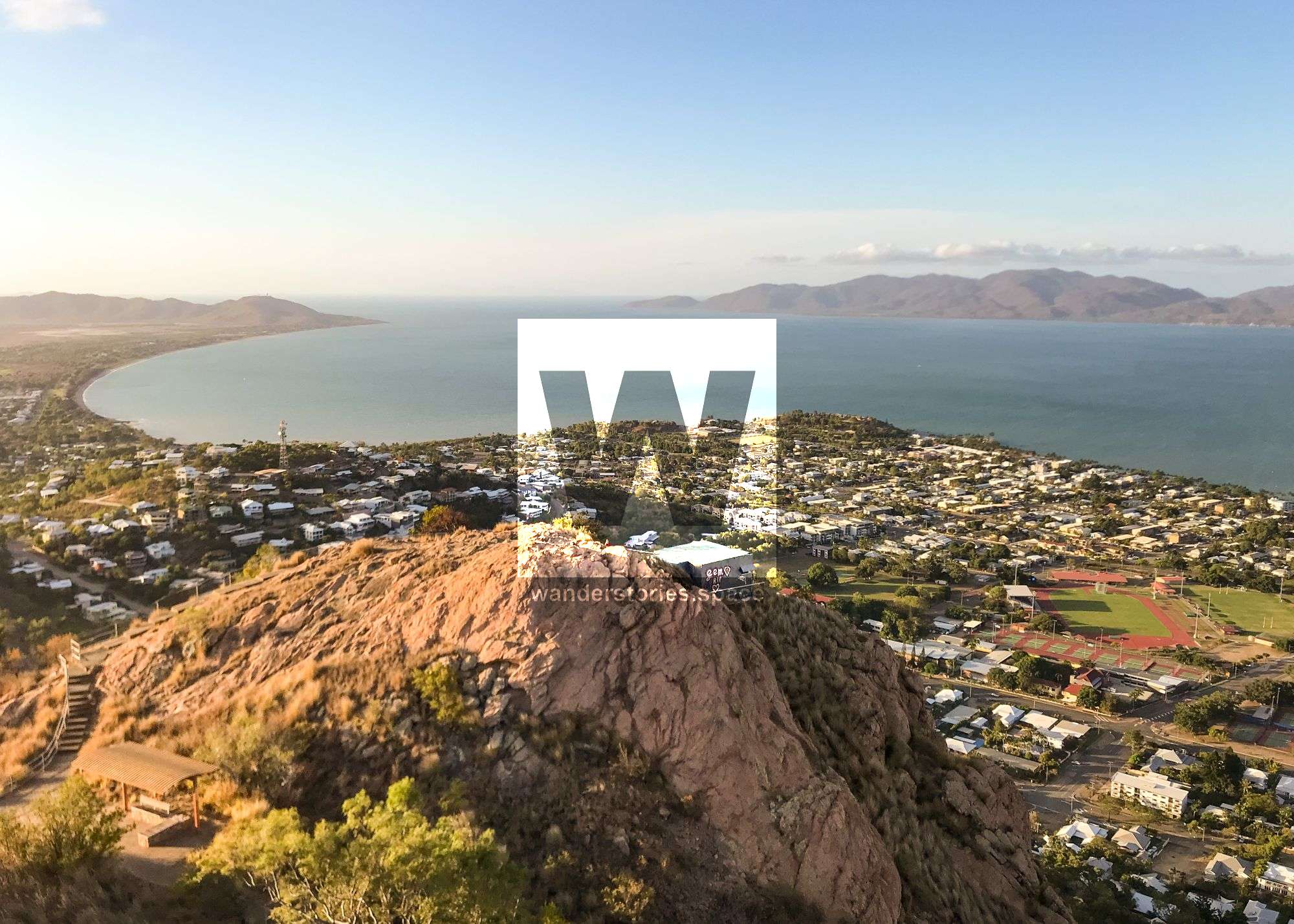
Castle Hill
Distance - Approximately 4-5 km return, depending on the route you take
Time - Approximately 1 to 2 hours return depending on fitness and breaks
Castle Hill – a heritage-listed lone, pink, monolithic, granite giant – is the most popular outdoor fitness destination within Townsville City. From the road to the more intensive goat tracks and Hell's Staircase, there's a route for everyone and any fitness level.
In fact, did you know that there could be as many as fifteen official trails to its summit?
All the tracks are well-worn and easy to follow but do not take shortcuts, as this causes erosion. The most popular is the Cudtheringa Track (1.1 km, one-way). It is accessed from opposite the first car park at the bottom of Castle Hill Road, and spits walkers out back onto Castle Hill Road just shy of the summit. The route climbs steeply through scrubby vegetation and rocky landscape, heading up the north-western flank, then meets with The Goat Track, before climbing steeply up Hell's Staircase, which will surely get your heart pumping.
If you don't like crowds, avoid 5-7 am and 5-7 pm on weekdays, as this track, in particular, tends to be the choice for pre- and post-work fitness activities.
However, the sunrise and sunset 360-degree views of Townsville at the top are well worth the journey. Even at night, the view of the city lights are quite spectacular. A World War II observation bunker sits on one corner of the hill as a reminder of Castle Hill's military history.
The wicked waterfalls trilogy
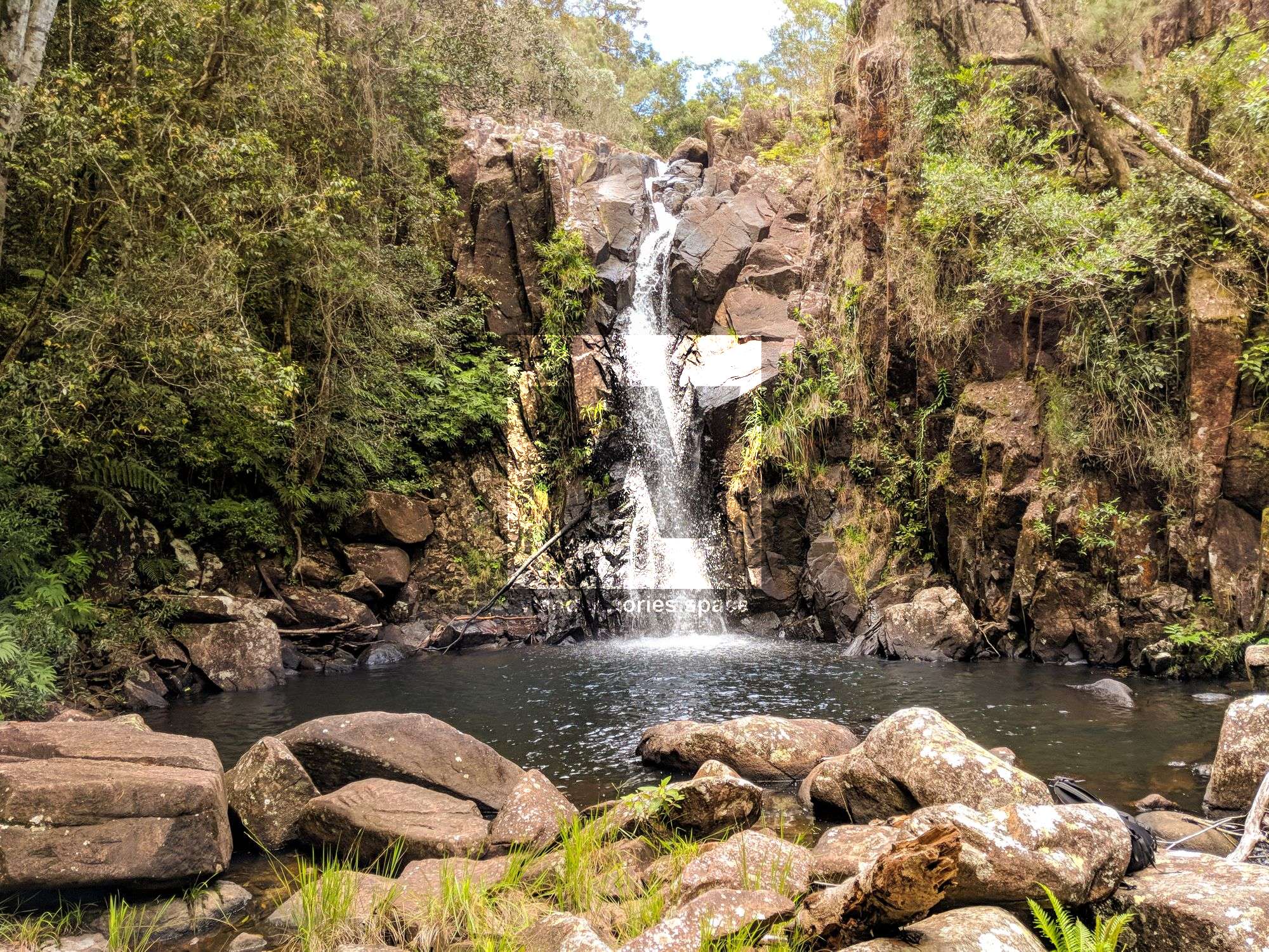
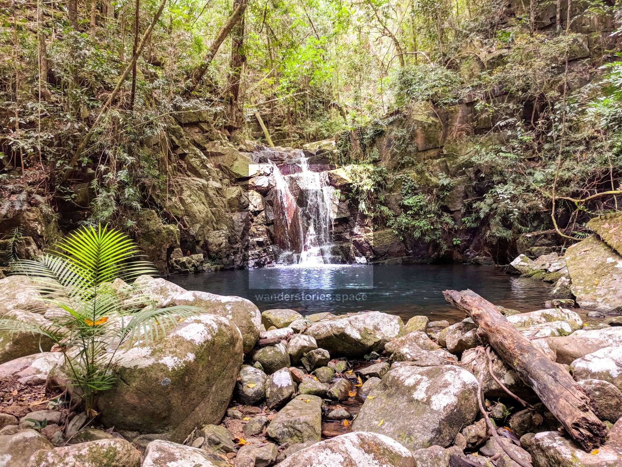
Ethel Creek Falls
Distance - Approximately 3 km return from Hussey Road or 8-10 km return from Paluma Village
Time - Approximately 2 to 3 hours return
Ethel Falls is a hidden gem in the middle of Paluma Range National Park. Not only are these falls beautiful, but you're very likely to be the only ones there! The falls are located behind the acreages to the west of Paluma and are primarily accessible on-track via the Paluma trail network.
Access these falls via Hussey Road, Smith Crescent, or Cloudy Creek Falls. For the latter option, start from McClelland's Lookout at the Eastern edge of Paluma Township. Once you reach Cloudy Creek Falls, you will notice two steel poles concreted into the ground and perhaps two more on the other side of the creek, all of which are the remains of an old suspension bridge.
The track to Ethel Creek Falls is less defined than the Cloudy Creek track, but there are also trail markers tied and nailed to tree trunks along the route, and there are numbered markers at the major intersections as part of the larger trail network. All of these elements should help you find your way without trouble.
Once you reach Ethel Creek, you'll find yourself at the top of the falls. Cross the creek and follow the track to the right where you'll find a steep climb down to the bottom of the falls. There, you'll also find a rope tied as a handrail most of the way down. The water hole at the bottom of the falls is big enough to swim in to cool off before your return journey. Consider packing a picnic to enjoy at the falls as well.
Diorite Falls
Distance - Approximately 15-22 km return, depending on route
Time - Approximately 6 to 10 hours return depending on fitness and breaks
Diorite Falls offers uniquely appealing water cascades over broad rock slabs, which creates a perfect swimming hole to cool off and enjoy the day! If you have an opportunity for a swim, do it! But, be mindful when leaning up against the waterfalls, as you may end up with a million tiny leeches hitching a free ride on your skin!
Diorite Falls is best accessed via Paluma Dam and covers about an 18 km loop. A great route is via crossing the Paluma Dam wall and then heading northeast to Diorite Falls. It is also possible to enter Waterfall Creek from the northern track. Then, you can rock hop about 100 metres upstream to Diorite Falls. When you depart, you can take the southern track back to the main trail network.
While out near Diorite Falls, you may also want to check out Shay's Clearing or camp there for the night, which is possible under a Queensland National Parks permit.
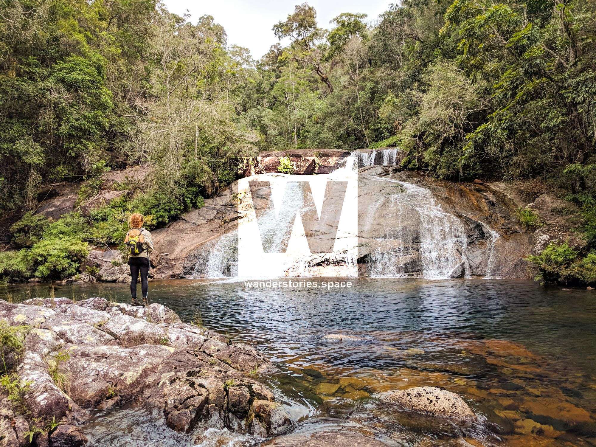
Triple Falls
Distance - Approximately 3.5 km return
Time - Approximately 2 to 3 hours return
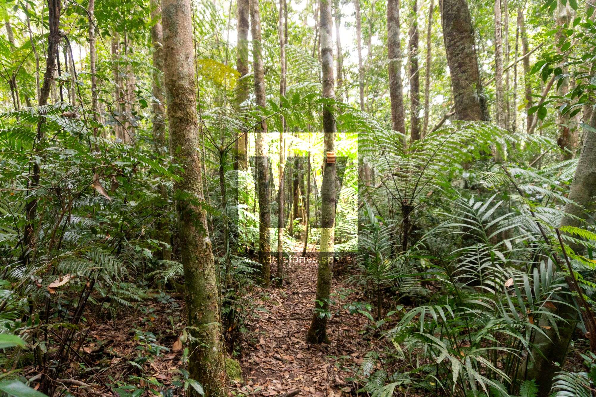
The Bluegum Creek Circuit starts on the south side of Paluma village and is an easy day walk that takes you on a loop down into Star Valley. It only takes about one hour from the H Track to get to what is locally known as "Triple Falls". Check out the waterfalls and enjoy a refreshing swim. The track takes you through a variety of rainforest, bluegum forest, and ecotone areas.
The track branches off from the well-known H track circuit at the National Park "H Track Loop" sign. The track is not marked at this point, but the footpath is clear and well-used. This route is actually part of the old, original forestry H track that went down the ridgeline to Bluegum Creek. You can occasionally see old forestry track markers as well.
The track is easy to follow and flat for a while. Then, you will encounter a 400-metre steep descent into the valley. When you reach the junction marker, turn right and take a short, but very steep, track walk down to Triple Falls. There, you'll find a rope in place at the bottom to assist you to the pool and base of the falls. To explore the mid and upper falls, scramble up on the left side to reach them. Return via the same route.
A weekend-worthy summit
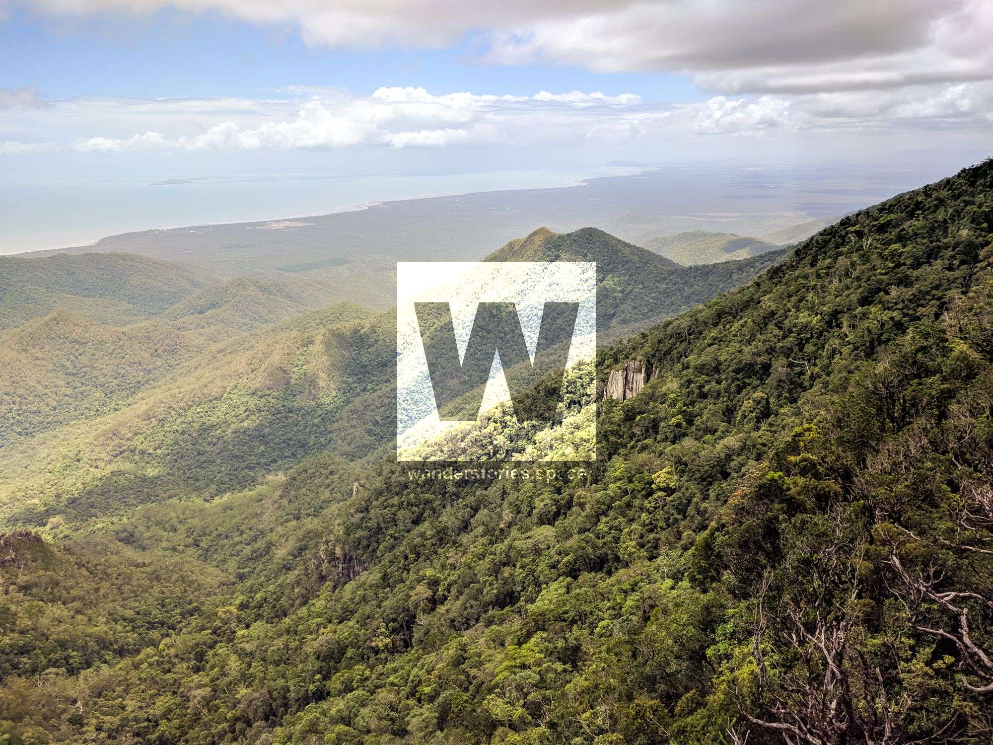
Mount Halifax
Distance - Approximately 11 km return with over 1,000 metres ascent and descent
Time - Approximately 5 to 10 hours return, depending on fitness and breaks
Summiting Mount Halifax is strenuous. You'll need to be fit to climb up some steep hill sections. The bush track is rough and uneven underfoot. There is also a bit of rock hopping involved, and so you'll need to have adequate technical skills and good foot placement for this hike. The route is generally well-marked with orange and yellow metal reflective markers. The trail is rough and, in some places, difficult to discern without the markers. However, the journey is what makes his trail one of the best around Townsville, and the splendid swimming holes in the lower reaches and stunning views on the mountain tops make this one memorable, to say the least!
To get there, turn onto Pace's Road and drive until you reach the logbook sign-in point for the trailhead. Park your car on the roadside before the gate. Vehicles are not to proceed through Pace's gate, as it's private property.
Much of the bushwalk at lower altitudes is in or alongside a rocky and boulder-strewn rainforest creek. Along the way, there are some small gorges, waterfalls, and cascades often frequented by locals. However, during some parts of the year, there may be no flowing water in the creek. Take notice of the diverse vegetation changes along the walk as altitude changes, spanning woodland, to rainforest, then she-oak and grass trees, and bottle brush on exposed ridges. Then, as the track ascends, you climb narrow rocky ridgelines to encounter rainforest vegetation again when you reach the top.
From the summit, views of the cliff face can be admired, and you can even crowd onto a rocky outcrop just south of the summit for great views. If you continue further south a few meters, you can scramble onto Mickle's Lookout. It can be quite overgrown, but this spot has even better views than the other vantage points!
Leave No Trace
What is 'Leave No Trace'? It is all about protecting environments in their natural state and a primary goal of national, regional, and state parks worldwide. Indeed, #LeaveNoTrace or #LNT ensures that everyone can enjoy the natural beauty of the outdoors in harmony; so, this point is the foundation of respect for parks, rangers, traditional owners, and those enjoying natural areas.
Hikers, walkers, and adventurers can all aim to minimise impact through the following 10 tips of #LeaveNoTrace or #LNT:
- Stay in single file, stick to the track, and avoid shortcuts to reduce erosion
- Avoid lighting fires, especially on dry, windy ridgelines, saddles, etc., and be fire smart. Note that in most Queensland National Parks, open fires are prohibited.
- Dispose of waste correctly, and don't throw waste that won't burn in a fire (e.g., glass bottles, bottle caps, and aluminium foil are often found in fire pits as they do not burn). Even food waste needs proper disposal, as it will not biodegrade quickly is an eyesore to others, and can impact wildlife. #PackItInPackItOut
Leave No Trace doesn't just refer to litter. - Rock cairns or stone-stacking is an ancient practice and – in some places – holds a historical significance. While long been used as path indicators, when it's done for fun, it can confuse other hikers, causing them to veer off the trail. Random rock stacks are an eyesore and can also destroy ecosystems when rocks are removed from, for example, streams and creek beds.
Plan to poo! Learn how to do it correctly! - Use toilets beforehand and when provided. Especially in high traffic areas, pack out faecal waste for minimum impact. If you do dig a hole, ensure it is at least 15–20 cm deep and 100 m from tracks, campsites, and waterbodies. Cover it when you are finished. Always pack out wet wipes, sanitary pads, tampons, condoms, nappies, etc., as they do not biodegrade.
Other ways to minimise impact... - Use biodegradable soap and toothpaste and do so sparingly. Stay at least 50 m from water sources to avoid harming wildlife and contaminating drinking water.
- Avoid single-use plastics and try to remove packaging before you embark on your adventure. Better yet, use reusable containers for food and drinks.
- Bring a reusable garbage bag to carry your rubbish out and any extra rubbish that you find. Your actions will directly impact the next person's experience and may save wildlife as well. #HikeItOut
Respect the culture and nature - Respect Aboriginal sites and other culturally significant or historic areas by observing quietly, sticking to paths, and never touching.
- Avoid touching trees and moss that you pass, as damage builds up over time. At camp, avoid tying ropes and hammocks to trees, as they can easily ringbark the trees. "Take only photographs, and leave only footprints." Do not take shells, rocks, fossils, etc. from the natural environment. Not only does it damage ecosystems, but it is also culturally disrespectful and against the law.
How well do you really know your 'Leave No Trace' principles? Google the Cool of the Wild quiz to find out!
About these authors... about Wanderstories
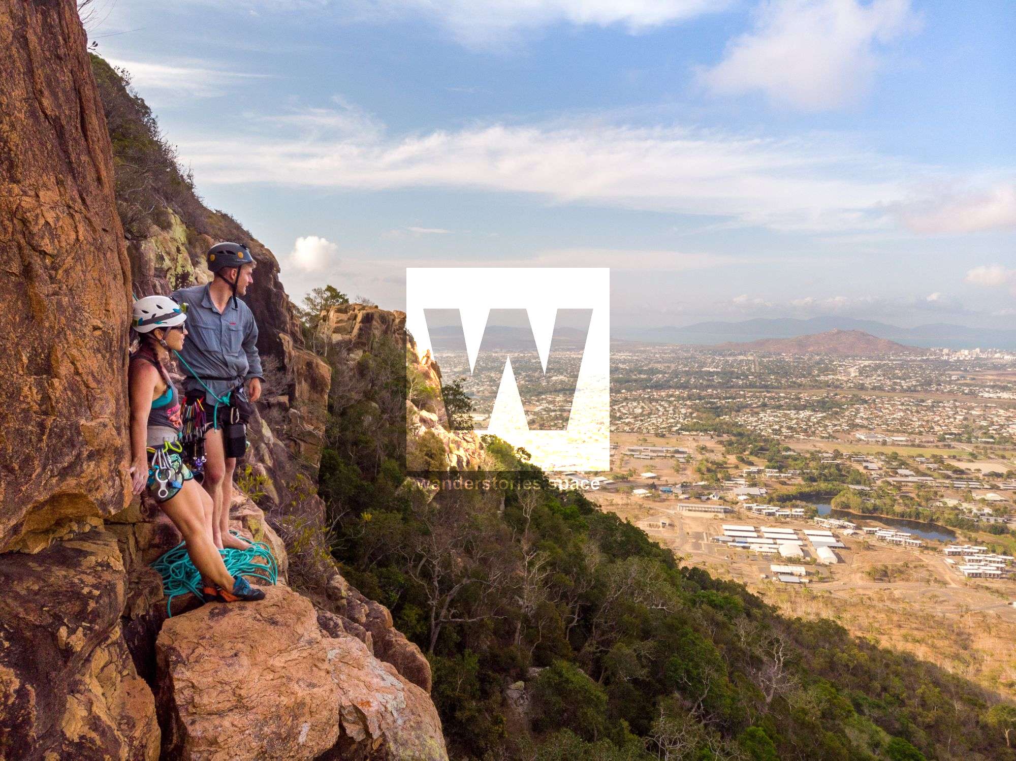
We are Luen Warneke and Jodie Rummer. Luen loves to explore the great outdoors no matter the level of expedition and is constantly learning new skills and investigating new areas. Jodie is a career scientist, ocean lover, rock climber, and an all-around outdoorsy adventurer.
However, Wanderstories is really about community! We are made up of adventurers and outdoor lovers like yourself. Our goal is to share knowledge and experiences via informative resources, photographs, videos, and maps. As of January 2020, our website receives over 15,000 unique visitors each month! We have 1,000+ website subscribers, and 3,000+ social media followers across all channels.
Check us out, and then get outdoors on an adventure!
This article was published in the Townsville North Queensland – Alive in 2020 guide which has been launched in newspapers down the East Coast of Australia including Cairns, Townsville, Mackay, Brisbane, Sydney (CBD), Melbourne (CBD).
This article, and all other articles, are for entertainment purposes only and are not to be used as a guide. Please see our Disclaimer for more information.