Hidden Aboriginal rock art around Townsville
This article covers aboriginal paintings in and around Townsville which includes Cape Cleveland, Hervey Range, Magnetic Island, and Townsville areas.

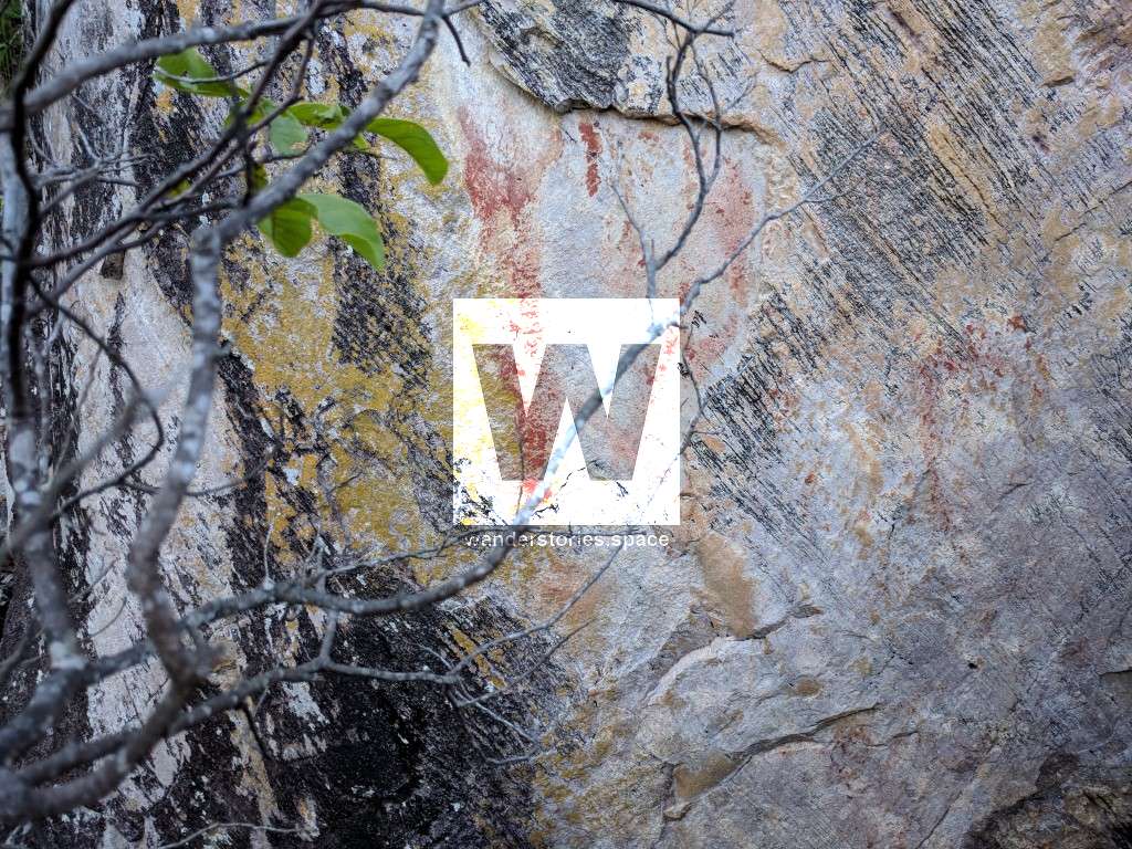
Townsville's Indigenous history spans thousands of years and finding remnants of that history can be difficult. Aboriginal paintings are art made by indigenous Australians and is closely linked to religious ceremonies or rituals. Ochre is a natural clay earth pigment that is used to create paintings. It's a mixture of ferric oxide and varying amounts of clay and sand and ranges in colour from yellow to deep orange and brown. Ochre containing a large amount of hematite, or dehydrated iron oxide, has a reddish tint known as "red ochre".
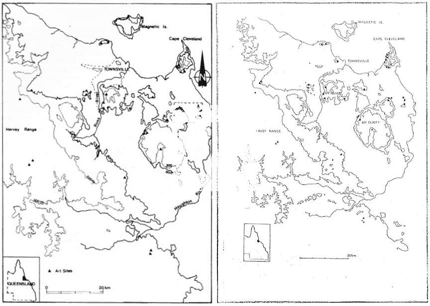
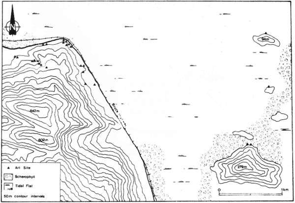
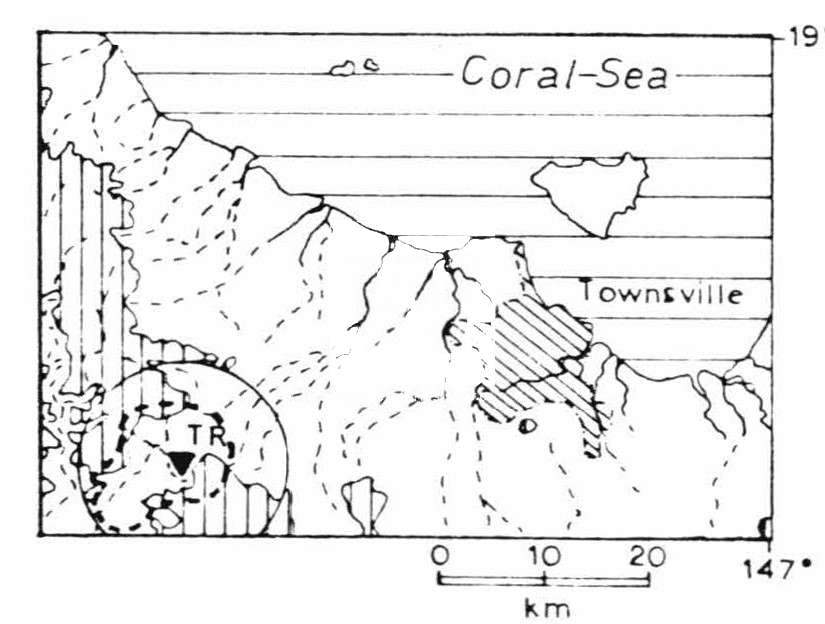
Townsville surprisingly has a lot of Aboriginal rock art to offer within half an hour's drive, roughly the traditional land of the Coonambelah People and the northern extremity, south of the pinnacles, of the Bindal (or Biri) People and Hervey Range while coastwards and towards Hidden Valley, the Wulgurukaba (or Wulguru, the 'canoe people') Aboriginal tribe, northwards of the Star River to the Herbert River and on the coast from Paluma Range (near Crystal Creek and Jourama Falls) to the coastal plain between about Rollingstone and Forrest Beach was the Njawaygi (or Nawagi / Nywagai / Nywaigi), Deception Creek and Thunderbolt Creek were Gudjal and other areas were also traditional lands of the Girrugubba and the Warakamai People. For the Gugu-Badhun People, it is an extensive area going west of the Paluma Range, and for the Gurambilbarra Wulgurukaba People, from the Ross River north to about Rollingstone. The recently registered claim by the Nywaigi People covers about 840 km² south of Ingham and includes parts of the Charters Towers, Hinchinbrook and Townsville Council areas. The Wulgurukaba tribe also have claimed to be the Traditional Owner of the Townsville City area.
See this Map of Indigenous Australia.
All of these Aboriginal tribe's history will of course be very rich but unfortunately was nowhere near as well-recorded as in the Herbert or Tully areas. These areas and tribes demonstrate considerable research potential.
It must also be acknowledged that when the Benham family moved into this area in the 1880s, they were moving into Nywaigi country as very early European settlers of the Mount Spec area.
In 1846, James Morrill was shipwrecked from the Peruvian and was adopted by the Bindal people for 17 years before being found by 'white men' and returning to Brisbane.
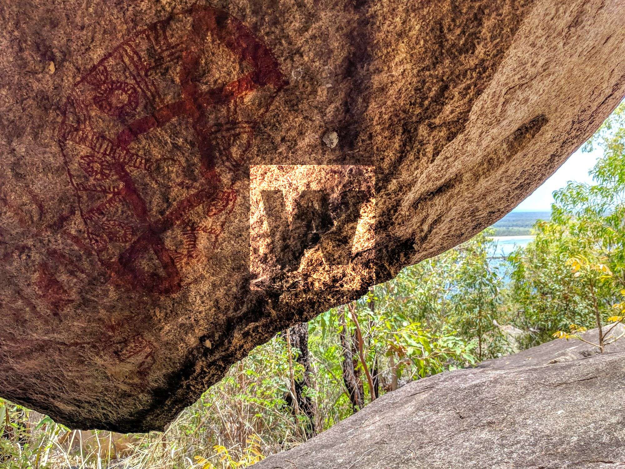
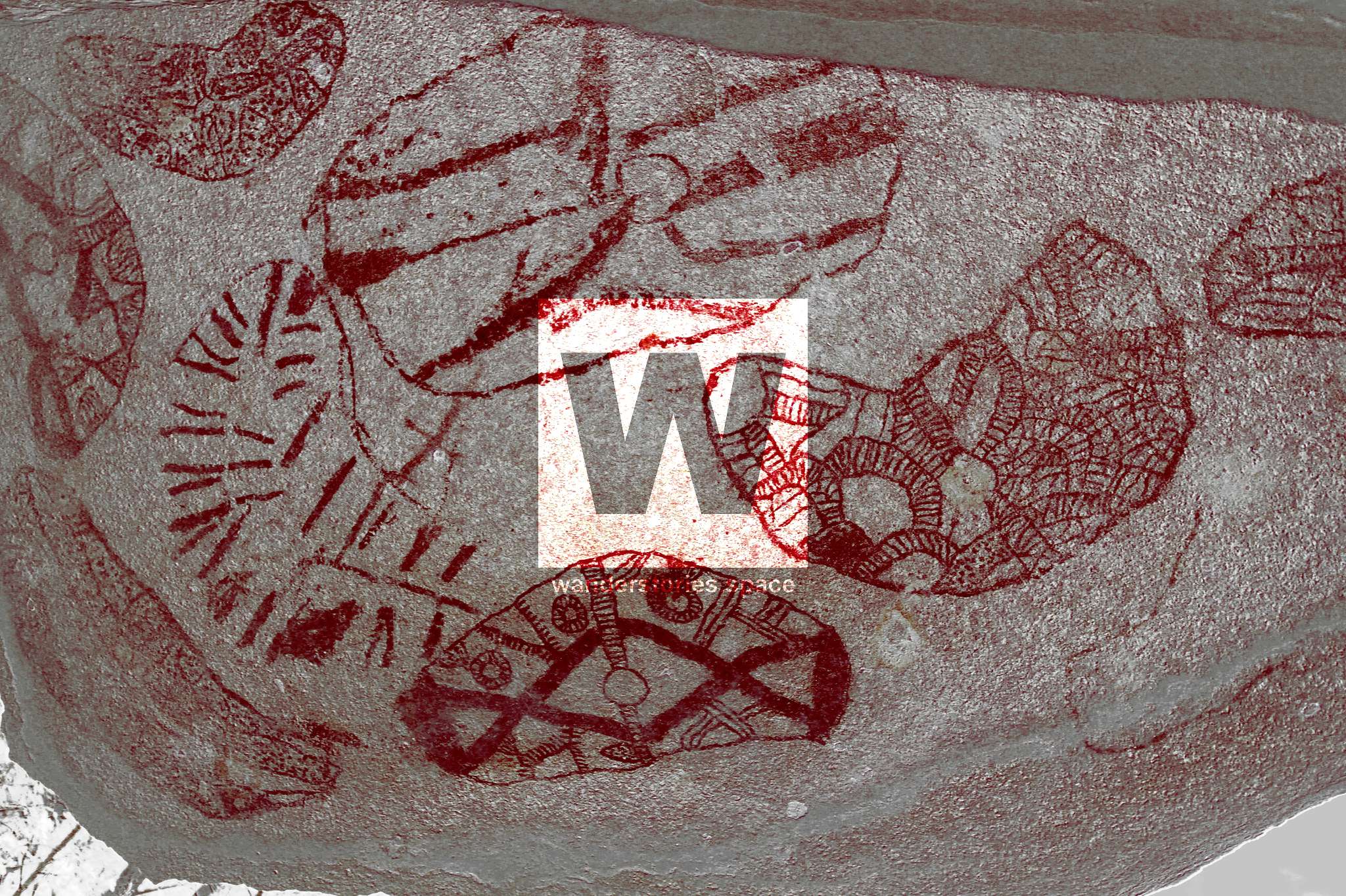
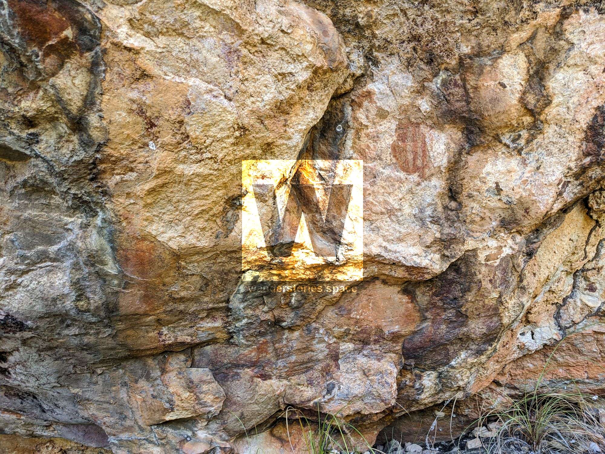
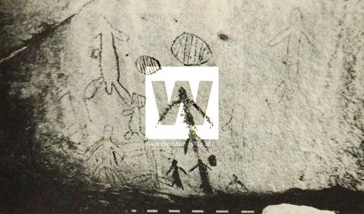
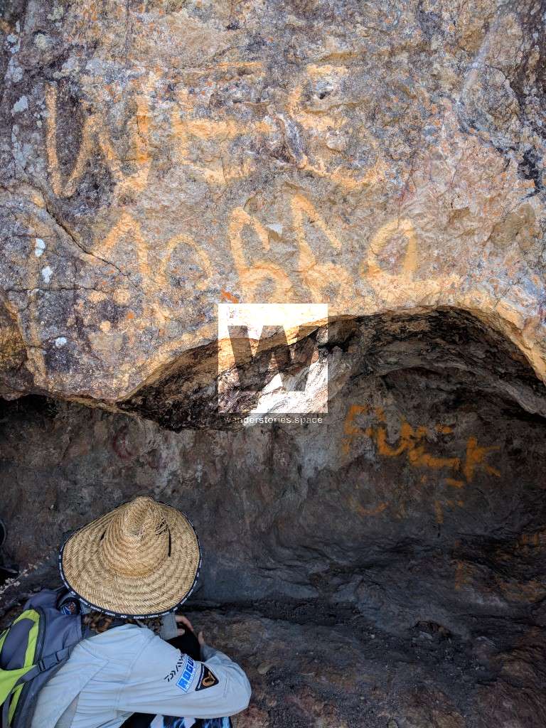
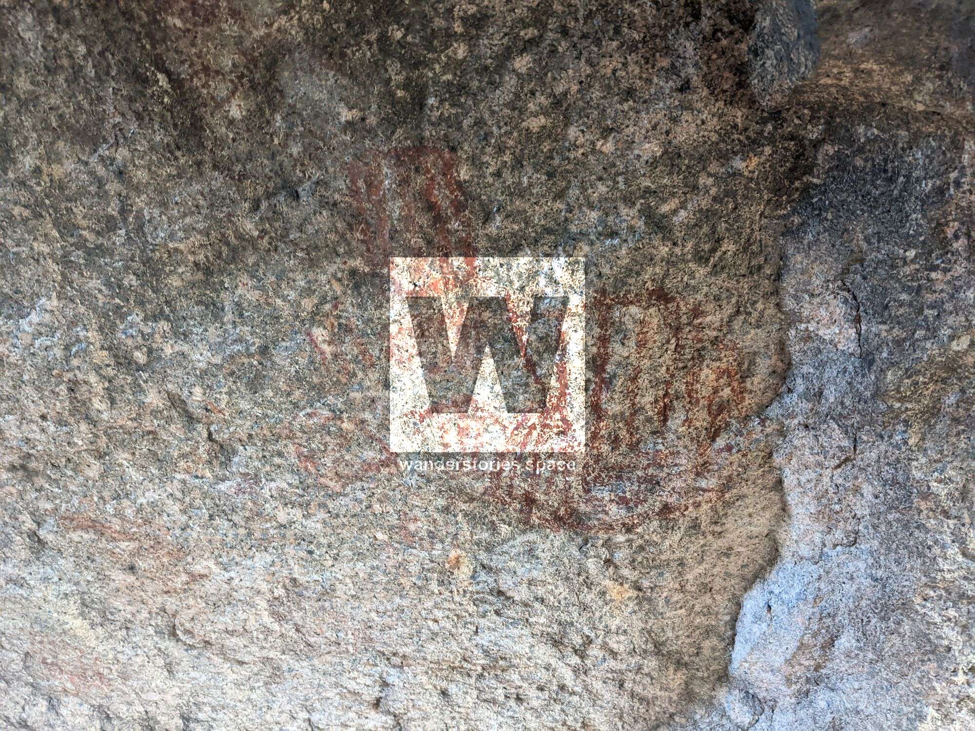
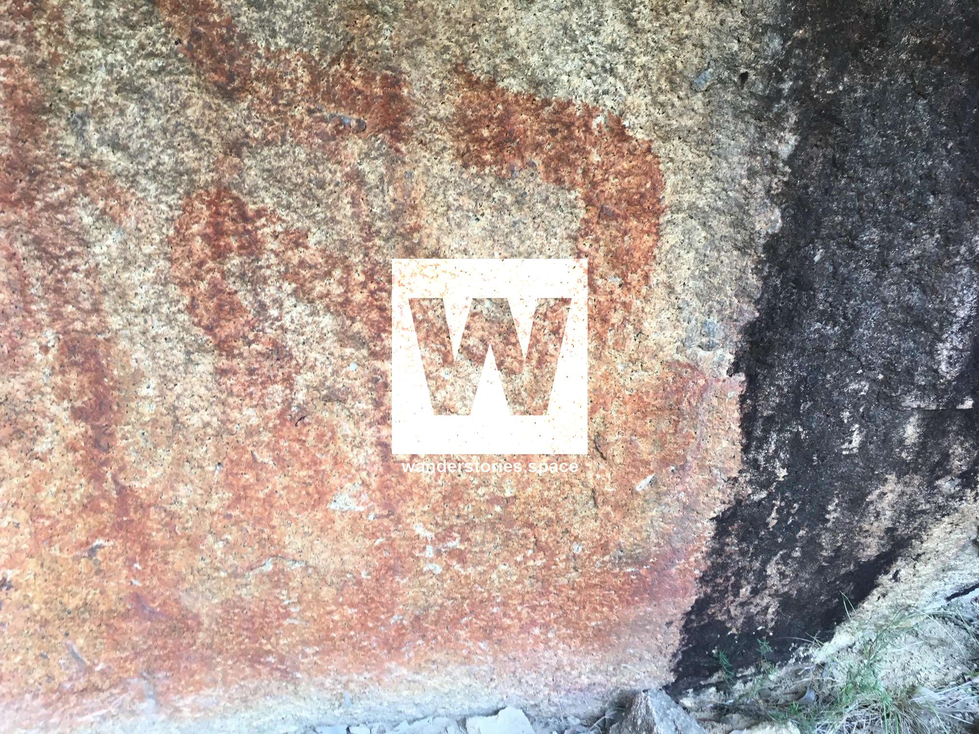
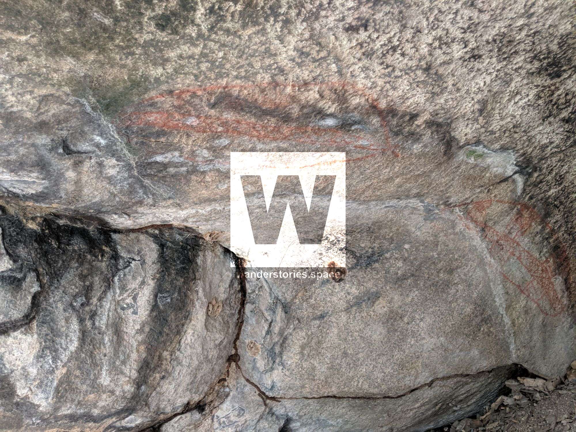
There are over 50 sites but most of the information and locations have been lost throughout history (this number includes some that are small groups of closely associated painted boulders). The only remains are a few mud maps and an illustration of 'shields'. Note that it is possible that these illustrations may not be 'shields' but a particular kind of motif that is only found in this immediate area. The majority of the sites are in the 'Clevedon' area. Access to these places can be problematic. As always, please respect and treat these places with great care. They are culturally significant and sensitive sites. Please do not graffiti or litter and dispose of human waste correctly. Traditional Owners should be the first contact when accessing these sites.
The map and illustrations are all based on the work of Helen Brayshaw who started researching local Aboriginal evidence in 1973 and produced a lengthy thesis in 1977, which was then published in 1990 as "Well Beaten Paths", by JCU. At some later date when fashions changed, they decided to shred their remaining stock but luckily they were rescued by Townsville Museum, where you can still buy a copy for AU$16. Elizabeth Hatte later revisited this topic and wrote "Boring Coastal Stuff". These and other publications can be found on the Trove website.
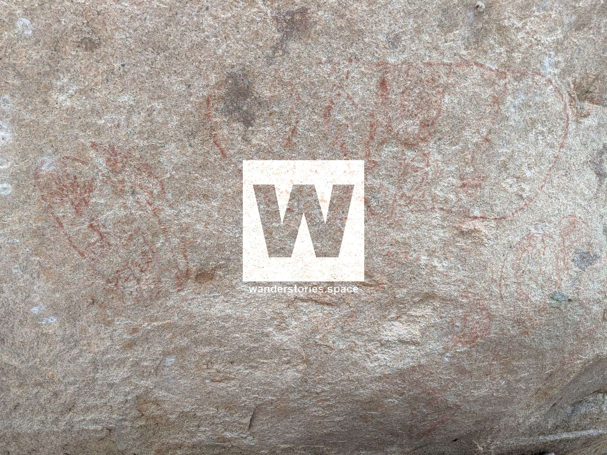
There is a huge story to tell about Aboriginal culture in the Townsville region, and there hasn't been any serious study since perhaps the 1980's and most of that has simply disappeared. As you may have gathered, a lot of the rock art is very faded, and sometimes software is needed to enhance and reveal the paint.
The Aboriginal shields were made about one to two hundred kilometres further north in the rainforest from the buttress root of rainforest fig trees (Ficus sp.), and were traded into the Townsville area. Used for battle and ceremony, they painted their shields and weapons for power, protection and identity. They also had a close association of shields with honour and manhood.
The lack of material culture remaining today to commemorate the Aboriginal occupation of the forests surrounding Munan Gumburu (Paluma) may have several causes. Within the Herbert / Burdekin district, the coastal ranges in the vicinity of Paluma appear to have been a boundary not only of linguistic groups but of general cultural associations. Aboriginal groups to the south and southwest of Paluma were associated with the culture extending to the Carnarvon Ranges. Groups north of the Herbert River were more closely associated with the rainforest Aborigines. The area between the Herbert River and Townsville shows some features of both groups, as a continuum between the two cultural types. For example, there is an overlap in the Townsville region of two distinctly different types of shields - the larger decorated type from the rainforest and the smaller club shield of the inland and south-east coast of the Herbert / Burdekin district. Similar diversity is found within the rock art sites found within a thirty-kilometre radius of Crystal Creek, The five sites belonged to three different language groups. The lack of a dominant cultural influence may have limited the examples of material culture recorded.
Bowling Green Bay National Park
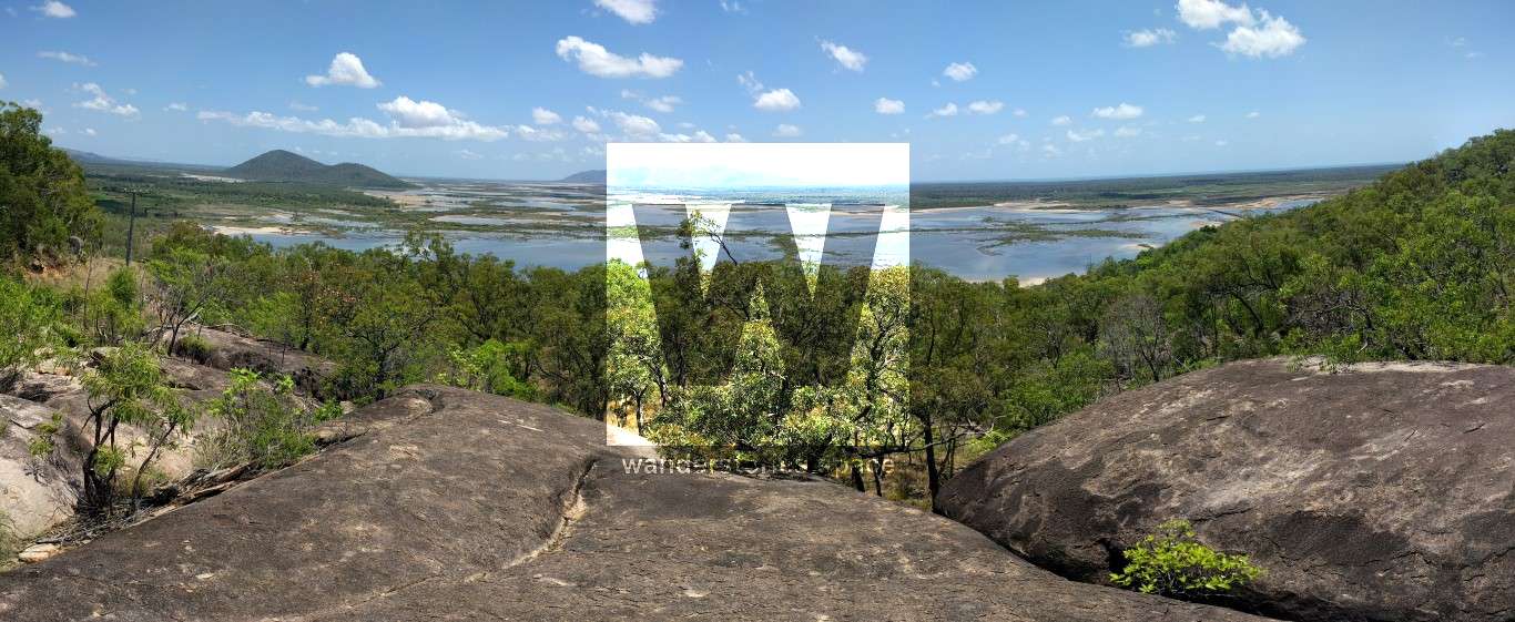
It is rumoured that Mount Elliot was set aside as a national park partly for the preservation of its rock painting sites. The eastern side of this park is extremely rich in sites. A major group of more than sixty painted granite boulders lies only metres from the main road (the Bruce Highway) just south of Townsville. This is the group on Mount Elliot's eastern side.
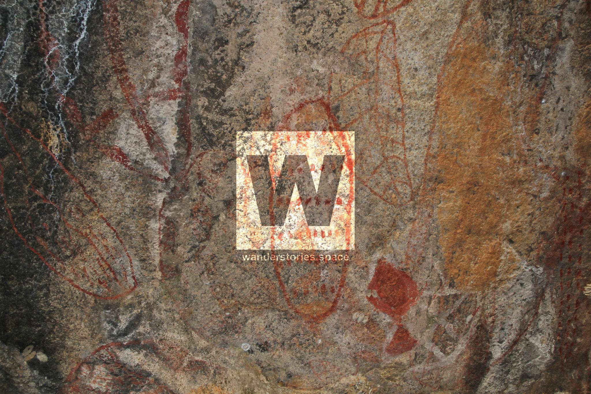
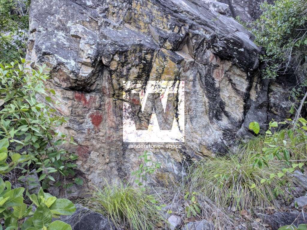
Located at the base of Mount Storth, this area is by far the best of the Aboriginal rock art around Townsville and is known as 'Clevedon' by some locals. When the highway was first planned to be built, it was going to go straight through the hillside which would have destroyed these historic sites. Thankfully that never happened.
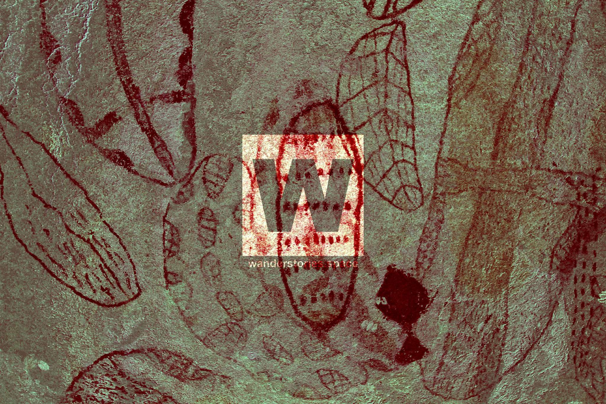
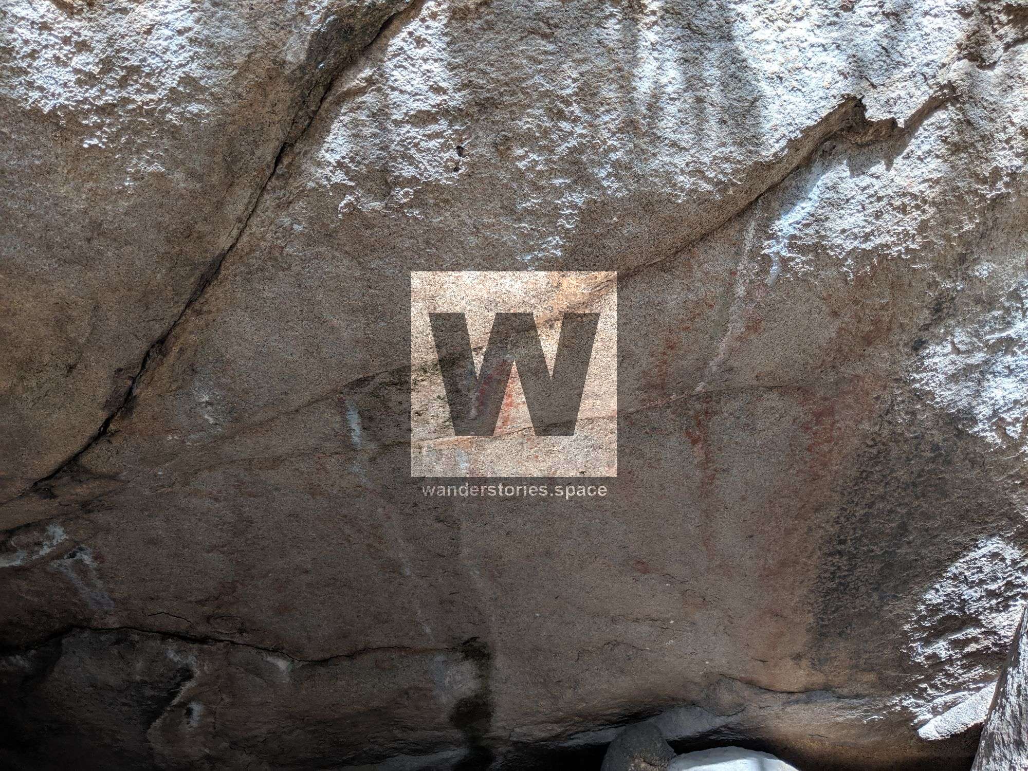
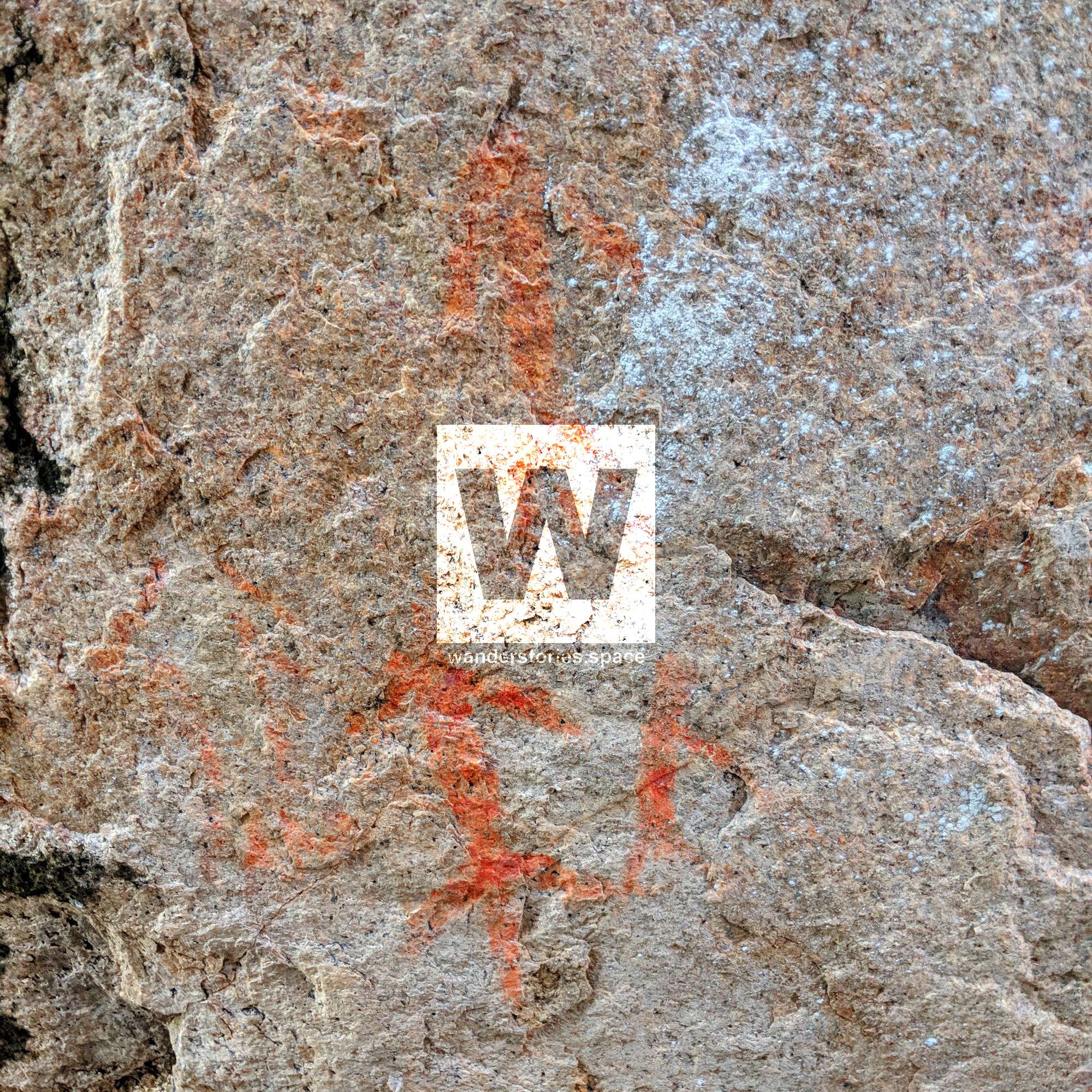
Before and after DStretch software enhancement; Photo credit John Elliott
With these numerous rock art sites in the Clevedon area, it seems that it may have been a highway along the coast also for the Aboriginals, perhaps also a meeting place.
They are well hidden so you will need to climb through and look around at all the rocks. Allow one to two hours to walk around to fully appreciate this significant area.
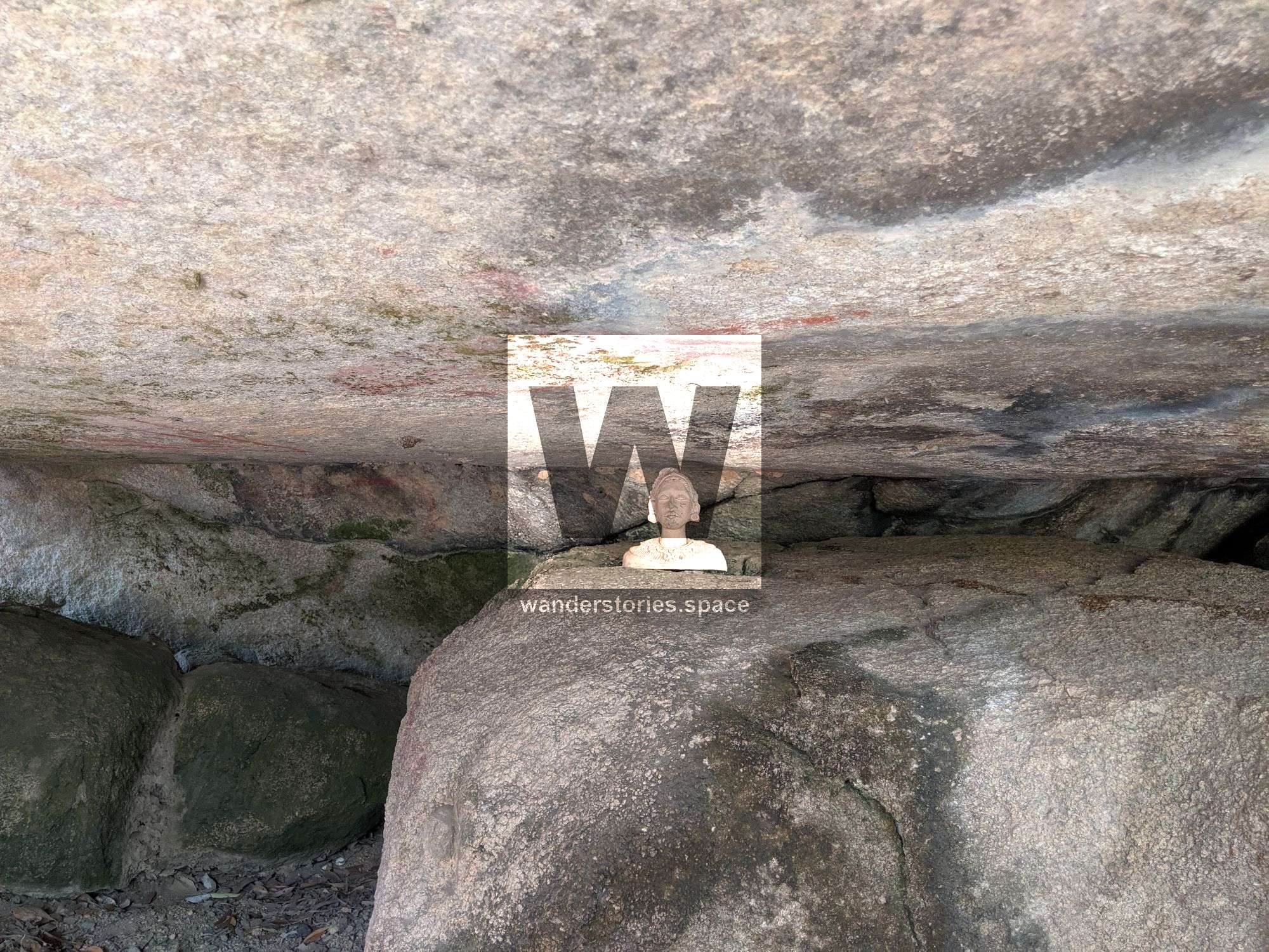
Aborigines use to choose specific areas to place their art. It needed to be a memorable area with features that stood out and had a canvas for their art which was protected from the elements, preferably where a slab of granite freshly peeled off revealing a new and unweathered, rock.
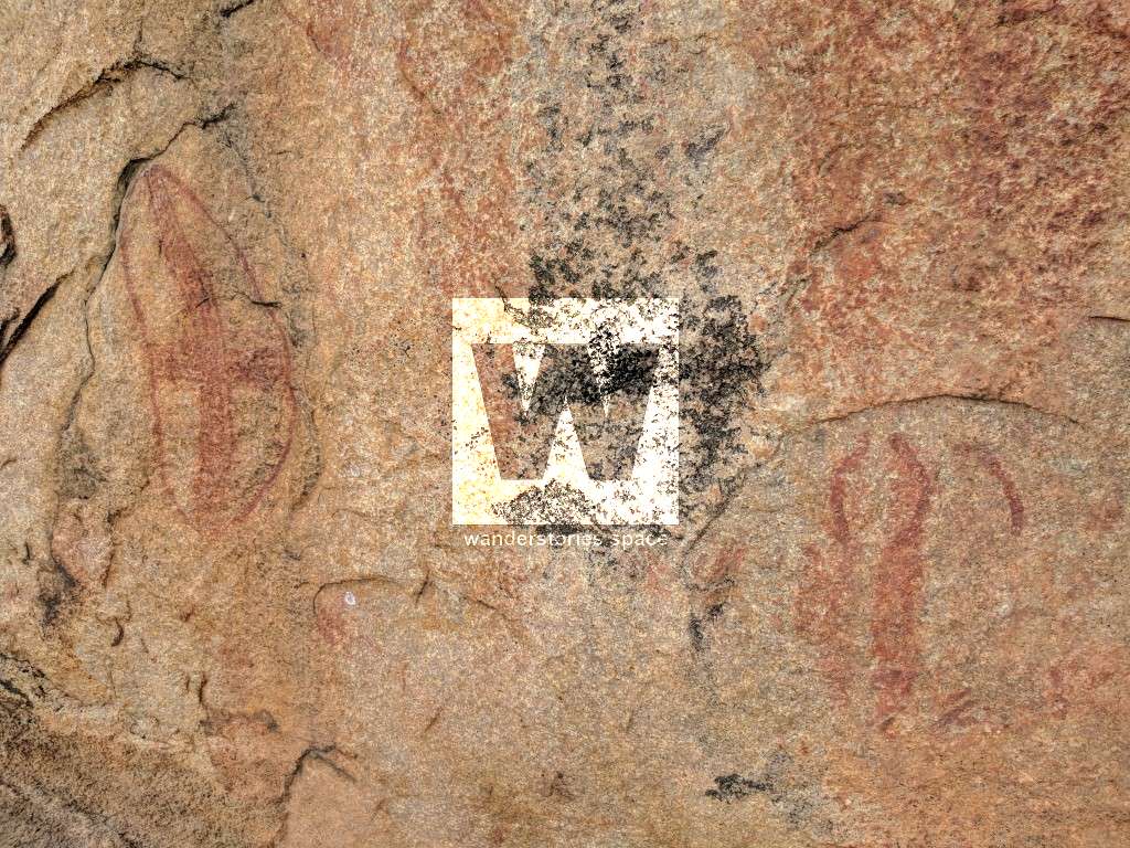
There are also several paintings out at Cape Cleveland near Cocoa Creek, Launs Beach and White Rock Bay near the beach below a large perpendicular rock. People who have researched these paintings are of the belief that there could be rock art just about anywhere. There are numerous rock shelters where there is no evidence of habitation.
Mount Burrumbush, also known as The Cone and Feltham Cone, is located near Burrumbush Creek southeast of Townsville within the Bowling Green Bay National Park.
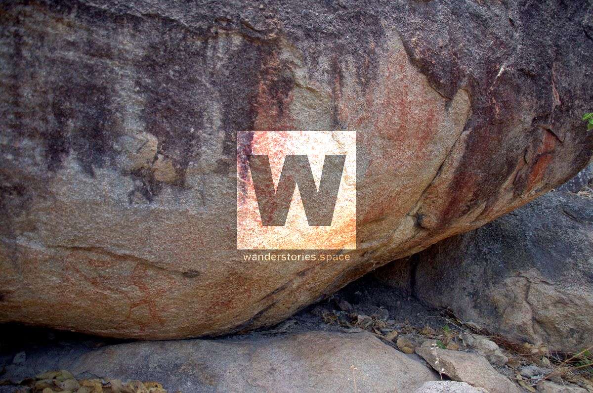
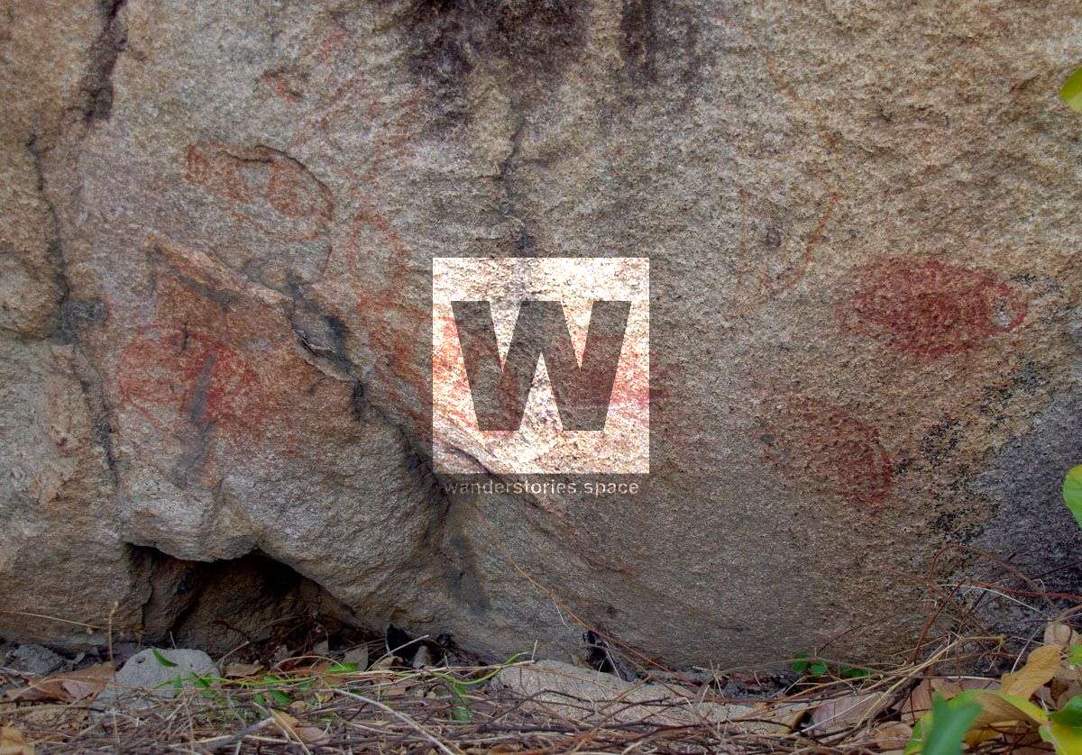
Photo credit Russell Cumming
There is also mud maps referring to sites at Mount Elliot seemingly near the fork of Alligator creek and Cockatoo Creek, and Major Creek.
Frederick Peak
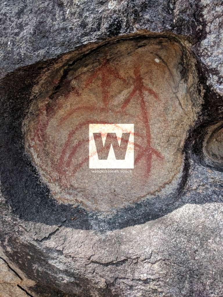
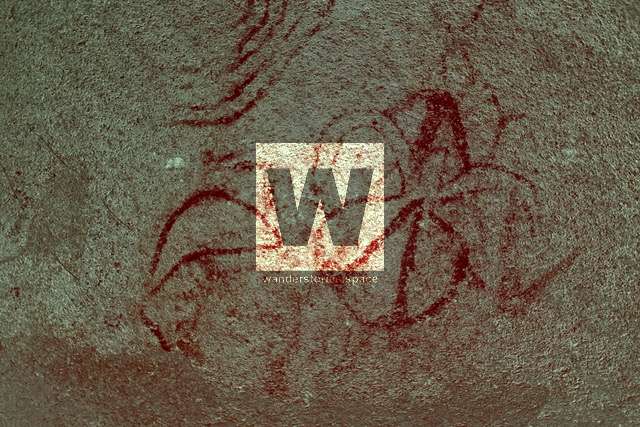
Frederick Peak is located just North of Townsville before Hervey Range. These prominent pinnacles are quite a sight and can be seen from almost every vantage point in Townsville. There are several sites located out in Pinnacles National Park.
Located near the South Sentinel, though these paintings have faded and rock crumbled; Photo credit Luen Warneke
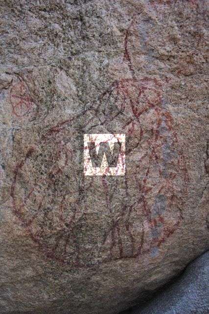
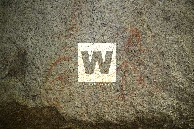
More art is scattered through the landscape.
Located near in the valley; Photo credit Luen Warneke
Hervey Range
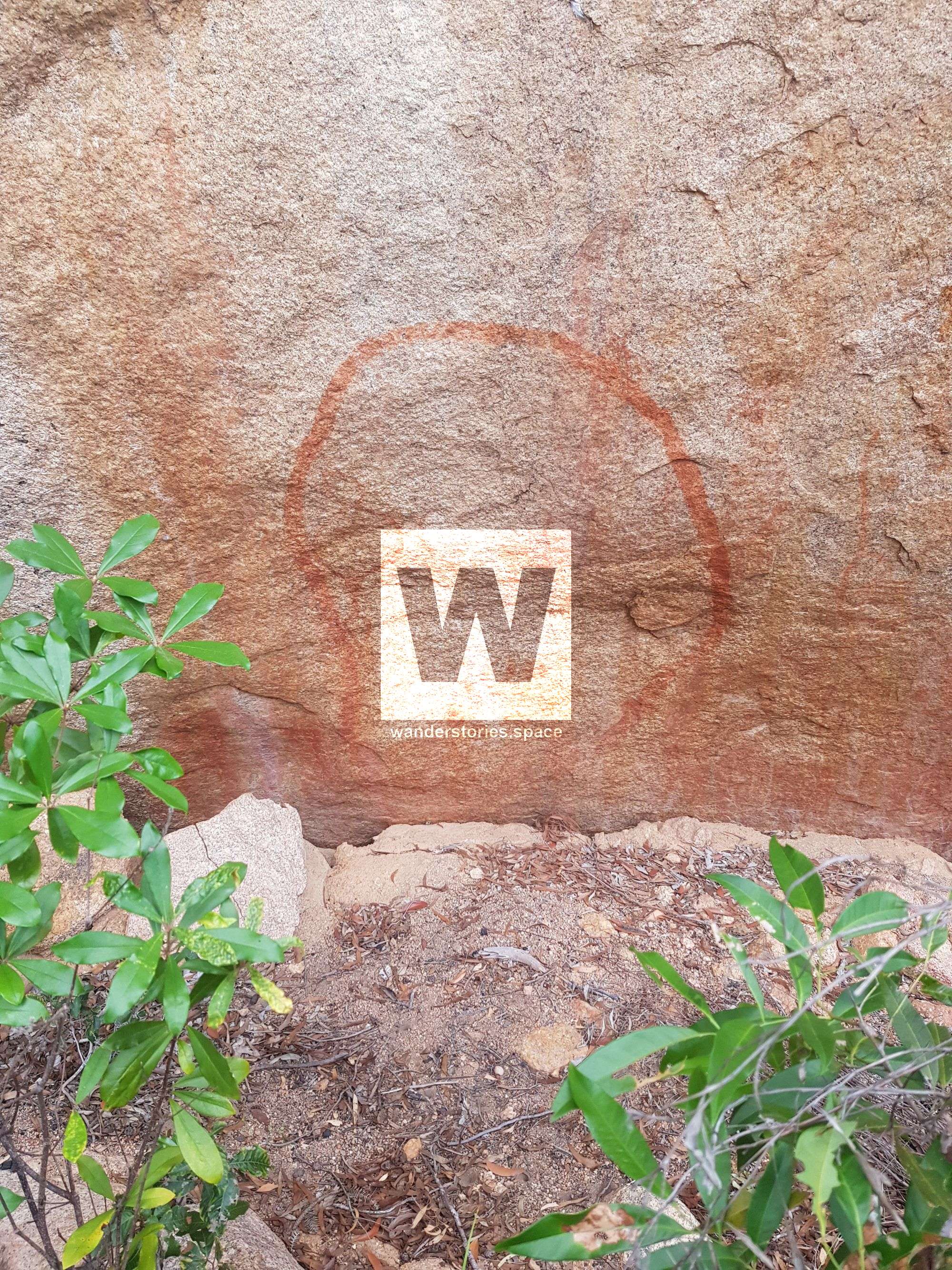
At the bottom of Hervey Range beside the highway is a bunch of large boulders featuring Aboriginal rock art. Climb a little further up the side of the Range near Hervey's Range Road to pass through a pretty special patch of closed forest to Palm Creek and possibly view an excellent example of Indigenous Rock Art. In the wet season, the Palm Creek cascades have a number of visitors.
These paintings are quite unique because a few of them were painted with laundry blue stolen from early European settlers. Before we had modern laundry detergents with optical brighteners, there was a mysterious little blue bag that was placed in the washing machine on the final rinse. This was called laundry bluing or blue. There is one faded blue painting and one that looks like it's has been gone over.
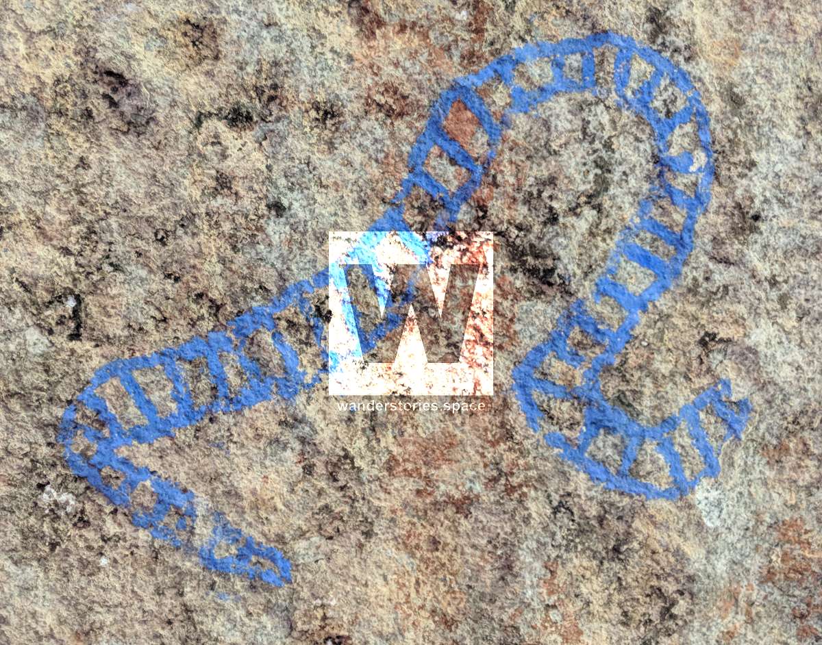
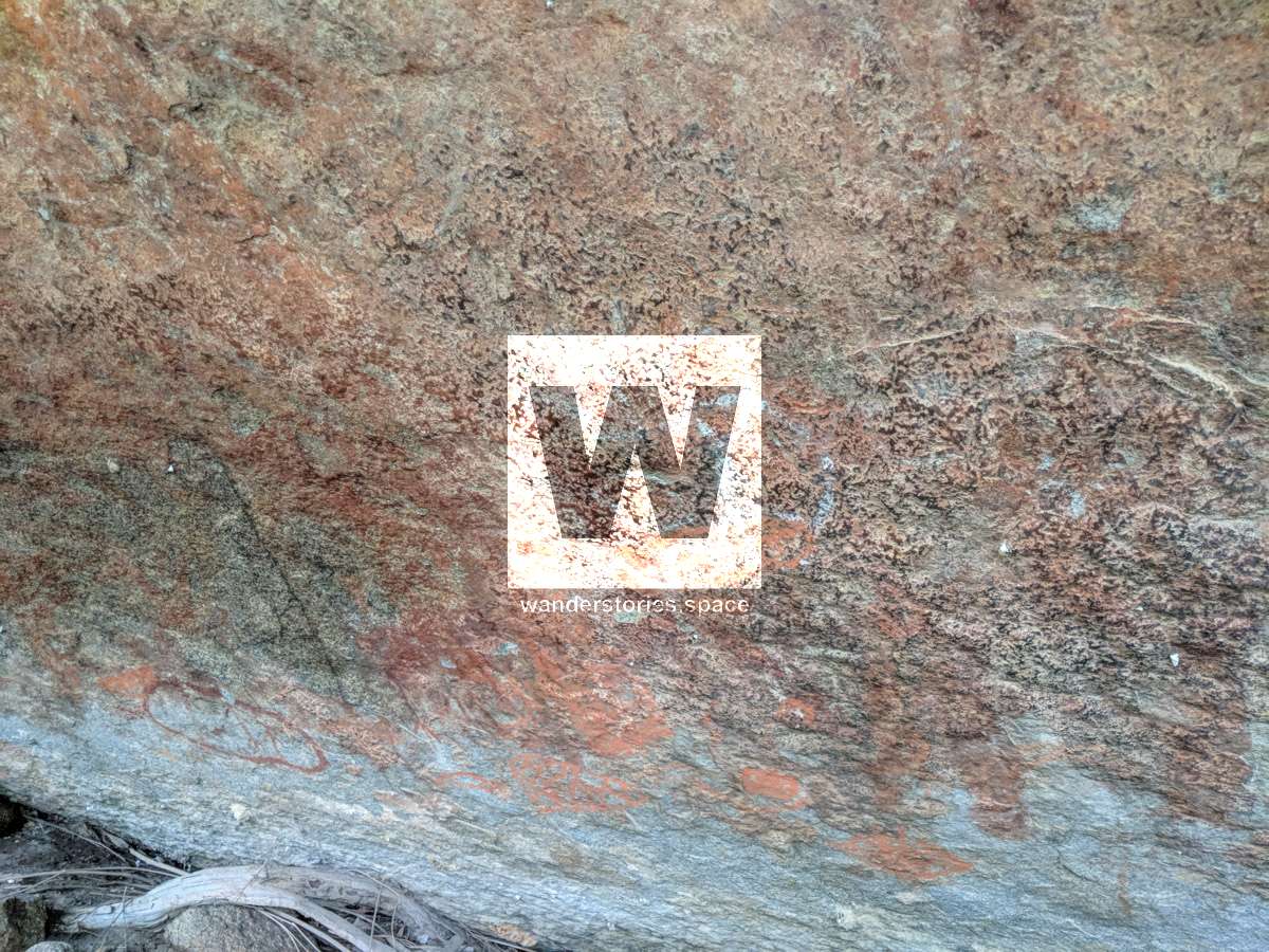
Photo credit Luen Warneke
There is also some that look new and non-Aboriginal.
From the entrance to the 350-metre tunnel, walk up to Thornton's Gap and on another ten-kilometre return to see another excellent example of Aboriginal rock art. This was an important indigenous route.
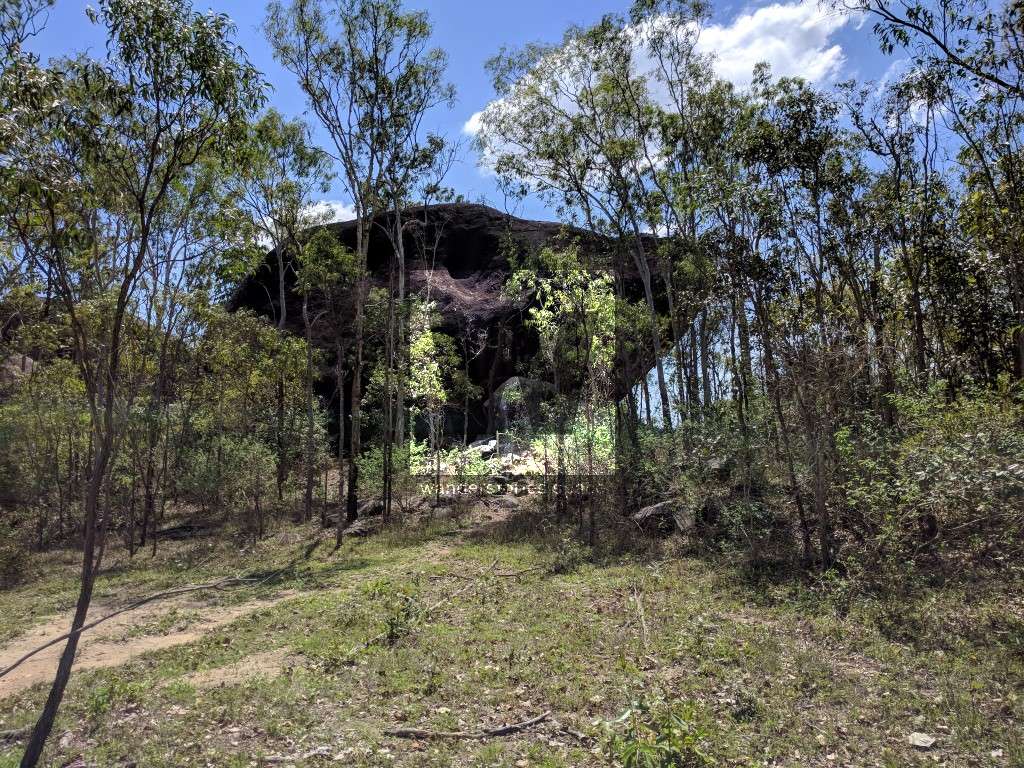
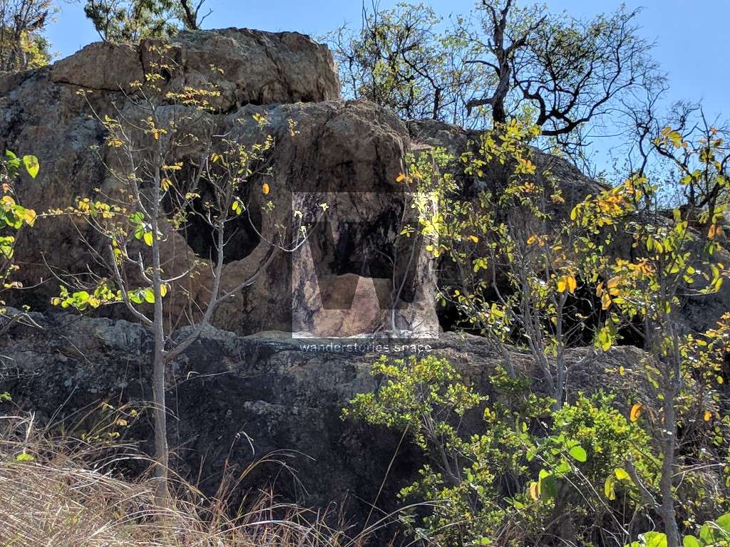
Turtle Rock is located out at Hervey Range on Table Top Station and is not a well-known tourist attraction. Even most of the locals do not know of its existence. Peel through the logbook when there.
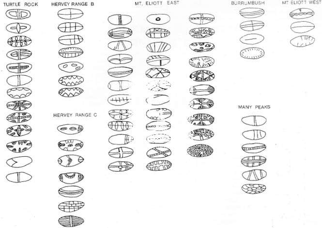
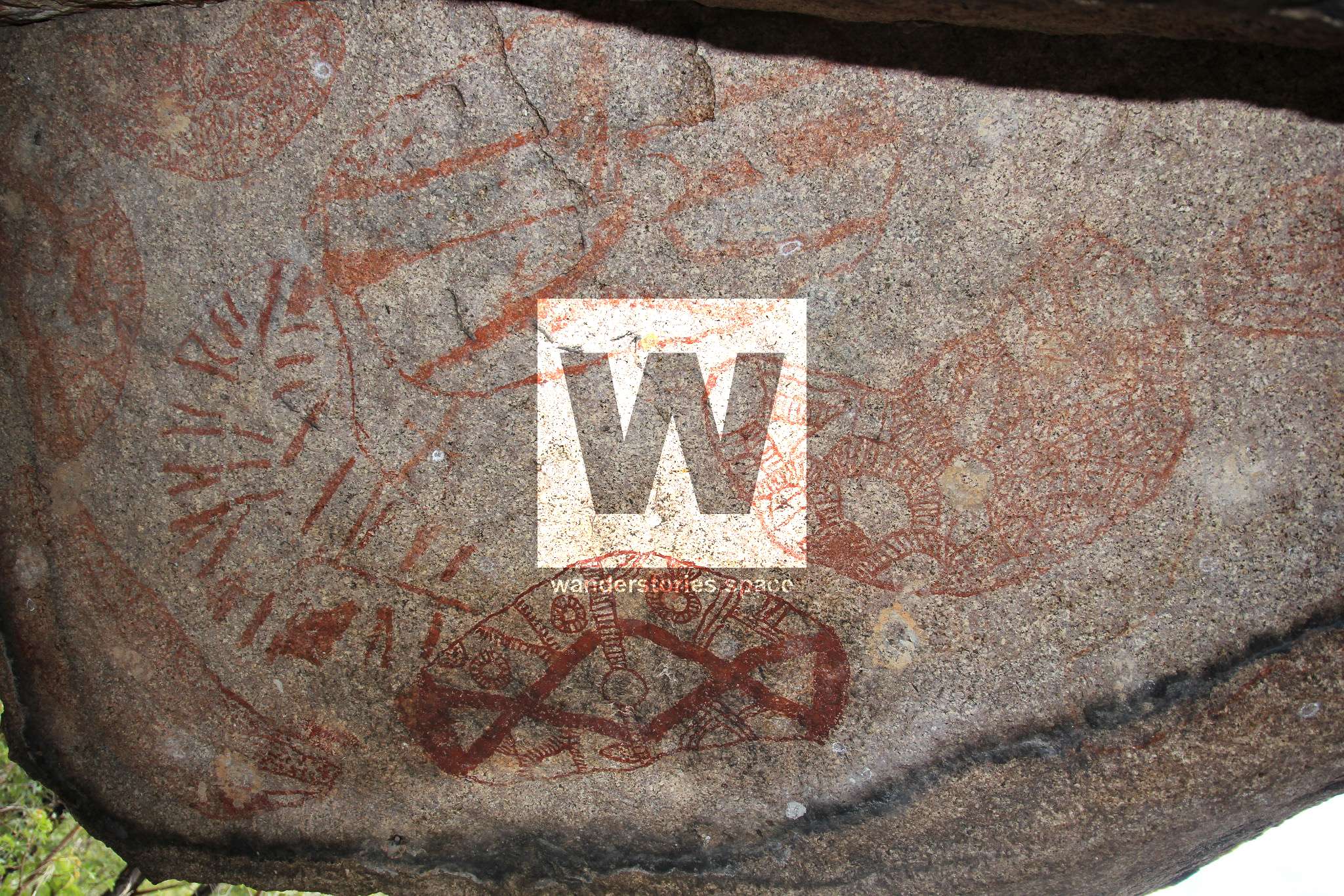
There are numerous ochre images on its overhanging roof, and archaeological studies have shown that the shelter was in use at least 4000 years ago, the work (1970s onwards) by Campbell, Brayshaw, and Hatte.
Beneath Turtle Rock's eastern side, there is a fairly spacious shelter with a palimpsest of rock paintings and with widespread though apparently shallow floor deposits. It's is basically one large rock that has an overhang where the entire surface is covered in Aboriginal art. There is in addition a crawl-space that connects the eastern entrance and the main area of rock paintings with a 'window' to the northwest.
Please note that permission is required by the Fryer family to access Table Top Station.
Turtle Rock is only a five-minute walk from where you park your car.
The vegetation is generally of the dry tropical savannah woodland type. Trees are mostly dry sclerophyll species but there are a few tropical rainforest species in the immediate vicinity, especially amongst the moister rocks and along the wetter creeks.
Turtle Rock Art Site has been a place of importance to Aboriginal people for over 4,000 years. Archaeological research here has shown that people lived in the shelter, cooked and ate their meals and made their tools in the shade of the rock. Materials in the site have been carried up to 20 kilometres and suggest that the site may have had some importance as a notable place or camp.
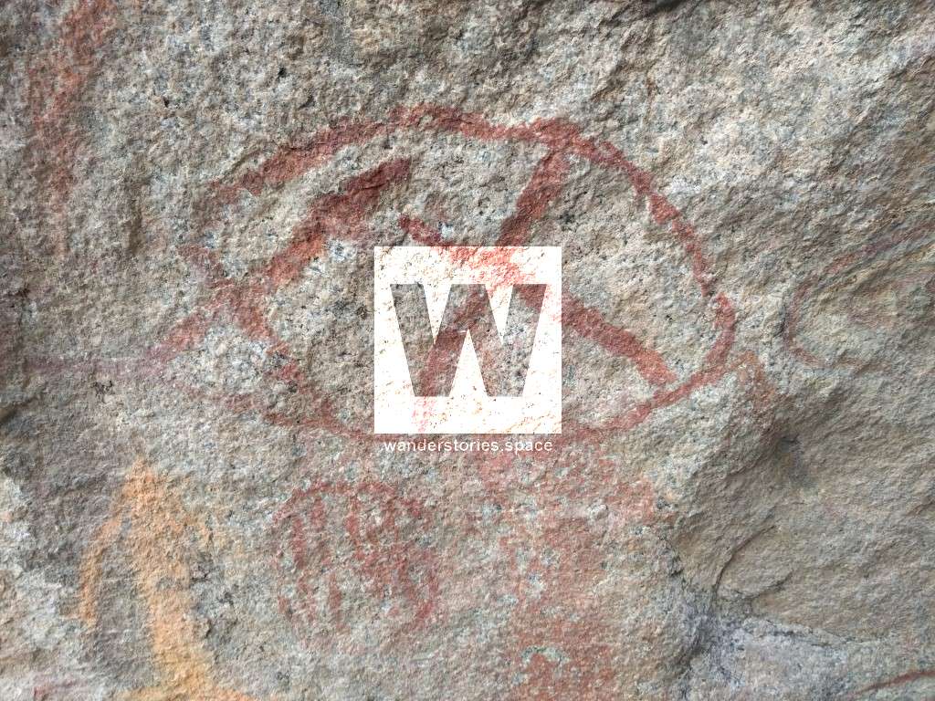
Art motifs at the site also indicate that social and spiritual activities took place here. The exact meaning of the art may not be known today, but this site still remains special to the Aboriginal people.
"Large pockets of well developed rainforest exist 30 km north-north-west of Turtle Rock and 55 km east-south-east at Mt Halifax and Mt Elliot, respectively. To the northeast the sea is just within 30 km where there are mangroves and many other littoral resources, not to mention the wealth of the Coral Sea itself. Freshwater is available close at hand for most of the year, and Two Mile Creek is nearly permanent and in better years never runs dry. Various fish, insects and molluscs are available, and indigenous mammals, birds and reptiles are still fairly abundant. However, indigenous people are no longer in the Turtle Rock/Hervey Range area and generally have not been since about 1915 at the latest." - Preliminary Report on 1977 Surveys and Excavations at Turtle Rock, Hervey Range, North Queensland - John B. Campbell
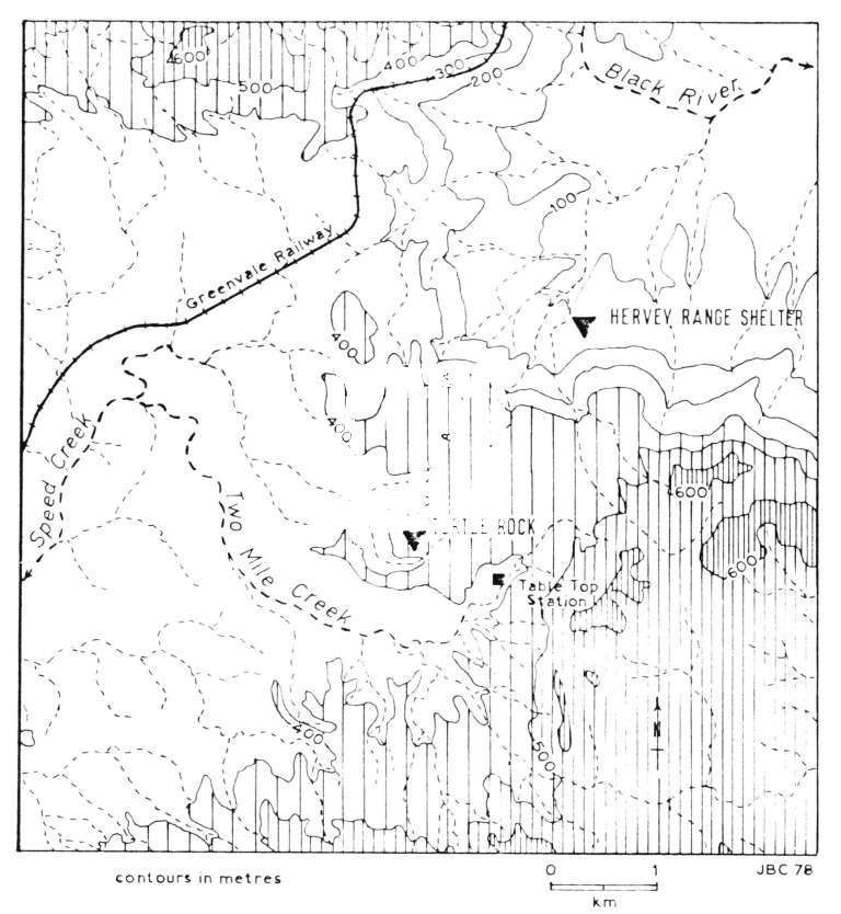
Turtle Rock location published in Preliminary Report on 1977 Surveys and Excavations at Turtle Rock, Hervey Range, North Queensland - John B. Campbell
There are also a few other sites in the area. One of which is south of Turtle Rock in the distance near the hills near Fanning River which is now Army Land; it is thought that it is near the small waterfall and slight mound out there. There is also a site near Leichhardt Creek in between Pepper Pot Mountain and Ross River Mountain and according to the mud map, there should be one out near Bunkers Hill and Redbank Creek.
Mount Louisa
I've recently visited this area and found out that this area has been graffiti. It's always sad to see history vandalised. However, there is only one painting in this area that is significantly faded. If you look towards the Louisa hills, you will be able to see a rock feature with several concaves. The painting is in the far right hole.
Mount Louisa sites graffitied; Photo credit Luen Warneke
Cape Pallarenda
Cape Pallarenda, also known as Many Peaks, Mount Marlow, and Townsville Town Common Conservation Park, was a gateway to easily access Magnetic Island at low tide.
There are two sites; one on the western end of Many Peaks and the other on the east. This western site is unusual in that it is almost out in the open and unsurprisingly, very hard to make out. It is just west of the Freshwater Trail, up the track a little and looks well visited by locals.
Many Peaks Range was the area that the Indigenous were contained in because of the growing population of Townsville in the 1860s, and they were controlled by Inspector John Marlow. Mount Marlow at Cape Pallarenda is named after John Marlow. So there may be a few more hidden Aboriginal art sites in this area.
Mandilgun / Gurrumbilbarra (Mount Stuart)
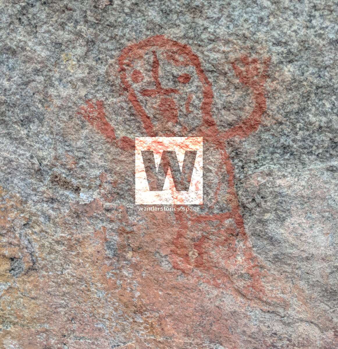
Though stick figures occur throughout the Townsville district in several sizes and forms, there is a great concentration of more than 100 at a single site on Mount Stuart, as well as at a similar site on Big Jack.
Also, according to the revised mud map, there may have been a site on Cutheringa (Castle Hill) but it's very hard to tell.
Munan Gumburu (Paluma Range National Park)
There are no reports of Aboriginal occupation of the Seaview Range, or its offshoot the Paluma Range, in the ethnographic literature Brayshaw surveyed and the only reported material culture nearby is rock art at Crystal Creek in the coastal foothills.
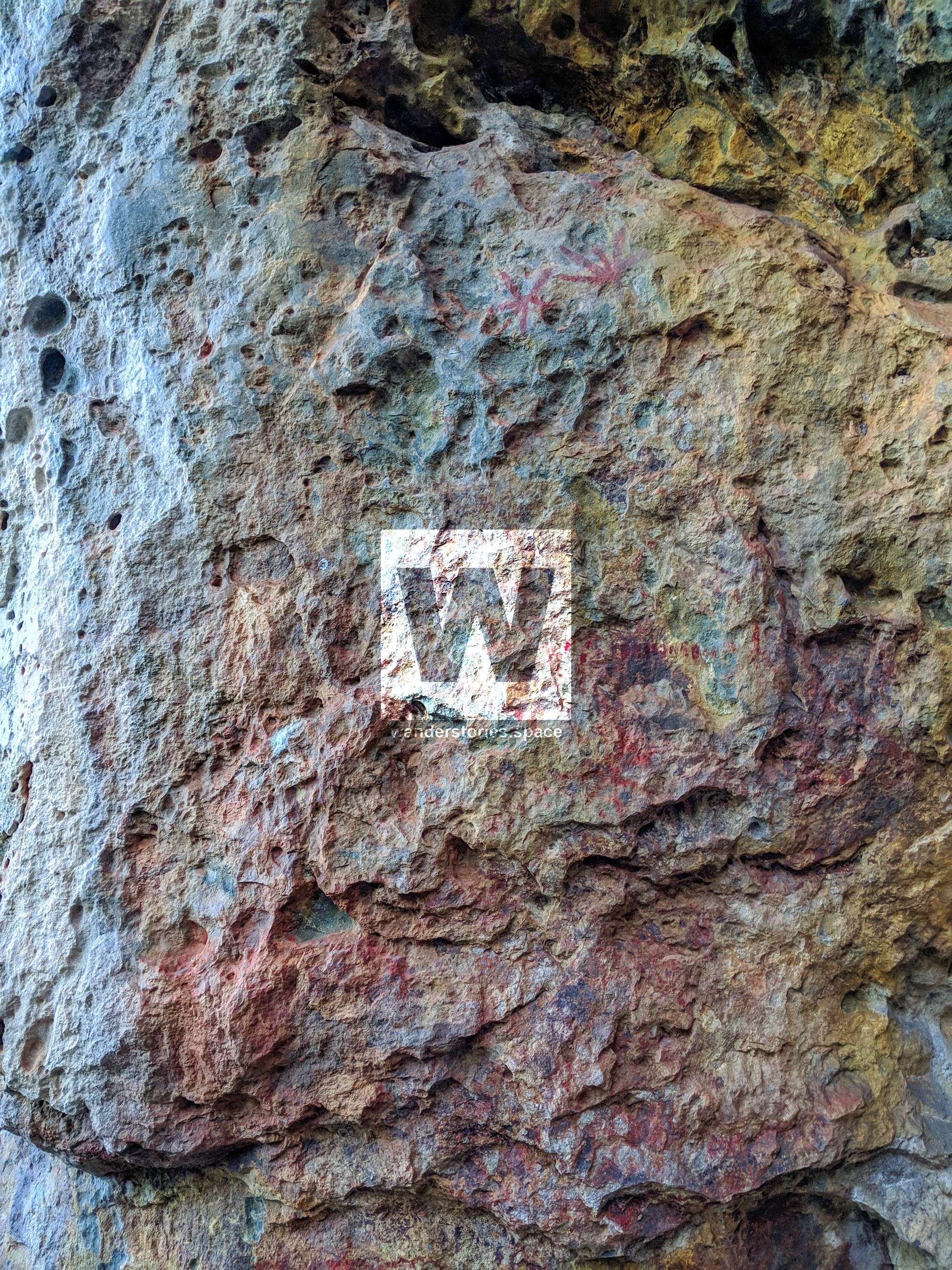
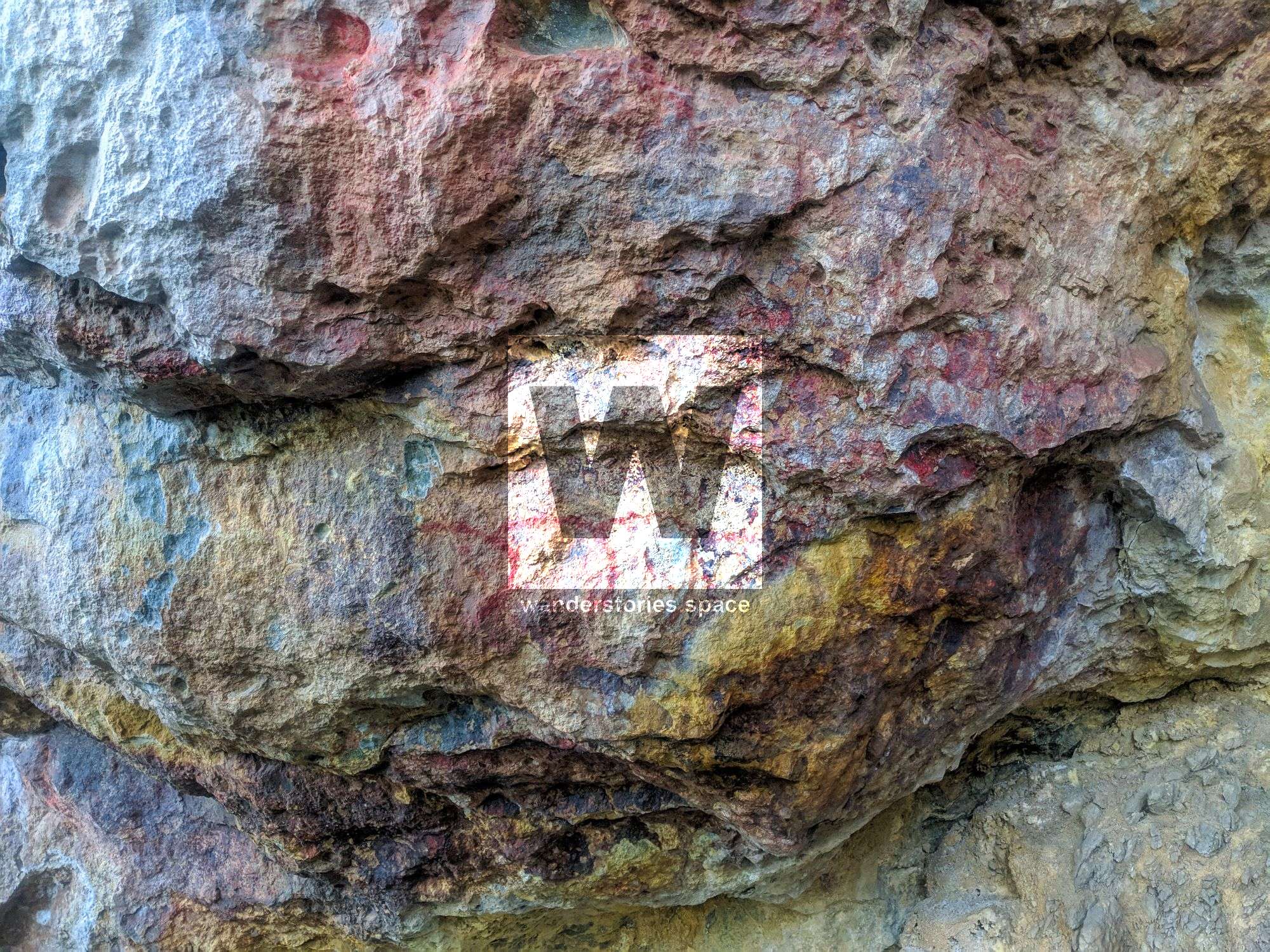
The only documented rock art sites near Munan Gumburu (Paluma) are paintings on granite in the open forest at Big Crystal Creek at the foot of the range. The thirty-eight drawings there are all red and are mostly linear. Only one of the five separate sites at Crystal Creek has solid drawings. Crystal Creek art included stencilling and shield-like figures. Only two sites showed any surface signs of occupation.
The Crystal Creek rock art sites recorded by Brayshaw are behind the Andrews' property. Bullocky Tom's Track ran from Big Crystal Creek up the ridges to Mount Spec and existed in April 1984 as an unmarked walking trail within Mount Spec National Park. Bullocky Tom planted the mango trees along the track at a location now shown on maps as the 'Mango Tree'. Two orange trees mark his grave on Mount Ruth, a small hill half a mile from Mutarnee, and the small creek bordering the Andrews property is now called Bullocky Tom's Creek after this early settler.
Under a rock, near Crystal Creek and next to Bullocky Tom's Track is a very faded Aboriginal painting. And Saddle Creek has a few.
Bullock Tom's Track (Crystal Creek area) - before and after DStretch software enhancement; Photo credit John Elliott
In the earlier days, Aboriginal tribes were numerous in the coastal area at the foot of the range. An old Aboriginal burial ground is located on the slopes of Mount Ruth. There are no records of native attacks in the immediate area - the nearest being at Pappin's Road, Hidden Valley, and Kangaroo Hills.
Towards the foothills in Mutarnee are a few other Aboriginal paintings. There are two trees that have been blazed at the base of the hill which marks the start of the walk. Just follow those trees straight up to the rocks. Death adders love this country so wear snake-resistant gaiters.
There is also a site near Jourama Falls in close proximity to the car park.
Hidden Valley area
There are several known sites around Hidden Valley & Blackfriars. One in particular is near Communist Cave, Thunderbolt Creek.
There's also another known site near Pine Creek.
Yunbenun (Magnetic Island)
Magnetic Island, known as Yunbenun to the Wulgurukaba Aboriginal Traditional Owners, is scattered with Aboriginal artefacts and rock art. Cockle Bay, near the island's southern tip, was a popular camping spot. Because the mangrove system sheltered mud crabs and grew oysters, the hunting in the bush behind the bay was plentiful. You could walk from the mainland across the salt pans to Pallarenda and then swim across the channel and reef flats at low tide.
Arcadia sites; Photo credit Luen Warneke
Red ochre is the only colour we use on the island in rock art sites. However, there is white ochre available but it was probably used for trading with other tribes. Magnetic Island had a small relatively permanent population of its own, but there are many indications that other Gurambilbarra people (story of Gabul) routinely used Magnetic Island.
Horseshoe Bay sites; Photo credit Luen Warneke
Rock art locations include Hawkings Point (the point between Picnic Bay and Rocky Bay), Bright Point (the point between Nelly Bay and Geoffrey Bay), Alma Bay near Alma Lookout and Petersen Creek, and Horseshoe Bay.
Palm Island Group
There's a small Aboriginal painting on Orpheus Island National Park to the left of Yanks Jetty. The Palm Island Group may hold several more sites like this.
How to get there
A few of these sites are right next to main roads but other sites require a bit of bushwalking. Please note that when bushwalking, there are no paths or tracks.
Map Hidden...James Morrill's History
James Morrill had a similar experience to William Buckley, who lived with Aborigines for over 30 years. Morrill was a carpenter that worked onboard the barque Peruvian. He was part of the crew and passengers who left Sydney bound for China on 27 February 1846. In a storm, the Peruvian hit and sank on Horseshoe Reef in the outer Great Barrier Reef off the coast from Shoalwater Bay, north of Rockhampton.
Twenty-two survivors made a makeshift raft, somehow crossed the reef, and then drifted northwards for over a month. They existed only on a diet of raw fish and because of this, the death rate rose rapidly. When the craft finally beached near Cape Bowling Green, south of Townsville, only five remained alive - Morrill, Miller, White, Captain Ritkethley, and Ritkethley's wife.
Miller disappeared and White died of malnutrition. Both the Pitkethleys and Morrill were adopted into Aboriginals. Pitkethleys joined a Cape Cleveland tribe, however, both died within two years. Morrill joined a neighbouring tribe centred on Mount Elliot for some 17 years. During 1861, prospects changed for Morrill when pastoralists pushed into the new frontier of North Queensland. Two years later his opportunity came when his hunting party of Aborigines came across two European station hands. He then made himself known to the men and return to European society.
There was some recognition of what he had achieved and his knowledge of the country and experience of the Aborigines were often consulted. He joined the Department of Customs at Bowen and in 1864 was part of George Dalrymple's expedition to Cardwell. Later in the year, he captained the Anel taking the first cargo to Cleveland Bay (Townsville).
Morrill died in Bowen in October 1865 where he was buried. A number of local Aborigines attended a mourning ceremony. Part of the country he lived in and journeyed through stretched between the Black and Burdekin rivers and includes the Mount Elliot area within Bowling Green Bay National Park. Alligator, St Margarets, Major and Spring creeks draining Mount Elliot are perennial and would have been a constant supply of water, except in the driest of seasons.
This article, and all other articles, are for entertainment purposes only and are not to be used as a guide. Please see our Disclaimer for more information.