Paluma to Wallaman Falls Trail (PROPOSED)
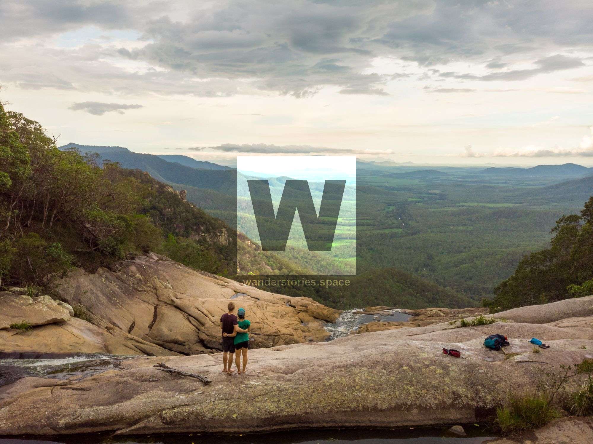
The P2WF Trail is designed as a mixed-use route for mountain biking, trail running, and walking that stretches approximately 127 km, taking an estimated 8 days and 7 nights to complete. It connects Paluma, a rainforest village, to Wallaman Falls, home to Australia's largest single-drop waterfall.

Location - Paluma Range National Park and Girringun National Park, North Queensland, Australia
Difficulty - TBD
Distance - ~127km one-way
Time - 8-days, 7-nights
The trail, set to be a walking, trail running, and mountain biking paradise, aims to span approximately 127 km, requiring an 8-day, 7-night commitment to complete. It would connect Paluma with Wallaman Falls, Australia's highest sheer drop waterfall while immersing visitors in the rich cultural tapestry of the Warrgamay and GuGu Badhun First Nations people. The Paluma to Wallaman Falls (P2WF) trail is an ancient First Nation trading line, a language line and a songline. The trail is poised to be an immersive experience, interwoven with dreamtime stories and deep connections to the land.
Eco-friendly accommodations and campsites will be available at 11-15 km intervals for walkers and 30-40 km for mountain bikers. The trail design considers various considerations such as cultural significance, community feedback, and environmental impacts.
Route and Maps
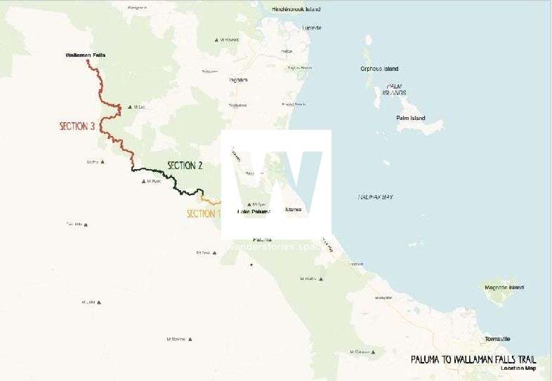
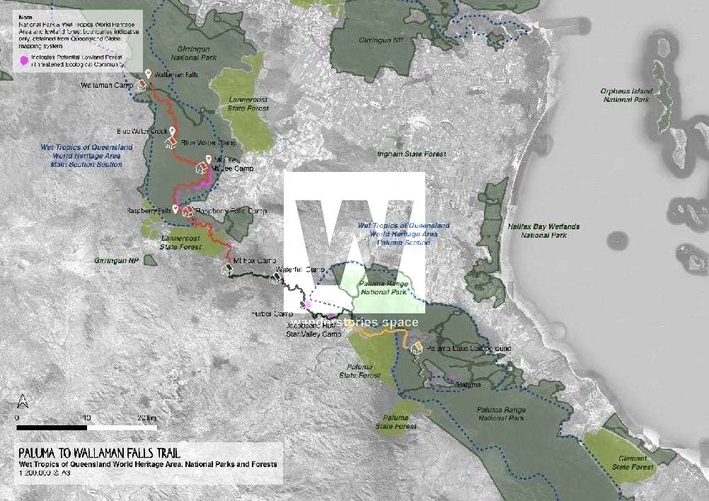
The initial two sections offer a multi-use trail experience connecting Paluma to Mount Fox, accommodating walking, trail running, mountain biking, and various adventure events. Section 3 is focused on walking and trail running, as mountain biking is not catered for.
This would make for a great addition to the PRB Track (Paluma, Rollingstone, Bluewater), where walkers can start at Bluewater, Townsville.
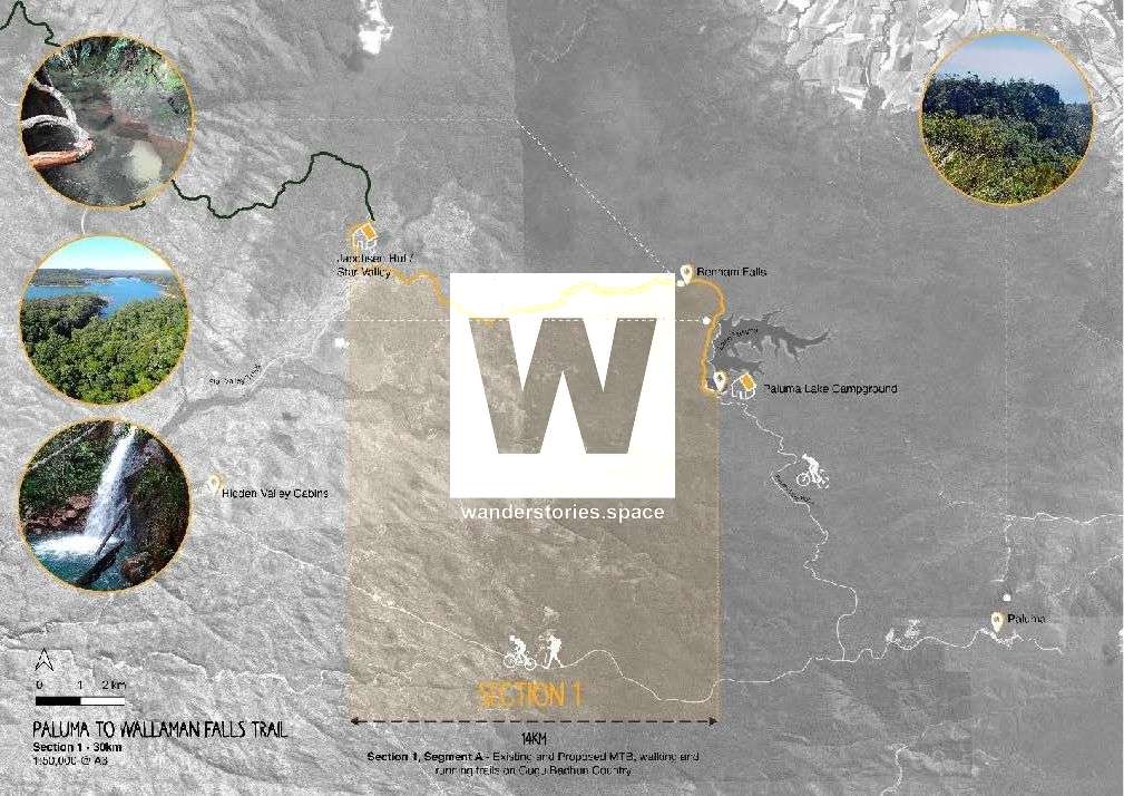
Section 1: Paluma to Hidden Valley
Segment - Paluma to Paluma Lake
Distance: 12km
Duration: 3-5 hours
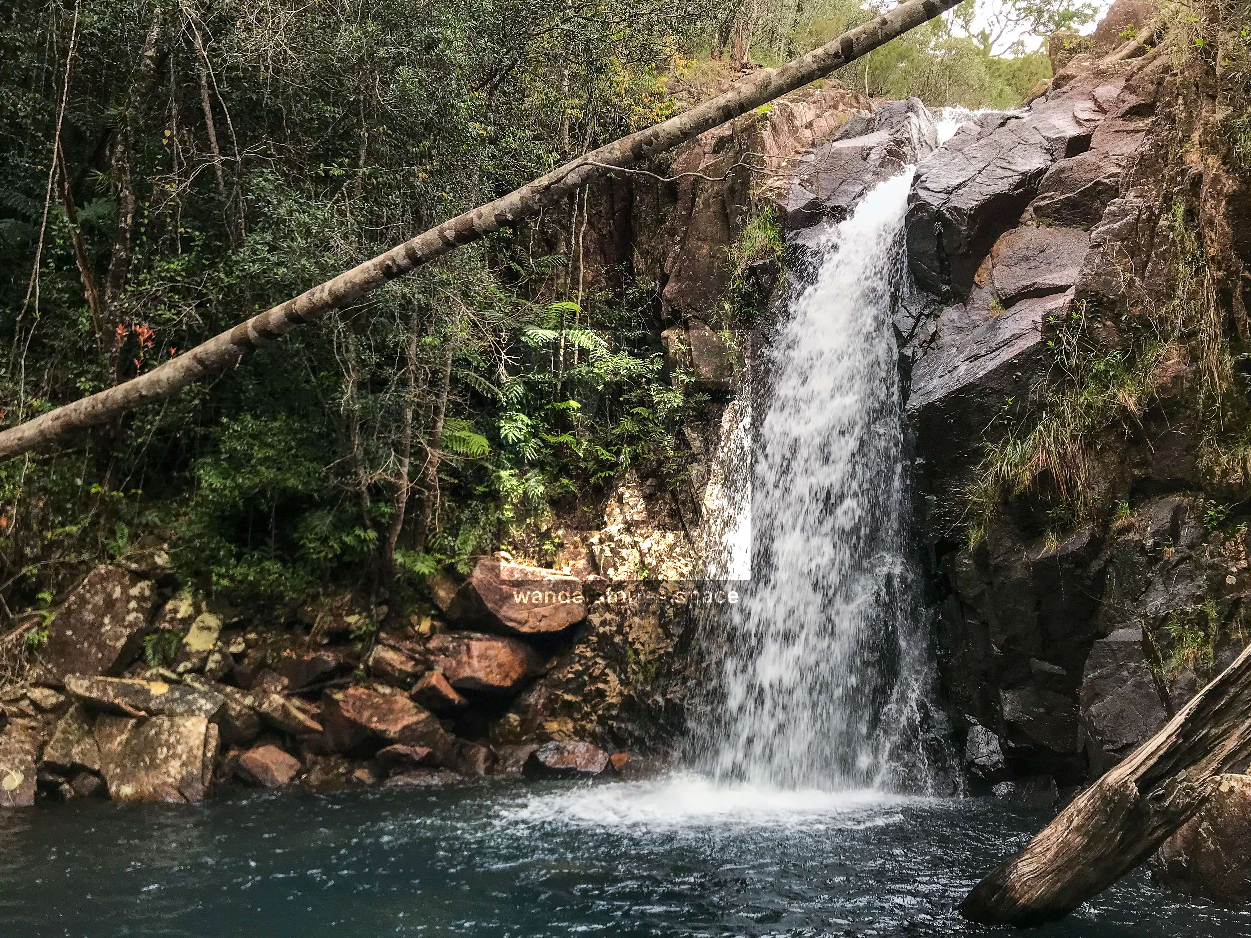
Starting in Paluma Village, walk the existing tracks to Paluma Dam. With side tracks to Crystal Falls & Wilfred's Lookout.
Segment A - Paluma Lake to Star Valley
Distance: 14km
Starting at the Paluma Trail Head, the route suits walking and trail running. Trails from Paluma village take you out to Paluma Dam, and the unsealed Paluma Dam Road offers an added dimension for mountain bike (MTB) enthusiasts and a drop-off point for extended rides. Stop off at Ethel Falls, Mossy Falls, Birthday Falls, and Benham Falls. The Lake Paluma Campground is also accessible by vehicle. Existing narrow forest tracks are available for MTB and trail servicing. Shared-use sections run through rainforest areas, with dedicated walking and MTB single tracks opening up as the terrain becomes less dense. Star Valley Track and Hidden Valley offer servicing, drop-off, and pick-up options. There are also several options to camp around the dam: Lake Paluma camping, DCK Shelter (Private Property), Johnstone Clearing, and Shay's Clearing.
The trail includes branches to scenic spots like Lake Paluma and Jourama Falls (Jacobsen Track) for aquatic activities. Cyclists can link up with existing forest tracks via Paluma Dam Road. Mountain bikers can either loop back to Paluma through Hidden Valley and Star Valley Track or proceed along the Paluma to Wallaman Trail towards Mount Fox Road. Offering spur trails to Jourama Falls and a host of other detours.
Furber Camp, situated near Furber Road, makes servicing and transfer activities convenient. Forest tracks provide access from Furber Road to the southern part of Waterfall Camp and Round Top. The trail alignment is parallel to Ewans Road. Private tracks may offer negotiated access points, dividing the land into smaller holdings.
Section 2: Hidden Valley to Mount Fox
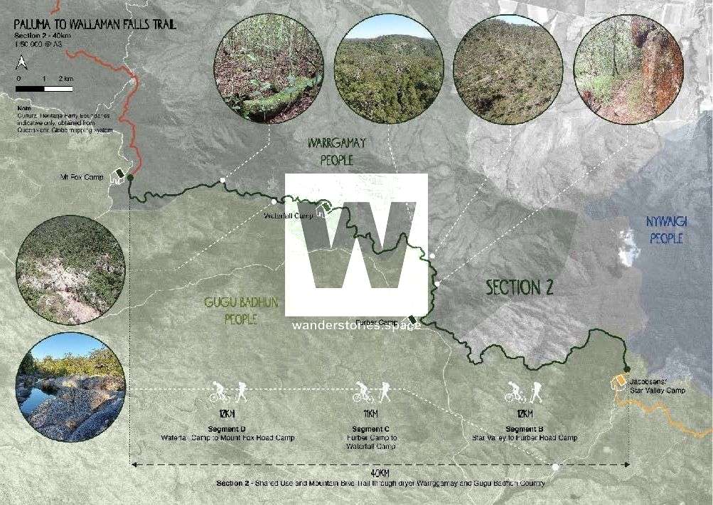
Section 2, stretching from the Star Valley Track intersection to Mount Fox, features purpose-built shared trails and exciting single tracks for mountain bikers, walkers, and trail runners. These trails allow users to immerse themselves in evolving landscapes, with segments offering panoramic views, waterfalls, and unique features. Some sections, like Round Top, will require cyclists to dismount and walk due to challenging terrain.
Segment B - Star Valley to Furber Camp
Distance: 12km
Jacobsens Star Valley Camp to Furber Road Camp.
Segment C - Furber Camp to Waterfall Camp
Distance: 11km
Overnight accommodation options for cyclists include Hidden Valley Cabins or camping at Hidden Valley Cricket Ground. This allows riders to pace themselves for a more leisurely journey to Mount Fox Road the next day. Additional mountain biking experiences, such as the Seaview Range descent, gravity, and downhill riding, are under exploration.
Segment D - Waterfall Camp to Mount Fox Camp
Distance: 12km
This section would include Upper Stone River waterfalls and bushland vegetation.
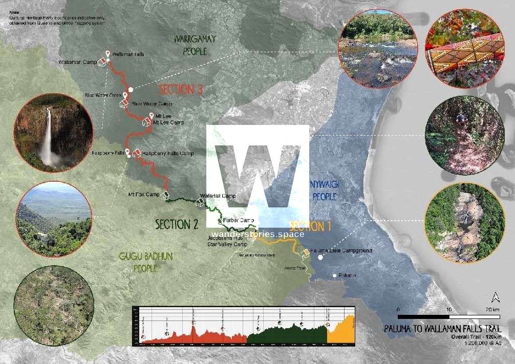
Section 3: Mount Fox Road to Wallaman Falls
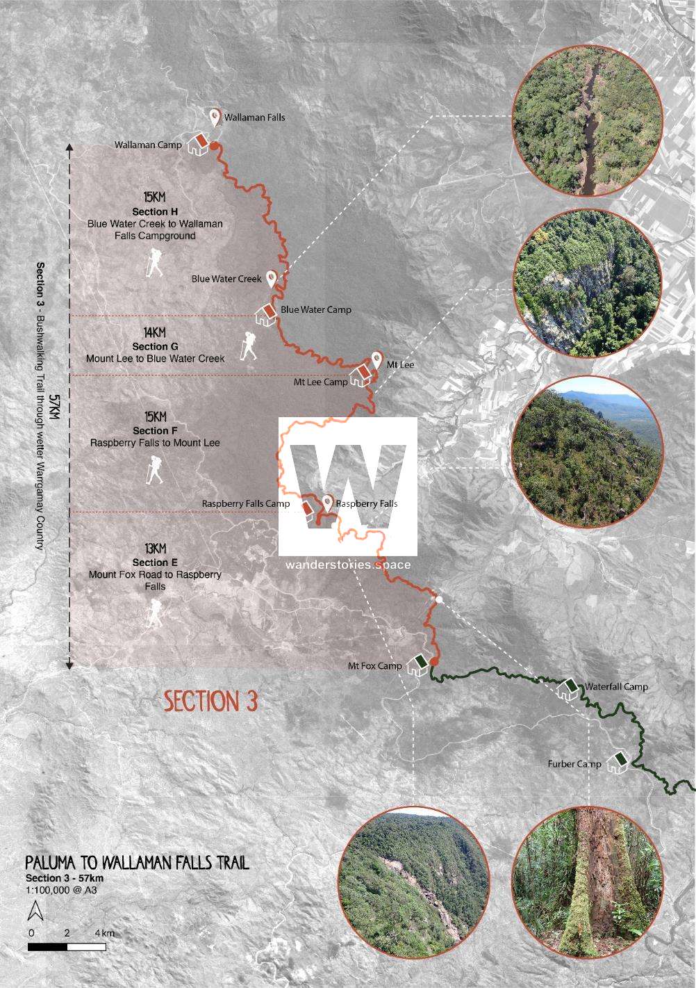
This 57km segment traverses some of the region's most untouched rainforests and riversides, primarily within the acclaimed Wet Tropics World Heritage Area. The focus is on walking and trail running, as mountain biking is not catered for. The trail offers access to the finest bird-watching locales and is recognised for its remote natural beauty.
Segment E - Mount Fox Road to Raspberry Falls
Distance: 13km
Partial vehicle access is available to Raspberry Falls as a drop-off and pick-up location. However, servicing this area is challenging and may require developing new trails or helicopter services. Beyond Raspberry Falls, access becomes limited to walking or air travel. Coordinating drop-off and pick-up will be essential for those opting for the complete 3-night, 4-day experience.
Segment F - Raspberry Falls to Mount Lee
Distance: 15km
While plateau and gorge areas near Mount Lee were considered, they didn't offer the same unique appeal as other portions of the trail.
Segment G - Mount Lee to Blue Water Creek
Distance: 14km
However, the connection to Blue Water Creek adds diversity to the trail and provides ideal locations for cabins and campsites above flood levels. Blue Water Creek near Wallaman is primarily accessible by foot. Modern cabin designs in these areas are configured to accommodate helicopter drop-ins.
Timeline
In 2019, $450,000 in Commonwealth-State funding was allocated to initiate a strategic business case and assess the feasibility of the trail. To underline their commitment, the Queensland Government announced an additional $2 million in funding in July 2022 for the project's next phase, focusing on environmental and cultural assessments, among other vital activities.
- December 2019: Project announced
- December 2020: TRC Tourism engaged
- June 2022: Final strategic business case delivered
- July 2022: Additional $2 million funding announced
- Late 2022: Stakeholder consultations planned
- 2023: Early works and further planning
Economic and Community Impact
With a strategic ten-year delivery program in place, official estimates project trail user numbers to grow substantially:
- Mountain bikers: From 4,000 in year 1 to 10,808 in year 10.
- Walkers/Runners: From 5,000 in year 1 to 15,075 in year 10.
- Total users: From 9,000 in year 1 to 25,883 in year 10.
Traditional Owners have been and will continue to be integral in shaping the trail, from initial planning to future enhancements.
See also:


This article, and all other articles, are for entertainment purposes only and are not to be used as a guide. Please see our Disclaimer for more information.